Search
Images for earthquake-damaged roads; more images...
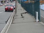
Digital Photograph: Earthquake Damage to Road on Norwich Quay, Lyttelton
Images, Canterbury Museum
One landscape colour digital photograph taken on 25 February 2011 showing earthquake damage to the road, footpath and retaining wall on Norwich Quay. The photograph is taken from below the intersection of Norwich Quay and Canterbury Street looking east along Norwich Quay. Unlike most areas of Christchurch, land damage on the Port Hills was due ...
Digital Photograph: Exterior of Christchurch Chinese Methodist Church
Images, Canterbury Museum
One portrait colour digital photograph taken on 6 September 2010 showing earthquake damage to the red brick building of the Christchurch Chinese Methodist Church, 165 Papanui Road. The Christchurch Chinese Methodist Church on Papanui Road sustained severe damage during the 4 September 2010 earthquake. The church still stands although financial ...
Earthquake damage to the road from Cheviot to Port Robinson
Images, Alexander Turnbull Library
Earthquake damage to the road from Cheviot to Port Robinson, 1901. Taken by an unidentified photographer. This is a copy of a photograph from `The Weekly Press', Nov 27, 1901 Note on back of file print reads: "Fissures on the road from Cheviot to Port Robinson. There is a creek on the right side of the road, and below the fissure the road has fallen towards it.....and is 2 1/2' below its proper level. The fissures are 2 1/2' deep" (Probably the caption from `The Weekly Press') Quantity: 1 b&w original negative(s).
Digital Photograph: Van outside Christchurch Chinese Methodist Church
Images, Canterbury Museum
One landscape colour digital photograph taken on 6 September 2010 showing earthquake damage to a van caused by red bricks from the Christchurch Chinese Methodist Church, 165 Papanui Road. The Christchurch Chinese Methodist Church on Papanui Road sustained severe damage during the 4 September 2010 earthquake. Constructed from unreinforced red br...
Digital Photograph: Exterior of Christchurch Chinese Methodist Church
Images, Canterbury Museum
One landscape colour digital photograph taken on 6 September 2010 showing earthquake damage to the red brick building of the Christchurch Chinese Methodist Church, 165 Papanui Road. The Christchurch Chinese Methodist Church on Papanui Road sustained severe damage during the 4 September 2010 earthquake. The red placards placed on the door of the...
Digital Photograph: Exterior of Christchurch Chinese Methodist Church
Images, Canterbury Museum
One landscape colour digital photograph taken on 6 September 2010 showing earthquake damage and a red placard on the red brick building of the Christchurch Chinese Methodist Church, 165 Papanui Road. The Christchurch Chinese Methodist Church on Papanui Road sustained severe damage during the 4 September 2010 earthquake. The red placards placed ...
Digital Photograph: Earthquake damage to a retaining wall, Lyttelton
Images, Canterbury Museum
One landscape colour digital photograph taken on 30 June 2011 showing earthquake damage to a section of retaining wall in Sumner Road. Plastic sheeting installed to stabilise previous damage and protect from water erosion is visible to the right of the photograph. Also visible in the photograph is a boarded up broken window and temporary safety ...
Digital Photograph: Earthquake Damage to the Plunket Rooms on Sumner Road,…
Images, Canterbury Museum
One portrait colour digital photograph taken on 25 February 2011 showing damage to the Plunket Rooms on Sumner Road. Also visible in the photograph are the rear of the former Library and Fire Station, 2 London Street and the eastern end of The Church of the Most Holy Trinity. When the Lyttelton Plunket Rooms were demolished in July 2012, archae...
Digital Photograph: Earthquake damage to the London Street Restaurant on L…
Images, Canterbury Museum
One landscape colour digital photograph taken on 27 April 2011 showing damage to the London Street Restaurant. Photograph taken looking west from the intersection of London Street with Oxford Street and Sumner Road. Adaptability and quick thinking has become a key part of business survival in post earthquake Canterbury. The owner of this bui...
Digital Photograph: Retaining Wall, Sumner Road, Lyttelton
Images, Canterbury Museum
One landscape colour digital photograph taken on 27 May 2013 of a retaining wall in Sumner Road which was replaced due to earthquake damage. The original wall was created using red volcanic rock. Many walls like this were built using the Hard Labour Gang from the Lyttelton Gaol. The replacement wall has a small section of stone installed to sho...
Digital Photograph: Earthquake Damage to the Lodge of Unanimity No 3, at t…
Images, Canterbury Museum
One landscape colour digital photograph taken on 25 February 2011 showing damage to the Lodge of Unanimity No 3 at the intersection of St Davids Street and Sumner Road. Original BuildingAdditions The Lodge of Unanimity was established in Lyttelton in 1851. This building was designed in 1878 by Benjamin Woolfield Mountfort, who was a member of th...
Digital Photograph: Earthquake Damage and Demolition Work on London Street…
Images, Canterbury Museum
One landscape colour digital photograph taken on 27 April 2011 showing damage to London Street and demolition work being undertaken on the Harbourlight Theatre. Photograph taken looking west from the intersection of London Street with Oxford Street and Sumner Road. Architect In Christchurch's Central Business District many of the high profile d...
Digital Photograph: London Street, Lyttelton
Images, Canterbury Museum
One landscape colour digital photograph taken on 25 February 2011 showing damage to the Lyttelton Police Station on Sumner Road and London Street. Photograph taken looking west from St Davids Street. In December 2011, the New Zealand Police decided that the Lyttelton Police Station would be demolished. The building, which opened in 1882 was re...
- 1


