Search
found 37 results
Images for Diversity; more images...

Diversity Awards 2015 submission: Category: Empowerment
Articles, UC QuakeStudies
An award submission nominating SCIRT Women in Construction (SWIC) for the 2015 Diversity Awards: Category: Empowerment.
CTV News - SCIRT Women
Videos, UC QuakeStudies
A video of a CTV News broadcast of a Ministry of Women's Affairs initiative to attract more women into trades and construction related jobs.
Hays NAWIC Excellence Awards 2015 submission: Category: Professional Woman…
Articles, UC QuakeStudies
An award submission nominating Paula Lock for the Hays NAWIC Excellence Awards 2015: Category: Professional Woman of the Year.
Hays NAWIC Excellence Awards 2015 submission: Category: Helen Tippett Award
Articles, UC QuakeStudies
An award submission nominating SCIRT Women in Construction (SWIC) for the Hays NAWIC Excellence Awards 2015: Category: Helen Tippett Award.
Hays NAWIC Excellence Awards 2016 submission: Category: Professional Trade…
Articles, UC QuakeStudies
An award submission nominating Jane Taylor for the Hays NAWIC Excellence Awards 2016: Category: Professional Tradeswoman of the Year.
APEC workshop presentation
Articles, UC QuakeStudies
A presentation which outlines SCIRT's approach to raising the visibility of and enabling women working in construction across the SCIRT programme.
Building new opportunities for women
Articles, UC QuakeStudies
A document which describes the establishment of the SCIRT Women in Construction (SWIC) group and its achievements.
SCIRT Women in Construction advertisements
Articles, UC QuakeStudies
A series of SCIRT advertisements which feature images of women in construction.
Diversity and public engagement in planning: A case study of Chinese migra…
Research papers, Lincoln University
Aotearoa New Zealand’s population has grown rapidly from 3.85 million in 2000, to 5 million in 2020. Ethnic diversity has consequently increased. Territorial Authorities (TAs) undertaking statutory consultation and wider public engagement processes need to respond to increased diversity and foster inclusivity. Inclusivity is necessary to facilitate a greater understanding of TA statutory functions, as well as to encourage awareness and participation in annual planning processes, and resource management plans and consents. We examined perceptions, and experiences, of planning within the ethnic Chinese immigrant population of Christchurch. The Chinese ethnic group is a significant part of the city’s population and is in itself derived from diverse cultural and language backgrounds. We surveyed 111 members of this community, via social media and in person, to identify environmental and planning issues of concern to them. We sought to ascertain their previous engagement with planning processes and to gauge their willingness for future involvement. We also undertook a small number of semi-structured interviews with Chinese immigrants to explore their experiences with planning in more detail. Results showed only 6% of respondents had been engaged in any planning processes, despite only 20% being unwilling to participate. We analysed these responses by gender, age, visa category, and length of time resident in Christchurch. Notwithstanding the low level of reported engagement, earthquake recovery (70% of respondents) along with water quality, transport, and air quality were the most important issues of concern. However, there was a general lack of awareness of the ability to make public submissions on these and other issues, and of the statutory responsibilities of TAs. We discuss possible explanations and provide several suggestions for TAs to increase awareness and to improve engagement. This includes further research to assist in identifying the nature of barriers as well as the effectiveness of trialling different solutions.
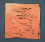
Children's Artwork: Black Marker on Orange Paper
Images, Canterbury Museum
One square piece of folded orange paper with artwork in black marker. This folded square of orange coloured origami paper with childlike artwork in black marker is one of twelve similar pieces recovered from the Canterbury Television (CTV) site. These items demonstrate the diversity of the tributes left by the fence surrounding the site in memo...
Children's Artwork: Black Marker on Red Paper
Images, Canterbury Museum
One roughly hexagonal piece of red paper with children's artwork in black marker. This folded square of red coloured origami paper with childlike artwork in black marker is one of twelve similar pieces recovered from the Canterbury Television (CTV) site. These items demonstrate the diversity of the tributes left by the fence surrounding the sit...
Children's Artwork: Black Marker on Pink Paper
Images, Canterbury Museum
One roughly hexagonal piece of pink paper with children's artwork in black marker. This folded square of pink coloured origami paper with childlike artwork in black marker is one of twelve similar pieces recovered from the Canterbury Television (CTV) site. These items demonstrate the diversity of the tributes left on or near the fence surroundi...
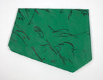
Children's Artwork: Black Marker on Green Paper
Images, Canterbury Museum
One roughly hexagonal piece of green paper with children's artwork in black marker. This folded square of green coloured origami paper with childlike artwork in black marker is one of twelve similar pieces recovered from the Canterbury Television (CTV) site. These items demonstrate the diversity of the tributes left on or near the fence surroun...
Children's Artwork: Black Marker on Red Paper
Images, Canterbury Museum
One roughly hexagonal piece of red paper with children's artwork in black marker. This folded square of red coloured origami paper with childlike artwork in black marker is one of twelve similar pieces recovered from the Canterbury Television (CTV) site. These items demonstrate the diversity of the tributes left on or near the fence surrounding...
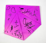
Children's Artwork: Black Marker on Purple Paper
Images, Canterbury Museum
One roughly folded square piece of purple paper with children's artwork in black marker. This folded square of purple coloured origami paper with childlike artwork in black marker is one of twelve similar pieces recovered from the Canterbury Television (CTV) site. These items demonstrate the diversity of the tributes left on or near the fence s...
Children's Artwork: Black Marker on Blue Paper
Images, Canterbury Museum
One roughly folded square piece of blue paper with children's artwork in black marker. This folded square of blue coloured origami paper with childlike artwork in black marker is one of twelve similar pieces recovered from the Canterbury Television (CTV) site. These items demonstrate the diversity of the tributes left on or near the fence surro...
Children's Artwork: Black Marker on Yellow Paper
Images, Canterbury Museum
One roughly folded square piece of yellow paper. This folded square of yellow coloured origami paper with childlike artwork in black marker is one of twelve similar pieces recovered from the Canterbury Television (CTV) site. These items demonstrate the diversity of the tributes left on or near the fence surrounding the site in memory of the 115...
Children's Artwork: Black Marker on Blue Paper
Images, Canterbury Museum
One roughly folded square piece of blue paper with children's artwork in black marker. This folded square of blue coloured origami paper with childlike artwork in black marker is one of twelve similar pieces recovered from the Canterbury Television (CTV) site. These items demonstrate the diversity of the tributes left on or near the fence surro...
Children's Artwork: Black Marker on Orange Paper
Images, Canterbury Museum
One roughly folded square piece of orange paper with children's artwork in black marker. This folded square of orange coloured origami paper with childlike artwork in black marker is one of twelve similar pieces recovered from the Canterbury Television (CTV) site. These items demonstrate the diversity of the tributes left on or near the fence s...
Children's Artwork: Black Marker on Blue Paper
Images, Canterbury Museum
One square piece of blue paper roughly folded into the shape of an aeroplane held together with sellotape. This folded square of blue coloured origami paper with childlike artwork in black marker is one of twelve similar pieces recovered from the Canterbury Television (CTV) site. These items demonstrate the diversity of the tributes left on or ...
Children's Artwork: Orange Paper Plane
Images, Canterbury Museum
One square piece of orange paper roughly folded into the shape of an aeroplane. This folded square of orange coloured origami paper with childlike artwork in black marker is one of twelve similar pieces recovered from the Canterbury Television (CTV) site. These items demonstrate the diversity of the tributes left on or near the fence surroundin...
Diverse Density: An alternative housing strategy
Research papers, Victoria University of Wellington
Diverse Density proposes an alternative housing strategy to the idealistic top-down process of housing development. The term ‘Top – down’ refers to a situation in which decisions are made by a few people in authority rather than by the people who are affected by the decisions (Cambridge). Problems/Position/Question: New Zealand’s urban housing is in a period of flux. Pressures of densification have permitted the intervention of medium density housing development schemes but these are not always successful. These typically top-down processes often result in internally focused design schemes that do not adhere to their specific context. The subsequent design outcomes can cause detrimental impacts to the local, urban and architectural conditions. With vast quantities of council regulations, building restrictions and design guidelines clouding over the housing sector, commonly referred to as ‘red tape’, occupant participation in the housing development sector is dwindling. A boundless separation between top-down and traditional housing processes has occurred and our existing neighbourhoods and historic architectural character are taking on the brunt of the problem. The thought-provoking, alternative housings strategies of key research theorists Alejandro Aravena and John Habraken frame positions that challenge contemporary densification methods with an alternative strategy. This position is addressed by endeavoring to answer; How can demands for denser housing achieve dynamic design responses that adhere to changes in occupancy, function and local site conditions? Aim: The aim of this thesis is to challenge New Zealand’s current housing densification methods by proposing an alternative densification strategy. Explicit devotion will be attributed to opposing top-down building developments. Secondly, this thesis aims to test a speculative site-specific housing model. The implementation of a Christchurch housing scenario will situate an investigative study to test the strategy and its ability to stimulate greater diversity, site responsiveness, functional adaptability and occupancy permutation. The post-earthquake housing conditions of Christchurch provide an appropriate scenario to test and implement design-led investigations. Objectives: The primary objectives of this design-led research investigation it to challenge the idealistic top-down method of developing density with a new method to: - Develop contextual architectural cohesion - Encourage residential diversity - Reinvigorate architectural autonomy - Respond to, and recognise, existing site conditions - Develop a housing model that: - Adapts to occupant functionality preferences - Caters to occupancy diversity - Achieves contextual responsiveness The proposition is addressed through a speculative design-led scenario study. A well-established Christchurch urban environment is adopted to implement and critique the envisioned alternative strategy. Development of the designs responsiveness, adaptability, and functionality produce a prototype housing model that actively adheres to its particular context. Implication: The implications of this research would be an alternative densification strategy to perceive the advancement of punctual assessment of building compliance. With accelerated building processes, the research may have implications for addressing New Zealand’s housing crisis whilst simultaneously providing diverse, personable and responsive architectural solutions. A more dynamic, up-to-date and responsive housing development sector would be informed.
Earthquake forum: regaining solid ground - urban design and recovery
Research papers, Lincoln University
The University of Canterbury held its inaugural Earthquake Forum on the 2nd September 2011. It was an opportunity to hear the diversity of earthquake-related research currently being undertaken in Canterbury and a chance for researchers and those working on the recovery to identify further areas where the research can support the recovery effort.The morning consisted of presentations showcasing the breadth of research currently underway and the afternoon will create the opportunity for people to connect in a series of concurrent workshops on the land, buildings and people. Neil Challenger's presentation covers landscape architecture, temporary landscapes, exploration of design ideas and specific student research related to urban design and earthquake recovery.
Indigenous Peoples and urban disaster: Māori responses to the 2010-12 Chri…
Research papers, Lincoln University
Indigenous Peoples retain traditional coping strategies for disasters despite the marginalisation of many Indigenous communities. This article describes the response of Māori to the Christchurch earthquakes of 2010 and 2012 through analyses of available statistical data and reports, and interviews done three months and one year after the most damaging event. A significant difference between Māori and ‘mainstream’ New Zealand was the greater mobility enacted by Māori throughout this period, with organisations having roles beyond their traditional catchments throughout the disaster, including important support for non-Māori. Informed engagement with Indigenous communities, acknowledging their internal diversity and culturally nuanced support networks, would enable more efficient disaster responses in many countries.
Federated Digital Archives and Disaster Recovery: The Role of the Digital …
Research papers, University of Canterbury Library
The University of Canterbury CEISMIC Canterbury Earthquake Digital Archive draws on the example of the Centre for History and New Media’s (CHNM) September 11 Archive, which was used to collect digital artefacts after the bombing of the World Trade Centre buildings in 2001, but has gone significantly further than this project in its development as a federated digital archive. The new University of Canterbury Digital Humanities Programme – initiated to build the archive – has gathered together a Consortium of major national organizations to contribute content to a federated archive based on principles of openness and collaboration derived directly from the international digital humanities community.
The Role of Religion, Spirituality and Faith in the Processes of Significa…
Research papers, Victoria University of Wellington
For some people, religion, spirituality and faith (RSF) serves an important function, helping them deal with difficult everyday life challenges. This qualitative ethnographic study examines how and in what ways a group of Cantabrians engaged with RSF in dealing with diverse forms of significant trauma – from moments of crisis through to more extended processes of recovery. The research is located within the context of post-earthquake Christchurch, and is based on fieldwork undertaken in 2012–2013. It explores the experiences of respondents representing traditional Christian and non-orthodox, non-Christian faith paths. The thesis draws on data from participant stories to emphasise the subjective experience of RSF and trauma. It argues that in times of crisis, some people draw on RSF to help them address difficult life challenges. The study demonstrates the breadth, diversity and significance of such resourcing, as well as the sometimes surprising, unanticipated forms that this engagement with RSF may take. Contrary to theories that emphasise the marginalisation of religion during times of intense distress, the thesis shows that in varying moments of crisis, people for whom RSF is important, may draw on diverse forms of RSF as a matter of priority to help them.
Reinforcing Memory: Embracing a Neurodivergent Perspective to Stitch Chris…
Research papers, The University of Auckland Library
The seismic tremor that shook Christchurch on February 22, 2011, not only shattered buildings but also the spirit of the city’s residents. Amidst the ruins, this design-focused thesis unravels two intertwining narratives, each essential to the city’s resurrection. At its core, this thesis probes the preservation of Christchurch’s memory and character, meticulously chronicling the lost heritage architecture and the subsequent urban metamorphosis. Beyond bricks and mortar, it also confronts the silent aftershocks - the pervasive mental health challenges stemming from personal losses and the disfigured cityscape. As a native of Christchurch, intimately connected to its fabric, my lens reflects not just on the architectural reconstruction but also on the emotional reconstruction. My experience as an autistic individual, a recently discovered facet of my identity, infuses this design journey with a distinct prism through which I perceive and interact with the world. The colourful sketches that drive the design process aren’t mere illustrations but manifestations of my interpretation of spaces and concepts, evoking joy and vitality—a testament to embracing diversity in design. Drawing parallels between healing my own traumas with my colourful and joyful neurodivergent worldview, I’ve woven this concept into proposals aimed at healing the city through whimsy, joy, and vibrant colours. Personal experiences during and post-earthquakes profoundly shape my design proposals. Having navigated the labyrinth of my own mental health amid the altered cityscape, I seek avenues for reconciliation, both personal and communal. The vibrant sketches and designs presented in this thesis encapsulate this vision—a fusion of vivid, unconventional interpretations and a dedication to preserving the essence of the original cityscape while still encouraging movement into the future
Invertebrate Responses to Large-Scale Change : Impacts of Eutrophication a…
Research papers, University of Canterbury Library
Environmental stress and disturbance can affect the structure and functioning of marine ecosystems by altering their physical, chemical and biological features. In estuaries, benthic invertebrate communities play important roles in structuring sediments, influencing primary production and biogeochemical flux, and occupying key food web positions. Stress and disturbance can reduce species diversity, richness and abundance, with ecological theory predicting that biodiversity will be at its lowest soon after a disturbance with assemblages dominated by opportunistic species. The Avon-Heathcote Estuary in Christchurch New Zealand has provided a novel opportunity to examine the effects of stress, in the form of eutrophication, and disturbance, in the form of cataclysmic earthquake events, on the structure and functioning of an estuarine ecosystem. For more than 50 years, large quantities (up to 500,000m3/day) of treated wastewater were released into this estuary but in March 2010 this was diverted to an ocean outfall, thereby reducing the nutrient loading by around 90% to the estuary. This study was therefore initially focussed on the reversal of eutrophication and consequent effects on food web structure in the estuary as it responded to lower nutrients. In 2011, however, Christchurch was struck with a series of large earthquakes that greatly changed the estuary. Massive amounts of liquefied sediments, covering up to 65% of the estuary floor, were forced up from deep below the estuary, the estuary was tilted by up to a 50cm rise on one side and a corresponding drop on the other, and large quantities of raw sewage from broken wastewater infrastructure entered the estuary for up to nine months. This study was therefore a test of the potentially synergistic effects of nutrient reduction and earthquake disturbance on invertebrate communities, associated habitats and food web dynamics. Because there was considerable site-to-site heterogeneity in the estuary, the sites in this study were selected to represent a eutrophication gradient from relatively “clean” (where the influence of tidal flows was high) to highly impacted (near the historical discharge site). The study was structured around these sites, with components before the wastewater diversion, after the diversion but before the earthquakes, and after the earthquakes. The eutrophication gradient was reflected in the composition and isotopic chemistry of primary producer and invertebrate communities and the characteristics of sediments across the sample sites. Sites closest to the former wastewater discharge pipe were the most eutrophic and had cohesive organic -rich, fine sediments and relatively depauperate communities dominated by the opportunistic taxa Capitellidae. The less-impacted sites had coarser, sandier sediments with fewer pollutants and far less organic matter than at the eutrophic sites, relatively high diversity and lower abundances of micro- and macro-algae. Sewage-derived nitrogen had became incorporated into the estuarine food web at the eutrophic sites, starting at the base of the food chain with benthic microalgae (BMA), which were found to use mostly sediment-derived nitrogen. Stable isotopic analysis showed that δ13C and δ15N values of most food sources and consumers varied spatially, temporally and in relation to the diversion of wastewater, whereas the earthquakes did not appear to affect the overall estuarine food web structure. This was seen particularly at the most eutrophic site, where isotopic signatures became more similar to the cleaner sites over two-and-a-half years after the diversion. New sediments (liquefaction) produced by the earthquakes were found to be coarser, have lower concentrations of heavy metals and less organic matter than old (existing) sediments. They also had fewer macroinvertebrate inhabitants initially after the earthquakes but most areas recovered to pre-earthquake abundance and diversity within two years. Field experiments showed that there were higher amounts of primary production and lower amounts of nutrient efflux from new sediments at the eutrophic sites after the earthquakes. Primary production was highest in new sediments due to the increased photosynthetic efficiency of BMA resulting from the increased permeability of new sediments allowing increased light penetration, enhanced vertical migration of BMA and the enhanced transport of oxygen and nutrients. The reduced efflux of NH4-N in new sediments indicated that the capping of a large portion of eutrophic old sediments with new sediments had reduced the release of legacy nutrients (originating from the historical discharge) from the sediments to the overlying water. Laboratory experiments using an array of species and old and new sediments showed that invertebrates altered levels of primary production and nutrient flux but effects varied among species. The mud snail Amphibola crenata and mud crab Austrohelice crassa were found to reduce primary production and BMA biomass through the consumption of BMA (both species) and its burial from bioturbation and the construction of burrows (Austrohelice). In contrast, the cockle Austrovenus stutchburyi did not significantly affect primary production and BMA biomass. These results show that changes in the structure of invertebrate communities resulting from disturbances can also have consequences for the functioning of the system. The major conclusions of this study were that the wastewater diversion had a major effect on food web dynamics and that the large quantities of clean and unpolluted new sediments introduced to the estuary during the earthquakes altered the recovery trajectory of the estuary, accelerating it at least throughout the duration of this study. This was largely through the ‘capping’ effect of the new liquefied, coarser-grained sediments as they dissipated across the estuary and covered much of the old organic-rich eutrophic sediments. For all aspects of this study, the largest changes occurred at the most eutrophic sites; however, the surrounding habitats were important as they provided the context for recovery of the estuary, particularly because of the very strong influence of sediments, their biogeochemistry, microalgal and macroalgal dynamics. There have been few studies documenting system level responses to eutrophication amelioration and to the best on my knowledge there are no other published studies examining the impacts of large earthquakes on benthic communities in an estuarine ecosystem. This research gives valuable insight and advancements in the scientific understanding of the effects that eutrophication recovery and large-scale disturbances can have on the ecology of a soft-sediment ecosystem.
People in Disasters Conference - Community and Social Service Organisation…
Videos, UC QuakeStudies
A video of a presentation by Bridget Tehan and Sharon Tortonson during the Community and Social Recovery Stream of the 2016 People in Disasters Conference. The presentation is titled, "Community and Social Service Organisations in Emergencies and Disasters in Australia and New Zealand".The abstract for this presentation reads as follows: What happens when support services for issues such as mental health, foster care or homelessness are impacted by a disaster? What happens to their staff? What happens to their clients? The community sector is a unique, valuable and diverse component of Australasian economy and society. Through its significant numbers of employees and volunteers, its diversity, the range of service and advocacy programs it delivers, and the wide range of people it supports, it delivers value to communities and strengthens society. The community and social services sector builds resilience daily through services to aged care, child welfare and disability, domestic violence, housing and homelessness, and mental health care. The sector's role is particularly vital in assisting disadvantaged people and communities. For many, community sector organisations are their primary connection to the broader community and form the basis of their resilience to everyday adversity, as well as in times of crisis. However, community sector organisations are particularly vulnerable in a major emergency or disaster. Australian research shows that the most community sector organisations are highly vulnerable and unprepared for emergencies. This lack of preparedness can have impacts on service delivery, business continuity, and the wellbeing of clients. The consequences of major disruptions to the provision of social services to vulnerable people are serious and could be life-threatening in a disaster. This presentation will review the Victorian Council of Social Service (Australia) and Social Equity and Wellbeing Network (formerly the Christchurch Council of Social Services) records on the impacts of emergencies on community sector organisations, staff, and clients. From the discussion of records, recommendations will be presented that could improve the resilience of this crucial sector.
Earthquake impacts in old-growth Nothofagus forests in New Zealand
Research papers, Lincoln University
Six stands located on different land forms in mixed old-growth Nothofagus forests in the Matiri Valley (northwest of South Island, New Zealand) were sampled to examine the effects of two recent large earthquakes on tree establishment and tree-ring growth, and how these varied across land forms. 50 trees were cored in each stand to determine age structure and the cores were cross-dated to precisely date unusual periods of radial growth. The 1968 earthquake (M = 7.1, epicentre 35 km from the study area) had no discernible impact on the sampled stands. The impact of the 1929 earthquake (M = 7.7, epicentre 20 km from the study area) varied between stands, depending on whether or not they had been damaged by soil or rock movement. In all stands, the age structures showed a pulse of N. fusca establishment following the 1929 earthquake, with this species dominating establishment in large gaps created by landslides. Smaller gaps, created by branch or tree death, were closed by both N. fusca and N. menziesii. The long period of releases (1929-1945) indicates that direct earthquake damage was not the only cause of tree death, and that many trees died subsequently most likely of pathogen attack or a drought in the early 1930s. The impacts of the 1929 earthquake are compared to a storm in 1905 and a drought in 1974-1978 which also affected forests in the region. Our results confirm that earthquakes are an important factor driving forest dynamics in this tectonically active region, and that the diversity of earthquake impacts is a major source of heterogeneity in forest structure and regeneration.
- 1
- »