Search
Images for Christchurch central city; more images...
"The earthquakes stopped us..."
Images, eqnz.chch.2010
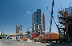
Christchurch Central City - 29 September 2013 File reference: CCL-2013-09-29-Lost-in-Central-City-DSC_0958.JPG Photo by Valerie Livingstone.
X Marks the Spot
Images, eqnz.chch.2010
What I found on a walk around the city Christchurch November 20, 2013 New Zealand. www.isaactheatreroyal.co.nz/ en.wikipedia.org/wiki/2011_Christchurch_earthquake
Shermine Kwok Photograph 71
Images, UC QuakeStudies
A photograph of the entrance to the new Christchurch City Council Civic offices on Worcester Street.
Shermine Kwok Photograph 72
Images, UC QuakeStudies
A photograph of the entrance to the new Christchurch City Council Civic offices on Worcester Street.
BeckerFraserPhotos March 2013 photograph 094
Images, UC QuakeStudies
An aerial photograph of the Christchurch central city with Armagh Street in the foreground and Christ Church Cathedral in the centre.
BeckerFraserPhotos March 2013 photograph 082
Images, UC QuakeStudies
An aerial photograph looking west over the Christchurch central city, centred on Cashel Street.
Shermine Kwok Photograph 42
Images, UC QuakeStudies
A photograph of a sign reading, "Save this building", on the badly-damaged Christchurch City Council building on Tuam Street.
BeckerFraserPhotos March 2013 photograph 077
Images, UC QuakeStudies
An aerial photograph looking north over the Christchurch central city from Moorhouse Avenue centred on Manchester Street.
Shermine Kwok Photograph 7
Images, UC QuakeStudies
A photograph of the temporary QuakeCity museum at Re:START mall.
BeckerFraserPhotos March 2013 photograph 070
Images, UC QuakeStudies
An aerial photograph looking south-east across the Christchurch central city, with Ferry Road at the top centre.
Shermine Kwok Photograph 16
Images, UC QuakeStudies
A photograph of a model city at the Rebuild Central office on Lichfield Street. The model was created by members of the public as part of the Christchurch City Council's Transitional City consultation project.
Shermine Kwok Photograph 18
Images, UC QuakeStudies
A photograph of a model city at the Rebuild Central office on Lichfield Street. The model was created by members of the public as part of the Christchurch City Council's Transitional City consultation project.
Shermine Kwok Photograph 8
Images, UC QuakeStudies
A photograph of a plaque dedicate to those who lost their lives in City Mall during the earthquake of 22 February 2011. The plague is located under a tree in Re:START mall.
BeckerFraserPhotos March 2013 photograph 061
Images, UC QuakeStudies
An aerial photograph looking west over the northern part of the Christchurch central city with Bealey Avenue to the right and Hagley Park in the distance.
BeckerFraserPhotos March 2013 photograph 062
Images, UC QuakeStudies
An aerial photograph looking south west over the Christchurch CBD with the Avon River visible to the left and Hagley Park in the distance.
Implications of the Canterbury earthquake sequence for Adelaide, South Aus…
Research papers, The University of Auckland Library
The city of Christchurch has experienced over 10,000 aftershocks since the 4th of September 2010 earthquake of which approximately 50 have been greater than magnitude 5. The damage caused to URM buildings in Christchurch over this sequence of earthquakes has been well documented. Due to the similarity in age and construction of URM buildings in Adelaide, South Australia and Christchurch (they are sister cities, of similar age and heritage), an investigation was conducted to learn lessons for Adelaide based on the Christchurch experience. To this end, the number of URM buildings in the central business districts of both cities, the extent of seismic strengthening that exists in both cities, and the relative earthquake hazards for both cities were considered. This paper will report on these findings and recommend strategies that the city of Adelaide could consider to significantly reduce the seismic risk posed by URM buildings in future earthquake.
- 1

