Search
Images for 100% Canon; more images...
20120827_2023_G12-08 Container about to be unloaded
Images, eqnz.chch.2010
RWTU3388135 (ex Triton TTNU3388135) about to be placed on the ground outside my "Red Zone" house. This is the second container, the first is away in storage with 95% of the house hold stuff. This one is for the hobby (no, not photography gear) and garage stuff.
20121112_2364_G12-12 Farmers Carpark Building
Images, eqnz.chch.2010
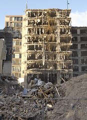
Being demolished.
20120718_1497_G12-25 New Brighton icon is demolished
Images, eqnz.chch.2010
The old New Brighton Power Boat Club building was badly damaged in the February 2011 earthquake, and is only now (July 2012) being demolished. The building is just down the road from where I grew up and is a New Brighton iconic building.
20120718_1499_G12-9 New Brighton icon is demolished
Images, eqnz.chch.2010
The old New Brighton Power Boat Club building was badly damaged in the February 2011 earthquake, and is only now (July 2012) being demolished. The building is just down the road from where I grew up and is a New Brighton iconic building.
20121117_0338_1D3-150 The old Police Station
Images, eqnz.chch.2010
Cordoned off after damage from the earthquakes.
20120805_7566_1D3-600 Newstalk ZB building starting to go down 131
Images, eqnz.chch.2010
None
20120805_7576_1D3-600 Newstalk ZB building starting to go down 141
Images, eqnz.chch.2010
None
20121117_0314_1D3-200 Summit Road - Closed
Images, eqnz.chch.2010
Obvious seeing why the Summit Road has been closed below Mt Cavendish since the February 22 2011 earthquake. There are some large rocks there!
20121117_0316_1D3-70 Summit Road Closed
Images, eqnz.chch.2010
Obvious seeing why the Summit Road has been closed below Mt Cavendish since the February 22 2011 earthquake. There are some large rocks there!
20120805_7446_1D3-600 Newstalk ZB building starting to go down 11
Images, eqnz.chch.2010
None
20120805_7456_1D3-600 Newstalk ZB building starting to go down 21
Images, eqnz.chch.2010
None
20120805_7451_1D3-600 Newstalk ZB building starting to go down 16
Images, eqnz.chch.2010
None
20120805_7461_1D3-600 Newstalk ZB building starting to go down 26
Images, eqnz.chch.2010
None
20121018_9144_1D3-60 Tunnel building
Images, eqnz.chch.2010
Built in the early 1960s for the Lyttelton Road Tunnel, it was severley damaged in the February 2011 earthquake and is not currently used.
20120118_7814_1D3-17F East on Cashel.
Images, eqnz.chch.2010
17mm M42 Takumar Fisheye on a Canon 1D MkIII (1.3x crop factor) via an adaptor ring.
20120131_8129_1D3-400 Eathquake damage
Images, eqnz.chch.2010
Houses teeter over the edge above Redcliffs School.
Eathquake damage
Images, eqnz.chch.2010
20120131_8174_1D3-400 Eathquake damage Houses above Main Road, Sumner. #2153
20120131_8198_1D3-400 Eathquake damage
Images, eqnz.chch.2010
Damaged houses above Shag Rock.
20121117_0342_1D3-85 Fuze Cafe
Images, eqnz.chch.2010
Went into this cafe a few times in years gone by (all on camera club field trips or photowalks). It was a nice two-storey building then. Not now after the earthquakes of 2010 and 2011.
20120805_7441_1D3-600 Newstalk ZB building starting to go down 06
Images, eqnz.chch.2010
20120805_7441_1D3-600 Newstalk ZB building starting to go down 06 #2642
20120131_8169_1D3-400 Conatiner wall
Images, eqnz.chch.2010
Part of a house that fell can be seen on the rocks above right hand containers.
20120131_8153_1D3-400 Conatiner wall
Images, eqnz.chch.2010
Part of the container wall to stop rock falls on Main Road, Sumner.
30 seconds later the dust drifts across the city.
Images, eqnz.chch.2010
20120805_7586_1D3-600 30 seconds later the dust drifts across the city. Following the demolition of the earthquake damaged Newstalk ZB building. #2649
20121117_2387_G12-06 New Brighton Road flooded again
Images, eqnz.chch.2010
With the land dropping about 1metre to 1.4metres after the earthquakes, a few roads besides the Avon and Heathcote Rivers are flooded with very high tides. Extra stop banks (on right) erected after the quakes have helped, but the road is now well below high water level. New Brighton Road, just short of New Brighton. The Pages Road bridge may b...
20120131_8167_1D3-400 Shag Pile
Images, eqnz.chch.2010
What more can one say except that Shag Rock is now about one third it's original height. Whitewash Head in the background with the road that now drops over a cliff.
20120128_8071_1D3-400 Redcliffs wall
Images, eqnz.chch.2010
The sea wall at Beachville Road, Redcliffs, after the earthquake. It used to be straight and level - not now! As a teenager I went fishing off this wall.
20121124_0566_1D3-67 Cunningham House
Images, eqnz.chch.2010
Cunningham House at the Christchurch Botanic Gardens is still closed due to earthquake damage. I wonder if it will ever re-open or suffer the demolition fate many other iconic structures in Christchurch have.
20120321_2416_1D3-24 Fallen Cone
Images, eqnz.chch.2010
A month after the 1st anniversary of the deadly Christchurch earthquake (22/02/11) a road cone lies on New Brighton Road, alongside the Avon River. Part of the earthquake 1st anniversary remembrance was for people to place flowers in road cones (and there are hundreds of thousands in the city). Many had flowers in them, as this one did. Photo ...
20120805_7436_1D3-600 Newstalk ZB building starting to go down 01
Images, eqnz.chch.2010
Shot from up Hunstbury Hill with a 600mm f/4 on a very grey morning. 8am demolition. The guy behind me only looked up when the sounds of the explosion reahed us and the building was half way down!
20120702_1387_G12-18 Another one bites the dust
Images, eqnz.chch.2010
8 Velsheda Street, Bexley, Christchurch, across the road from my house was demolished a week or so ago, just one of many demolitions of Red Zone properties at the moment. This house was about ten years old and suffered land damage during the 4th September 2010 and 22nd February 2011 earthquakes. The same fate awaits my house later in the year o...
- 1
- »


