Search
found 315 results
Images for tectonics; more images...

Tectonic geomorphology and paleoseismology of the Lake Heron and Torlesse …
Research papers, University of Canterbury Library
A number of reverse and strike-slip faults are distributed throughout mid-Canterbury, South Island, New Zealand, due to oblique continental collision. There is limited knowledge on fault interaction in the region, despite historical multi-fault earthquakes involving both reverse and strike-slip faults. The surface expression and paleoseismicity of these faults can provide insights into fault interaction and seismic hazards in the region. In this thesis, I studied the Lake Heron and Torlesse faults to better understand the key differences between these two adjacent faults located within different ‘tectonic domains’. Recent activity and surface expression of the Lake Heron fault was mapped and analysed using drone survey, Structure-from-Motion (SfM) derived Digital Surface Model (DSM), aerial image, 5 m-Digital Elevation Model (DEM), luminescence dating technique, and fold modelling. The results show a direct relationship between deformation zone width and the thickness of the gravel deposits in the area. Fold modelling using fault dip, net slip and gravel thickness produces a deformation zone comparable to the field, indicating that the fault geometry is sound and corroborating the results. This result Is consistent with global studies that demonstrate deposit (or soil thickness) correlates to fault deformation zone width, and therefore is important to consider for fault displacement hazard. A geomorphological study on the Torlesse fault was conducted using SfM-DSM, DEM and aerial images Ground Penetrating Radar (GPR) survey, trenching, and radiocarbon and luminescence dating. The results indicate that the Torlesse fault is primarily strike-slip with some dip slip component. In many places, the bedding-parallel Torlesse fault offsets post-glacial deposits, with some evidence of flexural slip faulting due to folding. Absolute dating of offset terraces using radiocarbon dating and slip on fault determined from lateral displacement calculating tool demonstrates the fault has a slip rate of around 0.5 mm/year to 1.0 mm/year. The likelihood of multi-fault rupture in the Torlesse Range has been characterised using paleoseismic trenching, a new structural model, and evaluation of existing paleoseismic data on the Porters Pass fault. Identification of overlapping of paleoseismic events in main Torlesse fault, flexural-slip faults and the Porters Pass fault in the Torlesse Range shows the possibility of distinct or multi-fault rupture on the Torlesse fault. The structural connectivity of the faults in the Torlesse zone forming a ‘flower structure’ supports the potential of multi-fault rupture. Multi-fault rupture modelling carried out in the area shows a high probability of rupture in the Porters Pass fault and Esk fault which also supports the co-rupture probability of faults in the region. This study offers a new understanding of the chronology, slip distribution, rupture characteristics and possible structural and kinematic relationship of Lake Heron fault and Torlesse fault in the South Island, New Zealand.
Our Changing World - Christchurch Earthquake Geology
Audio, Radio New Zealand
University of Canterbury geologist Mark Quigley has earned a reputation for being a great science communicator on the subject of earthquakes. But when he's not in the media spotlight, he's out and about around Canterbury building a picture of the region's tectonic history, and trying to understand what might happen in the future.
IMG_2432
Images, eqnz.chch.2010
This originally straight farm fence has been laterally displaced at least 2 metres where it crosses the previously unknown faultline from which the Saturday 4 September 2010 earthquake originated.
IMG_2437
Images, eqnz.chch.2010
This originally straight farm fence has been laterally displaced at least 2 metres where it crosses the previously unknown Greendale Faultline from which the Saturday 4 September 2010 earthquake originated.
IMG_2443
Images, eqnz.chch.2010
The faultline cuts across Telegraph Road, leaving a kink in its originally straight alignment; aftermath of the magnitude 7.1 earthquake in mid-Canterbury on Saturday 4 September 2010.
IMG_2393
Images, eqnz.chch.2010
Efforts are being made to shore up and strengthen this building (corner of Hereford Street / Manchester Street) to save it from demolition after it suffered structural damage in the magnitude 7.1 earthquake that struck Christchurch on Saturday 4 September 2010.
IMG_2435
Images, eqnz.chch.2010
This originally straight farm fence has been laterally displaced at least 2 metres where it crosses the previously unknown faultline from which the Saturday 4 September 2010 earthquake originated.
IMG_2429
Images, eqnz.chch.2010
This originally straight farm fence has been laterally displaced at least 2 metres where it crosses the previously unknown faultline from which the Saturday 4 September 2010 earthquake originated.
IMG_2441
Images, eqnz.chch.2010
The faultline cuts across Telegraph Road, leaving a kink in its originally straight alignment; aftermath of the magnitude 7.1 earthquake in mid-Canterbury on Saturday 4 September 2010.
IMG_2434
Images, eqnz.chch.2010
This originally straight farm fence has been laterally displaced at least 2 metres where it crosses the previously unknown faultline from which the Saturday 4 September 2010 earthquake originated.
IMG_2436
Images, eqnz.chch.2010
This originally straight farm fence has been laterally displaced at least 2 metres where it crosses the previously unknown faultline from which the Saturday 4 September 2010 earthquake originated.
IMG_2438
Images, eqnz.chch.2010
The faultline cuts across Telegraph Road, leaving a kink in its originally straight alignment; aftermath of the magnitude 7.1 earthquake in mid-Canterbury on Saturday 4 September 2010.
IMG_2444
Images, eqnz.chch.2010
The faultline cuts across Telegraph Road, leaving a kink in its originally straight alignment; aftermath of the magnitude 7.1 earthquake in mid-Canterbury on Saturday 4 September 2010.
IMG_2423
Images, eqnz.chch.2010
This originally straight farm fence has been laterally displaced at least 2 metres where it crosses the previously unknown faultline from which the Saturday 4 September 2010 earthquake originated.
IMG_2428
Images, eqnz.chch.2010
This originally straight farm fence has been laterally displaced at least 2 metres where it crosses the previously unknown faultline from which the Saturday 4 September 2010 earthquake originated.
IMG_2247
Images, eqnz.chch.2010
This originally straight farm fence has been laterally displaced at least 3 metres where it crosses the previously unknown faultline from which the Saturday 4 September 2010 earthquake originated.
IMG_2433
Images, eqnz.chch.2010
This originally straight farm fence has been laterally displaced at least 2 metres where it crosses the previously unknown faultline from which the Saturday 4 September 2010 earthquake originated.
IMG_2316
Images, eqnz.chch.2010
Collapsed silos at David Bell Daffodil Farm in Leeston; aftermath of the magnitude 7.1 earthquake that struck mid-Canterbury on Saturday 4 September 2010.
IMG_2442
Images, eqnz.chch.2010
The faultline cuts across Telegraph Road, leaving a kink in its originally straight alignment; aftermath of the magnitude 7.1 earthquake in mid-Canterbury on Saturday 4 September 2010.
IMG_2439
Images, eqnz.chch.2010
The faultline cuts across Telegraph Road, leaving a kink in its originally straight alignment; aftermath of the magnitude 7.1 earthquake in mid-Canterbury on Saturday 4 September 2010.
IMG_2392
Images, eqnz.chch.2010
Efforts are being made to shore up and strengthen this building (corner of Hereford Street / Manchester Street) to save it from demolition after it suffered structural damage in the magnitude 7.1 earthquake that struck Christchurch on Saturday 4 September 2010.
IMG_2426
Images, eqnz.chch.2010
This originally straight farm fence has been laterally displaced at least 2 metres where it crosses the previously unknown faultline from which the Saturday 4 September 2010 earthquake originated.
IMG_2431
Images, eqnz.chch.2010
This originally straight farm fence has been laterally displaced at least 2 metres where it crosses the previously unknown faultline from which the Saturday 4 September 2010 earthquake originated.
IMG_2422
Images, eqnz.chch.2010
Looking along this previously unknown faultline that runs through this paddock, note how the ground had heaved and subsided; magnitude 7.1 earthquake in mid-Canterbury on Saturday 4 September 2010.
IMG_2440
Images, eqnz.chch.2010
The faultline cuts across Telegraph Road, leaving a kink in its originally straight alignment; aftermath of the magnitude 7.1 earthquake in mid-Canterbury on Saturday 4 September 2010.
IMG_2154
Images, eqnz.chch.2010
Falling gable of the Anglican Community of the Sacred Name building left a gaping hole in the roof in the magnitude 7.1 earthquake that hit Christchurch on 4 September 2010. The chimney would have toppled as well had it not been braced.
IMG_2399
Images, eqnz.chch.2010
Steel frames are being used to shore the unstable facade of the St John the Baptist Church at Latimer Square while the building is being repaired and strengthened following the magnitude 7.1 earthquake that struck Christchurch on Saturday 4 September 2010.
IMG_2319
Images, eqnz.chch.2010
Damage to the St John The Evangelist Catholic Church in Leeston suffered during the magnitude 7.1 earthquake that struck mid-Canterbury on Saturday 4 September 2010.
IMG_2271
Images, eqnz.chch.2010
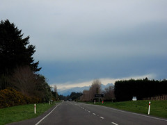
Hehehe ..... did the surveyors get the road setout wrong? This previously straight road is now kinked across this previously unknown faultline along which the Saturday 4 September 2010 magnitude 7.1 earthquake originated.
IMG_2272
Images, eqnz.chch.2010
Hehehe ..... did the surveyors get the road setout wrong? This previously straight road is now kinked across this previously unknown faultline along which the Saturday 4 September 2010 magnitude 7.1 earthquake originated.