
Search
found 350 results
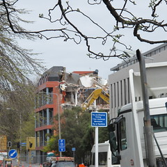
Images for Christchurch Central Library; more images...


BeckerFraserPhotos March 2013 photograph 094
Images, UC QuakeStudies
An aerial photograph of the Christchurch central city with Armagh Street in the foreground and Christ Church Cathedral in the centre.
Photographs of central Christchurch after the 2010 and 2011 earthquakes
Images, Alexander Turnbull Library
Photographs of central Christchurch after the 2010-2012 earthquakes taken 25 February 2012 by Sean McMahon. Locations are chiefly Manchester, Saint Asaph, Cashel, Columbo and Lichfield Streets, and the Bridge of Remembrance. Images show fencing around areas closed to the public, damaged and collapsed commercial buildings, cleared sites, re-opened Cashel Street area with shops and a cafe. Source of title - Title supplied by Library Quantity: 34 digital photograph(s).
The Central finally arrives at Christchurch's Arts Centre
Audio, Radio New Zealand
It's been a long, long wait but Christchurch's Arts Centre finally has a contemporary art gallery space again - and it's just opened. It's the latest 'reveal' in the Arts Centre post-earthquake rebuild. The new gallery's called The Central and is housed in the original Canterbury College Library. Four Christchurch families and gallerist Jonathan Smart have made it happen and artists including local sculptor Neil Dawson, photographer Peter Peryer, glitter specialist Reuben Patterson and painter Dick Frizzell are in the mix for the opening group show. There are some new names there too. Lynn Freeman speaks to The Central's Jonathan Smart and Ngai Tahu artist Lonnie Hutchinson who has work in the opening show.
Nicky Wagner MP for Christchurch Central.
Other, National Library of New Zealand
Site of the National Party MP for Christchurch Central. Communicates her political activities and parliamentary speeches. Includes updates about Christchurch earthquake recovery and rebuild.
Temporary Street Furniture Talk and Public Reconfiguration Photograph 1
Images, UC QuakeStudies
A photograph of temporary street furniture outside the temporary Central Library on Tuam Street. The furniture was designed and fabricated by F3 Design for the Christchurch City Council.
Central City Plan.
Other, National Library of New Zealand
Provides information about the redevelopment of Christchurch central city following February’s earthquake and the draft plan. Includes a virtual tour through the city, pre and post quake.
Future Christchurch
Other, National Library of New Zealand
Christchurch City Council website on the infrastructure rebuild of Christchurch following the 2010 and 2011 earthquakes. Includes news; information on SMART building; projects related to rebuilding of facilities, transport, suburban centres and the central city.
New Zealand Defence Force photograph 682
Images, UC QuakeStudies
Damage to the former Lyttelton Public Library on Sumner Road in Lyttelton. The facade of the building has crumbled onto the road. Tape and cones have been placed around the building to warn people off.
Fairfax Video, March 2012 (7)
Videos, UC QuakeStudies
A video of a tour of the Christchurch central city Red Zone. The video includes footage of the site of the Brannigans Building on the corner of Oxford Terrace and Gloucester Street, the inside of the central library, Gloucester Street, Manchester Street, High Street, Poplar Lane, and Hereford Street.
Bromhead, Peter, 1933-:'The Christchurch Blueprint'. 2 August 2012
Images, Alexander Turnbull Library
Shows a couple (representing the suburbs) under a large blue umbrella (representing the Christchurch Blueprint) in a rain storm. Refers to the blueprint for central Christchurch developed by the Christchurch Central Development Unit, which was unveiled on 30 July 2012. Quantity: 1 digital cartoon(s).
Nisbet, Alastair, 1958- :'See! with some simple surgery things can still f…
Images, Alexander Turnbull Library
Shows a patched wind up heart labelled 'ChCh Central' with several tubes attached. Context: On 18 April 2012 Earthquake Minister Gerry Brownlee annnounced the establishment of Christchurch Central Development Unit focussing on the rebuilding of the Christchurch Central Business District (CBD) (Scoop website 18 April 2012). Quantity: 1 digital cartoon(s).
Bromhead, Peter, 1933-:The Blueprint. 31 July 2012
Images, Alexander Turnbull Library
Shows a man representing Christchurch holding aloft the words 'belief', 'optimism' and 'faith' on a plate. Refers to the blueprint for central Christchurch developed by the Christchurch Central Development Unit, which was unveiled on 30 July 2012. Quantity: 1 digital cartoon(s).
Nisbet, Alastair, 1958- :[Manchester]. 15 April 2013
Images, Alexander Turnbull Library
Shows a throng of sex workers rushing back following the announcement that 'Manchester Street's open!'. Prior to the Christchurch earthquake in February 2011 Manchester Street was the focus of street prostitution. On 13 April 2013 the Canterbury Earthquake Recovery Authority (CERA) announced: 'A temporary change to the cordon tonight sees Manchester Street open all the way through for the first time in over two years'. Quantity: 1 digital cartoon(s).
Re:Start.
Other, National Library of New Zealand
Decribes the new Re:Start village project in the Cashel Mall, which housing business previously located in Christchurch’s central city. Includes a directory of retailers, events, photographs, information about parking and access, and Christchurch central city news.
Rebuild of Christchurch: supporting resilient staff while responding with …
Research Papers, Lincoln University
4th September 2010 a 7.1 magnitude earthquake strikes near Christchurch, New Zealand’s second largest city of approximately 370,000 people. This is followed by a 6.3 magnitude quake on 22nd February 2011 and a 6.4 on 13th June. In February 181 people died and a state of national emergency was declared from 23 February to 30th April. Urban Search and Rescue teams with 150 personnel from New Zealand and 429 from overseas worked tirelessly in addition to Army, Police and Fire services. Within the central business district 1,000 buildings (of 4,000) are expected to be demolished. An estimated 10,000 houses require demolition and over 100,000 were damaged. Meanwhile the over 7,000 aftershocks have become part of the “new normal” for us all. During this time how have libraries supported their staff? What changes have been made to services? What are the resourcing opportunities? This presentation will provide a personal view from Lincoln University, Te Whare Wanaka o Aoraki, Library Teaching and Learning. Lincoln is New Zealand's third oldest university having been founded in 1878. Publicly owned and operated it is New Zealand's specialist land-based university. Lincoln is based on the Canterbury Plains, 22 kilometres south of Christchurch. On campus there was mostly minor damage to buildings while in the Library 200,000 volumes were thrown from the shelves. I will focus on the experiences of the Disaster Team and on our experiences with hosting temporarily displaced staff and students from the Christchurch Polytechnic Institute of Technology, Library, Learning & Information Services. Experiences from two other institutions will be highlighted: Christchurch City Libraries, Ngā Kete Wānanga-o-Ōtautahi. Focusing on the Māori Services Team and the Ngā Pounamu Māori and Ngāi Tahu collections. The Central library located within the red zone cordon has been closed since February, the Central library held the Ngā Pounamu Māori and Ngai Tahu collections, the largest Māori collections in the Christchurch public library network. The lack of access to these collections changed the way the Māori Services Team, part of the larger Programmes, Events and Learning Team at Christchurch City Libraries were able to provide services to their community resulting in new innovative outreach programmes and a focus on promotion of online resources. On 19th December the “temporary” new and smaller Central library Peterborough opened. The retrieved Ngā Pounamu Māori and Ngai Tahu collections "Ngā rakau teitei e iwa”, have since been re-housed and are once again available for use by the public. Te Rūnanga o Ngāi Tahu. This organisation, established by the Te Rūnanga o Ngāi Tahu Act 1996, services the statutory rights for the people of Ngāi Tahu descent and ensures that the benefits of their Treaty Claim Settlement are enjoyed by Ngāi Tahu now and in the future. Ngāi Tahu are the indigenous Māori people of the southern islands of New Zealand - Te Waipounamu. The iwi (people) hold the rangatiratanga or tribal authority to over 80 per cent of the South Island. With their headquarters based in the central business they have also had to be relocated to temporary facilities. This included their library/archive collection of print resources, art works and taonga (cultural treasures).
Jennifer Middendorf's Blog 21/10/2012: Back by maternal demand
Articles, UC QuakeStudies
An entry from Jennifer Middendorf's blog for 21 October 2012 entitled, "Back by maternal demand".
Characterisation of ground conditions in the Christchurch Central Business…
Research papers, University of Canterbury Library
The magnitude Mw 6.2 earthquake of February 22nd 2011 that struck beneath the city of Christchurch, New Zealand, caused widespread damage and was particularly destructive to the Central Business District (CBD). The shaking caused major damage, including collapses of structures, and initiated ground failure in the form of soil liquefaction and consequent effects such as sand boils, surface flooding, large differential settlements of buildings and lateral spreading of ground towards rivers were observed. A research project underway at the University of Canterbury to characterise the engineering behaviour of the soils in the region was influenced by this event to focus on the performance of the highly variable ground conditions in the CBD. This paper outlines the methodology of this research to characterise the key soil horizons that underlie the CBD that influenced the performance of important structures during the recent earthquakes, and will influence the performance of the rebuilt city centre under future events. The methodology follows post-earthquake reconnaissance in the central city, a desk study on ground conditions, site selection, mobilisation of a post-earthquake ground investigation incorporating the cone penetration test (CPT), borehole drilling, shear wave velocity profiling and Gel-push sampling followed by a programme of laboratory testing including monotonic and cyclic testing of the soils obtained in the investigation. The research is timely and aims to inform the impending rebuild, with appropriate information on the soils response to dynamic loading, and the influence this has on the performance of structures with various foundation forms.
Nisbet, Alistair, 1958- :'Your land's safe to re-build on...Geo-Tech are j…
Images, Alexander Turnbull Library
The cartoon shows a scene of rubble in central Christchurch, a workman appears to have fallen down a deep hole whilst another workman says to a man in a suit 'Your land's safe to re-build on...Geo-Tech are just finishing their in-depth report!'. Context: Refers to sceptism about rebuilding central Christchurch after earthquake damage in 2011. Quantity: 1 digital cartoon(s).
Is there a serious role for cycling in the renewal of earthquake damaged C…
Research papers, University of Canterbury Library
Since September 2010 Christchurch, New Zealand, has experienced a number of significant earthquakes. In addition to loss of life, this has resulted in significant destruction to infrastructure, including road corridors; and buildings, especially in the central city, where it has been estimated that 60% of buildings will need to be rebuilt. The rebuild and renewal of Christchurch has initially focused on the central city under the direction of the Christchurch City Council. This has seen the development of a draft Central City Plan that includes a number of initiatives that should encourage the use of the bicycle as a mode of transport. The rebuild and renewal of the remainder of the city is under the jurisdiction of a specially set up authority, the Christchurch Earthquake Recovery Authority (CERA). CERA reports to an appointed Minister for Canterbury Earthquake Recovery, who is responsible for coordinating the planning, spending, and actual rebuilding work needed for the recovery. Their plans for the renewal and rebuild of the remainder of the city are not yet known. This presentation will examine the potential role of the bicycle as a mode of transport in a rebuilt Christchurch. The presentation will start by describing the nature of damage to Christchurch as a result of the 2010 and 2011 earthquakes. It will then review the Central City Plan (the plan for the rebuild and renewal for central Christchurch) focusing particularly on those aspects that affect the role of the bicycle. The potential for the success of this plan will be assessed. It will specifically reflect on this in light of some recent research in Christchurch that examined the importance of getting infrastructure right if an aim of transport planning is to attract new people to cycle for utilitarian reasons.
Review of transect of Christchurch CBD following 22 February 2011 earthqua…
Research papers, The University of Auckland Library
Two days after the 22 February 2011 M6.3 earthquake in Christchurch, New Zealand, three of the authors conducted a transect of the central city, with the goal of deriving an estimate of building damage levels. Although smaller in magnitude than the M7.1 4 September 2010 Darfield earthquake, the ground accelerations, ground deformation and damage levels in Christchurch central city were more severe in February 2011, and the central city was closed down to the general public. Written and photographic notes of 295 buildings were taken, including construction type, damage level, and whether the building would likely need to be demolished. The results of the transect compared favourably to Civil Defence rapid assessments made over the following month. Now, more than one year and two major aftershocks after the February 2011 earthquake these initial estimates are compared to the current demolition status to provide an updated understanding of the state of central Christchurch.
Nisbet, Alistair, 1958- :"I can really see it growing on me!" - September …
Images, Alexander Turnbull Library
The title reads 'Greener square for Christchurch?..' The cartoon depicts the city centre in Christchurch entirely covered with green and there are cows wandering by the stream as well as grazing on the tops of buildings. A man at the top of the green cathedral says 'I can see it really growing on me!' Context: This is a reference to the draft Central City plan under which the Central City will be greener and more attractive. Quantity: 1 digital cartoon(s).
Soil profile characterisation of Christchurch Central Business District st…
Research papers, University of Canterbury Library
This paper presents an overview of the soil profile characteristics at strong motion station (SMS) locations in the Christchurch Central Business District (CBD) based on recently completed geotechnical site investigations. Given the variability of Christchurch soils, detailed investigations were needed in close vicinity to each SMS. In this regard, CPT, SPT and borehole data, and shear wave velocity (Vs) profiles from surface wave dispersion data in close vicinity to the SMSs have been used to develop detailed representative soil profiles at each site and to determine site classes according to the New Zealand standard NZS1170.5. A disparity between the NZS1170.5 site classes based on Vs and SPT N60 investigation techniques is highlighted, and additional studies are needed to harmonize site classification based on these techniques. The short period mode of vibration of soft deposits above gravels, which are found throughout Christchurch, are compared to the long period mode of vibration of the entire soil profile to bedrock. These two distinct modes of vibration require further investigation to determine their impact on the site response. According to current American and European approaches to seismic site classification, all SMSs were classified as problematic soil sites due to the presence of liquefiable strata, soils which are not directly accounted for by the NZS1170.5 approach.
Gardensity : the future of inner city living in Christchurch
Other, National Library of New Zealand
Site is a contemporary art/architecture/media proposal for inner-city living in Christchurch. Originated prior to the 4 Sept. 2010 earthquake, in response to a Christchurch City Council plan to increase the number of central city residents. Includes a video file and blog, including archive.
Nisbet, Alistair, 1958- :Cheaper, stronger, Christchurch iconic building?.…
Images, Alexander Turnbull Library
Refers to the reopening of the Christchurch strip club 'Calendar Girls' after more than a year inside the central-city cordon. The building suffered minimal damage but was inaccessible because damage to neighbouring buildings meant the road (Hereford Street) were closed. Quantity: 1 digital cartoon(s).
Nisbet, Alistair, 1958- :Why not have a mobile CBD?. 10 January 2012
Images, Alexander Turnbull Library
The cartoon shows a mobile CBD (central business district) which is mounted on tractor tracks and will be great for dodging aftershocks. Refers to problems and questions about the rebuilding of the Christchurch CBD after the earthquakes and while aftershocks continue. Quantity: 1 digital cartoon(s).
The experience and future of businesses displaced by earthquake from centr…
Research papers, University of Canterbury Library
A large number of businesses that used to be in the centre of Christchurch relocated after the earthquakes. Are they satisfied with their new locations and do they intend to return to the central city? We questioned 209 relocated businesses about their relocation history, present circumstances and future intentions. Many businesses were content with their new premises, despite having encountered a range of problems; those businesses that were questioned later in our survey period were more content. The average business in our sample rated the chances of moving back to the central city as around 50 %, but this varies with the type of business. Building height did not emerge as a major issue, but rents may be. The mix of types of business is likely to be different in the new city centre.
Nisbet, Alastair, 1958- :'Perfect! hospital - stadium bloodbin - bloodbank…
Images, Alexander Turnbull Library
Under the caption 'Best value for money?' is a football stadium displaying a red cross. From within a voice proclaims the advantages of having a combined covered stadium, hospital and blood bank. Under CERA, the Christchurch Central Development Unit had planned for a covered sports stadium, with attached facilities and shops as one of the key sites in the Christchurch rebuild after the 2010 and 2011 earthquakes. The 'blood bin' refers to the recent practice in rugby of sending off players with flesh wounds. There were also plans for a new hospital. Quantity: 1 digital cartoon(s).
Urban Disaster Recovery in Christchurch: The Central Business District Cor…
Research papers, University of Canterbury Library
The Canterbury earthquakes, which involved widespread damage in the February 2011 event and ongoing aftershocks near the Christchurch central business district (CBD), presented decision-makers with many recovery challenges. This paper identifies major government decisions, challenges, and lessons in the early recovery of Christchurch based on 23 key-informant interviews conducted 15 months after the February 2011 earthquake. It then focuses on one of the most important decisions – maintaining the cordon around the heavily damaged CBD – and investigates its impacts. The cordon displaced 50,000 central city jobs, raised questions about (and provided new opportunities for) the long-term viability of downtown, influenced the number and practice of building demolitions, and affected debris management; despite being associated with substantial losses, the cordon was commonly viewed as necessary, and provided some benefits in facilitating recovery. Management of the cordon poses important lessons for planning for catastrophic urban earthquakes around the world.
Share an idea.
Other, National Library of New Zealand
An initiative developed by the Christchurch City Council in which the community can share their ideas on a new vision for the future development of the central city following the Canterbury earthquakes.
Regional Differences in the Psychological Recovery of Christchurch Residen…
Research papers, University of Canterbury Library
We examined changes in psychological distress experienced by residents of Christchurch following two catastrophic earthquakes in late 2010 and early 2011, using data from the New Zealand Attitudes and Values Study (NZAVS), a national probability panel study of New Zealand adults. Analyses focused on the 267 participants (172 women, 95 men) who were living in central Christchurch in 2009 (i.e., before the Christchurch earthquakes), and who also provided complete responses to our yearly panel questionnaire conducted in late 2010 (largely between the two major earthquakes), late 2011, and late 2012. Levels of psychological distress were similar across the different regions of central Christchurch immediately following the September 2010 earthquake, and remained comparable across regions in 2011. By late 2012, however, average levels of psychological distress in the regions had diverged as a function of the amount of property damage experienced within each given region. Specifically, participants in the least damaged region (i.e., the Fendalton-Waimairi and Riccarton-Wigram wards) experienced greater drops in psychological distress than did those in the moderately damaged region (i.e., across the Spreydon-Heathcote and Hagley- Ferrymead wards). However, the level of psychological distress reported by participants in the most damaged region (i.e., across Shirley-Papanui and Burwood-Pegasus) were not significantly different to those in the least damaged region of central Christchurch. These findings suggest that different patterns of psychological recovery emerged across the different regions of Christchurch, with the moderately damaged region faring the worst, but only after the initial shock of the destruction had passed.