Search
found 262 results
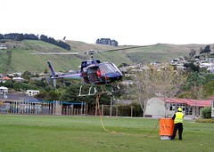
Images for risk; more images...

Developing an Emergency Hub Plan for Governors Bay. Report prepared part o…
Research papers, University of Canterbury Library
Research undertaken and literature reviewed show that major natural disasters present considerable risk to Governors Bay. Earthquakes, and resulting secondary hazards from natural disasters, could lead to the isolation of the Governors Bay community for an extended period. In particular, the rupture of the Alpine Fault and the resulting mega-quake could leave Governors Bay isolated for well over three weeks. Weaknesses in existing infrastructure in Governors Bay further places residents at risk. Therefore, it is essential that residents are prepared for a period of extended isolation, with little to no access to clean water, power, internet and cellular coverage. Ultimately, community preparedness will be the key to maintaining social cohesion and saving lives during an emergency event. The community hub in Governors Bay establishes a pre-determined locale for community co-ordination, collection, and distribution of supplies as well as a functional place to go when all else fails.
Dallington 19
Articles, UC QuakeStudies
A photograph captioned, "We get the young fellas to come in and do the upkeep on the government houses that have been sold. They cut down all the long grass and just tidy up all the fire risk sections. This one's easier cos the house is gone. If you keep it tidy it looks tidy from the road. There's people living here, and there's nothing worse than looking over your house and seeing grass this high".
Warning Contaminated Water
Images, UC QuakeStudies
A sign warning of contaminated water lies on the ground. The sign reads "Warning, contaminated water. Due to Sewage Overflows the water is unsafe for human contact and activity and is a Public Health Risk. Please keep all people and pets out of contact with the water and do not consume any seafood or shellfish collected from this area." The photographer comments, "The sign for contaminated water has fallen, but the warning should still be heeded".
Checkpoint Top Stories for Friday 3 May 2013
Audio, Radio New Zealand
Police prosecutor jailed for dealing drugs;Sharebrokers getting late rush of MRP investors;Pressure mounts on MP Aaron Gilmore;Police rule out anyone else being at risk;Mother of electrocuted son is pleased that electricians been named and shamed;NZ Post signals to Government it will need to invest in KiwiBank in two years;Judge says young killer could have made something of himself;Elderly in Christchurch say they are low on priority list for earthquake repairs and payouts.
Māori and the Christchurch earthquakes: The interplay between Indigenous e…
Research papers, Lincoln University
The disastrous earthquakes that struck Christchurch in 2010 and 2011 seriously impacted on the individual and collective lives of Māori residents. This paper continues earlier, predominantly qualitative research on the immediate effects on Māori by presenting an analysis of a survey carried out 18 months after the most destructive event, on 22 February 2011. Using a set-theoretic approach, pathways to Māori resilience are identified, emphasising the combination of whānau connectivity and high incomes in those who have maintained or increased their wellbeing post-disaster. However, the results show that if resilience is used to describe a “bounce back” in wellbeing, Māori are primarily enduring the post-disaster environment. This endurance phase is a precursor to any resilience and will be of much longer duration than first thought. With continued uncertainty in the city and wider New Zealand economy, this endurance may not necessarily lead to a more secure environment for Māori in the city.
Mary Hobbs' Story
Articles, UC QuakeStudies
Summary of oral history interview with Mary Hobbs about her experiences of the Canterbury earthquakes.
Christchurch earthquake victim's husband says new rules 'putting money ahe…
Audio, Radio New Zealand
Money is being put ahead of lives according the husband of a woman who died when the CTV building pancaked in the Christchurch earthquake. The government is moving to a new risk based approach to earthquake strengthening, saying it will save building owners more than $8.2 billion across New Zealand. Under the rules a building like the CTV building would not automatically be deemed earhquake prone. Professor Mann Alkaisi who's wife died in that building, spoke to Lisa Owen.
Fairfax Video, December 2013 (1)
Videos, UC QuakeStudies
A video of a press conference with Gerry Brownlee announcing a CERA review which will change the zoning of 270 Port Hills properties. Brownlee announces that 247 properties will change from green zoned to red zoned and 33 properties will change from red zoned to green zoned. The properties that have been rezoned red have an unacceptable level of life risk from cliff collapse and the potential of debris inundation.
Lifelines - Lessons from Natural Hazards in Canterbury
Research papers, University of Canterbury Library
The Canterbury Earthquake Recovery Authority (CERA) and the Canterbury Lifeline Utilities Group have collaborated to assemble documented infra- structure-related learnings from the recent Canterbury earthquakes and other natural hazard events over the last 15 years (i.e. since publication of Risks and Realities). The project was led by the Centre for Advanced Engineering (CAE) and was undertaken to promote knowledge sharing by facilitating access to diverse documents on natural hazard learnings, a matter of ongoing relevance and very considerable current interest.
Multi-Hazard Analysis: Gap Analysis Report
Research papers, University of Canterbury Library
Christchurch City Council (Council) is undertaking the Land Drainage Recovery Programme in order to assess the effects of the earthquakes on flood risk to Christchurch. In the course of these investigations it has become better understood that floodplain management should be considered in a multi natural hazards context. Council have therefore engaged the Jacobs, Beca, University of Canterbury, and HR Wallingford project team to investigate the multihazards in eastern areas of Christchurch and develop flood management options which also consider other natural hazards in that context (i.e. how other hazards contribute to flooding both through temporal and spatial coincidence). The study has three stages: Stage 1 Gap Analysis – assessment of information known, identification of gaps and studies required to fill the gaps. Stage 2 Hazard Studies – a gap filling stage with the studies identified in Stage 1. Stage 3 Collating, Optioneering and Reporting – development of options to manage flood risk. This present report is to document findings of Stage 1 and recommends the studies that should be completed for Stage 2. It has also been important to consider how Stage 3 would be delivered and the gaps are prioritised to provide for this. The level of information available and hazards to consider is extensive; requiring this report to be made up of five parts each identifying individual gaps. A process of identifying information for individual hazards in Christchurch has been undertaken and documented (Part 1) followed by assessing the spatial co-location (Part 2) and probabilistic presence of multi hazards using available information. Part 3 considers multi hazard presence both as a temporal coincidence (e.g. an earthquake and flood occurring at one time) and as a cascade sequence (e.g. earthquake followed by a flood at some point in the future). Council have already undertaken a number of options studies for managing flood risk and these are documented in Part 4. Finally Part 5 provides the Gap Analysis Summary and Recommendations to Council. The key findings of Stage 1 gap analysis are: - The spatial analysis showed eastern Christchurch has a large number of hazards present with only 20% of the study area not being affected by any of the hazards mapped. Over 20% of the study area is exposed to four or more hazards at the frequencies and data available. - The majority of the Residential Red Zone is strongly exposed to multiple hazards, with 86% of the area being exposed to 4 or more hazards, and 24% being exposed to 6 or more hazards. - A wide number of gaps are present; however, prioritisation needs to consider the level of benefit and risks associated with not undertaking the studies. In light of this 10 studies ranging in scale are recommended to be done for the project team to complete the present scope of Stage 3. - Stage 3 will need to consider a number of engineering options to address hazards and compare with policy options; however, Council have not established a consistent policy on managed retreat that can be applied for equal comparison; without which substantial assumptions are required. We recommend Council undertake a study to define a managed retreat framework as an option for the city. - In undertaking Stage 1 with floodplain management as the focal point in a multi hazards context we have identified that Stage 3 requires consideration of options in the context of economics, implementation and residual risk. Presently the scope of work will provide a level of definition for floodplain options; however, this will not be at equal levels of detail for other hazard management options. Therefore, we recommend Council considers undertaking other studies with those key hazards (e.g. Coastal Hazards) as a focal point and identifies the engineering options to address such hazards. Doing so will provide equal levels of information for Council to make an informed and defendable decision on which options are progressed following Stage 3.
Tsunami evacuation dynamics following the 2016 Kaikōura earthquake in Chri…
Research papers, University of Canterbury Library
Recent global tsunami events have highlighted the importance of effective tsunami risk management strategies (including land-use planning, structural and natural defences, warning systems, education and evacuation measures). However, the rarity of tsunami means that empirical data concerning reactions to tsunami warnings and tsunami evacuation behaviour is rare when compared to findings about evacuations to avoid other sources of hazard. To date empirical research into tsunami evacuations has focused on evacuation rates, rather than other aspects of the evacuation process. More knowledge is required about responses to warnings, pre-evacuation actions, evacuation dynamics and the return home after evacuations. Tsunami evacuation modelling has the potential to inform evidence-based tsunami risk planning and response. However to date tsunami evacuation models have largely focused on timings of evacuations, rather than evacuation behaviours. This Masters research uses a New Zealand case study to reduce both of these knowledge gaps. Qualitative survey data was gathered from populations across coastal communities in Banks Peninsula and Christchurch, New Zealand, required to evacuate due to the tsunami generated by the November 14th 2016 Kaikōura Earthquake. Survey questions asked about reactions to tsunami warnings, actions taken prior to evacuating and movements during the 2016 tsunami evacuation. This data was analysed to characterise trends and identify factors that influenced evacuation actions and behaviour. Finally, it was used to develop an evacuation model for Banks Peninsula. Where appropriate, the modelling inputs were informed by the survey data. Three key findings were identified from the results of the evacuation behaviour survey. Although 38% of the total survey respondents identified the earthquake shaking as a natural cue for the tsunami, most relied on receiving official warnings, including sirens, to prompt evacuations. Respondents sought further official information to inform their evacuation decisions, with 39% of respondents delaying their evacuation in order to do so. Finally, 96% of total respondents evacuated by car. This led to congestion, particularly in more densely populated Christchurch city suburbs. Prior to this research, evacuation modelling had not been completed for Banks Peninsula. The results of the modelling showed that if evacuees know how to respond to tsunami warnings and where and how to evacuate, there are no issues. However, if there are poor conditions, including if people do not evacuate immediately, if there are issues with the roading network, or if people do not know where or how to evacuate, evacuation times increase with there being more bottlenecks leading out of the evacuation zones. The results of this thesis highlight the importance of effective tsunami education and evacuation planning. Reducing exposure to tsunami risk through prompt evacuation relies on knowledge of how to interpret tsunami warnings, and when, where and how to evacuate. Recommendations from this research outline the need for public education and engagement, and the incorporation of evacuation signage, information boards and evacuation drills. Overall these findings provide more comprehensive picture of tsunami evacuation behaviour and decision making based on empirical data from a recent evacuation, which can be used to improve tsunami risk management strategies. This empirical data can also be used to inform evacuation modelling to improve the accuracy and realism of the evacuation models.
Fairfax Video, July 2012 (4)
Videos, UC QuakeStudies
A video of an interview with Laurence Mote about the wall of containers in Sumner. Shipping containers line the south side of Main Road in Sumner, protecting road users from potential rock fall from the cliffs above. Mote bikes past the containers every day on his way to work. He talks about the risks facing cyclists along Main Road and in greater Christchurch, including pot holes and narrow roads. He advises cyclists to wear bright clothing and lights, and for cars to slow down and give cyclists room.
An Independent Review of Project Management Processes for CERA’s Port Hill…
Research papers, University of Canterbury Library
This report to RCP Ltd and University of Canterbury summarises the findings of a 5 month secondment to the CERA Port Hills Land Clearance Team. Improvement strategies were initiated and observed. The Port Hills Land Clearance Programme is the undertaking of the demolition of all built structures from the Crown’s compulsory acquired 714 residential red zoned properties. These properties are zoned red due to an elevated life risk as a result of geotechnical land uncertainty following the 2011 Canterbury Earthquakes.
Geographic variation in exposure to the 2010/11 Canterbury earthquake seri…
Research papers, University of Canterbury Library
Natural hazard disasters often have large area-wide impacts, which can cause adverse stress-related mental health outcomes in exposed populations. As a result, increased treatment-seeking may be observed, which puts a strain on the limited public health care resources particularly in the aftermath of a disaster. It is therefore important for public health care planners to know whom to target, but also where and when to initiate intervention programs that promote emotional wellbeing and prevent the development of mental disorders after catastrophic events. A large body of literature assesses factors that predict and mitigate disaster-related mental disorders at various time periods, but the spatial component has rarely been investigated in disaster mental health research. This thesis uses spatial and spatio-temporal analysis techniques to examine when and where higher and lower than expected mood and anxiety symptom treatments occurred in the severely affected Christchurch urban area (New Zealand) after the 2010/11 Canterbury earthquakes. High-risk groups are identified and a possible relationship between exposure to the earthquakes and their physical impacts and mood and anxiety symptom treatments is assessed. The main research aim is to test the hypothesis that more severely affected Christchurch residents were more likely to show mood and anxiety symptoms when seeking treatment than less affected ones, in essence, testing for a dose-response relationship. The data consisted of mood and anxiety symptom treatment information from the New Zealand Ministry of Health’s administrative databases and demographic information from the National Health Index (NHI) register, when combined built a unique and rich source for identifying publically funded stress-related treatments for mood and anxiety symptoms in almost the whole population of the study area. The Christchurch urban area within the Christchurch City Council (CCC) boundary was the area of interest in which spatial variations in these treatments were assessed. Spatial and spatio-temporal analyses were done by applying retrospective space-time and spatial variation in temporal trends analysis using SaTScan™ software, and Bayesian hierarchical modelling techniques for disease mapping using WinBUGS software. The thesis identified an overall earthquake-exposure effect on mood and anxiety symptom treatments among Christchurch residents in the context of the earthquakes as they experienced stronger increases in the risk of being treated especially shortly after the catastrophic 2011 Christchurch earthquake compared to the rest of New Zealand. High-risk groups included females, elderly, children and those with a pre-existing mental illness with elderly and children especially at-risk in the context of the earthquakes. Looking at the spatio-temporal distribution of mood and anxiety symptom treatments in the Christchurch urban area, a high rates cluster ranging from the severely affected central city to the southeast was found post-disaster. Analysing residential exposure to various earthquake impacts found that living in closer proximity to more affected areas was identified as a risk factor for mood and anxiety symptom treatments, which largely confirms a dose-response relationship between level of affectedness and mood and anxiety symptom treatments. However, little changes in the spatial distribution of mood and anxiety symptom treatments occurred in the Christchurch urban area over time indicating that these results may have been biased by pre-existing spatial disparities. Additionally, the post-disaster mobility activity from severely affected eastern to the generally less affected western and northern parts of the city seemed to have played an important role as the strongest increases in treatment rates occurred in less affected northern areas of the city, whereas the severely affected eastern areas tended to show the lowest increases. An investigation into the different effects of mobility confirmed that within-city movers and temporary relocatees were generally more likely to receive care or treatment for mood or anxiety symptoms, but moving within the city was identified as a protective factor over time. In contrast, moving out of the city from minor, moderately or severely damaged plain areas of the city, which are generally less affluent than Port Hills areas, was identified as a risk factor in the second year post-disaster. Moreover, residents from less damaged plain areas of the city showed a decrease in the likelihood of receiving care or treatment for mood or anxiety symptoms compared to those from undamaged plain areas over time, which also contradicts a possible dose-response relationship. Finally, the effects of the social and physical environment, as well as community resilience on mood and anxiety symptom treatments among long-term stayers from Christchurch communities indicate an exacerbation of pre-existing mood and anxiety symptom treatment disparities in the city, whereas exposure to ‘felt’ earthquake intensities did not show a statistically significant effect. The findings of this thesis highlight the complex relationship between different levels of exposure to a severe natural disaster and adverse mental health outcomes in a severely affected region. It is one of the few studies that have access to area-wide health and impact information, are able to do a pre-disaster / post-disaster comparison and track their sample population to apply spatial and spatio-temporal analysis techniques for exposure assessment. Thus, this thesis enhances knowledge about the spatio-temporal distribution of adverse mental health outcomes in the context of a severe natural disaster and informs public health care planners, not only about high-risk groups, but also where and when to target health interventions. The results indicate that such programs should broadly target residents living in more affected areas as they are likely to face daily hardship by living in a disrupted environment and may have already been the most vulnerable ones before the disaster. Special attention should be focussed on women, elderly, children and people with pre-existing mental illnesses as they are most likely to receive care or treatment for stress-related mental health symptoms. Moreover, permanent relocatees from affected areas and temporarily relocatees shortly after the disaster may need special attention as they face additional stressors due to the relocation that may lead to the development of adverse mental health outcomes needing treatment.
Fairfax Video, December 2012 (8)
Videos, UC QuakeStudies
A video of an interview with Rick Hellings, Managing Director of Smiths City Group, about the experiences of businesses in the aftermath of the 2010 and 2011 Canterbury earthquakes. Hellings talks about the changes in regulation and geography in Christchurch after the earthquakes and the importance of managing risks, understanding insurance, and being prepared for change. He also talks about the importance of keeping customers and business partners informed, looking after staff and customers, and reducing costs to offset the increases in rent. This video is part of a series about businesses in Christchurch after the earthquakes.
Cross-sectoral suicide prevention implementation post-disasters in Canterb…
Research papers, University of Canterbury Library
From 2010, Canterbury, a province of Aotearoa New Zealand, experienced three major disaster events. This study considers the socio-ecological impacts on cross-sectoral suicide prevention agencies and their service users of the 2010 – 2016 Canterbury earthquake sequence, the 2019 Christchurch mosque attacks and the COVID-19 pandemic in Canterbury. This study found the prolonged stress caused by these events contributed to a rise in suicide risk factors including anxiety, fear, trauma, distress, alcohol misuse, relationship breakdown, childhood adversity, economic loss and deprivation. The prolonged negative comment by the media on wellbeing in Canterbury was also unhelpful and affected morale. The legacy of these impacts was a rise in referrals to mental health services that has not diminished. This adversity in the socio-ecological system also produced post-traumatic growth, allowing Cantabrians to acquire resilience and help-seeking abilities to support them psychologically through the COVID-19 pandemic. Supporting parental and teacher responses, intergenerational support and targeted public health campaigns, as well as Māori family-centred programmes, strengthened wellbeing. The rise in suicide risk led to the question of what services were required and being delivered in Canterbury and how to enable effective cross-sectoral suicide prevention in Canterbury, deemed essential in all international and national suicide prevention strategies. Components from both the World Health Organisation Suicide Prevention Framework (WHO, 2012; WHO 2021) and the Collective Impact model (Hanleybrown et al., 2012) were considered by participants. The effectiveness of dynamic leadership and the essential conditions of resourcing a supporting agency were found as were the importance of processes that supported equity, lived experience and the partnership of Māori and non-Māori stakeholders. Cross-sectoral suicide prevention was found to enhance the wellbeing of participants, hastening learning, supporting innovation and raising awareness across sectors which might lower stigma. Effective communication was essential in all areas of cross-sectoral suicide prevention and clear action plans enabled measurement of progress. Identified components were combined to create a Collective Impact Suicide Prevention framework that strengthens suicide prevention implementation and can be applied at a local, regional and national level. This study contributes to cross-sectoral suicide prevention planning by considering the socio- ecological, policy and practice mitigations required to lower suicide risk and to increase wellbeing and post-traumatic growth, post-disaster. This study also adds to the growing awareness of the contribution that social work can provide to suicide prevention and conceptualises an alternative governance framework and practice and policy suggestions to support effective cross-sectoral suicide prevention.
Implementing a disaster recovery programme: a demolition and debris manage…
Research papers, University of Canterbury Library
The timeliness and quality of recovery activities are impacted by the organisation and human resourcing of the physical works. This research addresses the suitability of different resourcing strategies on post-disaster demolition and debris management programmes. This qualitative analysis primarily draws on five international case studies including 2010 Canterbury earthquake, 2009 L’Aquila earthquake, 2009 Samoan Tsunami, 2009 Victorian Bushfires and 2005 Hurricane Katrina. The implementation strategies are divided into two categories: collectively and individually facilitated works. The impacts of the implementation strategies chosen are assessed for all disaster waste management activities including demolition, waste collection, transportation, treatment and waste disposal. The impacts assessed include: timeliness, completeness of projects; and environmental, economic and social impacts. Generally, the case studies demonstrate that detritus waste removal and debris from major repair work is managed at an individual property level. Debris collection, demolition and disposal are generally and most effectively carried out as a collective activity. However, implementation strategies are affected by contextual factors (such as funding and legal constraints) and the nature of the disaster waste (degree of hazardous waste, geographical spread of waste etc.) and need to be designed accordingly. Community involvement in recovery activities such as demolition and debris removal is shown to contribute positively to psychosocial recovery.
Christchurch lawyer accuses govt contractors of intimidation
Audio, Radio New Zealand
A lawyer who is suing Southern Response on behalf of earthquake claimants says he was intimidated by private investigators for another government agency in 2013. Southern Response is in charge of settling the outstanding quake claims of former AMI customers in Christchurch, but is now under investigation by the public sector watchdog, the State Services Commission. The Commission is looking at whether standards of integrity and conduct for state servants have been breached in its hiring of security company, Thompson and Clark. Southern Response says it hired the firm in 2014 to assess the level of risk some customers posed to staff. Lawyer Grant Shand tells Guyon Espiner he's waiting to see the results of the inquiry.
Improving community resilience to natural events
Research papers, University of Canterbury Library
Improving community resilience requires a way of thinking about the nature of a community. Two complementary aspects are proposed: the flows connecting the community with its surrounding environment and the resources the community needs for its ongoing life. The body of necessary resources is complex, with many interactions between its elements. A systems approach is required to understand the issues adequately. Community resilience is discussed in general terms together with strategies for improving it. The ideas are then illustrated and amplified by an extended case study addressing means of improving the resilience of a community on the West Coast of New Zealand to natural disasters. The case study is in two phases. The first relies on a mix of on-the-ground observations and constructed scenarios to provide recommendations for enhancing community resilience, while the second complements the first by developing a set of general lessons and issues to be addressed from observations of the Christchurch earthquakes of 2010 and 2011.
How can tiny homes encourage adaptive community development in response to…
Research papers, University of Canterbury Library
The affect that the Christchurch Earthquake Sequence(CES) had on Christchurch residents was severe, and the consequences are still being felt today. The Ōtākaro Avon River Corridor (OARC) was particularly impacted, a geographic zone that had over 7,000 homes which needed to be vacated and demolished. The CES demonstrated how disastrous a natural hazard can be on unprepared communities. With the increasing volatility of climate change being felt around the world, considering ways in which communities can reduce their vulnerabilities to natural hazards is vital. This research explores how communities can reduce their vulnerabilities to natural hazards by becoming more adaptable, and in particular the extent to which tiny homes could facilitate the development of adaptive communities. In doing so, three main themes were explored throughout this research: (1) tiny homes, (2) environmental adaptation and (3) community adaptability. To ensure that it is relevant and provides real value to the local community, the research draws upon the local case study of the Riverlution Tiny House Village(RTHV), an innovative community approach to adaptable, affordable, low-impact, sustainable living on margins of land which are no longer suitable for permanent housing. The main findings of the research are that Christchurch is at risk of climate change and natural hazards and it is therefore important to consider ways in which communities can stay intact and connected while adapting to the risks they face. Tiny homes provide an effective way of doing so, as they represent a tangible way that people can take adaptation into their own hands while maintaining a high-quality lifestyle.
Mapping shallow groundwater salinity in a coastal urban setting to assess …
Research papers, University of Canterbury Library
Study region: Christchurch, New Zealand. Study focus: Low-lying coastal cities worldwide are vulnerable to shallow groundwater salinization caused by saltwater intrusion and anthropogenic activities. Shallow groundwater salinization can have cascading negative impacts on municipal assets, but this is rarely considered compared to impacts of salinization on water supply. Here, shallow groundwater salinity was sampled at high spatial resolution (1.3 piezometer/km2 ), then mapped and spatially interpolated. This was possible due to a uniquely extensive set of shallow piezometers installed in response to the 2010–11 Canterbury Earthquake Sequence to assess liquefaction risk. The municipal assets located within the brackish groundwater areas were highlighted. New hydrological insights for the region: Brackish groundwater areas were centred on a spit of coastal sand dunes and inside the meander of a tidal river with poorly drained soils. The municipal assets located within these areas include: (i) wastewater and stormwater pipes constructed from steel-reinforced concrete, which, if damaged, are vulnerable to premature failure when exposed to chloride underwater, and (ii) 41 parks and reserves totalling 236 ha, within which salt-intolerant groundwater-dependent species are at risk. This research highlights the importance of determining areas of saline shallow groundwater in low-lying coastal urban settings and the co-located municipal assets to allow the prioritisation of sites for future monitoring and management.
Seismic Assessment and Retrofit Prioritisation of Auckland Council’s Prope…
Research papers, The University of Auckland Library
Territorial authorities in New Zealand are responding to regulatory and market forces in the wake of the 2011 Christchurch earthquake to assess and retrofit buildings determined to be particularly vulnerable to earthquakes. Pending legislation may shorten the permissible timeframes on such seismic improvement programmes, but Auckland Council’s Property Department is already engaging in a proactive effort to assess its portfolio of approximately 3500 buildings, prioritise these assets for retrofit, and forecast construction costs for improvements. Within the programme structure, the following varied and often competing factors must be accommodated: * The council’s legal, fiscal, and ethical obligations to the people of Auckland per building regulations, health and safety protocols, and economic growth and urban development planning strategies; * The council’s functional priorities for service delivery; * Varied and numerous stakeholders across the largest territorial region in New Zealand in both population and landmass; * Heritage preservation and community and cultural values; and * Auckland’s prominent economic role in New Zealand’s economy which requires Auckland’s continued economic production post-disaster. Identifying those buildings most at risk to an earthquake in such a large and varied portfolio has warranted a rapid field assessment programme supplemented by strategically chosen detailed assessments. Furthermore, Auckland Council will benefit greatly in time and resources by choosing retrofit solutions, techniques, and technologies applicable to a large number of buildings with similar configurations and materials. From a research perspective, the number and variety of buildings within the council’s property portfolio will provide valuable data for risk modellers on building typologies in Auckland, which are expected to be fairly representative of the New Zealand building stock as a whole.
The influence of legislative and governance arrangements on public engagem…
Research papers, University of Canterbury Library
Under the framework of New Public Management, the government has decentralised the responsibility for Disaster Risk Management (DRM) to regional, local, and community levels in New Zealand. This decentralisation serves political agendas related to resource allocation and is supported by empirical evidence suggesting that involving communities in DRM during recovery decision-making enhances disaster resilience. Extensive evidence indicates that community participation in DRM, especially during recovery decision-making, can significantly improve recovery outcomes at the community level. However, there has been limited research into whether the legal framework in New Zealand effectively facilitates meaningful public engagement to empower the public in influencing disaster recovery decisions. To address this gap in the literature, this thesis aims to explore the extent to which legislative and governance arrangements transfer the responsibility, liability, and costs of managing disaster risks to local levels without enabling meaningful public contribution to and influence on recovery decisions affecting them. Situated within Public Law and Disaster Risk and Resilience disciplines and using a case study of Greater Christchurch, New Zealand, this interdisciplinary thesis examines both common law and statutory provisions in the legal framework impacting public engagement before and during recovery from the Canterbury Earthquake Sequence. In particular, this thesis assesses how legislative, and governance frameworks influenced communities’ ability to influence recovery decision-making following the 2010-2011 Canterbury Earthquake Sequence (CES). This thesis shows that before the CES, the New Zealand public engagement system closely adhered to the common law principle of the ‘duty to consult’, which remains the current legal standard. This principle required decision-makers to use the 'public notice and comment' approach as a minimum, limiting meaningful community participation in decision-making. After the earthquakes, reliance on this traditional approach caused growing frustration and division locally, as the public struggled to effectively engage in and influence recovery decisions, resulting in new community activism. The Canterbury Earthquake Recovery Act (CER Act), introduced following the Christchurch Earthquake, included innovative provisions on public engagement. However, for various reasons, this Act appeared to have minimal impact on meaningful public engagement in recovery decision-making, which continued to align with the broader, existing public engagement system and associated norms. The empirical findings indicate that despite the novel legislative language, the traditional public engagement framework in New Zealand constrained effective engagement, leading to a broader erosion of trust between the public and the government. This was largely attributed to the default ‘public notice and comment’ approach at the local government level, with inadequate mechanisms for community engagement in central government decision-making shaping the expectations of recovery decision-makers still operating within this framework. Notable departures from this traditional approach were evident in the practices of the Waimakariri District Council and Christchurch City Council. Particularly noteworthy was the ‘Share an Idea’ public engagement campaign. Unlike conventional processes, it did not commence with a near-final or draft document. Instead, it utilised participatory mechanisms that fostered meaningful dialogue, enabling the public to significantly shape the content of the draft Christchurch Central Recovery Plan. The initial success of such participatory engagement underscores its potential effectiveness throughout the entire recovery planning process, an option that was not exercised by the central government. In conclusion, this thesis argues that New Zealand should move beyond the entrenched ‘public notice and comment’ approach and adopt more open and inclusive public participation mechanisms. It contends that supplementing this approach with proactive participatory methods before disasters could yield favorable outcomes during disaster recovery, thereby ensuring meaningful public involvement in future decisions that affect communities.
Nisbet, Alistair, 1958- :'Who needs light rail when you can have right wha…
Images, Alexander Turnbull Library
The title reads 'CBD: High water table, flood/liquefaction risk...' The cartoon shows several Southern Right whales being used to ferry people around Christchurch City. Someone says 'Who needs light rail when you can have right whale!' Context: discussion about building a light rail system as a part of Christchurch post-earthquake development. Context: Several large Southern right whales have found Akaroa Harbour to their liking this week, sticking around rather than heading back south as part of their annual migration back to Antarctica. Quantity: 1 digital cartoon(s).
Shadowy futures : the effect of turbidity on yellow-eyed mullet (Aldrichet…
Research papers, University of Canterbury Library
Worldwide turbidity is a huge concern for the health of aquatic ecosystems. Human activities on the land such as construction, deforestation, agriculture, and mining all have impacts on the amount of particulate solids that enter the world’s waterways. These particulate solids can pose a number of risks to aquatic life, but primary among them is the turbidity that they create in the water column. The way suspended solids interact with light creates cloudiness in the water which interferes with the vision, and visually mediated behaviours of aquatic organisms, particularly fish. The Avon-Heathcote estuary of Christchurch, New Zealand, is one such body of water that is subject to tremendous variation in turbidity, no doubt exacerbated by the destruction of Christchurch in the 2010 and 2011 earthquakes, as well as the subsequent ongoing rebuild. The yellow eyed mullet, Aldrichetta Forsteri, is one species that is common with the estuary, and uses it as a habitat for breeding. Though very common throughout New Zealand, and even a part of the catch of commercial fisheries, the yellow eyed mullet is a largely unstudied organism, with virtually no published scientific enquiry based on the species. The present work assesses how several behaviours of the yellow eyed mullet are effected by acute turbidity at 10, 50, 90, 130 and 170 NTU, finding that: 1) The optomotor response of mullet to 2.5 mm stripes drops to insignificant levels between 10 and 50 NTU, 2) The swimming activity of the yellow eyed mullet is highest at 10 NTU and drops to a significantly lower level at higher turbidities, 3) The grouping behaviour of small groups of yellow eyed mullet are unchanged by increasing turbidity levels, 4) that yellow eyed mullet do not exhibit significantly different behavioural response to a simulated predator at any of the tested turbidities, and 5) that yellow eyed mullet to do significantly alter their oxygen consumption during exposure to the turbidities in an increasing series. The results presented in these studies indicate that turbidites above 50 NTU pose a significant risk to the lifestyle of the yellow eyed mullet, potentially impacting their ability to perceive their surroundings, feed, school, and avoid predation. Future work has a lot of ground to cover to more precisely determine the relationship between yellow eyed mullet behaviour and physiology, and the turbidity of their environment. In particular, future work should focus more closely on the turbidities between 10 and 50 NTU, as well as looking to field work to see what the predominant predators of the mullet are, and specifically whether turbidity increases or decreases the risk of mullet being subject to avian predation. There is also considerable scope for studies on the effects of chronic turbidity upon mullet, which will add understand to the predicament of escalating turbidity and its effects upon this common and yet mysterious native fish.
Multi-hazards and the City: Tsunami and River Flooding in Earthquake Impac…
Research papers, University of Canterbury Library
In the aftermath of the 2010-2011 Canterbury Earthquake Sequence (CES), the location of Christchurch-City on the coast of the Canterbury Region (New Zealand) has proven crucial in determining the types of- and chains of hazards that impact the city. Very rapidly, the land subsidence of up to 1 m (vertical), and the modifications of city’s waterways – bank sliding, longitudinal profile change, sedimentation and erosion, engineered stop-banks… - turned rainfall and high-tides into unprecedented floods, which spread across the eastern side of the city. Within this context, this contribution presents two modeling results of potential floods: (1) results of flood models and (2) the effects of further subsidence-linked flooding – indeed if another similar earthquake was to strike the city, what could be the scenarios of further subsidence and then flooding. The present research uses the pre- and post-CES LiDAR datasets, which have been used as the boundary layer for the modeling. On top of simple bathtub model of inundation, the river flood model was conducted using the 2-D hydrodynamic code NAYS-2D developed at the University of Hokkaido (Japan), using a depth-averaged resolution of the hydrodynamic equations. The results have shown that the area the most at risk of flooding are the recent Holocene sedimentary deposits, and especially the swamplands near the sea and in the proximity of waterways. As the CES drove horizontal and vertical displacement of the land-surface, the surface hydrology of the city has been deeply modified, increasing flood risks. However, it seems that scientists and managers haven’t fully learned from the CES, and no research has been looking at the potential future subsidence in further worsening subsidence-related floods. Consequently, the term “coastal quake”, coined by D. Hart is highly topical, and most especially because most of our modern cities and mega-cities are built on estuarine Holocene sediments.
Sink or swim? The planner’s predicament in a changing Christchurch
Research papers, Lincoln University
The world is constantly changing. Christchurch, New Zealand, has recently experienced drastic changes after earthquakes struck the city. The earthquakes caused the city to physically shake, and the land to sink in some places and rise in others. Now further change is forcast and parts of Christchurch could be under water by 2115 according to experts. Climate change induced sea level rise is recognised as a international issue with potential impacts for coastal communities all over the world. The Chrischtchurch City Council is required to have a 100-year planning horizon for sea level rise and this means planning for at least one meter, and possibly up to two meters, of sea level rise by 2115. This dissertation investigates the planning response to slow onset disasters, change, and uncertainty, using the example of sea-level rise in Christchurch, and it examines the role of public participation in this. To achieve this, the ways in which planning theory and practice acknowledge uncertainty, and cope with change, were critically analysed along with the Christchurch City Council’s response to the Tonkin and Taylor predictions and modelling. Semi-structured interviews with professionals in natural hazards risk reduction, policy, and planning were conducted, and the previous and proposed Christchurch City District Plans were compared. Planning for sea level rise in Christchurch provides an example of how planners may cope with slow onset change. The results of this dissertation suggests that the favoured risk reduction strategy for coastal communities in Christchurch is an adaptation strategy, and at present there is no sign of managed retreat being employed. The results also suggests using a planning approach that involves public participation for best results when planning for change, uncertainty or slow onset disasters.
Disaster Waste Management: a systems approach
Research papers, University of Canterbury Library
Depending on their nature and severity, disasters can create large volumes of debris and waste. Waste volumes from a single event can be the equivalent of many times the annual waste generation rate of the affected community. These volumes can overwhelm existing solid waste management facilities and personnel. Mismanagement of disaster waste can affect both the response and long term recovery of a disaster affected area. Previous research into disaster waste management has been either context specific or event specific, making it difficult to transfer lessons from one disaster event to another. The aim of this research is to develop a systems understanding of disaster waste management and in turn develop context- and disaster-transferrable decision-making guidance for emergency and waste managers. To research this complex and multi-disciplinary problem, a multi-hazard, multi-context, multi-case study approach was adopted. The research focussed on five major disaster events: 2011 Christchurch earthquake, 2009 Victorian Bushfires, 2009 Samoan tsunami, 2009 L’Aquila earthquake and 2005 Hurricane Katrina. The first stage of the analysis involved the development of a set of ‘disaster & disaster waste’ impact indicators. The indicators demonstrate a method by which disaster managers, planners and researchers can simplify the very large spectra of possible disaster impacts, into some key decision-drivers which will likely influence post-disaster management requirements. The second stage of the research was to develop a set of criteria to represent the desirable environmental, economic, social and recovery effects of a successful disaster waste management system. These criteria were used to assess the effectiveness of the disaster waste management approaches for the case studies. The third stage of the research was the cross-case analysis. Six main elements of disaster waste management systems were identified and analysed. These were: strategic management, funding mechanisms, operational management, environmental and human health risk management, and legislation and regulation. Within each of these system elements, key decision-making guidance (linked to the ‘disaster & disaster waste’ indicators) and management principles were developed. The ‘disaster & disaster waste’ impact indicators, the effects assessment criteria and management principles have all been developed so that they can be practically applied to disaster waste management planning and response in the future.
Road infrastructure exposure to fault displacement hazard : regional analy…
Research papers, University of Canterbury Library
Recent surface-rupturing earthquakes in New Zealand have highlighted significant exposure and vulnerability of the road network to fault displacement. Understanding fault displacement hazard and its impact on roads is crucial for mitigating risks and enhancing resilience. There is a need for regional-scale assessments of fault displacement to identify vulnerable areas within the road network for the purposes of planning and prioritising site-specific investigations. This thesis employs updated analysis of data from three historical surface-rupturing earthquakes (Edgecumbe 1987, Darfield 2010, and Kaikoūra 2016) to develop an empirical model that addresses the gap in regional fault displacement hazard analysis. The findings contribute to understanding of • How to use seismic hazard model inputs for regional fault displacement hazard analysis • How faulting type and sediment cover affects the magnitude and spatial distribution of fault displacement • How the distribution of displacement and regional fault displacement hazard is impacted by secondary faulting • The inherent uncertainties and limitations associated with employing an empirical approach at a regional scale • Which sections of New Zealand’s roading network are most susceptible to fault displacement hazard and warrant site-specific investigations • Which regions should prioritise updating emergency management plans to account for post-event disruptions to roading. I used displacement data from the aforementioned historical ruptures to generate displacement versus distance-to-fault curves for various displacement components, fault types, and geological characteristics. Using those relationships and established relationships for along-strike displacement, displacement contours were generated surrounding active faults within the NZ Community Fault Model. Next, I calculated a new measure of 1D strain along roads as well as relative hazard, which integrated 1D strain and normalised slip rate data. Summing these values at the regional level identified areas of heightened relative hazard across New Zealand, and permits an assessment of the susceptibility of road networks using geomorphon land classes as proxies for vulnerability. The results reveal that fault-parallel displacements tend to localise near the fault plane, while vertical and fault-perpendicular displacements sustain over extended distances. Notably, no significant disparities were observed in off-fault displacement between the hanging wall and footwall sides of the fault, or among different surface geology types, potentially attributed to dataset biases. The presence of secondary faulting in the dataset contributes to increased levels of tectonic displacement farther from the fault, highlighting its significance in hazard assessments. Furthermore, fault displacement contours delineate broader zones around dip-slip faults compared to strike-slip faults, with correlations identified between fault length and displacement width. Road ‘strain’ values are higher around dip-slip faults, with notable examples observed in the Westland and Buller Districts. As expected, relative hazard analysis revealed elevated values along faults with high slip rates, notably along the Alpine Fault. A regional-scale analysis of hazard and exposure reveals heightened relative hazard in specific regions, including Wellington, Southern Hawke’s Bay, Central Bay of Plenty, Central West Coast, inland Canterbury, and the Wairau Valley of Marlborough. Notably, the Central West Coast exhibits the highest summed relative hazard value, attributed to the fast-slipping Alpine Fault. The South Island generally experiences greater relative hazard due to larger and faster-slipping faults compared to the North Island, despite having fewer roads. Central regions of New Zealand face heightened risk compared to Southern or Northern regions. Critical road links intersecting high-slipping faults, such as State Highways 6, 73, 1, and 2, necessitate prioritisation for site-specific assessments, emergency management planning and targeted mitigation strategies. Roads intersecting with the Alpine Fault are prone to large parallel displacements, requiring post-quake repair efforts. Mitigation strategies include future road avoidance of nearby faults, modification of road fill and surface material, and acknowledgement of inherent risk, leading to prioritised repair efforts of critical roads post-quake. Implementing these strategies enhances emergency response efforts by improving accessibility to isolated regions following a major surface-rupturing event, facilitating faster supply delivery and evacuation assistance. This thesis contributes to the advancement of understanding fault displacement hazard by introducing a novel regional, empirical approach. The methods and findings highlight the importance of further developing such analyses and extending them to other critical infrastructure types exposed to fault displacement hazard in New Zealand. Enhancing our comprehension of the risks associated with fault displacement hazard offers valuable insights into various mitigation strategies for roading infrastructure and informs emergency response planning, thereby enhancing both national and global infrastructure resilience against geological hazards.
Warnings house and contents insurance overpriced
Audio, Radio New Zealand
New Zealanders are paying too much for house and contents insurance, according to a new survey. Consumer NZ's price comparison survey shows climate and natural hazard risk is being factored in, and is more expensive than ever. Quotes for a large house differed by more than $3,000 across Auckland, Hamilton, Wellington, Christchurch, and Dunedin, and there's a more than $2,000 difference between the cheapest and most expensive policies on offer for a standard-sized house. If you live somewhere with a higher chance of earthquakes - such as Wellington or Christchurch - you'll be charged more for insurance. The cost of house and contents insurance has risen by 5.6% this year, over the past ten years it's gone up 150%. Kathryn is joined by Consumer NZ's Gemma Rasmussen and Katrina Shanks Chief Executive of Financial Advice New Zealand, which represents independent and professional financial advisors.