Search
found 1701 results
Images for central; more images...

BeckerFraserPhotos December 2011 photograph 2009
Images, UC QuakeStudies
A photograph captioned by BeckerFraserPhotos, "Pieces of iron fretwork from the entrance to the Warners Hotel carefully laid on the ground in front of the building. Thisshows the careful salvaging which has taken place during the demolistion of many heritage building in order to be able to re-use significant pieces later".
BeckerFraserPhotos October 2011 photograph 410
Images, UC QuakeStudies
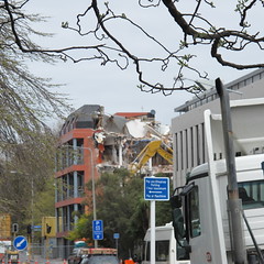
A pile of rubble from a demolished building on Worcester Street. In the background, the partially demolished Warners Hotel can be seen as well as the Novotel and the PricewaterhouseCoopers Building in the distance. A digger and long-reach excavator can also be seen.
WEMO ERT Set 1 - February 2011 - Photograph 26
Images, UC QuakeStudies
A photograph of the earthquake damage to the Provincial Hotel on the corner of Barbadoes and Cashel Streets. The second storey walls have crumbled, and the bricks have fallen onto the ground below. Scaffolding erected in front of the building is now on a lean. Wire fencing has been placed around the building as a cordon.
WEMO ERT Set 3 - February 2011 - Photograph 016
Images, UC QuakeStudies
A photograph of members of the Wellington Emergency Management Office Emergency Response Team in Latimer Square. There are members of other emergency management teams in the background including the Tauranga Response Team, the Taupo Response Team, and the New South Wales USAR team.
WEMO ERT Set 2 - February 2011 - Photograph 07
Images, UC QuakeStudies
A photograph of the earthquake-damaged Cathedral of the Blessed Sacrament on Barbadoes Street. Rubble from the collapsed tower is lying on the ground in front. A car has been crushed under this rubble. Wire fencing, shipping containers, and road cones have been placed around the building as a cordon.
WEMO ERT Set 3 - February 2011 - Photograph 051
Images, UC QuakeStudies
A photograph of the earthquake-damaged Cathedral of the Blessed Sacrament on Barbadoes Street. Rubble from the collapsed tower is lying on the ground in front. A car has been crushed under this rubble. Wire fencing, shipping containers, and road cones have been placed around the building as a cordon.
WEMO ERT Set 1 - February 2011 - Photograph 24
Images, UC QuakeStudies
A photograph of the earthquake damage to the Cathedral of the Blessed Sacrament on Barbadoes Street. The tower on the right has crumbled, and the masonry has fallen to the pavement below. A car has been crushed by the fallen rubble. Windows in the tower behind are broken.
WEMO ERT Set 3 - February 2011 - Photograph 052
Images, UC QuakeStudies
A photograph of the earthquake-damaged Cathedral of the Blessed Sacrament on Barbadoes Street. Rubble from the collapsed tower is lying on the ground in front. A car has been crushed under this rubble. Wire fencing, shipping containers, and road cones have been placed around the building as a cordon.
BeckerFraserPhotos October 2011 photograph 614
Images, UC QuakeStudies
Photograph captioned by BeckerFraserPhotos, "Aerial view of the centre of the city, with the cathedral in the centre, and the art gallery in the foreground".
Paul and Sam Corliss's Street Art Photograph (2011:07:13 04:42:33)
Images, UC QuakeStudies
A photograph of street art on the wall of a building on Colombo Street. The artwork is by Otis Frizzell and depicts police officer Constable Nao Yoshimizu comforting the grieving relative of an earthquake victim. Constable Yoshimizu acted as liaison officer for the families of Japanese victims of the earthquake. The mural was commissioned by the New Zealand Police as a recruitment advertisement.
BeckerFraserPhotos December 2011 photograph 2014
Images, UC QuakeStudies
A photograph captioned by BeckerFraserPhotos, "The demolition site of the Press building and Warners Hotel in Cathedral Square. The site has now been filled and compressed so that it provides a much pleasanter environment. From here, there is now a marvellous view of the Heritage Apartments building, which allows us a wider perspective of the building than was possible before".
WEMO ERT Set 3 - February 2011 - Photograph 050
Images, UC QuakeStudies
A photograph of the earthquake damage to the Cycle Trading store on Manchester Street. The gable of the store has collapsed, and bricks and other rubble have fallen onto the footpath in front. A car parked on the street has been crushed by the fallen rubble. The word "Clear" has been spray-painted on the front of the car. Wire fencing has been placed around the building as a cordon.
WEMO ERT Set 1 - February 2011 - Photograph 23
Images, UC QuakeStudies
A photograph of the earthquake damage to the Cathedral of the Blessed Sacrament on Barbadoes Street. The tower on the right has crumbled and the masonry has fallen to the pavement below. A car has been crushed by the fallen rubble. The dome of the left tower has collapsed and the cross at the top of the building is on a lean.
WEMO ERT Set 1 - February 2011 - Photograph 16
Images, UC QuakeStudies
A photograph of the earthquake-damaged buildings and rubble on Colombo Street near the intersection of St Asaph Street. The walls of the top storey of the buildings to the left have crumbled, and bricks and other rubble have fallen onto the footpath and road below. Wire fencing and police tape have been placed across the street as a cordon.
WEMO ERT Team Set 1 - April 2011 - Photograph 3
Images, UC QuakeStudies
A photograph of a map used by emergency management personnel to inspect buildings after the 22 February 2011 earthquake. The map is of central Christchurch. Almost all of the blocks outside four streets (Moorhouse Avenue, Oxford Terrace, Kilmore Street, and Barbadoes Street) have been highlighted in yellow. Latimer Square has also been highlighted. A message written at the top of the map reads, "Query pile checked by dogs".
BeckerFraserPhotos December 2011 photograph 0288
Images, UC QuakeStudies
An aerial photograph of Hereford Street and Cathedral Square. The photograph has been captioned by BeckerFraserPhotos, "Hereford Street running across the foreground of this photograph, with Cathedral Square above. The IBIS Hotel and the ANZ Bank are staying, while the BNZ is currently being soft-stripped. Christ Church Cathedral officially has a status of 'partial demolish'".
BeckerFraserPhotos December 2011 photograph 0343
Images, UC QuakeStudies
An aerial photograph of High, Lichfield, Manchester, and Tuam Streets. The photographs has been captioned by BeckerFraserPhotos, "High Street can be seen running from the bottom left to the top right of the photograph. The old Majestic Theatre is prominent halfway up on the left. The prominent streets are Lichfield Street (on the left) and Tuam Street (on the right)".
WEMO ERT Set 1 - February 2011 - Photograph 63
Images, UC QuakeStudies
A photograph of a Wellington Emergency Management Office Emergency Response Team member talking to a member of the Professional Building Services on Gloucester Street. In the background is the Press House building with many cracks in the façade. Bits of bricks and other debris are scattered across the footpath. Some of the windows above the facade have broken. USAR codes have been spray-painted on one of the bottom-storey windows.
WEMO ERT Set 1 - February 2011 - Photograph 19
Images, UC QuakeStudies
A photograph of the earthquake damage to the Country Theme store on the corner of Manchester and St Asaph Streets. Sections of the second storey walls have crumbled, and the bricks have fallen onto the footpath below. Wire fences have been placed around the building as a cordon. Red stickers on the front door and the wire fence indicate that the building is not safe to enter.
BeckerFraserPhotos December 2011 photograph 0284
Images, UC QuakeStudies
An aerial photograph of the Christchurch CBD. The photograph has been captioned by BeckerFraserPhotos, "This photograph shows the many tall CBD buildings, with the Hotel Grand Chancellor under demolition in the centre of the photograph. The street in the foreground running up the photograph from left to right is Lichfield Street with the old Bus Exchange clearly visible".
Performance of Bridges during the 2010 Darfield and 2011 Christchurch Eart…
Research papers, The University of Auckland Library
The region in and around Christchurch, encompassing Christchurch city and the Selwyn and Waimakariri districts, contains more than 800 road, rail, and pedestrian bridges. Most of these bridges are reinforced concrete, symmetric, and have small to moderate spans (15–25 m). The 22 February 2011 moment magnitude (Mw) 6.2 Christchurch earthquake induced high levels of localized ground shaking (Bradley and Cubrinovski 2011, page 853 of this issue; Guidotti et al. 2011, page 767 of this issue; Smyrou et al. 2011, page 882 of this issue), with damage to bridges mainly confined to the central and eastern parts of Christchurch. Liquefaction was evident over much of this part of the city, with lateral spreading affecting bridges spanning both the Avon and Heathcote rivers.