Search
found 18487 results
Images for Community; more images...


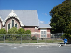
Umut Akguzel Photograph 462
Images, UC QuakeStudies
A photograph of the badly-damaged buildings on the corner of High Street and Tuam Street. The corner has been cordoned off and fallen bricks lie behind the fences. Stark, white mannequins can be seen in the windows.
Elizabeth Ackermann Photograph 085
Images, UC QuakeStudies
A photograph of the second storey of the partially-demolished Westende Jewellers Building on the corner of Manchester and Worcester Streets, which housed Alva Rados Mexican restaurant. The building was severely damage during the 4 September 2010 earthquake and had to be demolished.
Jennifer Middendorf's Blog 09/10/2013: Random things
Articles, UC QuakeStudies
An entry from Jennifer Middendorf's blog for 9 October 2013 entitled, "Random things".
Jennifer Middendorf's Blog 20/09/2013: Show and tell
Articles, UC QuakeStudies
An entry from Jennifer Middendorf's blog for 20 September 2013 entitled, "Show and tell".
Jennifer Middendorf's Blog 21/01/2014: Weekend wanderings
Articles, UC QuakeStudies
An entry from Jennifer Middendorf's blog for 21 January 2014 entitled, "Weekend wanderings".
Ruth Gardner's Blog 30/09/2013: Scape 'n' Streets
Articles, UC QuakeStudies
An entry from Ruth Gardner's blog for 30 September 2013 entitled, "Scape 'n' Streets".
Ruth Gardner's Blog 23/01/2014: Alhambra Attractions
Articles, UC QuakeStudies
An entry from Ruth Gardner's Blog for 23 January 2014 entitled, "Alhambra Attractions".
Ruth Gardner's Blog 01/03/2011: Two minute silence - inside the Christchur…
Articles, UC QuakeStudies
An entry from Ruth Gardner's blog for 1 March 2011 entitled, "Two minute silence - inside the Christchurch cordon".
Ruth Gardner's Blog 05/09/2010: Aftershocks
Articles, UC QuakeStudies
An entry from Ruth Gardner's blog for 5 September 2010 entitled, "Aftershocks".
Ruth Gardner's Blog 24/09/2010: Earthquake Update 24/9
Articles, UC QuakeStudies
An entry from Ruth Gardner's blog for 24 September 2010 entitled, "Earthquake Update 24/9".
Ruth Gardner's Blog 06/09/2010: Riverside Ravages
Articles, UC QuakeStudies
An entry from Ruth Gardner's blog for 6 September 2010 entitled, "Riverside Ravages".
Ruth Gardner's Blog 22/02/2012: Loss of Lives, Livelihood and Living
Articles, UC QuakeStudies
An entry from Ruth Gardner's blog for 22 February 2012 entitled, "Loss of Lives, Livelihood and Living".
Ruth Gardner's Blog 12/03/2011: Day 19, 10am - inside the red zone
Articles, UC QuakeStudies
An entry from Ruth Gardner's blog for 12 March 2011 entitled, "Day 19, 10am - inside the red zone".
Transcript of John Le Riche's earthquake story
Articles, UC QuakeStudies
Transcript of John Le Riche's earthquake story, captured by the UC QuakeBox project.
Assessing the link between sea level rise and mental well-being : a case s…
Research papers, University of Canterbury Library
With sea level rise (SLR) fast becoming one of the most pressing matters for governments worldwide, there has been mass amounts of research done on the impacts of SLR. However, these studies have largely focussed on the ways that SLR will impact both the natural and built environment, along with how the risk to low-lying coastal communities can be mitigated, while the inevitable impacts that this will have on mental well-being has been understudied. This research has attempted to determine the ways in which SLR can impact the mental well-being of those living in a low-lying coastal community, along with how these impacts could be mitigated while remaining adaptable to future environmental change. This was done through conducting an in-depth literature review to understand current SLR projections, the key components of mental well-being and how SLR can influence changes to mental well-being. This literature review then shaped a questionnaire which was distributed to residents of the New Brighton coastline. This questionnaire asked respondents how they interact with the local environment, how much they know about SLR and its associated hazards, whether SLR causes any level of stress or worry along with how respondents feel that these impacts could be mitigated. This research found that SLR impacts the mental well-being of those living in low-lying coastal communities through various methods: firstly, the respondents perceived risk to SLR and its associated hazards, which was found to be influenced by the suburbs that respondents live in, their knowledge of SLR, their main sources of information and the prior experience of the Canterbury Earthquake Sequence (CES). Secondly, the financial aspects of SLR were also found to be drivers of stress or worry, with depreciating property values and rising insurance premiums being frequently noted by respondents. It was found that the majority of respondents agreed that being involved in and informed of the protection process, having more readable and accurate information, and an increased engagement with community events and greenspaces would help to reduce the stress or worry caused by SLR, while remaining adaptable to future environmental change.
Paul and Sam Corliss's Street Art Photograph (2015:03:22 14:38:13)
Images, UC QuakeStudies
A photograph of a section of a piece of street art on the wall of a building between Brighton Mall and Hawke Street. This section of the artwork depicts a child blowing bubbles.
Paul and Sam Corliss's Street Art Photograph (2015:03:22 14:32:19)
Images, UC QuakeStudies
A photograph of street art on a door in New Brighton. The photographer believes that the artwork was created by the artist 'Porta'.
Paul and Sam Corliss's Street Art Photograph (2015:03:21 12:45:18)
Images, UC QuakeStudies
A photograph of street art on a shipping container behind the Embassy clothing store on Colombo Street. The photographer believes that the artwork was created by the artist 'Paulie'.
Paul and Sam Corliss's Street Art Photograph (2015:03:21 12:45:20)
Images, UC QuakeStudies
A photograph of street art on a shipping container behind the Embassy clothing store on Colombo Street. The photographer believes that the artwork was created by the artist 'Paulie'.
Paul and Sam Corliss's Street Art Photograph (2015:02:20 13:39:42)
Images, UC QuakeStudies
A photograph of a section of a piece of street art on Manchester Street. This section of the artwork is of an elephant. The photograph believes that the artwork was created by the artist Owen Dippie.
Paul and Sam Corliss's Street Art Photograph (2015:02:20 13:40:00)
Images, UC QuakeStudies
A photograph of street art on the wall of a building on Manchester Street. This section of the artwork depicts two elephants. The photograph believes that the artwork was created by the artist Owen Dippie.
Paul and Sam Corliss's Street Art Photograph (2015:02:20 13:46:15)
Images, UC QuakeStudies
A photograph of street art on Welles Street. Birds, animals and flowers are depicted on a green, plant-filled background. The artist is Flox.
Paul and Sam Corliss's Street Art Photograph (2015:02:20 13:36:11)
Images, UC QuakeStudies
A photograph of street art on the wall of a building on Manchester Street. The artwork is of four elephants. The photograph believes that the artwork was created by the artist Owen Dippie.
Paul and Sam Corliss's Street Art Photograph (2015:02:20 13:39:20)
Images, UC QuakeStudies
A photograph of street art on the partially-demolished wall of the Odeon Theatre. The photograph believes that the artwork was created by the artist Owen Dippie.
Paul and Sam Corliss's Street Art Photograph (2015:02:20 13:46:39)
Images, UC QuakeStudies
A photograph of street art on Welles Street. The artwork depicts flowers and rabbits in shades of green. The artist is Flox.
Paul and Sam Corliss's Street Art Photograph (2015:02:20 13:35:25)
Images, UC QuakeStudies
A photograph of street art on the partially-demolished walls of the Odeon Theatre.
Paul and Sam Corliss's Street Art Photograph (2015:02:20 13:36:04)
Images, UC QuakeStudies
A photograph of street art on the wall of a building on Manchester Street. The artwork is of four elephants. The photograph believes that the artwork was created by the artist Owen Dippie.
Paul and Sam Corliss's Street Art Photograph (2015:02:20 13:37:08)
Images, UC QuakeStudies
A photograph of street art on the wall of a building on Manchester Street. The artwork depicts four elephants. The photograph believes that the artwork was created by the artist Owen Dippie.
Paul and Sam Corliss's Street Art Photograph (2015:03:22 14:43:17)
Images, UC QuakeStudies
A photograph of a section of a piece of street art on a wall facing onto a car park off Hawke Street. This section is signed, "To Jessie, I love you baby, Merry Christmas".
Elizabeth Ackermann Photograph 215
Images, UC QuakeStudies
A photograph of workers loading a trailer with items salvaged from people's homes during the Residential Access Project. The project gave residents temporary access within the red-zone cordon in order to retrieve items from their homes.