
Search
found 168 results
Images for 2011; more images...


1940s bike-athon
Audio, Radio New Zealand
Back in 2011, a slightly rusty three speed bike abandoned after the September earthquake on a demolition site in Christchurch caught the attention of John Smithies. He's 72, only slightly older than the bike, and he decided it would be just the bicycle to take on a epic, 2000 kilometre journey from Cape Reinga to Bluff. He started in September and expects to reach Bluff on Friday. He's making the epic journey in memory of his wife, Alison who died two years ago of a form of non-Hodgkin lymphoma. The ride down State Highway One is raising money for leukemia and blood cancer.
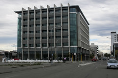
20131231_8509_EOS M-22 Forsyth Barr building with remains of PWC just behi…
Images, eqnz.chch.2010
Another city walk around, this time with my brother-in-law from Auckland. Also went to the Quake City exhibition in the city organised by the Canterbury Museum. First fine day for a while.
20130827_2683_1D3-28 Thanks 4 the Memories exhibit
Images, eqnz.chch.2010
Worcester Blvd. Lawrence Roberts works for Photo & Video in Christchurch, suppliers of much of my photo gear in exchange for cash!
20131231_8513_EOS M-22 The chocolate double decker
Images, eqnz.chch.2010
Another city walk around, this time with my brother-in-law from Auckland. Also went to the Quake City exhibition in the city organised by the Canterbury Museum. First fine day for a while. This bus is used as a chocolate restaurant, and is parked next to the Pallet Pavilion on the site of the old Park Royal Hotel.
20130827_2674_1D3-35 Where Scott was
Images, eqnz.chch.2010
The site of the Robert Falcon Scott statue. Here is what it looked like before (lining up ICE from POLICE on the Police building) www.flickr.com/photos/johnstewartnz/5921425414/in/set-721...
The influence of near-fault motions on liquefaction triggering during the …
Research papers, University of Canterbury Library
The objective of this study is to examine the influence of near-fault motions on liquefaction triggering in Christchurch and neighboring towns during the 2010-2011 Canterbury earthquake sequence (CES). The CES began with the 4 September 2010, Mw7.1 Darfield earthquake and included up to ten events that triggered liquefaction. However, most notably, widespread liquefaction was induced by the Darfield earthquake and the Mw6.2, 22 February 2011 Christchurch earthquake. Of particular relevance to this study is the forward directivity effects that were prevalent in the motions recorded during the Darfield earthquake, and to a much lesser extent, during the Christchurch earthquake. A 2D variant of the Richart-Newmark fatigue theory was used to compute the equivalent number of cycles (neq) for the ground motions, where volumetric strain was used as the damage metric. This study is unique because it considers the contribution and phasing of both the fault-normal and fault-parallel components of motion on neq and the magnitude scaling factor (MSF). It was found that when the fault-normal and fault-parallel motions were treated individually, the former yielded a lower neq than the latter. Additionally, when the combined effects of fault-normal and fault-parallel components were considered, it was found that the MSF were higher than those commonly used. This implies that motions containing near-fault effects are less demanding on the soil than motions that do not. This may be one of several factors that resulted in less severe liquefaction occurring during the Darfield earthquake than the Christchurch earthquake.
The Panel with Brian Edwards and Michele Boag (Part 1)
Audio, Radio New Zealand
Topics - Official statistics released today show New Zealand's population has increased by 214,000 people in the seven years since the last census. The census, usually held every five years, was delayed in 2011 due to the Christchurch earthquakes. In what has been described as a "stealthy assault" in Somalia - and also in a raid in Libya's capital - US special forces have struck out against Islamic extremists who carried out terrorist attacks in East Africa. The commandos snatched a Libyan al-Qaida leader allegedly involved in the bombings of US embassies 15 years ago - but aborted a mission to capture a terrorist suspect linked to last month's Nairobi shopping mall attack after a fierce firefight.
20130915_3534_1D3-24 Cardboard Cathedral
Images, eqnz.chch.2010
A couple of city blocks away from the now damaged Cathedral a temporary $4million cathedral has been built using large cardboard tubes and sheeting.
20131231_8504_EOS M-22 Looking up Cashel Street
Images, eqnz.chch.2010
Another city walk around, this time with my brother-in-law from Auckland. Also went to the Quake City exhibition in the city organised by the Canterbury Museum. First fine day for a while. For 36 years I worked in a now gone building where that red car is parked (on the left). and would have walked this route thousands of times, yet now it is...
20130511_1535_EOS M-22 Captain Cook (Day 131/365)
Images, eqnz.chch.2010
The statue of Captain Cook looks over an empty Victoria Square with autumn leaves lying around. This used to be a very tidy and busy area, but is now nearly all fenced off. Pedestrian access to this section was established about five or six months ago.
The Performance of House Foundations in the Canterbury Earthquakes
Research papers, University of Canterbury Library
The Canterbury Earthquakes of 2010-2011, in particular the 4th September 2010 Darfield earthquake and the 22nd February 2011 Christchurch earthquake, produced severe and widespread liquefaction in Christchurch and surrounding areas. The scale of the liquefaction was unprecedented, and caused extensive damage to a variety of man-made structures, including residential houses. Around 20,000 residential houses suffered serious damage as a direct result of the effects of liquefaction, and this resulted in approximately 7000 houses in the worst-hit areas being abandoned. Despite the good performance of light timber-framed houses under the inertial loads of the earthquake, these structures could not withstand the large loads and deformations associated with liquefaction, resulting in significant damage. The key structural component of houses subjected to liquefaction effects was found to be their foundations, as these are in direct contact with the ground. The performance of house foundations directly influenced the performance of the structure as a whole. Because of this, and due to the lack of research in this area, it was decided to investigate the performance of houses and in particular their foundations when subjected to the effects of liquefaction. The data from the inspections of approximately 500 houses conducted by a University of Canterbury summer research team following the 4th September 2010 earthquake in the worst-hit areas of Christchurch were analysed to determine the general performance of residential houses when subjected to high liquefaction loads. This was followed by the detailed inspection of around 170 houses with four different foundation types common to Christchurch and New Zealand: Concrete perimeter with short piers constructed to NZS3604, concrete slab-on-grade also to NZS3604, RibRaft slabs designed by Firth Industries and driven pile foundations. With a focus on foundations, floor levels and slopes were measured, and the damage to all areas of the house and property were recorded. Seven invasive inspections were also conducted on houses being demolished, to examine in more detail the deformation modes and the causes of damage in severely affected houses. The simplified modelling of concrete perimeter sections subjected to a variety of liquefaction-related scenarios was also performed, to examine the comparative performance of foundations built in different periods, and the loads generated under various bearing loss and lateral spreading cases. It was found that the level of foundation damage is directly related to the level of liquefaction experienced, and that foundation damage and liquefaction severity in turn influence the performance of the superstructure. Concrete perimeter foundations were found to have performed most poorly, suffering high local floor slopes and being likely to require foundation repairs even when liquefaction was low enough that no surface ejecta was seen. This was due to their weak, flexible foundation structure, which cannot withstand liquefaction loads without deforming. The vulnerability of concrete perimeter foundations was confirmed through modelling. Slab-on-grade foundations performed better, and were unlikely to require repairs at low levels of liquefaction. Ribraft and piled foundations performed the best, with repairs unlikely up to moderate levels of liquefaction. However, all foundation types were susceptible to significant damage at higher levels of liquefaction, with maximum differential settlements of 474mm, 202mm, 182mm and 250mm found for concrete perimeter, slab-on-grade, ribraft and piled foundations respectively when subjected to significant lateral spreading, the most severe loading scenario caused by liquefaction. It was found through the analysis of the data that the type of exterior wall cladding, either heavy or light, and the number of storeys, did not affect the performance of foundations. This was also shown through modelling for concrete perimeter foundations, and is due to the increased foundation strengths provided for heavily cladded and two-storey houses. Heavy roof claddings were found to increase the demands on foundations, worsening their performance. Pre-1930 concrete perimeter foundations were also found to be very vulnerable to damage under liquefaction loads, due to their weak and brittle construction.
20130511_1538_EOS M-22 The Last National Bank?
Images, eqnz.chch.2010
I think all the National Banks in the country have been either closed or rebranded ANZ, but this one on the corner of Colombo and Armagh Streets is still inside the CBD red zone and has yet to be touched. I have heard that this building is staying so whether it becomes an ANZ or not time will tell. This was one of the top five busiest pedest...
20130827_2619_1D3-105 Queensland Search and Rescue sign
Images, eqnz.chch.2010
Exactly 2½ years (27/02/11 - 27/08/13) since the Queensland (Australia) SAR team TF1 spray painted this on a concrete fence in Armagh Street. Not many of these signs left now as many buildings have been demolished.
20130915_3522_1D3-55 Shock of the Millenium
Images, eqnz.chch.2010
The damaged (and once iconic Christchurch Cathedral) waits it's fate (repaired or demolish/rebuild) with the Millenium hotel in background.
Seismic Anisotropy and Stress of the Canterbury Plains
Research papers, Victoria University of Wellington
The Mѡ=7.1 Darfield (Canterbury) earthquake struck on 4 September 2010, approximately 45 km west of Christchurch, New Zealand. It revealed a previously unknown fault (the Greendale fault) and caused billions of dollars of damage due to high peak ground velocities and extensive liquefaction. It also triggered the Mw=6.3 Christchurch earthquake on 22 February 2011, which caused further damage and the loss of 185 lives. The objective of this research was to determine the relationship between stress and seismic properties in a seismically active region using manually-picked P and S wave arrival times from the aftershock sequence between 8 September 2010-13 January 2011 to estimate shear-wave splitting (SWS) parameters, VP =VS-ratios, anisotropy (delay-time tomography), focal mechanisms, and tectonic stress on the Canterbury plains. The maximum horizontal stress direction was highly consistent in the plains, with an average value of SHmax=116 18 . However, the estimates showed variation in SHmax near the fault, with one estimate rotating by as much as 30° counter-clockwise. This suggests heterogeneity of stress at the fault, though the cause remains unclear. Orientations of the principal stresses predominantly indicate a strike-slip regime, but there are possible thrust regimes to the west and north/east of the fault. The SWS fast directions (ø) on the plains show alignment with SHmax at the majority of stations, indicating stress controlled anisotropy. However, structural effects appear more dominant in the neighbouring regions of the Southern Alps and Banks Peninsula.
Evaluation of the Earthquake Support Coordination Service
Research papers, University of Canterbury Library
The Canterbury earthquakes, which started with the 7.1 magnitude event on September 4, 2010, caused significant damage in the region. The September 4 earthquakes brought substantial damage to land, buildings, and infrastructure, while the 6.3 magnitude earthquake on February 22, 2011 (and its subsequent aftershocks), brought even greater property damage, but also significant loss of life in addition to the region. Thousands were injured, and 185 persons died. A national State of Emergency was declared and remained in effect until April 30, 2011. A significant number of people required immediate assistance and support to deal with loss, injury, trauma experiences, and property damages. Many had to find alternate accommodation as their houses were too damaged to stay in. Of those affected, many were already vulnerable, and others had been too traumatized by the events to effectively deal with the challenges they were faced with. A number of human service organizations in the region, from both government and non-government sectors, joined forces to be able to more effectively and efficiently help those in need. This was the start of what would become known as the Earthquake Support Coordination Service. The aim of this report is to present an evaluation of the Earthquake Support Coordination Service and its collaborative organization, based on documentation and interviews with key stakeholders of the service. The aim is also to evaluate the service based on perspectives gathered among the clients as well as the coordinators working in the service. The final aim is to offer a reflection on the service model, and on what factors enabled the service, as well as recommendations regarding aspects of the service which may require review, and aspects which may be useful in other contexts.
20130901_2890_1D3-70 10:26am Gone!
Images, eqnz.chch.2010
See previous photo (exactly 3 hours earlier). Demolition of the support structure for NZ Breweries smokestack in Christchurch. CERES NZ's nibbler is at work, the pipe stack having been removed yesterday (Saturday). This is three hours after the previous photo, and just a pile of rubble sits beside the tree (largely undamaged despite being next...
20130901_2862_1D3-175 7:26am
Images, eqnz.chch.2010
Demolition of the support structure for NZ Breweries smokestack in Christchurch. CERES NZ's nibbler is at work, the pipe stack having been removed yesterday (Saturday). I retuned three hours later to see what progress had been made and it was GONE! See next photo. Damage to complex was from the 22/02/20011 earthquake.
20130123_1662_1D3-35 Canterbury substation (Day 23/365)
Images, eqnz.chch.2010
The electrical supply substation built into the Lion Breweries Canterbury Draught brewery in St Asaph Street, Christchurch. Now the whole complex is being demolished due to earthquake damage.
Post-disaster Management of Human Resources: Learning From an Extended Cri…
Research papers, University of Canterbury Library
Disasters are rare events with major consequences; yet comparatively little is known about managing employee needs in disaster situations. Based on case studies of four organisations following the devastating earthquakes of 2010 - 2011 in Christchurch, New Zealand, this paper presents a framework using redefined notions of employee needs and expectations, and charting the ways in which these influence organisational recovery and performance. Analysis of in-depth interview data from 47 respondents in four organisations highlighted the evolving nature of employee needs and the crucial role of middle management leadership in mitigating the effects of disasters. The findings have counterintuitive implications for human resource functions in a disaster, suggesting that organisational justice forms a central framework for managing organisational responses to support and engage employees for promoting business recovery.
Key elements of sectoral recovery and resilience after the Canterbury eart…
Research papers, University of Canterbury Library
The Canterbury region of New Zealand experienced four earthquakes greater than MW 6.0 between September 2010 and December 2011. This study employs system dynamics as well as hazard, recovery and organisational literature and brings together data collected via surveys, case studies and interviews with organisations affected by the earthquakes. This is to show how systemic interactions and interdependencies within and between industry and geographic sectors affect their recovery post-disaster. The industry sectors in the study are: construction for its role in the rebuild, information and communication technology which is a regional high-growth industry, trucking for logistics, critical infrastructure, fast moving consumer goods (e.g. supermarkets) and hospitality to track recovery through non-discretionary and discretionary spend respectively. Also in the study are three urban centres including the region’s largest Central Business District, which has been inaccessible since the earthquake of 22 February 2011 to the time of writing in February 2013. This work also highlights how earthquake effects propagated between sectors and how sectors collaborated to mitigate difficulties such as product demand instability. Other interacting factors are identified that influence the recovery trajectories of the different industry sectors. These are resource availability, insurance payments, aid from central government, and timely and quality recovery information. This work demonstrates that in recovering from disaster it is crucial for organisations to identify what interacting factors could affect their operations. Also of importance are efforts to reduce the organisation’s vulnerability and increase their resilience to future crises and in day-to-day operations. Lastly, the multi-disciplinary approach to understanding the recovery and resilience of organisations and industry sectors after disaster, leads to a better understanding of effects as well as more effective recovery policy.
A 3D seismic velocity model for Canterbury, New Zealand for broadband grou…
Research papers, University of Canterbury Library
his poster presents the ongoing development of a 3D Canterbury seismic velocity model which will be used in physics-based hybrid broadband ground motion simulation of the 2010-2011 Canterbury earthquakes. Velocity models must sufficiently represent critical aspects of the crustal structure over multiple length scales which will influence the results of the simulations. As a result, numerous sources of data are utilized in order to provide adequate resolution where necessary. Figure 2: (a) Seismic reflection line showing P-wave velocities and significant geologic horizons (Barnes et al. 2011), and (b) Shear wave profiles at 10 locations (Stokoe et al. 2013). Figure 4: Cross sections of the current version of the Canterbury velocity model to depths of 10km as shown in Figure 1: (a) at a constant latitude value of -43.6˚, and (b) at a constant longitude value of 172.64˚. 3. Ground Surface and Geologic Horizon Models Figure 3: (a) Ground surface model derived from numerous available digital elevation models, and (b) Base of the Quaternary sediments derived from structural contours and seismic reflection line elevations. The Canterbury region has a unique and complex geology which likely has a significant impact on strong ground motions, in particular the deep and loose deposits of the Canterbury basin. The Canterbury basin has several implications on seismic wave phenomena such as long period ground motion amplification and wave guide effects. Using a realistic 3D seismic velocity model in physics-based ground motion simulation will implicitly account for such effects and the resultant simulated ground motions can be studied to gain a fundamental understanding of the salient ground motion phenomena which occurred during the Canterbury earthquakes, and the potential for repeat occurrences in the Canterbury region. Figure 1 shows the current model domain as a rectangular area between Lat=[-43.2˚,-44.0˚], and Lon=[171.5˚,173.0˚]. This essentially spans the area between the foot of the Southern Alps in the North West to Banks Peninsula in the East. Currently the model extends to a depth of 50km below sea level.
Developing Local Partners in Emergency Planning and Management: Lyttleton …
Research papers, University of Canterbury Library
This research examines a surprising partner in emergency management - a local community time bank. Specifically, we explain the role of the Lyttelton Time Bank in promoting community resiliency following the Canterbury earthquakes in 2010 and 2011. A time bank is a grassroots exchange system in which members trade services non-reciprocally. This exchange model assumes that everyone has tradable skills and all labour is equal in value. One hour of any labour earns a member one time bank hour, which can be used to purchase another member’s services. Before the earthquakes struck, the Lyttelton Time Bank (TB) had organised over 10% of the town’s residents and 18 local organisations. It was documenting, developing, and mobilising skills to solve individual and collective problems. This report examines the Lyttelton Time Bank and its’ role before, during, and after the earthquakes based on the analysis of over three and a half years of fieldwork, observations, interviews, focus groups, trading activity, and secondary data.
Learning From Disasters
Research papers, University of Canterbury Library
Two projects are documented within this MEM Report: I. The first project examined what was learnt involving the critical infrastructure in the aftermath of natural disasters in the Canterbury region of New Zealand – the most prominent being the series of earthquakes between 2010 and 2011. The project identified several learning gaps, leading to recommendations for further investigations that could add significant value for the lifeline infrastructure community. II. Following the Lifeline Lesson Learnt Project, the Disaster Mitigation Guideline series was initiated with two booklets, one on Emergency Potable Water and a second on Emergency Sanitation. The key message from both projects is that we can and must learn from disasters. The projects described are part of the emergency management, and critical infrastructure learning cycles – presenting knowledge captured by others in a digestible format, enabling the lessons to be reapplied. Without these kinds of projects, there will be fewer opportunities to learn from other’s successes and failures when it comes to preparing for natural disasters.
Post-Disaster Mobilities: Exploring Household Relocation after the Canterb…
Research papers, University of Canterbury Library
During 2010 and 2011, a series of major earthquakes caused widespread damage in the city of Christchurch, New Zealand. The magnitude 6.3 quake in February 2011 caused 185 fatalities. In the ensuing months, the government progressively zoned residential land in Christchurch on the basis of its suitability for future occupation (considering damage from these quakes and future earthquake risk). Over 6,000 homes were placed in the ‘red-zone’, meaning that property owners were forced to sell their land to the Crown. This study analysed patterns of residential mobility amongst thirty-one red-zone households from the suburb of Southshore, Christchurch. Drawing on interviews and surveys, the research traced their experience from the zoning announcement until they had moved to a new residence. The research distinguished between short (before the zoning announcement) and long term (post the red zone ‘deadline’) forms of household relocation. The majority of households in the study were highly resistant to short term movement. Amongst those which did relocate before the zoning decision, the desire to maintain a valued social connection with a person outside of the earthquake environment was often an important factor. Some households also moved out of perceived necessity (e.g. due to lack of power or water). In terms of long-term relocation, concepts of affordability and safety were much more highly valued by the sample when purchasing post-quake property. This resulted in a distinct patterning of post-quake housing location choices. Perceived control over the moving process, relationship with government organisations and insurance companies, and time spent in the red-zone before moving all heavily influenced participants’ disaster experience. Contrary to previous studies, households in this study recorded higher levels of subjective well-being after relocating. The study proposed a typology of movers in the Christchurch post-disaster environment. Four mobility behaviours, or types, are identified: the Committed Stayers (CSs), the Environment Re-Creators (ERCs), the Resigned Acceptors (RAs), and the Opportunistic Movers (OMs). The CSs were defined by their immobility rather than their relocation aspirations, whilst the ERCs attempted to recreate or retain aspects of Southshore through their mobility. The RAs expressed a form of apathy towards the post-quake environment, whereas, on the other hand, the OMs moved relative to pre-earthquake plans, or opportunities that arose from the earthquake itself. Possibilities for further research include examining household adaptability to new residential environments and tracking further mobility patterns in the years following relocation from the red- zone.
Near-Fault Forward-Directivity Aspects of Strong Ground Motions in the 201…
Research papers, University of Canterbury Library
The purpose of this thesis is to conduct a detailed examination of the forward-directivity characteristics of near-fault ground motions produced in the 2010-11 Canterbury earthquakes, including evaluating the efficacy of several existing empirical models which form the basis of frameworks for considering directivity in seismic hazard assessment. A wavelet-based pulse classification algorithm developed by Baker (2007) is firstly used to identify and characterise ground motions which demonstrate evidence of forward-directivity effects from significant events in the Canterbury earthquake sequence. The algorithm fails to classify a large number of ground motions which clearly exhibit an early-arriving directivity pulse due to: (i) incorrect pulse extraction resulting from the presence of pulse-like features caused by other physical phenomena; and (ii) inadequacy of the pulse indicator score used to carry out binary pulse-like/non-pulse-like classification. An alternative ‘manual’ approach is proposed to ensure 'correct' pulse extraction and the classification process is also guided by examination of the horizontal velocity trajectory plots and source-to-site geometry. Based on the above analysis, 59 pulse-like ground motions are identified from the Canterbury earthquakes , which in the author's opinion, are caused by forward-directivity effects. The pulses are also characterised in terms of their period and amplitude. A revised version of the B07 algorithm developed by Shahi (2013) is also subsequently utilised but without observing any notable improvement in the pulse classification results. A series of three chapters are dedicated to assess the predictive capabilities of empirical models to predict the: (i) probability of pulse occurrence; (ii) response spectrum amplification caused by the directivity pulse; (iii) period and amplitude (peak ground velocity, PGV) of the directivity pulse using observations from four significant events in the Canterbury earthquakes. Based on the results of logistic regression analysis, it is found that the pulse probability model of Shahi (2013) provides the most improved predictions in comparison to its predecessors. Pulse probability contour maps are developed to scrutinise observations of pulses/non-pulses with predicted probabilities. A direct comparison of the observed and predicted directivity amplification of acceleration response spectra reveals the inadequacy of broadband directivity models, which form the basis of the near-fault factor in the New Zealand loadings standard, NZS1170.5:2004. In contrast, a recently developed narrowband model by Shahi & Baker (2011) provides significantly improved predictions by amplifying the response spectra within a small range of periods. The significant positive bias demonstrated by the residuals associated with all models at longer vibration periods (in the Mw7.1 Darfield and Mw6.2 Christchurch earthquakes) is likely due to the influence of basin-induced surface waves and non-linear soil response. Empirical models for the pulse period notably under-predict observations from the Darfield and Christchurch earthquakes, inferred as being a result of both the effect of nonlinear site response and influence of the Canterbury basin. In contrast, observed pulse periods from the smaller magnitude June (Mw6.0) and December (Mw5.9) 2011 earthquakes are in good agreement with predictions. Models for the pulse amplitude generally provide accurate estimates of the observations at source-to-site distances between 1 km and 10 km. At longer distances, observed PGVs are significantly under-predicted due to their slower apparent attenuation. Mixed-effects regression is employed to develop revised models for both parameters using the latest NGA-West2 pulse-like ground motion database. A pulse period relationship which accounts for the effect of faulting mechanism using rake angle as a continuous predictor variable is developed. The use of a larger database in model development, however does not result in improved predictions of pulse period for the Darfield and Christchurch earthquakes. In contrast, the revised model for PGV provides a more appropriate attenuation of the pulse amplitude with distance, and does not exhibit the bias associated with previous models. Finally, the effects of near-fault directivity are explicitly included in NZ-specific probabilistic seismic hazard analysis (PSHA) using the narrowband directivity model of Shahi & Baker (2011). Seismic hazard analyses are conducted with and without considering directivity for typical sites in Christchurch and Otira. The inadequacy of the near-fault factor in the NZS1170.5: 2004 is apparent based on a comparison with the directivity amplification obtained from PSHA.
Radio Quake: Broadcasting in Post-Quake Christchurch
Research papers, University of Canterbury Library
The Civil Defense understanding of the role of radio in disaster tends to focus on its value in providing essential information during and after the event. However this role is compromised when a station’s premises are destroyed, or rendered inaccessible by official cordons. The Radio Quake study examines how radio stations in Christchurch managed to resume broadcasting in the aftermath of the earthquake of February 22, 2011. In New Zealand’s heavily networked and commercialised radio environment there is a significant disparity between networked and independent stations’ broadcast commitments and resourcing. All Christchurch radio broadcasters were forced to improvise new locations, complex technical workarounds, and responsive styles of broadcasting after the February 22 earthquake, but the need to restore, or maintain, a full on air presence after the earthquake, rested entirely on often financially tenuous, locally owned and staffed independent radio: student, Iwi, community access, and local commercial stations. This paper will explore the resourcefulness and resilience of broadcasters riding out the aftershocks in hotels, motels, bedrooms, and a horse truck, using digital technologies in new ways to reimagine the practice of radio in Christchurch.
Initial demographic and economic changes for Maori in a post-disaster land…
Research papers, Lincoln University
The city of Ōtautahi/Christchurch experienced a series of earthquakes that began on September 4th, 2010. The most damaging event occurred on February 22nd, 2011 but significant earthquakes also occurred on June 13th and December 23rd with aftershocks still occurring well into 2012. The resulting disaster is the second deadliest natural disaster in New Zealand’s history with 185 deaths. During 2011 the Canterbury earthquakes were one of the costliest disasters worldwide with an expected cost of up to $NZ30 billion. Hundreds of commercial buildings and thousands of houses have been destroyed or are to be demolished and extensive repairs are needed for infrastructure to over 100,000 homes. As many as 8,900 people simply abandoned their homes and left the city in the first few months after the February event (Newell, 2012), and as many as 50,000 may leave during 2012. In particular, young whānau and single young women comprised a disproportionate number of these migrants, with evidence of a general movement to the North Island. Te Puni Kōkiri sought a mix of quantitative and qualitative research to examine the social and economic impacts of the Christchurch earthquakes on Māori and their whānau. The result of this work will be a collection of evidence to inform policy to support and assist Māori and their whānau during the recovery/rebuild phases. To that end, this report triangulates available statistical and geographical information with qualitative data gathered over 2010 and 2011 by a series of interviews conducted with Māori who experienced the dramatic events associated with the earthquakes. A Māori research team at Lincoln University was commissioned to undertake the research as they were already engaged in transdisciplinary research (began in the May 2010), that focused on quickly gathering data from a range of Māori who experienced the disaster, including relevant economic, environmental, social and cultural factors in the response and recovery of Māori to these events. Participants for the qualitative research were drawn from Māori whānau who both stayed and left the city. Further data was available from ongoing projects and networks that the Lincoln research team was already involved in, including interviews with Māori first responders and managers operating in the CBD on the day of the February event. Some limited data is also available from younger members of affected whānau. Māori in Ōtautahi/Christchurch City have exhibited their own culturally-attuned collective responses to the disaster. However, it is difficult to ascertain Māori demographic changes due to a lack of robust statistical frameworks but Māori outward migration from the city is estimated to range between 560 and 1,100 people. The mobility displayed by Māori demonstrates an important but unquantified response by whānau to this disaster, with emigration to Australia presenting an attractive option for young Māori, an entrenched phenomenon that correlates to cyclical downturns and the long-term decline of the New Zealand economy. It is estimated that at least 315 Māori have emigrated from the Canterbury region to Australia post-quake, although the disaster itself may be only one of a series of events that has prompted such a decision. Māori children made up more than one in four of the net loss of children aged 6 to 15 years enrolled in schools in Greater Christchurch over the year to June 2011. Research literature identifies depression affecting a small but significant number of children one to two years post-disaster and points to increasing clinical and organisational demands for Māori and other residents of the city. For those residents in the eastern or coastal suburbs – home to many of the city’s Māori population - severe damage to housing, schools, shops, infrastructure, and streets has meant disruption to their lives, children’s schooling, employment, and community functioning. Ongoing abandonment of homes by many has meant a growing sense of unease and loss of security, exacerbated by arson, burglaries, increased drinking, a stalled local and national economy, and general confusion about the city’s future. Māori cultural resilience has enabled a considerable network of people, institutions, and resources being available to Māori , most noticeably through marae and their integral roles of housing, as a coordinating hub, and their arguing for the wider affected communities of Christchurch. Relevant disaster responses need to be discussed within whānau, kōhanga, kura, businesses, communities, and wider neighbourhoods. Comprehensive disaster management plans need to be drafted for all iwi in collaboration with central government, regional, and city or town councils. Overall, Māori are remarkably philosophical about the effects of the disaster, with many proudly relishing their roles in what is clearly a historic event of great significance to the city and country. Most believe that ‘being Māori’ has helped cope with the disaster, although for some this draws on a collective history of poverty and marginalisation, features that contribute to the vulnerability of Māori to such events. While the recovery and rebuild phases offer considerable options for Māori and iwi, with Ngāi Tahu set to play an important stakeholder in infrastructural, residential, and commercial developments, some risk and considerable unknowns are evident. Considerable numbers of Māori may migrate into the Canterbury region for employment in the rebuild, and trades training strategies have already been established. With many iwi now increasingly investing in property, the risks from significant earthquakes are now more transparent, not least to insurers and the reinsurance sector. Iwi authorities need to be appraised of insurance issues and ensure sufficient coverage exists and investments and developments are undertaken with a clear understanding of the risks from natural hazards and exposure to future disasters.
Topophilia and topophobia in the post-earthquake landscape of Christchurch…
Research papers, Lincoln University
Earthquakes rupture not only the objective realm of the physical landscape, but also the subjective landscape of emotions. Using the concepts of topophilia and topophobia developed by Yi-Fu Tuan as theories of love and fear of place, this paper investigates the impact of Christchurch’s earthquakes of 2010 and 2011 on relationships with the city’s landscape. Published accounts of the earthquakes in newspapers from around New Zealand are examined for evidence of how people responded to the situation, in particular their shifting relationship with familiar landscapes. The reports illustrate how residents and visitors reacted to the actual and perceived changes to their surroundings, grappling with how a familiar place had become alien and often startling. The extreme nature of the event and the death toll of 185 heightened perceptions of the landscape, and even the most taken-for-granted elements of the landscape became amplified in significance. Enhanced understanding of the landscape of emotions is a vital component of wellbeing. Through recognising that the impact of disasters and perceived threats to familiar places has a profound emotional effect, the significance of sense of place to wellbeing can be appreciated.
Valued But Broken: Reconstructing Damaged Built Heritage
Research papers, Victoria University of Wellington
Heritage buildings are an important element of our urban environments, representing the hope and aspirations of a generation gone, reminding us of our achievements and our identity. When heritage buildings suffer damage, or fall into disrepair they are either met by one of two extremes; a bulldozer or painstaking repair. If the decision to conserve defeats the bulldozer, current heritage practice favours restoration into a mausoleum-type monument to yesteryear. But what if, rather than becoming a museum, these heritage buildings could live on and become a palimpsest of history? What if the damage was embraced and embodied in the repair? The Cathedral of the Blessed Sacrament on Barbadoes Street, Christchurch is the case study building for this thesis. Suffering damage in the Canterbury earthquakes of 2010 and 2011, the Cathedral sits in ruin waiting for decisions to be made around how it can be retained for future generations. This thesis will propose a reconstruction for the Cathedral through the analysis of precedent examples of reconstructing damaged heritage buildings and guided by a heritage framework proposed in this thesis. The employed process will be documented as an alternative method for reconstructing other damaged heritage buildings.