
Search
found 1290 results
Images for September 2010 Canterbury Earthquake; more images...


Darroch, Bob, 1940- :"It's ok - it's not the force 6 that they are expecti…
Images, Alexander Turnbull Library
The room shakes and shudders, ornaments fall off the mantelpeice, pictures fly off the walls and the family is jolted from chairs. It's granny upstairs doing her get-slim exercises'. 'It's not the force 6 that they are expecting'. Context: Reference to the Christchurch earthquakes. Quantity: 1 digital cartoon(s).
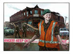
Cappuccino Dreams. "When I'm mayor you'll get more transparency in financi…
Images, Alexander Turnbull Library
'Cappuccino dreams'. Christchurch mayoral candidates Jim Anderton and incumbent mayor Bob Parker tell constituents that they will get respectively more transparency in 'financial dealings' and in 't-shirts'. As the earthquake strikes they continue their electioneering until they are told to 'clear orf' because 'these frames lack substance'. A front-end loader begins to dismantle the structure from which they are speaking. Refers to the local body elections to take place 9th October and the Canterbury earthquake of 4th September. Published in the Presto Quantity: 1 digital cartoon(s).
A comparison of ground motions and first-hand experience of the 2011 Mw6.3…
Research papers, University of Canterbury Library
This poster provides a comparison between the strong ground motions observed in the 22 February 2011 Mw6.3 Christchurch earthquake with those observed in Tokyo during the 11 March 2011 Mw9.0 Tohoku earthquake. The destuction resulting from both of these events has been well documented, although tsunami was the principal cause of damage in the latter event, and less attention has been devoted to the impact of earthquake-induced ground motions. Despite Tokyo being located over 100km from the nearest part of the causative rupture, the ground motions observed from the Tohoku earthquake were significant enough to cause structural damage and also significant liquefaction to loose reclaimed soils in Tokyo Bay. The author was fortunate enough (from the perspective of an earthquake engineer) to experience first-hand both of these events. Following the Tohoku event, the athor conducted various ground motion analyses and reconniassance of the Urayasu region in Tokyo Bay affected by liquefaction in collaboration with Prof. Kenji Ishihara. This conference is therefore a fitting opportunity in which to discuss some of authors insights obtained as a result of this first hand knowledge. Figure 1 illustrates the ground motions recorded in the Christchurch CBD in the 22 February 2011 and 4 September 2010 earthquakes, with that recorded in Tokyo Bay in the 11 March 2011 Tohoku earthquake. It is evident that these three ground motions vary widely in their amplitude and duration. The CBGS ground motion from the 22 February 2011 event has a very large amplitude (nearly 0.6g) and short duration (approx. 10s of intense shaking), as a result of the causal Mw6.3 rupture at short distance (Rrup=4km). The CBGS ground motion from the 4 September 2010 earthquake has a longer duration (approx. 30s of intense shaking), but reduced acceleration amplitude, as a result of the causal Mw7.1 rupture at a short-to-moderate distance (Rrup=14km). Finally, the Urayasu ground motion in Tokyo bay during the 11 March 2011 Tohoku earthquake exhibits an acceleration amplitude similar to the 4 September 2010 CBGS ground motion, but a significantly larger duration (approx 150s of intense shaking). Clearly, these three different ground motions will affect structures and soils in different ways depending on the vibration characteristics of the structures/soil, and the potential for strength and stiffness degradation due to cumulative effects. Figure 2 provides a comparison between the arias intensities of the several ground motion records from the three different events. It can be seen that the arias intensities of the ground motions in the Christchurch CBD from the 22 February 2011 earthquake (which is on average AI=2.5m/s) is approximately twice that from the 4 September 2010 earthquake (average AI≈1.25). This is consistent with a factor of approximately 1.6 obtained by Cubrinovski et al. (2011) using the stress-based (i.e.PGA-MSF) approach of liquefaction triggering. It can also be seen that the arias intensity of the ground motions recorded in Tokyo during the 2011 Tohoku earthquake are larger than ground motions in the Christchurch CBD from the 4 September 2011 earthquake, but smaller than those of the 22 February 2011 earthquake. Based on the arias intensity liquefaction triggering approach it can therefore be concluded that the ground motion severity, in terms of liquefaction potential, for the Tokyo ground motions is between those ground motions in Christchurch CBD from the 4 September 2010 and 22 February 2011 events.
Winter, Mark 1958- :More quACHES. 14 June 2011
Images, Alexander Turnbull Library
The cartoon consists of the words 'More quACHES' drawn with a stencil. Context - Two more earthquakes rocked Christchurch on 13th June, following those of 4 September 2010 and 22 February 2011. The first magnitude 5.5 quake struck at 1pm, 10 kilometres east of Christchurch at Taylor's Mistake beach, at a depth of 11 kilometres, and sent people scrambling for cover. It was followed at 2.20pm by a more powerful magnitude 6 quake, centred 10 kilometres southeast of the city and 9km underground. There is a wordplay on 'quakes' and 'aches'. Quantity: 1 digital cartoon(s).
The impacts of the Canterbury earthquakes on educational inequalities and …
Research papers, University of Canterbury Library
During 2010 and 2011, major earthquakes caused widespread damage and the deaths of 185 people in the city of Christchurch. Damaged school buildings resulted in state intervention which required amendment of the Education Act of 1989, and the development of ‘site sharing agreements’ in undamaged schools to cater for the needs of students whose schools had closed. An effective plan was also developed for student assessment through establishing an earthquake impaired derived grade process. Previous research into traditional explanations of educational inequalities in the United Kingdom, the United States of America, and New Zealand were reviewed through various processes within three educational inputs: the student, the school and the state. Research into the impacts of urban natural disasters on education and education inequalities found literature on post disaster education systems but nothing could be found that included performance data. The impacts of the Canterbury earthquakes on educational inequalities and achievement were analysed over 2009-2012. The baseline year was 2009, the year before the first earthquake, while 2012 is seen as the recovery year as no schools closed due to seismic events and there was no state intervention into the education of the region. National Certificate of Educational Achievement (NCEA) results levels 1-3 from thirty-four secondary schools in the greater Christchurch region were graphed and analysed. Regression analysis indicates; in 2009, educational inequalities existed with a strong positive relationship between a school’s decile rating and NCEA achievement. When schools were grouped into decile rankings (1-10) and their 2010 NCEA levels 1-3 results were compared with the previous year, the percentage of change indicates an overall lower NCEA achievement in 2010 across all deciles, but particularly in lower decile schools. By contrast, when 2011 NCEA results were compared with those of 2009, as a percentage of change, lower decile schools fared better. Non site sharing schools also achieved higher results than site sharing schools. State interventions, had however contributed towards student’s achieving national examinations and entry to university in 2011. When NCEA results for 2012 were compared to 2009 educational inequalities still exist, however in 2012 the positive relationship between decile rating and achievement is marginally weaker than in 2009. Human ethics approval was required to survey one Christchurch secondary school community of students (aged between 12 and 18), teachers and staff, parents and caregivers during October 2011. Participation was voluntary and without incentives, 154 completed questionnaires were received. The Canterbury earthquakes and aftershocks changed the lives of the research participants. This school community was displaced to another school due to the Christchurch earthquake on 22 February 2011. Research results are grouped under four geographical perspectives; spatial impacts, socio-economic impacts, displacement, and health and wellbeing. Further research possibilities include researching the lag effects from the Canterbury earthquakes on school age children.
Damage Assessment of Unreinforced Stone Masonry Buildings After the 2010-2…
Research papers, The University of Auckland Library
The sequence of earthquakes that has affected Christchurch and Canterbury since September 2010 has caused damage to a great number of buildings of all construction types. Following post-event damage surveys performed between April 2011 and June 2011, an inventory of the stone masonry buildings in Christchurch and surrounding areas was carried out in order to assemble a database containing the characteristic features of the building stock, as a basis for studying the vulnerability factors that might have influenced the seismic performance of the stone masonry building stock during the Canterbury earthquake sequence. The damage suffered by unreinforced stone masonry buildings is reported and different types of observed failures are described using a specific survey procedure currently in use in Italy. The observed performance of seismic retrofit interventions applied to stone masonry buildings is also described, as an understanding of the seismic response of these interventions is of fundamental importance for assessing the utility of such strengthening techniques when applied to unreinforced stone masonry structures. AM - Accepted Manuscript
UC Civil and Natural Resources Engineering Photograph 027
Images, UC QuakeStudies
A photograph of a fence on the Greendale Fault line which has been damaged by the 4 September 2010 earthquake. The wire has been pulled off the posts and is hanging loose. The ground has also shifted so the fence is no longer straight.
UC Civil and Natural Resources Engineering Photograph 026
Images, UC QuakeStudies
A photograph of a fence on the Greendale Fault line which has been damaged by the 4 September 2010 earthquake. The wire has been pulled off the posts and is hanging loose. The ground has also shifted so the fence is no longer straight.
UC Civil and Natural Resources Engineering Photograph 028
Images, UC QuakeStudies
A photograph of a fence on the Greendale Fault line which has been damaged by the 4 September 2010 earthquake. The wire has been pulled off the posts and is hanging loose. The ground has also shifted so the fence is no longer straight.
Top Stories for 30 September 2010
Audio, Radio New Zealand
Chaos predicted with switch in give way rules, The first GST increase in 21 years comes into force at midnight tonight, Villages around Samoa, American Samoa and Tonga are today remembering the day one year ago when lives, homes and businesses were destroyed by a deadly tsunami , One of Auckland most distinctive local bodies has made an emotional exit one month before the creation of the new super city, The Law Society has added its voice to condemnation the government is giving itself far too much power by passing the emergency Canterbury earthquake legislation.
Nisbet, Alistair, 1958- :"My god! not another aftershock!" ... 8 September…
Images, Alexander Turnbull Library
A couple are woken by loud thuds, rumbles and crashes. A woman leaps up in bed in a panic saying 'My God! Not another aftershock!' Her husband says 'Nah! Another flamin' haka!' A newspaper on the bed has a headline that reads 'World Cup in full swing.' Context: The World Cup began on Friday 9th September and ends on 23 October. People in Christchurch are still regularly jolted by aftershocks to the earthquakes of September 2010 and February and June 2011. Quantity: 1 digital cartoon(s).
The national seismic hazard model for New Zealand, and the Mw7.1 4 Septemb…
Research papers, University of Canterbury Library
A team of earthquake geologists, seismologists and engineering seismologists from GNS Science, NIWA, University of Canterbury, and Victoria University of Wellington have collectively produced an update of the 2002 national probabilistic seismic hazard (PSH) model for New Zealand. The new model incorporates over 200 new onshore and offshore fault sources, and utilises newly developed New Zealand-based scaling relationships and methods for the parameterisation of the fault and subduction interface sources. The background seismicity model has also been updated to include new seismicity data, a new seismicity regionalisation, and improved methodology for calculation of the seismicity parameters. Background seismicity models allow for the occurrence of earthquakes away from the known fault sources, and are typically modelled as a grid of earthquake sources with rate parameters assigned from the historical seismicity catalogue. The Greendale Fault, which ruptured during the M7.1, 4 September 2010 Darfield earthquake, was unknown prior to the earthquake. However, the earthquake was to some extent accounted for in the PSH model. The maximum magnitude assumed in the background seismicity model for the area of the earthquake is 7.2 (larger than the Darfield event), but the location and geometry of the fault are not represented. Deaggregations of the PSH model for Christchurch at return periods of 500 years and above show that M7-7.5 fault and background source-derived earthquakes at distances less than 40 km are important contributors to the hazard. Therefore, earthquakes similar to the Darfield event feature prominently in the PSH model, even though the Greendale Fault was not an explicit model input.
UC Civil and Natural Resources Engineering Photograph 106
Images, UC QuakeStudies
A photograph of a bookcase in the Civil Suite at the University of Canterbury after the 4 September 2010 earthquake. The photograph was taken on the day when the staff were allowed to return to the building. The shelves of the bookcase have been removed, exposing damage along the sides where they knocked against the back panel. Some books have been left on the bottom shelf.
Fairfax Video, December 2011 (5)
Videos, UC QuakeStudies
A video about Whare, a gift and homeware store which relocated several times after the 4 September 2010 earthquake. Whare originally had two stores, one in Beckenham, and another on Lichfield Street in the central city. Both stores were closed as a result of the 22 February 2011 earthquake. The store reopened temporarily in a garage and then in the Snowride Store on Lincoln Road. This video was part of The Press's 'Up and Running' series which showcases businesses which have stayed up and running despite the challenges posed by the 2010 and 2011 Canterbury earthquakes.
Evans, Malcolm Paul, 1945-:[Christchurch earthquakes and Pike River Mine] …
Images, Alexander Turnbull Library
The cartoon shows the hands of two people joined in mutual despair and kindness. One represents 'Christchurch' and the other the 'Pike River Mine'. Context - the 7.1 earthquake on 4 September 2010 in Christchurch in which there was a lot of damage but no deaths, the Pike River Mine disaster which occurred on the West Coast on 19 November 2010 and caused the deaths of 29 coal miners and now on 22 February 2011 a 6.3 magnitude earthquake in Christchurch which has probably killed more than 200 people (at this point the number is still not known) and caused much more severe damage. The reason the apparently lesser magnitude quake caused more destruction is because it was very shallow, was in the middle of the day and struck very close to the centre of the city. Colour and black and white versions of this cartoon are available Quantity: 2 digital cartoon(s).
Nisbet, Alistair, 1958- :"Is it my turn yet?" 7 June 2011
Images, Alexander Turnbull Library
Two huge wrestlers, one representing 'Port Hills fault' and the other 'Greendale fault' struggle together over a broken Christchurch. Another wrestler, representing 'Other faults' appears in the distance yelling 'Is it my turn yet?' Context - Christchurch has now had three major earthquakes and thousands of aftershocks. It now appears likely that the Christchurch quakes resulted from activity on a fault extending directly eastward from the Alpine fault that remained unknown until last year, says Roger Musson, a seismologist at the British Geological Survey in Edinburgh. The new fault first came to light last September (4th) when a stronger but less calamitous quake shook Darfield, 40 kilometres west of Christchurch. Musson says the latest quake (Feb 22, 2011) probably resulted from an eastward continuation of activity on the same fault. "It has probably not moved for tens of thousands of years, so lots of strain built up," says Musson. The third major quake happened on 13th June 2011. (New Scientist - February 22, 2011) Quantity: 1 digital cartoon(s).
Nisbet, Alistair, 1958- :'Psssssssst! Drop it boy... and we'll bounce it '…
Images, Alexander Turnbull Library
Chief executive of the Christchurch City Council, Tony Marryatt, has announced he has turned down a controversial $68,000 pay rise. The pay rise is particularly controversial in the face of widespread hardship in Christchurch because of the earthquakes that began in September 2010 and continue still. Quantity: 1 digital cartoon(s).
The Panel with Amanda Miller and Irene Gardiner (Part 1)
Audio, Radio New Zealand
Topics - New Zealand could begin full-scale military exercises with the United States within a year. A reported doubling of the number of supernatural events in Canterbury has been attributed to the 'sheer strength and power' of the September 4 earthquake, by a paranormal investigator.
Implications of the Canterbury earthquake sequence for Adelaide, South Aus…
Research papers, The University of Auckland Library
The city of Christchurch has experienced over 10,000 aftershocks since the 4th of September 2010 earthquake of which approximately 50 have been greater than magnitude 5. The damage caused to URM buildings in Christchurch over this sequence of earthquakes has been well documented. Due to the similarity in age and construction of URM buildings in Adelaide, South Australia and Christchurch (they are sister cities, of similar age and heritage), an investigation was conducted to learn lessons for Adelaide based on the Christchurch experience. To this end, the number of URM buildings in the central business districts of both cities, the extent of seismic strengthening that exists in both cities, and the relative earthquake hazards for both cities were considered. This paper will report on these findings and recommend strategies that the city of Adelaide could consider to significantly reduce the seismic risk posed by URM buildings in future earthquake.
The influence of near-fault motions on liquefaction triggering during the …
Research papers, University of Canterbury Library
The objective of this study is to examine the influence of near-fault motions on liquefaction triggering in Christchurch and neighboring towns during the 2010-2011 Canterbury earthquake sequence (CES). The CES began with the 4 September 2010, Mw7.1 Darfield earthquake and included up to ten events that triggered liquefaction. However, most notably, widespread liquefaction was induced by the Darfield earthquake and the Mw6.2, 22 February 2011 Christchurch earthquake. Of particular relevance to this study is the forward directivity effects that were prevalent in the motions recorded during the Darfield earthquake, and to a much lesser extent, during the Christchurch earthquake. A 2D variant of the Richart-Newmark fatigue theory was used to compute the equivalent number of cycles (neq) for the ground motions, where volumetric strain was used as the damage metric. This study is unique because it considers the contribution and phasing of both the fault-normal and fault-parallel components of motion on neq and the magnitude scaling factor (MSF). It was found that when the fault-normal and fault-parallel motions were treated individually, the former yielded a lower neq than the latter. Additionally, when the combined effects of fault-normal and fault-parallel components were considered, it was found that the MSF were higher than those commonly used. This implies that motions containing near-fault effects are less demanding on the soil than motions that do not. This may be one of several factors that resulted in less severe liquefaction occurring during the Darfield earthquake than the Christchurch earthquake.
Disaster lessons as governmentality : the disaster lessons of Canterbury e…
Research papers, University of Canterbury Library
Disasters that significantly affect people typically result in the production of documents detailing disaster lessons. This was the case in the 2010 and 2011 Canterbury earthquakes, as government and emergency response agencies, community organisations, and the media, engaged in the practice of producing and reporting disaster lessons. This thesis examines the disaster lessons that were developed by emergent groups following the Canterbury earthquakes (4 September 2010 and 22 February 2011). It adopts a Foucauldian analysis approach to investigate both the construction of disaster lessons and to document how this practice has come to dominate postdisaster activity following the Canterbury earthquakes. The study involved an analysis of academic literature, public documents and websites and interviews with key members of a range of Canterbury based emergent community groups. This material was used to generate a genealogy of disaster lessons, which was given in order to generate an account of how disaster lessons emerged and have come to dominate as a practice of disaster management. The thesis then examines the genealogy through the concept of governmentality so as to demonstrate how this discourse of disaster lessons has come to be used as a governing rationale that shapes and guides the emergent groups conduct in postdisaster New Zealand.
Post-earthquake structural design for fire - a New Zealand perspective
Research papers, University of Canterbury Library
On Tuesday 22 February 2011, a 6.3 magnitude earthquake struck Christchurch, New Zealand’s second largest city. The ‘earthquake’ was in fact an aftershock to an earlier 7.1 magnitude earthquake that had occurred on Saturday 4 September 2010. There were a number of key differences between the two events that meant they had dramatically different results for Christchurch and its inhabitants. The 22 February 2011 event resulted in one of New Zealand’s worst natural disasters on record, with 185 fatalities occurring and hundreds more being injured. In addition, a large number of buildings either collapsed or were damaged to the point where they needed to be totally demolished. Since the initial earthquake in September 2010, a large amount of building-related research has been initiated in New Zealand to investigate the impact of the series of seismic events – the major focus of these research projects has been on seismic, structural and geotechnical engineering matters. One project, however, conducted jointly by the University of Canterbury, the Fire Protection Association of New Zealand and BRANZ, has focused on the performance of fire protection systems in the earthquakes and the effectiveness of the systems in the event of post-earthquake fires occurring. Fortunately, very few fires actually broke out following the series of earthquake events in Christchurch, but fire after earthquakes still has significant implications for the built environment in New Zealand, and the collaborative research has provided some invaluable insight into the potential threat posed by post-earthquake fires in buildings. As well as summarising the damage caused to fire protection systems, this paper discusses the flow-on effect for designing structures to withstand post-earthquake fires. One of the underlying issues that will be explored is the existing regulatory framework in New Zealand whereby structural earthquake design and structural design for fire are treated as discrete design scenarios.
"As newly elected PM of Australia... I promise all cards on the table..." …
Images, Alexander Turnbull Library
New PM of Australia Julia Gillard stands on top of a house of cards that looks extremely unstable. She says 'As newly elected PM of Australia I promise all cards on the table'. Below are the words 'NZ not the only shaky country..' Refers to the recent closely-contested and 'most-extraordinary Australian election in decades' which has been won by Labour's Julia Gillard. The negotiating for a new government by Julia Gillard against her Liberal rival Tony Abbott took 17 days, with Julia Gillard, in the end, able to cobble together a government with the support of independents Tony Windsor and Rob Oakeshott as well as the Greens plus a long list of promises. Critics see her coalition as dysfunctional. The text below refers to the Canterbury earthquake of 4th September 2010. Quantity: 2 digital cartoon(s).
Evans, Malcolm Paul, 1945-:[Christchurch earthquake] 23 February 2011
Images, Alexander Turnbull Library
Someone holds a mobile phone and sends a text 'CH CH WE R ALL IN THS 2 GTHR' (Christchurch we are all in this together). Context - On 22 February 2011 at 12:51 pm (NZDT), Christchurch experienced a major magnitude 6.3 earthquake, which resulted in severe damage and many casualties. A National State of Emergency has been declared. This followed on from an original magnitude 7.1 earthquake on 4 September 2010 which did far less damage and in which no-one died. Both colour and black and white versions of this cartoon are available Quantity: 2 digital cartoon(s).
The Recovery of Canterbury’s Organisations:A comparative analysis of the 4…
Research papers, University of Canterbury Library
The 4 September, 22 February, and 13 June earthquakes experienced in Canterbury, New Zealand would have been significant events individually. Together they present a complex and unprecedented challenge for Canterbury and New Zealand. The repetitive and protracted nature of these events has caused widespread building and infrastructure damage, strained organisations’ financial and human resources and challenged insurer and investor confidence. The impact of the earthquakes was even more damaging coming in the wake of the worst worldwide recession since the great depression of the 1930s. However, where there is disruption there is also opportunity. Businesses and other organisations will drive the physical, economic and social recovery of Canterbury, which will be a dynamic and long-term undertaking. Ongoing monitoring of the impacts, challenges and developments during the recovery is critical to maintaining momentum and making effective mid-course adjustments. This report provides a synthesis of research carried out by the Resilient Organisations (ResOrgs) Research Programme1 at the University of Canterbury and Recover Canterbury in collaboration with Opus Central Laboratories (part of Opus International Consultants). The report includes discussions on the general state of the economy as well as data from three surveys (two conducted by ResOrgs and one by Recover Canterbury) on business impacts of the earthquakes, population movements and related economic recovery issues. This research and report offers two primary benefits:
Evans, Malcolm Paul, 1945-: RWC ticket. 17 March 2011
Images, Alexander Turnbull Library
The cartoon shows a terribly disappointed rugby fan standing in the centre of a devastated Christchurch holding up a 'RWC ticket' and bleating 'BUT...' Context - The decision that there will be no Rugby World Cup games in Christchurch because of the damage caused by the earthquakes of 4 September 2010 and 22 February 2011. Colour and black and white versions of this cartoon are available Quantity: 2 digital cartoon(s).
Walker, Malcolm, 1950-: Always design in context... 15 March 2011
Images, Alexander Turnbull Library
Text across the top of the cartoon reads 'always design in context' There is a globe, small in the context, with a little message reading 'you are here' pointing, perhaps, to New Zealand or even more specifically, Christchurch; the globe is being threatened from all sides by forces of nature represented by the hand of god reaching out of clouds. Context - the Christchurch earthquakes of 4 September 2010 and 22 February 2011 and the idea that buildings must be designed in the context of their environment - NZ being earthquake-prone. Perhaps also the idea of 'design in context' in a broader sense. Quantity: 1 digital cartoon(s).
Library services without a library: post-earthquake use of virtual referen…
Research papers, University of Canterbury Library
Following the September 2010 earthquake and the closure of a number of campus libraries, library staff at the University of Canterbury was forced to rethink how they connected with their users. The established virtual reference service now meant library staff could be contacted regardless of their physical location. After the February earthquake, with University library closures ranging from 3 weeks to indefinite, this service came into its own as a vital communication tool. It facilitated contact between the library and both students and academics, as well as proving invaluable as a means for library staff to locate and communicate with each other. Transcripts from our post-earthquake interactions with users were analyzed using NVivo and will be presented in poster format showing the increase in usage of the service following the earthquakes, who used the service most, and the numbers and types of questions received. Our virtual reference tool was well used in the difficult post-earthquake periods and we can see this usage continuing as university life returns to normal.
Tremain, Garrick 1941- :"You have reached the quake helpline..." 19 June 2…
Images, Alexander Turnbull Library
A man wearing shorts and gumboots stands surrounded by liquefaction beside his collapsing house. He tries to phone the 'Quake helpline' for assistance and gets the response 'You have reached the quake helpline... If you're up to your knees in liquefaction... Press 1. If your house is down around your ears... Press 2. If you're looking for assistance or answers press on'. Context - The increasing frustration and misery of many Christchurch residents who are experiencing huge difficulty getting assistance after months of delays and continuing aftershocks following the Christchurch earthquakes of 4th September, 22 February and the two most recent ones on 13 June. Quantity: 1 digital cartoon(s).
Vulnerabilities to Seismic Hazards in Coastal and River Environments: Less…
Research papers, University of Canterbury Library
Coastal and river environments are exposed to a number of natural hazards that have the potential to negatively affect both human and natural environments. The purpose of this research is to explain that significant vulnerabilities to seismic hazards exist within coastal and river environments and that coasts and rivers, past and present, have played as significant a role as seismic, engineering or socio-economic factors in determining the impacts and recovery patterns of a city following a seismic hazard event. An interdisciplinary approach was used to investigate the vulnerability of coastal and river areas in the city of Christchurch, New Zealand, following the Canterbury Earthquake Sequence, which began on the 4th of September 2010. This information was used to identify the characteristics of coasts and rivers that make them more susceptible to earthquake induced hazards including liquefaction, lateral spreading, flooding, landslides and rock falls. The findings of this research are applicable to similar coastal and river environments elsewhere in the world where seismic hazards are also of significant concern. An interdisciplinary approach was used to document and analyse the coastal and river related effects of the Canterbury earthquake sequence on Christchurch city in order to derive transferable lessons that can be used to design less vulnerable urban communities and help to predict seismic vulnerabilities in other New Zealand and international urban coastal and river environments for the future. Methods used to document past and present features and earthquake impacts on coasts and rivers in Christchurch included using maps derived from Geographical Information Systems (GIS), photographs, analysis of interviews from coastal, river and engineering experts, and analysis of secondary data on seismicity, liquefaction potential, geology, and planning statutes. The Canterbury earthquake sequence had a significant effect on Christchurch, particularly around rivers and the coast. This was due to the susceptibility of rivers to lateral spreading and the susceptibility of the eastern Christchurch and estuarine environments to liquefaction. The collapse of river banks and the extensive cracking, tilting and subsidence that accompanied liquefaction, lateral spreading and rock falls caused damage to homes, roads, bridges and lifelines. This consequently blocked transportation routes, interrupted electricity and water lines, and damaged structures built in their path. This study found that there are a number of physical features of coastal and river environments from the past and the present that have induced vulnerabilities to earthquake hazards. The types of sediments found beneath eastern Christchurch are unconsolidated fine sands, silts, peats and gravels. Together with the high water tables located beneath the city, these deposits made the area particularly susceptible to liquefaction and liquefaction-induced lateral spreading, when an earthquake of sufficient size shook the ground. It was both past and present coastal and river processes that deposited the types of sediments that are easily liquefied during an earthquake. Eastern Christchurch was once a coastal and marine environment 6000 years ago when the shoreline reached about 6 km inland of its present day location, which deposited fine sand and silts over this area. The region was also exposed to large braided rivers and smaller spring fed rivers, both of which have laid down further fine sediments over the following thousands of years. A significant finding of this study is the recognition that the Canterbury earthquake sequence has exacerbated existing coastal and river hazards and that assessments and monitoring of these changes will be an important component of Christchurch’s future resilience to natural hazards. In addition, patterns of recovery following the Canterbury earthquakes are highlighted to show that coasts and rivers are again vulnerable to earthquakes through their ability to recovery. This city’s capacity to incorporate resilience into the recovery efforts is also highlighted in this study. Coastal and river areas have underlying physical characteristics that make them increasingly vulnerable to the effects of earthquake hazards, which have not typically been perceived as a ‘coastal’ or ‘river’ hazard. These findings enhance scientific and management understanding of the effects that earthquakes can have on coastal and river environments, an area of research that has had modest consideration to date. This understanding is important from a coastal and river hazard management perspective as concerns for increased human development around coastlines and river margins, with a high seismic risk, continue to grow.