Search
found 110 results
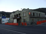
Images for 2011 New Zealand earthquake; more images...


Nisbet, Alastair, 1958- :'Can ya just pull the plug and let me die peacefu…
Images, Alexander Turnbull Library
Shows a sick and damaged Christchurch Anglican Cathedral in a hospital bed with two attendants. The Cathedral asks 'Can ya just pull the plug and let me die peacefully?'. Context refers to recent comments by Bishop Victoria Matthews that the Christchurch Cathedral is 'being left to die with no dignity' because of ongoing legal battles about its future. There has been ongoing debate and controversy over whether the Cathedral should be demolished, reconstructed or restored following damage suffered in the February 2011 Earthquake. Quantity: 1 digital cartoon(s).
The impacts of the Canterbury earthquakes on educational inequalities and …
Research papers, University of Canterbury Library
During 2010 and 2011, major earthquakes caused widespread damage and the deaths of 185 people in the city of Christchurch. Damaged school buildings resulted in state intervention which required amendment of the Education Act of 1989, and the development of ‘site sharing agreements’ in undamaged schools to cater for the needs of students whose schools had closed. An effective plan was also developed for student assessment through establishing an earthquake impaired derived grade process. Previous research into traditional explanations of educational inequalities in the United Kingdom, the United States of America, and New Zealand were reviewed through various processes within three educational inputs: the student, the school and the state. Research into the impacts of urban natural disasters on education and education inequalities found literature on post disaster education systems but nothing could be found that included performance data. The impacts of the Canterbury earthquakes on educational inequalities and achievement were analysed over 2009-2012. The baseline year was 2009, the year before the first earthquake, while 2012 is seen as the recovery year as no schools closed due to seismic events and there was no state intervention into the education of the region. National Certificate of Educational Achievement (NCEA) results levels 1-3 from thirty-four secondary schools in the greater Christchurch region were graphed and analysed. Regression analysis indicates; in 2009, educational inequalities existed with a strong positive relationship between a school’s decile rating and NCEA achievement. When schools were grouped into decile rankings (1-10) and their 2010 NCEA levels 1-3 results were compared with the previous year, the percentage of change indicates an overall lower NCEA achievement in 2010 across all deciles, but particularly in lower decile schools. By contrast, when 2011 NCEA results were compared with those of 2009, as a percentage of change, lower decile schools fared better. Non site sharing schools also achieved higher results than site sharing schools. State interventions, had however contributed towards student’s achieving national examinations and entry to university in 2011. When NCEA results for 2012 were compared to 2009 educational inequalities still exist, however in 2012 the positive relationship between decile rating and achievement is marginally weaker than in 2009. Human ethics approval was required to survey one Christchurch secondary school community of students (aged between 12 and 18), teachers and staff, parents and caregivers during October 2011. Participation was voluntary and without incentives, 154 completed questionnaires were received. The Canterbury earthquakes and aftershocks changed the lives of the research participants. This school community was displaced to another school due to the Christchurch earthquake on 22 February 2011. Research results are grouped under four geographical perspectives; spatial impacts, socio-economic impacts, displacement, and health and wellbeing. Further research possibilities include researching the lag effects from the Canterbury earthquakes on school age children.
Fairfax Video, May 2013 (10)
Videos, UC QuakeStudies
A video about the removal of 'Rocky', a 15-tonne boulder which tore through a house in Heathcote during the 22 February 2011 earthquake. The video includes an interview with Jan Kupec, Chief Geotechnical Engineer at CERA, about the dimensions and path of the boulder. It also includes interviews with James McKenzie, the manager at the Mt Hutt Ski Area who purchased the rock, and Phil Johnson, the owner of the Heathcote property who put the rock on sale.
Overview on the strengthening of New Zealand’s Unreinforced Masonry Buildi…
Research papers, The University of Auckland Library
Unreinforced masonry (URM) is a construction type that was commonly adopted in New Zealand between the 1880s and 1930s. URM construction is evidently vulnerable to high magnitude earthquakes, with the most recent New Zealand example being the 22 February 2011 Mw6.3 Christchurch earthquake. This earthquake caused significant damage to a majority of URM buildings in the Canterbury area and resulted in 185 fatalities. Many URM buildings still exist in various parts of New Zealand today, and due to their likely poor seismic performance, earthquake assessment and retrofit of the remaining URM building stock is necessary as these buildings have significant architectural heritage and occupy a significant proportion of the nation’s building stock. A collaborative research programme between the University of Auckland and Reid Construction Systems was conducted to investigate an economical yet effective solution for retrofitting New Zealand’s existing URM building stock. This solution adopts the shotcrete technique using an Engineered Cementitious Composite (ECC), which is a polyvinyl alcohol fibre reinforced mortar that exhibits strain hardening characteristics. Collaborations have been formed with a number of consulting structural engineers throughout New Zealand to develop innovative and cost effective retrofit solutions for a number of buildings. Two such case studies are presented in this paper. http://www.concrete2013.com.au/technical-program/
Red-zone letterbox sculptures
Audio, Radio New Zealand
A couple of Christchurch men are collecting letterboxes from the city's red-zoned suburbs, to create sculptures to tell the stories of the homes which have been demolished since the February 2011 earthquake. One of the men is Evan Smith - who co-chairs a group called the Avon-Otakaro Network. It's working toward creating a riverside park along the Avon, where the houses once stood.
Our Changing World - Heathcote River Recovery
Audio, Radio New Zealand
For six weeks after the February 2011 Christchurch earthquake millions of litres of raw sewage - along with lots of liquefaction - poured into the Avon and Heathcote Rivers. A team of biologists quickly got to work to measure the impact of this catastrophe on life in the Heathcote River and as they tell Alison Ballance, they were surprised by what they recorded over the next few months.
Fairfax Video, February 2013 (3)
Videos, UC QuakeStudies
A video of interviews with four enterprising young Christchurch residents recorded two years after the 22 February 2011 earthquake. The video includes interviews with Gap Filler Director Coralie Winn, Arts Centre Director Andrew Lovatt, artist Mike Hewson, and Student Volunteer Army leader Jason Pembleton. The interviewees are asked four questions: 'What do you think Christchurch city centre will look like in 10 years?', 'What do you most want to see in the new city?', 'What do you miss most about the old city?', and 'What keeps you in Christchurch?'.
Southern Story for 22 August 2013 - 37
Audio, Radio New Zealand
A new exhibition is simply called " 37". The show is by the photographer Doc Ross, features 37 Christchurch people captured on film using a 37 second exposure. The aim: to reflect the length of time their city shook during February 2011's devastating earthquake. Katy Gosset hears some of the stories behind the exhibition and hits the streets to record her own take on the 37 second concept.
Performance of Masonry Buildings in the Canterbury Earthquakes and Corresp…
Research papers, The University of Auckland Library
It is well known that buildings constructed using unreinforced masonry (URM) are susceptible to damage from earthquake induced lateral forces that may result in partial or full building collapse. The 2010/2011 Canterbury earthquakes are the most recent New Zealand example of destructive earthquakes, which have drawn people's attention to the inherent seismic weaknesses of URM buildings and anchored masonry veneer systems in New Zealand. A brief review of the data collected following the 2010 Darfield earthquake and more comprehensive documentation of data that was collected following the 2011 Christchurch earthquake is presented, along with the findings from subsequent data interrogation. Large stocks of earthquake prone vintage URM buildings that remain in New Zealand and in other seismically active parts of the world result in the need for minimally invasive and cost effective seismic retrofit techniques. The principal objective of the doctoral research reported herein was to investigate the applicability of near surface mounted (NSM) carbon fibre reinforced polymer (CFRP) strips as a seismic improvement technique. A comprehensive experimental program consisting of 53 pull tests is presented and is used to assess the accuracy of existing FRP-to-masonry bond models, with a modified model being proposed. The strength characteristics of vintage clay brick URM wall panels from two existing URM buildings was established and used as a benchmark when manufacturing replica clay brick test assemblages. The applicability of using NSM CFRP strips as a retrofitting technique for improving the shear strength and the ductility capacity of multi-leaf URM walls constructed using solid clay brick masonry is investigated by varying CFRP reinforcement ratios. Lastly, an experimental program was undertaken to validate the proposed design methodology for improving the strength capacity of URM walls. The program involved testing full-scale walls in a laboratory setting and testing full-scale walls in-situ in existing vintage URM buildings. Experimental test results illustrated that the NSM CFRP technique is an effective method to seismically strengthen URM buildings.
Fairfax Video, March 2013 (4)
Videos, UC QuakeStudies
A video about businesses in the Christchurch central city Red Zone. The Red Zone has now been renamed the Rebuild Zone. The video shows businesses which have remained untouched since the 22 February 2011 earthquake, including the Camelot Hotel and the i-SITE visitor centre in Cathedral Square, Subway on High Street, Jeans West on High Street, Time Zone on Colombo Street, Comics Compulsion on Manchester Street, Mortgage Solutions mortgage brokers on the corner of Hereford and Manchester Streets, Pocha Bar and Restaurant off Lichfield Street, and a fabric store on Lichfield Street.
Fairfax Video, October 2013 (3)
Videos, UC QuakeStudies
A video of an interview with Tony Simpson, Principal of Phillipstown School, about the High Court's ruling on the merger of Woolston School and Phillipstown School. The Ministry of Education planned to merge the schools after the 22 February 2011 earthquake. However, Justice John Fogarty declared that the Ministry's consultation process failed to meet the requirements of the Education Act in two respects and that the merger was unlawful. Simpson talks about the joy he felt on hearing the news, his disappointment that it came down to a High Court decision, and his plans for the school's future.
Spatial Modelling of Gastroenteritis Prevalence Following the February 22,…
Research papers, University of Canterbury Library
The potential for a gastroenteritis outbreak in a post-earthquake environment may increase because of compromised infrastructure services, contaminated liquefaction (lateral spreading and surface ejecta), and the presence of gastroenteritis agents in the drinking water network. A population in a post-earthquake environment might be seriously affected by gastroenteritis because it has a short incubation period (about 10 hours). The potential for a gastroenteritis outbreak in a post-earthquake environment may increase because of compromised infrastructure services, contaminated liquefaction (lateral spreading and surface ejecta), and the presence of gastroenteritis agents in the drinking water network. A population in a post-earthquake environment might be seriously affected by gastroenteritis because it has a short incubation period (about 10 hours). The aim of this multidisciplinary research was to retrospectively analyse the gastroenteritis prevalence following the February 22, 2011 earthquake in Christchurch. The first focus was to assess whether earthquake-induced infrastructure damage, liquefaction, and gastroenteritis agents spatially explained the recorded gastroenteritis cases over the period of 35 days following the February 22, 2011 earthquake in Christchurch. The gastroenteritis agents considered in this study were Escherichia coli found in the drinking water supply (MPN/100mL) and Non-Compliant Free Associated Chlorine (FAC-NC) (less than <0.02mg/L). The second focus was the protocols that averted a gastroenteritis outbreak at three Emergency Centres (ECs): Burnside High School Emergency Centre (BEC); Cowles Stadium Emergency Centre (CEC); and Linwood High School Emergency Centre (LEC). Using a mixed-method approach, gastroenteritis point prevalence and the considered factors were quantitatively analysed. The qualitative analysis involved interviewing 30 EC staff members. The data was evaluated by adopting the Grounded Theory (GT) approach. Spatial analysis of considered factors showed that highly damaged CAUs were statistically clustered as demonstrated by Moran’s I statistic and hot spot analysis. Further modelling showed that gastroenteritis point prevalence clustering could not be fully explained by infrastructure damage alone, and other factors influenced the recorded gastroenteritis point prevalence. However, the results of this research suggest that there was a tenuous, indirect relationship between recorded gastroenteritis point prevalence and the considered factors: earthquake-induced infrastructure damage, liquefaction and FAC-NC. Two ECs were opened as part of the post-earthquake response in areas with severe infrastructure damage and liquefaction (BEC and CEC). The third EC (CEC) provided important lessons that were learnt from the previous September 4, 2010 earthquake, and implemented after the February 22, 2011 earthquake. Two types of interwoven themes identified: direct and indirect. The direct themes were preventive protocols and indirect themes included type of EC building (school or a sports stadium), and EC staff. The main limitations of the research were Modifiable Areal Units (MAUP), data detection, and memory loss. This research provides a practical method that can be adapted to assess gastroenteritis risk in a post-earthquake environment. Thus, this mixed method approach can be used in other disaster contexts to study gastroenteritis prevalence, and can serve as an appendage to the existing framework for assessing infectious diseases. Furthermore, the lessons learnt from qualitative analysis can inform the current infectious disease management plans, designed for a post-disaster response in New Zealand and internationally Using a mixed-method approach, gastroenteritis point prevalence and the considered factors were quantitatively analysed. A damage profile was created by amalgamating different types of damage for the considered factors for each Census Area Unit (CAU) in Christchurch. The damage profile enabled the application of a variety of statistical methods which included Moran’s I , Hot Spot (HS) analysis, Spearman’s Rho, and Besag–York–Mollié Model using a range of software. The qualitative analysis involved interviewing 30 EC staff members. The data was evaluated by adopting the Grounded Theory (GT) approach. Spatial analysis of considered factors showed that highly damaged CAUs were statistically clustered as demonstrated by Moran’s I statistic and hot spot analysis. Further modelling showed that gastroenteritis point prevalence clustering could not be fully explained by infrastructure damage alone, and other factors influenced the recorded gastroenteritis point prevalence. However, the results of this research suggest that there was a tenuous, indirect relationship between recorded gastroenteritis point prevalence and the considered factors: earthquake-induced infrastructure damage, liquefaction and FAC-NC. Two ECs were opened as part of the post-earthquake response in areas with severe infrastructure damage and liquefaction (BEC and CEC). The third EC (CEC) provided important lessons that were learnt from the previous September 4, 2010 earthquake, and implemented after the February 22, 2011 earthquake. The ECs were selected to represent the Christchurch area, and were situated where potential for gastroenteritis was high. BEC represented the western side of Christchurch; whilst, CEC and LEC represented the eastern side, where the potential for gastroenteritis was high according to the outputs of the quantitative spatial modelling. Qualitative analysis from the interviews at the ECs revealed that evacuees were arriving at the ECs with gastroenteritis-like symptoms. Participants believed that those symptoms did not originate at the ECs. Two types of interwoven themes identified: direct and indirect. The direct themes were preventive protocols that included prolific use of hand sanitisers; surveillance; and the services offered. Indirect themes included the EC layout, type of EC building (school or a sports stadium), and EC staff. Indirect themes governed the quality and sustainability of the direct themes implemented, which in turn averted gastroenteritis outbreaks at the ECs. The main limitations of the research were Modifiable Areal Units (MAUP), data detection, and memory loss. It was concluded that gastroenteritis point prevalence following the February 22, 2011 earthquake could not be solely explained by earthquake-induced infrastructure damage, liquefaction, and gastroenteritis causative agents alone. However, this research provides a practical method that can be adapted to assess gastroenteritis risk in a post-earthquake environment. Creating a damage profile for each CAU and using spatial data analysis can isolate vulnerable areas, and qualitative data analysis provides localised information. Thus, this mixed method approach can be used in other disaster contexts to study gastroenteritis prevalence, and can serve as an appendage to the existing framework for assessing infectious diseases. Furthermore, the lessons learnt from qualitative analysis can inform the current infectious disease management plans, designed for a post-disaster response in New Zealand and internationally.
A 3D seismic velocity model for Canterbury, New Zealand for broadband grou…
Research papers, University of Canterbury Library
his poster presents the ongoing development of a 3D Canterbury seismic velocity model which will be used in physics-based hybrid broadband ground motion simulation of the 2010-2011 Canterbury earthquakes. Velocity models must sufficiently represent critical aspects of the crustal structure over multiple length scales which will influence the results of the simulations. As a result, numerous sources of data are utilized in order to provide adequate resolution where necessary. Figure 2: (a) Seismic reflection line showing P-wave velocities and significant geologic horizons (Barnes et al. 2011), and (b) Shear wave profiles at 10 locations (Stokoe et al. 2013). Figure 4: Cross sections of the current version of the Canterbury velocity model to depths of 10km as shown in Figure 1: (a) at a constant latitude value of -43.6˚, and (b) at a constant longitude value of 172.64˚. 3. Ground Surface and Geologic Horizon Models Figure 3: (a) Ground surface model derived from numerous available digital elevation models, and (b) Base of the Quaternary sediments derived from structural contours and seismic reflection line elevations. The Canterbury region has a unique and complex geology which likely has a significant impact on strong ground motions, in particular the deep and loose deposits of the Canterbury basin. The Canterbury basin has several implications on seismic wave phenomena such as long period ground motion amplification and wave guide effects. Using a realistic 3D seismic velocity model in physics-based ground motion simulation will implicitly account for such effects and the resultant simulated ground motions can be studied to gain a fundamental understanding of the salient ground motion phenomena which occurred during the Canterbury earthquakes, and the potential for repeat occurrences in the Canterbury region. Figure 1 shows the current model domain as a rectangular area between Lat=[-43.2˚,-44.0˚], and Lon=[171.5˚,173.0˚]. This essentially spans the area between the foot of the Southern Alps in the North West to Banks Peninsula in the East. Currently the model extends to a depth of 50km below sea level.
The Panel with David Farrar and Tony Doe (Part 1)
Audio, Radio New Zealand
Topics - appalling stories of Christchurch families living in garages and tents - even a couple renting a wash-house - are continuing to surface almost two years on from the February 2011 earthquake. Youth crime is described as "steadily falling" in New Zealand, with rates of police apprehensions and prosecutions of young people at record lows. Auckland Grammar has employed the services of a private investigator to check on parents trying to cheat on school zone boundaries.
Evans, Malcolm Paul, 1945- :[Shoulder-tapped Chinese Architect]. 8 April 2…
Images, Alexander Turnbull Library
Shows John Key phoning Canterbury Earthquake Recovery Minister Gerry Brownlee during his recent visit to China. Key tells Gerry he has found an architect friend in China who can design the new Christchurch Cathedral. Wider context refers to the debate over the 3 plans recently released for the Cathedral, but also refers to media debate concerning Key's involvement in instances of preferential appointments - in particular, his claim to have forgotten a phone call to his friend Ian Fletcher in which Key suggested Fletcher should apply to become director of the Government Communications Security Bureau. See Stuff, 3 April 2013. Colour and black and white versions available Quantity: 2 digital cartoon(s).
Geophysical imaging of subsurface earthquake-induced liquefaction features…
Research papers, University of Canterbury Library
On February 22, 2011, a magnitude Mw 6.2 earthquake affected the Canterbury region, New Zealand, resulting in many fatalities. Liquefaction occurred across many areas, visible on the surface as ‘‘sand volcanoes’’, blisters and subsidence, causing significant damage to buildings, land and infrastructure. Liquefaction occurred at a number of sites across the Christchurch Boys High School sports grounds; one area in particular contained a piston ground failure and an adjacent silt volcano. Here, as part of a class project, we apply near-surface geophysics to image these two liquefaction features and determine whether they share a subsurface connection. Hand auger results enable correlation of the geophysical responses with the subsurface stratigraphy. The survey results suggest that there is a subsurface link, likely via a paleo-stream channel. The anomalous responses of the horizontal loop electromagnetic survey and electrical resistivity imaging highlight the disruption of the subsurface electrical properties beneath and between the two liquefaction features. The vertical magnetic gradient may also show a subtle anomalous response in this area, however the results are inconclusive. The ground penetrating radar survey shows disruption of the subsurface stratigraphy beneath the liquefaction features, in particular sediment mounding beneath the silt ejection (‘‘silt volcano’’) and stratigraphic disruption beneath the piston failure. The results indicate how near-surface geophysics allow the characteristics of liquefaction in the subsurface to be better understood, which could aid remediation work following liquefaction-induced land damage and guide interpretation of geophysical surveys of paleoliquefaction features.
Seismic Assessment and Retrofit Prioritisation of Auckland Council’s Prope…
Research papers, The University of Auckland Library
Territorial authorities in New Zealand are responding to regulatory and market forces in the wake of the 2011 Christchurch earthquake to assess and retrofit buildings determined to be particularly vulnerable to earthquakes. Pending legislation may shorten the permissible timeframes on such seismic improvement programmes, but Auckland Council’s Property Department is already engaging in a proactive effort to assess its portfolio of approximately 3500 buildings, prioritise these assets for retrofit, and forecast construction costs for improvements. Within the programme structure, the following varied and often competing factors must be accommodated: * The council’s legal, fiscal, and ethical obligations to the people of Auckland per building regulations, health and safety protocols, and economic growth and urban development planning strategies; * The council’s functional priorities for service delivery; * Varied and numerous stakeholders across the largest territorial region in New Zealand in both population and landmass; * Heritage preservation and community and cultural values; and * Auckland’s prominent economic role in New Zealand’s economy which requires Auckland’s continued economic production post-disaster. Identifying those buildings most at risk to an earthquake in such a large and varied portfolio has warranted a rapid field assessment programme supplemented by strategically chosen detailed assessments. Furthermore, Auckland Council will benefit greatly in time and resources by choosing retrofit solutions, techniques, and technologies applicable to a large number of buildings with similar configurations and materials. From a research perspective, the number and variety of buildings within the council’s property portfolio will provide valuable data for risk modellers on building typologies in Auckland, which are expected to be fairly representative of the New Zealand building stock as a whole.
Key elements of sectoral recovery and resilience after the Canterbury eart…
Research papers, University of Canterbury Library
The Canterbury region of New Zealand experienced four earthquakes greater than MW 6.0 between September 2010 and December 2011. This study employs system dynamics as well as hazard, recovery and organisational literature and brings together data collected via surveys, case studies and interviews with organisations affected by the earthquakes. This is to show how systemic interactions and interdependencies within and between industry and geographic sectors affect their recovery post-disaster. The industry sectors in the study are: construction for its role in the rebuild, information and communication technology which is a regional high-growth industry, trucking for logistics, critical infrastructure, fast moving consumer goods (e.g. supermarkets) and hospitality to track recovery through non-discretionary and discretionary spend respectively. Also in the study are three urban centres including the region’s largest Central Business District, which has been inaccessible since the earthquake of 22 February 2011 to the time of writing in February 2013. This work also highlights how earthquake effects propagated between sectors and how sectors collaborated to mitigate difficulties such as product demand instability. Other interacting factors are identified that influence the recovery trajectories of the different industry sectors. These are resource availability, insurance payments, aid from central government, and timely and quality recovery information. This work demonstrates that in recovering from disaster it is crucial for organisations to identify what interacting factors could affect their operations. Also of importance are efforts to reduce the organisation’s vulnerability and increase their resilience to future crises and in day-to-day operations. Lastly, the multi-disciplinary approach to understanding the recovery and resilience of organisations and industry sectors after disaster, leads to a better understanding of effects as well as more effective recovery policy.
A Tale of Two Suburbs: Earthquake recovery and civil society in Christchur…
Research papers, University of Canterbury Library
This study followed two similarly affected, but socio-economically disparate suburbs as residents responded to and attempted to recover from the devastating 6.3 magnitude earthquake that struck Christchurch, New Zealand, on February 22, 2011. More specifically, it focuses on the role of local churches, community-based organisations (CBOs) and non-governmental organisations (NGOs), here referred to broadly as civil society, in meeting the immediate needs of local residents and assisting with the longer-term recovery of each neighbourhood. Despite considerable socioeconomic differences between the two neighbourhoods, civil society in both suburbs has been vital in addressing the needs of locals in the short and long term following the earthquake. Institutions were able to utilise local knowledge of both residents and the extent of damage in the area to a) provide a swifter local response than government or civil defence and then help direct the relief these agencies provided locally; b) set up central points for distribution of supplies and information where locals would naturally gather; c) take action on what were perceived to be unmet needs; and d) act as a way of bridging locals to a variety of material, informational, and emotional resources. However the findings also support literature which indicates that other factors are also important in understanding neighbourhood recovery and the role of civil society, including: local leadership; a shared, place-based identity; the type and form of civil society organizations; social capital; and neighbourhood- and household-level indicators of relative vulnerability and inequality. The intertwining of these various factors seems to influence how these neighbourhoods have coped with and taken steps in recovering from this disaster. It is recommended that future research be directed at developing a better understanding of how this occurs. It is suggested that a model similar to Yasui’s (2007) Community Vulnerability and Capacity model be developed as a useful way to approach future research in this area.
Artificial neural networks approach to predict principal ground motion par…
Research papers, The University of Auckland Library
Having a quick but reliable insight into the likelihood of damage to bridges immediately after an earthquake is an important concern especially in the earthquake prone countries such as New Zealand for ensuring emergency transportation network operations. A set of primary indicators necessary to perform damage likelihood assessment are ground motion parameters such as peak ground acceleration (PGA) at each bridge site. Organizations, such as GNS in New Zealand, record these parameters using distributed arrays of sensors. The challenge is that those sensors are not installed at, or close to, bridge sites and so bridge site specific data are not readily available. This study proposes a method to predict ground motion parameters for each bridge site based on remote seismic array recordings. Because of the existing abundant source of data related to two recent strong earthquakes that occurred in 2010 and 2011 and their aftershocks, the city of Christchurch is considered to develop and examine the method. Artificial neural networks have been considered for this research. Accelerations recorded by the GeoNet seismic array were considered to develop a functional relationship enabling the prediction of PGAs. http://www.nzsee.org.nz/db/2013/Posters.htm
Radio Quake: Broadcasting in Post-Quake Christchurch
Research papers, University of Canterbury Library
The Civil Defense understanding of the role of radio in disaster tends to focus on its value in providing essential information during and after the event. However this role is compromised when a station’s premises are destroyed, or rendered inaccessible by official cordons. The Radio Quake study examines how radio stations in Christchurch managed to resume broadcasting in the aftermath of the earthquake of February 22, 2011. In New Zealand’s heavily networked and commercialised radio environment there is a significant disparity between networked and independent stations’ broadcast commitments and resourcing. All Christchurch radio broadcasters were forced to improvise new locations, complex technical workarounds, and responsive styles of broadcasting after the February 22 earthquake, but the need to restore, or maintain, a full on air presence after the earthquake, rested entirely on often financially tenuous, locally owned and staffed independent radio: student, Iwi, community access, and local commercial stations. This paper will explore the resourcefulness and resilience of broadcasters riding out the aftershocks in hotels, motels, bedrooms, and a horse truck, using digital technologies in new ways to reimagine the practice of radio in Christchurch.
1940s bike-athon
Audio, Radio New Zealand
Back in 2011, a slightly rusty three speed bike abandoned after the September earthquake on a demolition site in Christchurch caught the attention of John Smithies. He's 72, only slightly older than the bike, and he decided it would be just the bicycle to take on a epic, 2000 kilometre journey from Cape Reinga to Bluff. He started in September and expects to reach Bluff on Friday. He's making the epic journey in memory of his wife, Alison who died two years ago of a form of non-Hodgkin lymphoma. The ride down State Highway One is raising money for leukemia and blood cancer.
Experimental pull-out test program of wall-to-diaphragm adhesive connectio…
Research papers, The University of Auckland Library
The connections between walls of unreinforced masonry (URM) buildings and flexible timber diaphragms are critical building components that must perform adequately before desirable earthquake response of URM buildings may be achieved. Field observations made during the initial reconnaissance and the subsequent damage surveys of clay brick URM buildings following the 2010/2011 Canterbury, New Zealand earthquakes revealed numerous cases where anchor connections joining masonry walls or parapets with roof or floor diaphragms appeared to have failed prematurely. These observations were more frequent for adhesive anchor connections than for through-bolt connections (i.e. anchorages having plates on the exterior façade of the masonry walls). Subsequently, an in-field test program was undertaken in an attempt to evaluate the performance of adhesive anchor connections between unreinforced clay brick URM walls and roof or floor diaphragm. The study consisted of a total of almost 400 anchor tests conducted in eleven existing URM buildings located in Christchurch, Whanganui and Auckland. Specific objectives of the study included the identification of failure modes of adhesive anchors in existing URM walls and the influence of the following variables on anchor load-displacement response: adhesive type, strength of the masonry materials (brick and mortar), anchor embedment depth, anchor rod diameter, overburden level, anchor rod type, quality of installation and the use of metal mesh sleeve. In addition, the comparative performance of bent anchors (installed at an angle of minimum 22.5o to the perpendicular projection from the wall surface) and anchors positioned horizontally was investigated. Observations on the performance of wall-to-diaphragm connections in the 2010/2011 Canterbury earthquakes, a snapshot of the performed experimental program and the test results and a preliminary proposed pull-out capacity of adhesive anchors are presented herein. http://www.confer.co.nz/nzsee/ VoR - Version of Record
First Responders to Cataclysmic Upheaval: Earthquake–Driven Effects on Mic…
Research papers, University of Canterbury Library
The Avon-Heathcote Estuary is of significant value to Christchurch due to its high productivity, biotic diversity, proximity to the city, and its cultural, recreational and aesthetic qualities. Nonetheless, it has been subjected to decades of degradation from sewage wastewater discharges and encroaching urban development. The result was a eutrophied estuary, high in nitrogen, affected by large blooms of nuisance macroalgae and covered by degraded sediments. In March 2010, treated wastewater was diverted from the estuary to a site 3 km offshore. This quickly reduced water nitrogen by 90% within the estuary and, within months, there was reduced production of macroalgae. However, a series of earthquakes beginning in September 2010 brought massive changes: tilting of the estuary, changes in channels and water flow, and a huge influx of liquefied sediments that covered up to 65% of the estuary floor. Water nitrogen increased due to damage to sewage infrastructure and the diversion pipeline being turned off. Together, these drastically altered the estuarine ecosystem. My study involves three laboratory and five in situ experiments that investigate the base of the food chain and responses of benthic microalgae to earthquake-driven sediment and nutrient changes. It was predicted that the new sediments would be coarser and less contaminated with organic matter and nutrients than the old sediments, would have decreased microalgal biomass, and would prevent invertebrate grazing and bioturbation activities. It was believed that microalgal biomass would become similar across new and old sediments types as the unstable new sediments were resuspended and distributed over the old sediments. Contact cores of the sediment were taken at three sites, across a eutrophication gradient, monthly from September 2011 to March 2012. Extracted chlorophyll a pigments showed that microalgal biomass was generally lower on new liquefied sediments compared to old sediments, although there was considerable site to site variation, with the highly eutrophic sites being the most affected by the emergence of the new sediments. Grazer experiments showed that invertebrates had both positive and negative site-specific effects on microalgal biomass depending on their identity. At one site, new sediments facilitated grazing by Amphibola crenata, whereas at another site, new sediments did not alter the direct and indirect effects of invertebrates (Nicon aestuariensis, Macropthalmus hirtipes, and A. crenata) on microalgae. From nutrient addition experiments it was clear that benthic microalgae were able to use nutrients from within both old and new sediments equally. This implied that microalgae were reducing legacy nutrients in both sediments, and that they are an important buffer against eutrophication. Therefore, in tandem with the wastewater diversion, they could underpin much of the recovery of the estuary. Overall, the new sediments were less favourable for benthic microalgal growth and recolonisation, but were less contaminated than old sediments at highly eutrophic sites. Because the new sediments were less contaminated than the old sediments, they could help return the estuary to a noneutrophic state. However, if the new sediments, which are less favourable for microalgal growth, disperse over the old sediments at highly eutrophic sites, they could become contaminated and interfere with estuarine recovery. Therefore, recovery of microalgal communities and the estuary was expected to be generally long, but variable and site-specific, with the least eutrophic sites recovering quickly, and the most eutrophic sites taking years to return to a pre-earthquake and non-eutrophied state. changes in channels and water flow, and a huge influx of liquefied sediments that covered up to 65% of the estuary floor. Water nitrogen increased due to damage to sewage infrastructure and the diversion pipeline being turned off. Together, these drastically altered the estuarine ecosystem. My study involves three laboratory and five in situ experiments that investigate the base of the food chain and responses of benthic microalgae to earthquake-driven sedimen tand nutrient changes. It was predicted that the new sediments would be coarser and less contaminated with organic matter and nutrients than the old sediments, would have decreased microalgal biomass, and would prevent invertebrate grazing and bioturbation activities. It was believed that microalgal biomass would become similar across new and old sediments types as the unstable new sediments were resuspended and distributed over the old sediments. Contact cores of the sediment were taken at three sites, across a eutrophication gradient, monthly from September 2011 to March 2012. Extracted chlorophyll a pigments showed that microalgal biomass was generally lower on new liquefied sediments compared to old sediments, although there was considerable site to site variation, with the highly eutrophic sites being the most affected by the emergence of the new sediments. Grazer experiments showed that invertebrates had both positive and negative site-specific effects on microalgal biomass depending on their identity. At one site, new sediments facilitated grazing by Amphibola crenata, whereas at another site, new sediments did not alter the direct and indirect effects of invertebrates (Nicon aestuariensis, Macropthalmus hirtipes, and A. crenata) on microalgae. From nutrient addition experiments it was clear that benthic microalgae were able to use nutrients from within both old and new sediments equally. This implied that microalgae were reducing legacy nutrients in both sediments, and that they are
Swimming in Christchurch: how the industry was affected by the earthquakes
Research Papers, Lincoln University
Throughout 2010 and 2011, the city of Christchurch, New Zealand, suffered a series of devastating earthquakes that caused serious damage to the city. This study examines the effect these earthquakes have had on the sport of swimming in Christchurch. It specifically focuses on three different aspects of the swimming industry: indoor competitive swimming, open water swimming and learning to swim. It reports on the industry prior to the earthquakes before examining the developments subsequent to the shakes. The effects on both facilities and participation numbers were examined. Results showed that many indoor swimming facilities were lost which had significant flow-on effects. In addition, many beaches were out of bounds and almost half of the schools in Canterbury lost the use of their own swimming pools. In terms of participation numbers, results showed that while there was a decrease in the number of indoor competitive swimmers, Canterbury clubs were still highly competitive and their rankings at events either remained similar or bettered during and after the period of the earthquakes. On the other hand, an increase in the number of participants was seen in swimming lessons as temporary pools were constructed and subsidies were offered to cover transport and lesson costs. Open water swimming, however, seems to have been relatively unaffected by the earthquakes.This report was made possible through Lincoln University’s Summer Scholarship programme. The authors would also like to acknowledge those anonymous interviewees who provided some valuable insight into the swimming industry in Christchurch.
The Performance of House Foundations in the Canterbury Earthquakes
Research papers, University of Canterbury Library
The Canterbury Earthquakes of 2010-2011, in particular the 4th September 2010 Darfield earthquake and the 22nd February 2011 Christchurch earthquake, produced severe and widespread liquefaction in Christchurch and surrounding areas. The scale of the liquefaction was unprecedented, and caused extensive damage to a variety of man-made structures, including residential houses. Around 20,000 residential houses suffered serious damage as a direct result of the effects of liquefaction, and this resulted in approximately 7000 houses in the worst-hit areas being abandoned. Despite the good performance of light timber-framed houses under the inertial loads of the earthquake, these structures could not withstand the large loads and deformations associated with liquefaction, resulting in significant damage. The key structural component of houses subjected to liquefaction effects was found to be their foundations, as these are in direct contact with the ground. The performance of house foundations directly influenced the performance of the structure as a whole. Because of this, and due to the lack of research in this area, it was decided to investigate the performance of houses and in particular their foundations when subjected to the effects of liquefaction. The data from the inspections of approximately 500 houses conducted by a University of Canterbury summer research team following the 4th September 2010 earthquake in the worst-hit areas of Christchurch were analysed to determine the general performance of residential houses when subjected to high liquefaction loads. This was followed by the detailed inspection of around 170 houses with four different foundation types common to Christchurch and New Zealand: Concrete perimeter with short piers constructed to NZS3604, concrete slab-on-grade also to NZS3604, RibRaft slabs designed by Firth Industries and driven pile foundations. With a focus on foundations, floor levels and slopes were measured, and the damage to all areas of the house and property were recorded. Seven invasive inspections were also conducted on houses being demolished, to examine in more detail the deformation modes and the causes of damage in severely affected houses. The simplified modelling of concrete perimeter sections subjected to a variety of liquefaction-related scenarios was also performed, to examine the comparative performance of foundations built in different periods, and the loads generated under various bearing loss and lateral spreading cases. It was found that the level of foundation damage is directly related to the level of liquefaction experienced, and that foundation damage and liquefaction severity in turn influence the performance of the superstructure. Concrete perimeter foundations were found to have performed most poorly, suffering high local floor slopes and being likely to require foundation repairs even when liquefaction was low enough that no surface ejecta was seen. This was due to their weak, flexible foundation structure, which cannot withstand liquefaction loads without deforming. The vulnerability of concrete perimeter foundations was confirmed through modelling. Slab-on-grade foundations performed better, and were unlikely to require repairs at low levels of liquefaction. Ribraft and piled foundations performed the best, with repairs unlikely up to moderate levels of liquefaction. However, all foundation types were susceptible to significant damage at higher levels of liquefaction, with maximum differential settlements of 474mm, 202mm, 182mm and 250mm found for concrete perimeter, slab-on-grade, ribraft and piled foundations respectively when subjected to significant lateral spreading, the most severe loading scenario caused by liquefaction. It was found through the analysis of the data that the type of exterior wall cladding, either heavy or light, and the number of storeys, did not affect the performance of foundations. This was also shown through modelling for concrete perimeter foundations, and is due to the increased foundation strengths provided for heavily cladded and two-storey houses. Heavy roof claddings were found to increase the demands on foundations, worsening their performance. Pre-1930 concrete perimeter foundations were also found to be very vulnerable to damage under liquefaction loads, due to their weak and brittle construction.
Observations from the 2010/2011 Canterbury Earthquakes and Subsequent Expe…
Research papers, The University of Auckland Library
The connections between walls of unreinforced masonry (URM) buildings and flexible timber diaphragms are critical building components that must perform adequately before desirable earthquake response of URM buildings may be achieved. Field observations made during the initial reconnaissance and the subsequent damage surveys of clay brick URM buildings following the 2010/2011 Canterbury, New Zealand earthquakes revealed numerous cases where anchor connections joining masonry walls or parapets with roof or floor diaphragms appeared to have failed prematurely. These observations were more frequent for adhesive anchor connections than for through-bolt connections (i.e. anchorages having plates on the exterior façade of the masonry walls). Subsequently, an in-field test program was undertaken in an attempt to evaluate the performance of adhesive anchor connections between unreinforced clay brick URM walls and roof or floor diaphragms. The study consisted of a total of almost 400 anchor tests conducted in eleven existing URM buildings located in Christchurch, Whanganui and Auckland. Specific objectives of the study included the identification of failure modes of adhesive anchors in existing URM walls and the influence of the following variables on anchor load-displacement response: adhesive type, strength of the masonry materials (brick and mortar), anchor embedment depth, anchor rod diameter, overburden level, anchor rod type, quality of installation and the use of metal mesh sleeve. In addition, the comparative performance of bent anchors (installed at an angle of minimum 22.5o to the perpendicular projection from the wall surface) and anchors positioned horizontally was investigated. Observations on the performance of wall-to-diaphragm connections in the 2010/2011 Canterbury earthquakes, a snapshot of the performed experimental program and the test results and a preliminary proposed pull-out capacity of adhesive anchors are presented herein.
Invertebrate Responses to Large-Scale Change : Impacts of Eutrophication a…
Research papers, University of Canterbury Library
Environmental stress and disturbance can affect the structure and functioning of marine ecosystems by altering their physical, chemical and biological features. In estuaries, benthic invertebrate communities play important roles in structuring sediments, influencing primary production and biogeochemical flux, and occupying key food web positions. Stress and disturbance can reduce species diversity, richness and abundance, with ecological theory predicting that biodiversity will be at its lowest soon after a disturbance with assemblages dominated by opportunistic species. The Avon-Heathcote Estuary in Christchurch New Zealand has provided a novel opportunity to examine the effects of stress, in the form of eutrophication, and disturbance, in the form of cataclysmic earthquake events, on the structure and functioning of an estuarine ecosystem. For more than 50 years, large quantities (up to 500,000m3/day) of treated wastewater were released into this estuary but in March 2010 this was diverted to an ocean outfall, thereby reducing the nutrient loading by around 90% to the estuary. This study was therefore initially focussed on the reversal of eutrophication and consequent effects on food web structure in the estuary as it responded to lower nutrients. In 2011, however, Christchurch was struck with a series of large earthquakes that greatly changed the estuary. Massive amounts of liquefied sediments, covering up to 65% of the estuary floor, were forced up from deep below the estuary, the estuary was tilted by up to a 50cm rise on one side and a corresponding drop on the other, and large quantities of raw sewage from broken wastewater infrastructure entered the estuary for up to nine months. This study was therefore a test of the potentially synergistic effects of nutrient reduction and earthquake disturbance on invertebrate communities, associated habitats and food web dynamics. Because there was considerable site-to-site heterogeneity in the estuary, the sites in this study were selected to represent a eutrophication gradient from relatively “clean” (where the influence of tidal flows was high) to highly impacted (near the historical discharge site). The study was structured around these sites, with components before the wastewater diversion, after the diversion but before the earthquakes, and after the earthquakes. The eutrophication gradient was reflected in the composition and isotopic chemistry of primary producer and invertebrate communities and the characteristics of sediments across the sample sites. Sites closest to the former wastewater discharge pipe were the most eutrophic and had cohesive organic -rich, fine sediments and relatively depauperate communities dominated by the opportunistic taxa Capitellidae. The less-impacted sites had coarser, sandier sediments with fewer pollutants and far less organic matter than at the eutrophic sites, relatively high diversity and lower abundances of micro- and macro-algae. Sewage-derived nitrogen had became incorporated into the estuarine food web at the eutrophic sites, starting at the base of the food chain with benthic microalgae (BMA), which were found to use mostly sediment-derived nitrogen. Stable isotopic analysis showed that δ13C and δ15N values of most food sources and consumers varied spatially, temporally and in relation to the diversion of wastewater, whereas the earthquakes did not appear to affect the overall estuarine food web structure. This was seen particularly at the most eutrophic site, where isotopic signatures became more similar to the cleaner sites over two-and-a-half years after the diversion. New sediments (liquefaction) produced by the earthquakes were found to be coarser, have lower concentrations of heavy metals and less organic matter than old (existing) sediments. They also had fewer macroinvertebrate inhabitants initially after the earthquakes but most areas recovered to pre-earthquake abundance and diversity within two years. Field experiments showed that there were higher amounts of primary production and lower amounts of nutrient efflux from new sediments at the eutrophic sites after the earthquakes. Primary production was highest in new sediments due to the increased photosynthetic efficiency of BMA resulting from the increased permeability of new sediments allowing increased light penetration, enhanced vertical migration of BMA and the enhanced transport of oxygen and nutrients. The reduced efflux of NH4-N in new sediments indicated that the capping of a large portion of eutrophic old sediments with new sediments had reduced the release of legacy nutrients (originating from the historical discharge) from the sediments to the overlying water. Laboratory experiments using an array of species and old and new sediments showed that invertebrates altered levels of primary production and nutrient flux but effects varied among species. The mud snail Amphibola crenata and mud crab Austrohelice crassa were found to reduce primary production and BMA biomass through the consumption of BMA (both species) and its burial from bioturbation and the construction of burrows (Austrohelice). In contrast, the cockle Austrovenus stutchburyi did not significantly affect primary production and BMA biomass. These results show that changes in the structure of invertebrate communities resulting from disturbances can also have consequences for the functioning of the system. The major conclusions of this study were that the wastewater diversion had a major effect on food web dynamics and that the large quantities of clean and unpolluted new sediments introduced to the estuary during the earthquakes altered the recovery trajectory of the estuary, accelerating it at least throughout the duration of this study. This was largely through the ‘capping’ effect of the new liquefied, coarser-grained sediments as they dissipated across the estuary and covered much of the old organic-rich eutrophic sediments. For all aspects of this study, the largest changes occurred at the most eutrophic sites; however, the surrounding habitats were important as they provided the context for recovery of the estuary, particularly because of the very strong influence of sediments, their biogeochemistry, microalgal and macroalgal dynamics. There have been few studies documenting system level responses to eutrophication amelioration and to the best on my knowledge there are no other published studies examining the impacts of large earthquakes on benthic communities in an estuarine ecosystem. This research gives valuable insight and advancements in the scientific understanding of the effects that eutrophication recovery and large-scale disturbances can have on the ecology of a soft-sediment ecosystem.
Post-Disaster Mobilities: Exploring Household Relocation after the Canterb…
Research papers, University of Canterbury Library
During 2010 and 2011, a series of major earthquakes caused widespread damage in the city of Christchurch, New Zealand. The magnitude 6.3 quake in February 2011 caused 185 fatalities. In the ensuing months, the government progressively zoned residential land in Christchurch on the basis of its suitability for future occupation (considering damage from these quakes and future earthquake risk). Over 6,000 homes were placed in the ‘red-zone’, meaning that property owners were forced to sell their land to the Crown. This study analysed patterns of residential mobility amongst thirty-one red-zone households from the suburb of Southshore, Christchurch. Drawing on interviews and surveys, the research traced their experience from the zoning announcement until they had moved to a new residence. The research distinguished between short (before the zoning announcement) and long term (post the red zone ‘deadline’) forms of household relocation. The majority of households in the study were highly resistant to short term movement. Amongst those which did relocate before the zoning decision, the desire to maintain a valued social connection with a person outside of the earthquake environment was often an important factor. Some households also moved out of perceived necessity (e.g. due to lack of power or water). In terms of long-term relocation, concepts of affordability and safety were much more highly valued by the sample when purchasing post-quake property. This resulted in a distinct patterning of post-quake housing location choices. Perceived control over the moving process, relationship with government organisations and insurance companies, and time spent in the red-zone before moving all heavily influenced participants’ disaster experience. Contrary to previous studies, households in this study recorded higher levels of subjective well-being after relocating. The study proposed a typology of movers in the Christchurch post-disaster environment. Four mobility behaviours, or types, are identified: the Committed Stayers (CSs), the Environment Re-Creators (ERCs), the Resigned Acceptors (RAs), and the Opportunistic Movers (OMs). The CSs were defined by their immobility rather than their relocation aspirations, whilst the ERCs attempted to recreate or retain aspects of Southshore through their mobility. The RAs expressed a form of apathy towards the post-quake environment, whereas, on the other hand, the OMs moved relative to pre-earthquake plans, or opportunities that arose from the earthquake itself. Possibilities for further research include examining household adaptability to new residential environments and tracking further mobility patterns in the years following relocation from the red- zone.
The Panel with Brian Edwards and Michele Boag (Part 1)
Audio, Radio New Zealand
Topics - Official statistics released today show New Zealand's population has increased by 214,000 people in the seven years since the last census. The census, usually held every five years, was delayed in 2011 due to the Christchurch earthquakes. In what has been described as a "stealthy assault" in Somalia - and also in a raid in Libya's capital - US special forces have struck out against Islamic extremists who carried out terrorist attacks in East Africa. The commandos snatched a Libyan al-Qaida leader allegedly involved in the bombings of US embassies 15 years ago - but aborted a mission to capture a terrorist suspect linked to last month's Nairobi shopping mall attack after a fierce firefight.