Search
Images for Damaged; more images...
Photos of damage in Waimakariri River Regional Park, taken by David Owen (…
Images, UC QuakeStudies
Photos of damage in Waimakariri River Regional Park, taken by David Owen.
Photo of damage in Kaiapoi, taken by Ian Heslop, 12 September 2010 (27)
Images, UC QuakeStudies
Photo of damage in Kaiapoi, taken by Ian Heslop, 12 September 2010.
Photo of damage in Waimakariri, taken by Ian Heslop, 5 September 2010 (30)
Images, UC QuakeStudies
Photo of damage in Waimakariri, taken by Ian Heslop, 5 September 2010.
Photo of damage in Waimakariri, taken by Ian Heslop, 5 September 2010 (13)
Images, UC QuakeStudies
Photo of damage in Waimakariri, taken by Ian Heslop, 5 September 2010.
Photo of damage in Kaiapoi, taken by Ian Heslop, 12 September 2010 (28)
Images, UC QuakeStudies
Photo of damage in Kaiapoi, taken by Ian Heslop, 12 September 2010.
Photo of damage in Kaiapoi, taken by Ian Heslop, 12 September 2010 (12)
Images, UC QuakeStudies
Photo of damage in Kaiapoi, taken by Ian Heslop, 12 September 2010.
Photos of damage in Waimakariri River Regional Park, taken by David Owen (…
Images, UC QuakeStudies
Photos of damage in Waimakariri River Regional Park, taken by David Owen.
Photograph by Jocelyn Kinghorn 072
Images, UC QuakeStudies
Damage to the Durham Street Methodist Church. The windows have been boarded up, and the wall is reinforced with steel bracing to prevent any future damage.
Photo of damage in Kaiapoi, taken by Compliance Enforcement, 9 September 2…
Images, UC QuakeStudies
Photo of damage in Kaiapoi, taken by Compliance Enforcement, 9 September 2010.
Photo of damage in Kaiapoi, taken by Compliance Enforcement, 9 September 2…
Images, UC QuakeStudies
Photo of damage in Kaiapoi, taken by Compliance Enforcement, 9 September 2010.
Photos of damage in Waimakariri River Regional Park, taken by David Owen (…
Images, UC QuakeStudies
Photos of damage in Waimakariri River Regional Park, taken by David Owen.
Photo of damage in Kaiapoi, taken by Compliance Enforcement, 9 September 2…
Images, UC QuakeStudies
Photo of damage in Kaiapoi, taken by Compliance Enforcement, 9 September 2010.
Photo of damage in Kaiapoi, taken by Compliance Enforcement, 10 September …
Images, UC QuakeStudies
Photo of damage in Kaiapoi, taken by Compliance Enforcement, 10 September 2010.
Photo of damage in Kaiapoi, taken by Compliance Enforcement, 9 September 2…
Images, UC QuakeStudies
Photo of damage in Kaiapoi, taken by Compliance Enforcement, 9 September 2010.
Photograph by Jocelyn Kinghorn 019
Images, UC QuakeStudies
View towards the intersection of Bealey Avenue and Victoria Street. On the left is the damaged Knox Church, with other damaged buildings on Victoria Street behind.
Photograph by Jocelyn Kinghorn 417
Images, UC QuakeStudies
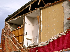
Damage to a house where the side wall has crumbled, exposing the inside. Scaffolding has been set up on one side to prevent any futher damage.
Ruth Gardner's Blog 24/03/2014: Kia Kaha Ti Kouka!
Articles, UC QuakeStudies
An entry from Ruth Gardner's Blog for 24 March 2014 entitled, "Kia Kaha Ti Kouka!".
Roz Johnson's Blog 08/06/2012: Christchurch Through New Eyes
Articles, UC QuakeStudies
An entry from Roz Johnson's blog for 8 June 2012 entitled, "Christchurch Through New Eyes".
Roz Johnson's Blog 21/07/2012: Of Patience and Patients
Articles, UC QuakeStudies
An entry from Roz Johnson's blog for 21 July 2012 entitled, "Of Patience and Patients".
Christchurch Press Image: Carys Monteath, 2011:02:23 07:27:58
Images, UC QuakeStudies
Photograph captioned by Fairfax, "Damage from the February 22nd earthquake in Christchurch. 158 Dyers Pass Road, roof tiles damaged".
Christchurch Press Image: Carys Monteath, 2011:02:23 07:28:01
Images, UC QuakeStudies
Photograph captioned by Fairfax, "Damage from the February 22nd earthquake in Christchurch. 158 Dyers Pass Road, roof tiles damaged".
Christchurch Press Image: Carys Monteath, 2011:02:23 07:21:35
Images, UC QuakeStudies
Photograph captioned by Fairfax, "Damage from the February 22nd earthquake in Christchurch. 30 Dyer Pass Road, Cashmere - house damage".
Christchurch Press Image: Carys Monteath, 2011:02:23 07:27:33
Images, UC QuakeStudies
Photograph captioned by Fairfax, "Damage from the February 22nd earthquake in Christchurch. 158 Dyers Pass Road, roof tiles damaged".
Christchurch Press Image: Carys Monteath, 2011:02:23 07:21:06
Images, UC QuakeStudies
Photograph captioned by Fairfax, "Damage from the February 22nd earthquake in Christchurch. 30 Dyers Pass Road, Cashmere. House damage".
Transect Survey as a Post-Disaster Global Rapid Damage Assessment Tool
Research papers, The University of Auckland Library
Following a damaging earthquake, the immediate emergency response is focused on individual collapsed buildings or other "hotspots" rather than the overall state of damage. This lack of attention to the global damage condition of the affected region can lead to the reporting of misinformation and generate confusion, causing difficulties when attempting to determine the level of postdisaster resources required. A pre-planned building damage survey based on the transect method is recommended as a simple tool to generate an estimate of the overall level of building damage in a city or region. A methodology for such a transect survey is suggested, and an example of a similar survey conducted in Christchurch, New Zealand, following the 22 February 2011 earthquake is presented. The transect was found to give suitably accurate estimates of building damage at a time when information was keenly sought by government authorities and the general public. VoR - Version of Record
Vulnerability to Seismic Hazards in Coastal and Riverside Communities, pho…
Images, UC QuakeStudies
Infrastructure damage in Lyttelton.
Vulnerability to Seismic Hazards in Coastal and Riverside Communities, pho…
Images, UC QuakeStudies
Damaged road in Brooklands.
Vulnerability to Seismic Hazards in Coastal and Riverside Communities, pho…
Images, UC QuakeStudies
Damaged road in Bexley.
Vulnerability to Seismic Hazards in Coastal and Riverside Communities, pho…
Images, UC QuakeStudies
Infrastructure damage in Lyttelton.
Vulnerability to Seismic Hazards in Coastal and Riverside Communities, pho…
Images, UC QuakeStudies
Damaged footpath in Lyttelton.


