
Search
found 50 results
Images for neighbourhood; more images...
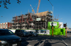
Shops in Opawa Road
Images, eqnz.chch.2010
Post February 22 Earthquake Damage PWS-2011-03-09-DSC9934
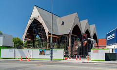
Shops in Opawa Road
Images, eqnz.chch.2010
Post February 22 Earthquake Damage PWS-2011-03-09-DSC9931
Shops in Opawa Road
Images, eqnz.chch.2010
Post February 22 Earthquake Damage PWS-2011-03-09-DSC9925
Shops in Opawa Road
Images, eqnz.chch.2010
Post February 22 Earthquake Damage PWS-2011-03-09-DSC9926
BeckerFraserPhotos September 2010 photograph 060
Images, UC QuakeStudies
A hole in the side of the road along Avonside Drive. A blue pipe can be seen inside the hole. Pipes like this were used to provide temporary water supplies to the neighbourhood while the water system was being repaired.
Henry Africa's Demolition - Photograph 01
Images, UC QuakeStudies
A digger demolishes Henry Africa's restaurant. The photographer comments, "A building housing a restaurant and a great little neighbourhood bar is finally coming down because of earthquake damage. The left half. Janes Bar and one of the upstairs flats were still standing today, but they'll be gone soon".
Shops in Opawa Road
Images, eqnz.chch.2010
Post February 22 Earthquake Damage PWS-2011-03-09-DSC9921
Shops in Opawa Road
Images, eqnz.chch.2010
Post February 22 Earthquake Damage PWS-2011-03-09-DSC9922
Shops in Opawa Road
Images, eqnz.chch.2010
Post February 22 Earthquake Damage PWS-2011-03-09-DSC9930
BeckerFraserPhotos December 2011 photograph 1953
Images, UC QuakeStudies
A photograph captioned by BeckerFraserPhotos, "The painted piano at 636 Ferry Road. This is one of a group of painted pianos which were placed on the sites of demolished building by Gap Filler to enable impromptu and planned neighbourhood concerts".
QuakeStory Photo 677
Images, UC QuakeStudies
A photograph submitted by Ginny Larsen to the QuakeStories website. The description reads, "I work for Neighbourhood Trust in Mairehau/Shirley. In April 2011 a group of people from Liberty Church came down to Christchurch to gift 100s of Easter boxes to residents – lots of treats to bring a smile.".
Room to Breathe: Designing a framework for medium density housing in Ōtaut…
Research papers, Victoria University of Wellington
<b>Ōtautahi-Christchurch faces the future in an enviable position. Compared to other New Zealand cities Christchurch has lower housing costs, less congestion, and a brand-new central city emerging from the rubble of the 2011 earthquakes. ‘Room to Breathe: designing a framework for medium density housing (MDH) in Ōtautahi-Christchurch’ seeks to answer the timely question how can medium density housing assist Ōtautahi-Christchurch to respond to growth in a way that supports a well-functioning urban environment? Using research by design, the argument is made that MDH can be used to support a safe, accessible, and connected urban environment that fosters community, while retaining a level of privacy. This is achieved through designing a neighbourhood concept addressing 3 morphological scales- macro- the city; meso- the neighbourhood; and micro- the home and street. The scales are used to inform a design framework for MDH specific to Ōtautahi-Christchurch, presenting a typological concept that takes full advantage of the benefits higher density living has to offer.</b> Room to Breathe proposes repurposing underutilised areas surrounding existing mass transit infrastructure to provide a concentrated populous who do not solely rely on private vehicles for transport. By considering all morphological scales Room to Breathe provides one suggestion on how MDH could become accepted as part of a well-functioning urban environment.
All Right? AWA Trails Chisnallwood Intermediate Photograph 6
Images, UC QuakeStudies
A photograph of purple footprints painted on a neighbourhood footpath. The photograph was taken on the inaugural walk for the Chisnallwood Trail as part of the AWA Trails launch at Chisnallwood Intermediate. All Right? posted the photograph on their Facebook page on 2 September 2015 at 3:56pm.
Size-specific tree mortality varies with neighbourhood crowding and distur…
Research papers, Lincoln University
Tree mortality is a fundamental process governing forest dynamics, but understanding tree mortality patterns is challenging because large, long-term datasets are required. Describing size-specific mortality patterns can be especially difficult, due to few trees in larger size classes. We used permanent plot data from Nothofagus solandri var. cliffortioides (mountain beech) forest on the eastern slopes of the Southern Alps, New Zealand, where the fates of trees on 250 plots of 0.04 ha were followed, to examine: (1) patterns of size-specific mortality over three consecutive periods spanning 30 years, each characterised by different disturbance, and (2) the strength and direction of neighbourhood crowding effects on sizespecific mortality rates. We found that the size-specific mortality function was U-shaped over the 30-year period as well as within two shorter periods characterised by small-scale pinhole beetle and windthrow disturbance. During a third period, characterised by earthquake disturbance, tree mortality was less size dependent. Small trees (,20 cm in diameter) were more likely to die, in all three periods, if surrounded by a high basal area of larger neighbours, suggesting that sizeasymmetric competition for light was a major cause of mortality. In contrast, large trees ($20 cm in diameter) were more likely to die in the first period if they had few neighbours, indicating that positive crowding effects were sometimes important for survival of large trees. Overall our results suggest that temporal variability in size-specific mortality patterns, and positive interactions between large trees, may sometimes need to be incorporated into models of forest dynamics.
BeckerFraserPhotos December 2011 photograph 2449
Images, UC QuakeStudies
A photograph captioned by BeckerFraserPhotos, "Rose and Richard in front of their house at 464 Avonside Drive. They decided to only move once, so are staying in Avonside Drive while Richard completes the build of their new home. Rose is keeping an eye on the neighbourhood during her daily walks along the river bank".
All Right? Communications: Media Release - March 2014
Articles, UC QuakeStudies
A PDF copy of a media release titled "Disillusionment and stress in Canterbury". The media release includes quotes from All Right? Campaign Manager Sue Turner about the results of the CERA Wellbeing Survey and what people can do to improve their wellbeing. The media release was produced in March 2014.
All Right? AWA Trails Chisnallwood Intermediate Photograph 3
Images, UC QuakeStudies
A photograph of Chisnallwood Intermediate pupils on the inaugural walk for the Chisnallwood Trail. The 'All Righties' are walking with the school pupils along a neighbourhood street. The photograph was taken at the launch of the Chisnallwood AWA trail at Chisnallwood Intermediate. All Right? posted the photograph on their Facebook page on 2 September 2015 at 3:55pm.
Di Madgin's Red Zone photograph 1
Images, UC QuakeStudies
A scanned copy of a photograph of the garden of Di Madgin's former home in the Red Zone, taken before the earthquakes. She describes the scene in the photograph as, "This is the courtyard that we made, to have an eating place at the back of the house. The tree in the neighbours' was a tree that Pete's brother stole on a school trip up in the mountains from a national park. They planted this red beech in the garden. It became the neighbourhood bird tree and the sound was fantastic in the evenings."
People in Disasters Conference - Investing in Connectedness: Building soci…
Videos, UC QuakeStudies
A video of a presentation by Matthew Pratt during the Resilience and Response Stream of the 2016 People in Disasters Conference. The presentation is titled, "Investing in Connectedness: Building social capital to save lives and aid recovery".The abstract for this presentation reads as follows: Traditionally experts have developed plans to prepare communities for disasters. This presentation discusses the importance of relationship-building and social capital in building resilient communities that are both 'prepared' to respond to disaster events, and 'enabled' to lead their own recovery. As a member of the Canterbury Earthquake Recovery Authority's Community Resilience Team, I will present the work I undertook to catalyse community recovery. I will draw from case studies of initiatives that have built community connectedness, community capacity, and provided new opportunities for social cohesion and neighbourhood planning. I will compare three case studies that highlight how social capital can aid recovery. Investment in relationships is crucial to aid preparedness and recovery.
The Breathe Urban Village competition: Why did it fail to deliver?
Research papers, Lincoln University
Successful urban regeneration projects generate benefits that are realised over a much longer timeframe than normal market developments and benefits well beyond those that can be uplifted by a market developer. Consequently there is substantial evidence in the literature that successful place-making and urban regeneration projects are usually public-private partnerships and involve a funder, usually local or central government, willing to contribute ‘patient’ capital. Following the 2010 and 2011 earthquakes that devastated the centre of Christchurch, there was an urgent need to rebuild and revitalise the heart of the city, and increasing the number of people living in or near the city centre was seen as a key ingredient of that. In October 2010, an international competition was launched to design and build an Urban Village, a project intended to stimulate renewed residential development in the city. The competition attracted 58 entrants from around world, and in October 2013 the winning team was chosen from four finalists. However the team failed to secure sufficient finance, and in November 2015 the Government announced that the development would not proceed. The Government was unwilling or unable to recognise that an insistence on a pure market approach would not deliver the innovative sustainable village asked for in the competition brief, and failed to factor in the opportunity cost to government, local government, local businesses and the wider Christchurch community of delaying by many years the residential development of the eastern side of the city. As a result, the early vision of the vitality that a thriving residential neighbourhood would bring to the city has not yet been realised.