
Search
found 43 results
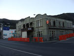
Images for September 2010 Canterbury Earthquake; more images...

Seismic Response of the UC Physics Building in the Canterbury Earthquakes
Research papers, University of Canterbury Library
The purpose of this thesis is to evaluate the seismic response of the UC Physics Building based on recorded ground motions during the Canterbury earthquakes, and to use the recorded response to evaluate the efficacy of various conventional structural analysis modelling assumptions. The recorded instrument data is examined and analysed to determine how the UC Physics Building performed during the earthquake-induced ground motions. Ten of the largest earthquake events from the 2010-11 Canterbury earthquake sequence are selected in order to understand the seismic response under various levels of demand. Peak response amplitude values are found which characterise the demand from each event. Spectral analysis techniques are utilised to find the natural periods of the structure in each orthogonal direction. Significant torsional and rocking responses are also identified from the recorded ground motions. In addition, the observed building response is used to scrutinise the adequacy of NZ design code prescriptions for fundamental period, response spectra, floor acceleration and effective member stiffness. The efficacy of conventional numerical modelling assumptions for representing the UC Physics Building are examined using the observed building response. The numerical models comprise of the following: a one dimensional multi degree of freedom model, a two dimensional model along each axis of the building and a three dimensional model. Both moderate and strong ground motion records are used to examine the response and subsequently clarify the importance of linear and non-linear responses and the inclusion of base flexibility. The effects of soil-structure interaction are found to be significant in the transverse direction but not the longitudinal direction. Non-linear models predict minor in-elastic behaviour in both directions during the 4 September 2010 Mw 7.1 Darfield earthquake. The observed torsional response is found to be accurately captured by the three dimensional model by considering the interaction between the UC Physics Building and the adjacent structure. With the inclusion of adequate numerical modelling assumptions, the structural response is able to be predicted to within 10% for the majority of the earthquake events considered.
Stabilisation of the Cathedral of the Blessed Sacrament following the Cant…
Research papers, The University of Auckland Library
As a result of the 4 September 2010 Darfield earthquake and the more damaging 22 February 2011 Christchurch earthquake, considerable damage occurred to a significant number of buildings in Christchurch. The damage that occurred to the Christchurch Roman Catholic Cathedral of the Blessed Sacrament (commonly known as the Christchurch Basilica) as a result of the Canterbury earthquakes is reported, and the observed failure modes are identified. A previous strengthening intervention is outlined and the estimated capacity of the building is discussed. This strengthening was completed in 2004, and addressed the worst aspects of the building's seismic vulnerability. Urgent work was undertaken post-earthquake to secure parts of the building in order to limit damage and prevent collapse of unstable parts of the building. The approach taken for this securing is outlined, and the performance of the building and the previously installed earthquake strengthening intervention is evaluated.A key consideration throughout the project was the interaction between the structural securing requirements that were driven by the requirement to limit damage and mitigate hazards, and the heritage considerations. Lessons learnt from the strengthening that was carried out, the securing work undertaken, and the approach taken in making the building "safe" are discussed. Some conclusions are drawn with respect to the effectiveness of strengthening similar building types, and the approach taken to secure the building under active seismic conditions. AM - Accepted Manuscript
Evaluation of the Earthquake Support Coordination Service
Research papers, University of Canterbury Library
The Canterbury earthquakes, which started with the 7.1 magnitude event on September 4, 2010, caused significant damage in the region. The September 4 earthquakes brought substantial damage to land, buildings, and infrastructure, while the 6.3 magnitude earthquake on February 22, 2011 (and its subsequent aftershocks), brought even greater property damage, but also significant loss of life in addition to the region. Thousands were injured, and 185 persons died. A national State of Emergency was declared and remained in effect until April 30, 2011. A significant number of people required immediate assistance and support to deal with loss, injury, trauma experiences, and property damages. Many had to find alternate accommodation as their houses were too damaged to stay in. Of those affected, many were already vulnerable, and others had been too traumatized by the events to effectively deal with the challenges they were faced with. A number of human service organizations in the region, from both government and non-government sectors, joined forces to be able to more effectively and efficiently help those in need. This was the start of what would become known as the Earthquake Support Coordination Service. The aim of this report is to present an evaluation of the Earthquake Support Coordination Service and its collaborative organization, based on documentation and interviews with key stakeholders of the service. The aim is also to evaluate the service based on perspectives gathered among the clients as well as the coordinators working in the service. The final aim is to offer a reflection on the service model, and on what factors enabled the service, as well as recommendations regarding aspects of the service which may require review, and aspects which may be useful in other contexts.
Analysis of liquefaction characteristics at Christchurch strong motion sta…
Research papers, University of Canterbury Library
The city of Christchurch and its surrounds experienced widespread damage due to soil liquefaction induced by seismic shaking during the Canterbury earthquake sequence that began in September 2010 with the Mw7.1 Darfield earthquake. Prior to the start of this sequence, the city had a large network of strong motion stations (SMSs) installed, which were able to record a vast database of strong ground motions. This paper uses this database of strong ground motion recordings, observations of liquefaction manifestation at the ground surface, and data from a recently completed extensive geotechnical site investigation program at each SMS to assess a range of liquefaction evaluation procedures at the four SMSs in the Christchurch Central Business District (CBD). In general, the characteristics of the accelerograms recorded at each SMS correlated well with the liquefaction evaluation procedures, with low liquefaction factors of safety predicted at sites with clear liquefaction identifiers in the ground motions. However, at sites that likely liquefied at depth (as indicated by evaluation procedures and/or inferred from the characteristics of the recorded surface accelerograms), the presence of a non-liquefiable crust layer at many of the SMS locations prevented the manifestation of any surface effects. Because of this, there was not a good correlation between surface manifestation and two surface manifestation indices, the Liquefaction Potential Index (LPI) and the Liquefaction Severity Number (LSN).
Key elements of sectoral recovery and resilience after the Canterbury eart…
Research papers, University of Canterbury Library
The Canterbury region of New Zealand experienced four earthquakes greater than MW 6.0 between September 2010 and December 2011. This study employs system dynamics as well as hazard, recovery and organisational literature and brings together data collected via surveys, case studies and interviews with organisations affected by the earthquakes. This is to show how systemic interactions and interdependencies within and between industry and geographic sectors affect their recovery post-disaster. The industry sectors in the study are: construction for its role in the rebuild, information and communication technology which is a regional high-growth industry, trucking for logistics, critical infrastructure, fast moving consumer goods (e.g. supermarkets) and hospitality to track recovery through non-discretionary and discretionary spend respectively. Also in the study are three urban centres including the region’s largest Central Business District, which has been inaccessible since the earthquake of 22 February 2011 to the time of writing in February 2013. This work also highlights how earthquake effects propagated between sectors and how sectors collaborated to mitigate difficulties such as product demand instability. Other interacting factors are identified that influence the recovery trajectories of the different industry sectors. These are resource availability, insurance payments, aid from central government, and timely and quality recovery information. This work demonstrates that in recovering from disaster it is crucial for organisations to identify what interacting factors could affect their operations. Also of importance are efforts to reduce the organisation’s vulnerability and increase their resilience to future crises and in day-to-day operations. Lastly, the multi-disciplinary approach to understanding the recovery and resilience of organisations and industry sectors after disaster, leads to a better understanding of effects as well as more effective recovery policy.
Fine grained sediment clean-up in a modern urban environment
Research papers, University of Canterbury Library
Fine grained sediment deposition in urban environments during natural hazard events can impact critical infrastructure and properties (urban terrain) leading to reduced social and economic function and potentially adverse public health effects. Therefore, clean-up of the sediments is required to minimise impacts and restore social and economic functionality as soon as possible. The strategies employed to manage and coordinate the clean-up significantly influence the speed, cost and quality of the clean-up operation. Additionally, the physical properties of the fine grained sediment affects the clean-up, transport, storage and future usage of the sediment. The goals of the research are to assess the resources, time and cost required for fine grained sediment clean-up in an urban environment following a disaster and to determine how the geotechnical properties of sediment will affect urban clean-up strategies. The thesis focuses on the impact of fine grained sediment (<1 mm) deposition from three liquefaction events during the Canterbury earthquake sequence (2010-2011) on residential suburbs and transport networks in Christchurch. It also presents how geotechnical properties of the material may affect clean-up strategies and methods by presenting geotechnical analysis of tephra material from the North Island of New Zealand. Finally, lessons for disaster response planning and decision making for clean-up of sediment in urban environments are presented. A series of semi-structured interviews of key stakeholders supported by relevant academic literature and media reports were used to record the clean-up operation coordination and management and to make a preliminary qualification of the Christchurch liquefaction ejecta clean-up (costs breakdown, time, volume, resources, coordination, planning and priorities). Further analysis of the costs and resources involved for better accuracy was required and so the analysis of Christchurch City Council road management database (RAMM) was done. In order to make a transition from general fine sediment clean-up to specific types of fine disaster sediment clean-up, adequate information about the material properties is required as they will define how the material will be handled, transported and stored. Laboratory analysis of young volcanic tephra from the New Zealand’s North Island was performed to identify their geotechnical properties (density, granulometry, plasticity, composition and angle of repose). The major findings of this research were that emergency planning and the use of the coordinated incident management system (CIMS) system during the emergency were important to facilitate rapid clean-up tasking, management of resources and ultimately recovery from widespread and voluminous liquefaction ejecta deposition in eastern Christchurch. A total estimated cost of approximately $NZ 40 million was calculated for the Christchurch City clean-up following the 2010-2011 Canterbury earthquake sequence with a partial cost of $NZ 12 million for the Southern part of the city, where up to 33% (418 km) of the road network was impacted by liquefaction ejecta and required clearing of the material following the 22 February 2011 earthquake. Over 500,000 tonnes of ejecta has been stockpiled at Burwood landfill for all three liquefaction inducing earthquake events. The average cost per kilometre for the event clean-up was $NZ 5,500/km (4 September 2010), $NZ 11,650/km (22 February 2011) and $NZ 11,185/km (13 June 2011). The duration of clean-up time of residential properties and the road network was approximately two to three months for each of the three liquefaction ejecta events; despite events volumes and spatial distribution of ejecta. Interviews and quantitative analysis of RAMM data revealed that the experience and knowledge gained from the Darfield earthquake (4 September 2010) clean-up increased the efficiency of the following Christchurch earthquake induced liquefaction ejecta clean-up events. Density, particle size, particle shape, clay content and moisture content, are the important geotechnical properties that need to be considered when planning for a clean-up method that incorporates collection, transport and disposal or storage. The geotechnical properties for the tephra samples were analysed to increase preparedness and reaction response of potentially affected North Island cities from possible product from the active volcanoes in their region. The geotechnical results from this study show that volcanic tephra could be used in road or construction material but the properties would have to be further investigated for a New Zealand context. Using fresh volcanic material in road, building or flood control construction requires good understanding of the material properties and precaution during design and construction to extra care, but if well planned, it can be economically beneficial.
Helping, caring and learning: strengths in new entrants settling into and …
Research papers, University of Canterbury Library
Christchurch has experienced a series of over 13,500 earthquakes between September 2010 and January 2012. Some children who have been exposed to earthquakes may experience post-traumatic stress disorder symptoms (PTSD) including difficulty concentrating, feeling anxious, restlessness and confusion. Other children may be resilient to the effects of disaster. Western models of resilience relate to a child’s social support and their capacity to cope. The Māori model of wellbeing relates to whanau (family), wairua (spiritual connections), tinana (the physical body) and hinengaro (the mind and emotions). Children’s concepts of helping, caring and learning may provide insight into resilience without introducing the topic of earthquakes into the conversation, which in itself may provoke an episode of stress. Many researchers have studied the effects of earthquakes on children. However, few studies have examined positive outcomes and resilience or listened to the children’s voices. The objective of this study was to listen to the voices of children who experienced the Canterbury earthquake period in order to gain a deeper understanding of the ideas associated resilience. Individual interviews were conducted with 17 five-year-old participants during their first term of primary school. After the interviews, the teacher shared demographic information and reports on the children’s stress and coping. Six children were identified as New Zealand European and eleven children identified as New Zealand Māori. Children had different views of helping, caring and learning. Themes of resilience from Western and Kaupapa Māori models were identified in transcripts of the children's voices and drawings. Māori children voiced more themes of resilience associated with the Western model, and in the Tapa Whā model, Māori children's transcripts were more likely to be inclusive of all four components of well-being. How five-year-old children, having experienced an earthquake disaster during their preschool years, talk or draw pictures about helping, caring and learning can provide insight into resilience, especially in situations where it is not advisable to re-traumatise children by discussing the disaster event. Future research should interview parents/caregivers and whānau to gain further insights. Considering information from both a Western and a Tapa Whā perspective can also provide new insights into resilience in young children. A limitation of this study is that qualitative studies are not always free from a researcher’s interpretation and are, therefore, subjective.
Spatial Modelling of Gastroenteritis Prevalence Following the February 22,…
Research papers, University of Canterbury Library
The potential for a gastroenteritis outbreak in a post-earthquake environment may increase because of compromised infrastructure services, contaminated liquefaction (lateral spreading and surface ejecta), and the presence of gastroenteritis agents in the drinking water network. A population in a post-earthquake environment might be seriously affected by gastroenteritis because it has a short incubation period (about 10 hours). The potential for a gastroenteritis outbreak in a post-earthquake environment may increase because of compromised infrastructure services, contaminated liquefaction (lateral spreading and surface ejecta), and the presence of gastroenteritis agents in the drinking water network. A population in a post-earthquake environment might be seriously affected by gastroenteritis because it has a short incubation period (about 10 hours). The aim of this multidisciplinary research was to retrospectively analyse the gastroenteritis prevalence following the February 22, 2011 earthquake in Christchurch. The first focus was to assess whether earthquake-induced infrastructure damage, liquefaction, and gastroenteritis agents spatially explained the recorded gastroenteritis cases over the period of 35 days following the February 22, 2011 earthquake in Christchurch. The gastroenteritis agents considered in this study were Escherichia coli found in the drinking water supply (MPN/100mL) and Non-Compliant Free Associated Chlorine (FAC-NC) (less than <0.02mg/L). The second focus was the protocols that averted a gastroenteritis outbreak at three Emergency Centres (ECs): Burnside High School Emergency Centre (BEC); Cowles Stadium Emergency Centre (CEC); and Linwood High School Emergency Centre (LEC). Using a mixed-method approach, gastroenteritis point prevalence and the considered factors were quantitatively analysed. The qualitative analysis involved interviewing 30 EC staff members. The data was evaluated by adopting the Grounded Theory (GT) approach. Spatial analysis of considered factors showed that highly damaged CAUs were statistically clustered as demonstrated by Moran’s I statistic and hot spot analysis. Further modelling showed that gastroenteritis point prevalence clustering could not be fully explained by infrastructure damage alone, and other factors influenced the recorded gastroenteritis point prevalence. However, the results of this research suggest that there was a tenuous, indirect relationship between recorded gastroenteritis point prevalence and the considered factors: earthquake-induced infrastructure damage, liquefaction and FAC-NC. Two ECs were opened as part of the post-earthquake response in areas with severe infrastructure damage and liquefaction (BEC and CEC). The third EC (CEC) provided important lessons that were learnt from the previous September 4, 2010 earthquake, and implemented after the February 22, 2011 earthquake. Two types of interwoven themes identified: direct and indirect. The direct themes were preventive protocols and indirect themes included type of EC building (school or a sports stadium), and EC staff. The main limitations of the research were Modifiable Areal Units (MAUP), data detection, and memory loss. This research provides a practical method that can be adapted to assess gastroenteritis risk in a post-earthquake environment. Thus, this mixed method approach can be used in other disaster contexts to study gastroenteritis prevalence, and can serve as an appendage to the existing framework for assessing infectious diseases. Furthermore, the lessons learnt from qualitative analysis can inform the current infectious disease management plans, designed for a post-disaster response in New Zealand and internationally Using a mixed-method approach, gastroenteritis point prevalence and the considered factors were quantitatively analysed. A damage profile was created by amalgamating different types of damage for the considered factors for each Census Area Unit (CAU) in Christchurch. The damage profile enabled the application of a variety of statistical methods which included Moran’s I , Hot Spot (HS) analysis, Spearman’s Rho, and Besag–York–Mollié Model using a range of software. The qualitative analysis involved interviewing 30 EC staff members. The data was evaluated by adopting the Grounded Theory (GT) approach. Spatial analysis of considered factors showed that highly damaged CAUs were statistically clustered as demonstrated by Moran’s I statistic and hot spot analysis. Further modelling showed that gastroenteritis point prevalence clustering could not be fully explained by infrastructure damage alone, and other factors influenced the recorded gastroenteritis point prevalence. However, the results of this research suggest that there was a tenuous, indirect relationship between recorded gastroenteritis point prevalence and the considered factors: earthquake-induced infrastructure damage, liquefaction and FAC-NC. Two ECs were opened as part of the post-earthquake response in areas with severe infrastructure damage and liquefaction (BEC and CEC). The third EC (CEC) provided important lessons that were learnt from the previous September 4, 2010 earthquake, and implemented after the February 22, 2011 earthquake. The ECs were selected to represent the Christchurch area, and were situated where potential for gastroenteritis was high. BEC represented the western side of Christchurch; whilst, CEC and LEC represented the eastern side, where the potential for gastroenteritis was high according to the outputs of the quantitative spatial modelling. Qualitative analysis from the interviews at the ECs revealed that evacuees were arriving at the ECs with gastroenteritis-like symptoms. Participants believed that those symptoms did not originate at the ECs. Two types of interwoven themes identified: direct and indirect. The direct themes were preventive protocols that included prolific use of hand sanitisers; surveillance; and the services offered. Indirect themes included the EC layout, type of EC building (school or a sports stadium), and EC staff. Indirect themes governed the quality and sustainability of the direct themes implemented, which in turn averted gastroenteritis outbreaks at the ECs. The main limitations of the research were Modifiable Areal Units (MAUP), data detection, and memory loss. It was concluded that gastroenteritis point prevalence following the February 22, 2011 earthquake could not be solely explained by earthquake-induced infrastructure damage, liquefaction, and gastroenteritis causative agents alone. However, this research provides a practical method that can be adapted to assess gastroenteritis risk in a post-earthquake environment. Creating a damage profile for each CAU and using spatial data analysis can isolate vulnerable areas, and qualitative data analysis provides localised information. Thus, this mixed method approach can be used in other disaster contexts to study gastroenteritis prevalence, and can serve as an appendage to the existing framework for assessing infectious diseases. Furthermore, the lessons learnt from qualitative analysis can inform the current infectious disease management plans, designed for a post-disaster response in New Zealand and internationally.
The undrained cyclic strength of undisturbed and reconstituted Christchurc…
Research papers, University of Canterbury Library
This paper presents insights from recent advanced laboratory testing of undisturbed and reconstituted specimens of Christchurch silty-sands. The purpose of the testing was to establish the cyclic strength of silty-sands from sites in the Central Business District (CBD), where liquefaction was observed in 4 September 2010, 22 February 2011, and 13 June 2011. Similar overall strengths were obtained from undisturbed and reconstituted tests prepared at similar densities, albeit with higher variability for the reconstituted specimens. Reconstituted specimens exhibited distinctly different response in terms of lower compressibility during initial loading cycles, and exhibited a more brittle response when large strains were mobilised, particularly for samples with high fines content. Given the lower variability in natural sample response and the possibility of age-related strength to be significant for sites not subjected to earthquakes, high quality undisturbed samples are recommended over the use of reconstituted specimens to establish the cyclic strength of natural sands.
First Responders to Cataclysmic Upheaval: Earthquake–Driven Effects on Mic…
Research papers, University of Canterbury Library
The Avon-Heathcote Estuary is of significant value to Christchurch due to its high productivity, biotic diversity, proximity to the city, and its cultural, recreational and aesthetic qualities. Nonetheless, it has been subjected to decades of degradation from sewage wastewater discharges and encroaching urban development. The result was a eutrophied estuary, high in nitrogen, affected by large blooms of nuisance macroalgae and covered by degraded sediments. In March 2010, treated wastewater was diverted from the estuary to a site 3 km offshore. This quickly reduced water nitrogen by 90% within the estuary and, within months, there was reduced production of macroalgae. However, a series of earthquakes beginning in September 2010 brought massive changes: tilting of the estuary, changes in channels and water flow, and a huge influx of liquefied sediments that covered up to 65% of the estuary floor. Water nitrogen increased due to damage to sewage infrastructure and the diversion pipeline being turned off. Together, these drastically altered the estuarine ecosystem. My study involves three laboratory and five in situ experiments that investigate the base of the food chain and responses of benthic microalgae to earthquake-driven sediment and nutrient changes. It was predicted that the new sediments would be coarser and less contaminated with organic matter and nutrients than the old sediments, would have decreased microalgal biomass, and would prevent invertebrate grazing and bioturbation activities. It was believed that microalgal biomass would become similar across new and old sediments types as the unstable new sediments were resuspended and distributed over the old sediments. Contact cores of the sediment were taken at three sites, across a eutrophication gradient, monthly from September 2011 to March 2012. Extracted chlorophyll a pigments showed that microalgal biomass was generally lower on new liquefied sediments compared to old sediments, although there was considerable site to site variation, with the highly eutrophic sites being the most affected by the emergence of the new sediments. Grazer experiments showed that invertebrates had both positive and negative site-specific effects on microalgal biomass depending on their identity. At one site, new sediments facilitated grazing by Amphibola crenata, whereas at another site, new sediments did not alter the direct and indirect effects of invertebrates (Nicon aestuariensis, Macropthalmus hirtipes, and A. crenata) on microalgae. From nutrient addition experiments it was clear that benthic microalgae were able to use nutrients from within both old and new sediments equally. This implied that microalgae were reducing legacy nutrients in both sediments, and that they are an important buffer against eutrophication. Therefore, in tandem with the wastewater diversion, they could underpin much of the recovery of the estuary. Overall, the new sediments were less favourable for benthic microalgal growth and recolonisation, but were less contaminated than old sediments at highly eutrophic sites. Because the new sediments were less contaminated than the old sediments, they could help return the estuary to a noneutrophic state. However, if the new sediments, which are less favourable for microalgal growth, disperse over the old sediments at highly eutrophic sites, they could become contaminated and interfere with estuarine recovery. Therefore, recovery of microalgal communities and the estuary was expected to be generally long, but variable and site-specific, with the least eutrophic sites recovering quickly, and the most eutrophic sites taking years to return to a pre-earthquake and non-eutrophied state. changes in channels and water flow, and a huge influx of liquefied sediments that covered up to 65% of the estuary floor. Water nitrogen increased due to damage to sewage infrastructure and the diversion pipeline being turned off. Together, these drastically altered the estuarine ecosystem. My study involves three laboratory and five in situ experiments that investigate the base of the food chain and responses of benthic microalgae to earthquake-driven sedimen tand nutrient changes. It was predicted that the new sediments would be coarser and less contaminated with organic matter and nutrients than the old sediments, would have decreased microalgal biomass, and would prevent invertebrate grazing and bioturbation activities. It was believed that microalgal biomass would become similar across new and old sediments types as the unstable new sediments were resuspended and distributed over the old sediments. Contact cores of the sediment were taken at three sites, across a eutrophication gradient, monthly from September 2011 to March 2012. Extracted chlorophyll a pigments showed that microalgal biomass was generally lower on new liquefied sediments compared to old sediments, although there was considerable site to site variation, with the highly eutrophic sites being the most affected by the emergence of the new sediments. Grazer experiments showed that invertebrates had both positive and negative site-specific effects on microalgal biomass depending on their identity. At one site, new sediments facilitated grazing by Amphibola crenata, whereas at another site, new sediments did not alter the direct and indirect effects of invertebrates (Nicon aestuariensis, Macropthalmus hirtipes, and A. crenata) on microalgae. From nutrient addition experiments it was clear that benthic microalgae were able to use nutrients from within both old and new sediments equally. This implied that microalgae were reducing legacy nutrients in both sediments, and that they are
Exploring the concept of Christchurch as a ‘super city’ from a sustainabil…
Research papers, Lincoln University
Group case study report prepared for lecturers Ton Buhrs and Roy Montgomery by students of ERST 635 at Lincoln University, 2013.The New Zealand Government’s decision to establish a unitary authority in the Auckland Region has provided much of the context and impetus for this review of current governance arrangements in the Canterbury region, to determine whether or not they are optimal for taking the communities of greater Christchurch into the future. A number of local governance academics, as well as several respected political pundits, have prophesised that the Auckland ‘Super City’ reforms of 2009 will have serious implications and ramifications for local governance arrangements in other major cities, particularly Wellington and Christchurch. Wellington councils have already responded to the possibility of change by undertaking a series of reports on local governance arrangements, as well as a major review led by Sir Geoffrey Palmer, to investigate options for governance reform. Alongside these developments, the Christchurch earthquakes beginning in September 2010 have raised a myriad of new and complex governance issues, which may or may not be able to be addressed under the status quo, while the replacement of Regional Councillors’ with centrally-appointed Commissioners is suggestive of government dissatisfaction with current arrangements. With these things in mind, the research group has considered local government in Canterbury and the greater Christchurch area in the wider governance context. It does not limit discussion to only the structure of local government in Canterbury but rather, as the brief (Appendix 1) indicates, considers more broadly the relationship between central, regional, and local tiers of government, as well as the relationship between local government and local communities.
Effects of Dietary Micronutrient Supplementation on the Development of Emo…
Research papers, University of Canterbury Library
There is a growing body of research into the effects of micronutrients on human mental health. There is evidence that multi-ingredient formulas are beneficial especially in relation to serious mental health disorders such as mood and anxiety disorders, attention-deficit hyperactivity disorder and obsessive-compulsive disorders. However there is almost no scientific research which looks at the effects of these formulas in an animal population. Therefore the aim of this study was to investigate the effects of a micronutrient formula, EMPowerplus, on anxiety behaviour in rats, and whether there is a relationship between dose and anxiolytic effect. In order to investigate this 40 male and 40 female rats received a diet consisting of either 0%, 1.25%, 2.5% or 5% EMP+ from when they were weaned (post natal day 30) until the end of testing 141 days later. Animals were tested in a Y maze, a light-dark emergence box and an open field at mid-adulthood (PND 136-138) and late adulthood (PND 186-188). Results found that animals receiving the 5% supplemented diet occupied the centre squares the most, occupied the corner squares the least and ambulated the most in the open field compared to the other experimental groups and control groups. No significant differences were found in the Y maze or Light-dark box. Animals were found to display more anxiety-like behaviour at time 2 than at time 1 regardless of receiving a supplemented diet or not. Overall a higher dose of EMP+ was associated with the greatest reduction in anxiety related behaviour. Due to the impact of the September 4th, 2010 Canterbury Earthquake caution should be taken when interpreting these results.
Initial demographic and economic changes for Maori in a post-disaster land…
Research papers, Lincoln University
The city of Ōtautahi/Christchurch experienced a series of earthquakes that began on September 4th, 2010. The most damaging event occurred on February 22nd, 2011 but significant earthquakes also occurred on June 13th and December 23rd with aftershocks still occurring well into 2012. The resulting disaster is the second deadliest natural disaster in New Zealand’s history with 185 deaths. During 2011 the Canterbury earthquakes were one of the costliest disasters worldwide with an expected cost of up to $NZ30 billion. Hundreds of commercial buildings and thousands of houses have been destroyed or are to be demolished and extensive repairs are needed for infrastructure to over 100,000 homes. As many as 8,900 people simply abandoned their homes and left the city in the first few months after the February event (Newell, 2012), and as many as 50,000 may leave during 2012. In particular, young whānau and single young women comprised a disproportionate number of these migrants, with evidence of a general movement to the North Island. Te Puni Kōkiri sought a mix of quantitative and qualitative research to examine the social and economic impacts of the Christchurch earthquakes on Māori and their whānau. The result of this work will be a collection of evidence to inform policy to support and assist Māori and their whānau during the recovery/rebuild phases. To that end, this report triangulates available statistical and geographical information with qualitative data gathered over 2010 and 2011 by a series of interviews conducted with Māori who experienced the dramatic events associated with the earthquakes. A Māori research team at Lincoln University was commissioned to undertake the research as they were already engaged in transdisciplinary research (began in the May 2010), that focused on quickly gathering data from a range of Māori who experienced the disaster, including relevant economic, environmental, social and cultural factors in the response and recovery of Māori to these events. Participants for the qualitative research were drawn from Māori whānau who both stayed and left the city. Further data was available from ongoing projects and networks that the Lincoln research team was already involved in, including interviews with Māori first responders and managers operating in the CBD on the day of the February event. Some limited data is also available from younger members of affected whānau. Māori in Ōtautahi/Christchurch City have exhibited their own culturally-attuned collective responses to the disaster. However, it is difficult to ascertain Māori demographic changes due to a lack of robust statistical frameworks but Māori outward migration from the city is estimated to range between 560 and 1,100 people. The mobility displayed by Māori demonstrates an important but unquantified response by whānau to this disaster, with emigration to Australia presenting an attractive option for young Māori, an entrenched phenomenon that correlates to cyclical downturns and the long-term decline of the New Zealand economy. It is estimated that at least 315 Māori have emigrated from the Canterbury region to Australia post-quake, although the disaster itself may be only one of a series of events that has prompted such a decision. Māori children made up more than one in four of the net loss of children aged 6 to 15 years enrolled in schools in Greater Christchurch over the year to June 2011. Research literature identifies depression affecting a small but significant number of children one to two years post-disaster and points to increasing clinical and organisational demands for Māori and other residents of the city. For those residents in the eastern or coastal suburbs – home to many of the city’s Māori population - severe damage to housing, schools, shops, infrastructure, and streets has meant disruption to their lives, children’s schooling, employment, and community functioning. Ongoing abandonment of homes by many has meant a growing sense of unease and loss of security, exacerbated by arson, burglaries, increased drinking, a stalled local and national economy, and general confusion about the city’s future. Māori cultural resilience has enabled a considerable network of people, institutions, and resources being available to Māori , most noticeably through marae and their integral roles of housing, as a coordinating hub, and their arguing for the wider affected communities of Christchurch. Relevant disaster responses need to be discussed within whānau, kōhanga, kura, businesses, communities, and wider neighbourhoods. Comprehensive disaster management plans need to be drafted for all iwi in collaboration with central government, regional, and city or town councils. Overall, Māori are remarkably philosophical about the effects of the disaster, with many proudly relishing their roles in what is clearly a historic event of great significance to the city and country. Most believe that ‘being Māori’ has helped cope with the disaster, although for some this draws on a collective history of poverty and marginalisation, features that contribute to the vulnerability of Māori to such events. While the recovery and rebuild phases offer considerable options for Māori and iwi, with Ngāi Tahu set to play an important stakeholder in infrastructural, residential, and commercial developments, some risk and considerable unknowns are evident. Considerable numbers of Māori may migrate into the Canterbury region for employment in the rebuild, and trades training strategies have already been established. With many iwi now increasingly investing in property, the risks from significant earthquakes are now more transparent, not least to insurers and the reinsurance sector. Iwi authorities need to be appraised of insurance issues and ensure sufficient coverage exists and investments and developments are undertaken with a clear understanding of the risks from natural hazards and exposure to future disasters.