
Search
found 103 results
Images for Geology--New Zealand--Canterbury; more images...

sand volcano
Images, eqnz.chch.2010
None
sand volcano
Images, eqnz.chch.2010
None
sand volcano landscape
Images, eqnz.chch.2010
None
sand volcano versus driveway
Images, eqnz.chch.2010
None
sand volcano versus lawn
Images, eqnz.chch.2010
None
sand volcano craters
Images, eqnz.chch.2010
None
sand volcano versus shed
Images, eqnz.chch.2010
None
sand volcano versus shed
Images, eqnz.chch.2010
None
sand volcano gushing
Images, eqnz.chch.2010
None
sand volcano versus path
Images, eqnz.chch.2010
None
sand volcano versus vegetables
Images, eqnz.chch.2010
None
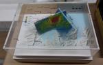
High-density shallow shear wave velocity characterisation of the urban Chr…
Research papers, University of Canterbury Library
This report summarizes the development of a region-wide surficial soil shear wave velocity (Vs ) model based on the unique combination of a large high-spatial-density database of cone penetration test (CPT) logs in the greater Christchurch urban area (> 15, 000 logs as of 1 February 2014) and the Christchurch-specific empirical correlation between soil Vs and CPT data developed by McGann et al. [1, 2]. This model has applications for site characterization efforts via maps of time-averaged Vs over specific depths (e.g. Vs30, Vs10), and for numerical modeling efforts via the identification of typical Vs profiles for different regions and soil behaviour types within Christchurch. In addition, the Vs model can be used to constrain the near-surface velocities for the 3D seismic velocity model of the Canterbury basin [3] currently being developed for the purpose of broadband ground motion simulation. The general development of these region-wide near-surface Vs models includes the following general phases, with each discussed in separate chapters of this report. • An evaluation of the available CPT dataset for suitability, and the definition of other datasets and assumptions necessary to characterize the surficial sediments of the region to 30 m depth. • The development of time-averaged shear wave velocity (Vsz) surfaces for the Christchurch area from the adopted CPT dataset (and supplementary data/assumptions) using spatial interpolation. The Vsz surfaces are used to explore the characteristics of the near-surface soils in the regions and are shown to correspond well with known features of the local geology, the historical ecosystems of the area, and observations made following the 2010- 2011 Canterbury earthquakes. • A detailed analysis of the Vs profiles in eight subregions of Christchurch is performed to assess the variablity in the soil profiles for regions with similar Vsz values and to assess Vsz as a predictive metric for local site response. It is shown that the distrubution of soil shear wave velocity in the Christchurch regions is highly variable both spatially (horizontally) and with depth (vertically) due to the varied geological histories for different parts of the area, and the highly stratified nature of the nearsurface deposits. This variability is not considered to be greatly significant in terms of current simplified site classification systems; based on computed Vs30 values, all considered regions can be categorized as NEHRP sites class D (180 < Vs < 360 m/s) or E (Vs < 180 m/s), however, detailed analysis of the shear wave velocity profiles in different subregions of Christchurch show that the expected surficial site response can vary quite a bit across the region despite the relative similarity in Vs30
Canterbury Earthquake 7.1
Images, eqnz.chch.2010
Rolleston/Burnham, South Island, NZ It's been a busy few weeks! Was away on geology fieldtrips all the previous two weeks, then on Saturday morning 4th September 2010 at 4.35 am we got woken in Westport to a reasonable but very long earthquake. My husband was back in Christchurch at the time and texted me saying "are you ok?". I replied, "yes!"...
Feature Guest - Mark Quigley
Audio, Radio New Zealand
Canadian-born Mark Quigley is a senior lecturer in Active Tectonics and Geomorphology at the Department of Geological Sciences at the University of Canterbury. He's become an unwitting star as the go-to scientific voice throughout the Canterbury earthquakes, using plain language to help people understand what's behind the earthquake sequence. He's also had his own personal quake story - his Avonside home was badly damaged and is in the red zone.
sand volcano in our front lawn
Images, eqnz.chch.2010
None
sand volcano
Images, eqnz.chch.2010
This one was really flowing out of the ground.
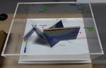
Development of a 3D Canterbury seismic velocity model and investigation of…
Research papers, University of Canterbury Library
This dissertation addresses a diverse range of topics in the area of physics-based ground motion simulation with particular focus on the Canterbury, New Zealand region. The objectives achieved provide the means to perform hybrid broadband ground motion simulation and subsequently validates the simulation methodology employed. In particu- lar, the following topics are addressed: the development of a 3D seismic velocity model of the Canterbury region for broadband ground motion simulation; the development of a 3D geologic model of the interbedded Quaternary formations to provide insight on observed ground motions; and the investigation of systematic effects through ground motion sim- ulation of small-to-moderate magnitude earthquakes. The paragraphs below outline each contribution in more detail. As a means to perform hybrid broadband ground motion simulation, a 3D model of the geologic structure and associated seismic velocities in the Canterbury region is devel- oped utilising data from depth-converted seismic reflection lines, petroleum and water well logs, cone penetration tests, and implicitly guided by existing contour maps and geologic cross sections in data sparse subregions. The model explicitly characterises five significant and regionally recognisable geologic surfaces that mark the boundaries between geologic units with distinct lithology and age, including the Banks Peninsula volcanics, which are noted to strongly influence seismic wave propagation. The Basement surface represents the base of the Canterbury sedimentary basin, where a large impedance contrast exists re- sulting in basin-generated waves. Seismic velocities for the lithological units between the geologic surfaces are derived from well logs, seismic reflection surveys, root mean square stacking velocities, empirical correlations, and benchmarked against a regional crustal model, thus providing the necessary information for a Canterbury velocity model for use in broadband seismic wave propagation. A 3D high-resolution model of the Quaternary geologic stratigraphic sequence in the Canterbury region is also developed utilising datasets of 527 high-quality water well logs, and 377 near-surface cone penetration test records. The model, developed using geostatistical Kriging, represents the complex interbedded regional Quaternary geology by characterising the boundaries between significant interbedded geologic formations as 3D surfaces including explicit modelling of the formation unconformities resulting from the Banks Peninsula volcanics. The stratigraphic layering present can result in complex wave propagation. The most prevalent trend observed in the surfaces was the downward dip from inland to the eastern coastline as a result of the dominant fluvial depositional environment of the terrestrial gravel formations. The developed model provides a benefi- cial contribution towards developing a comprehensive understanding of recorded ground motions in the region and also providing the necessary information for future site char- acterisation and site response analyses. To highlight the practicality of the model, an example illustrating the role of the model in constraining surface wave analysis-based shear wave velocity profiling is illustrated along with the calculation of transfer functions to quantify the effect of the interbedded geology on wave propagation. Lastly, an investigation of systematic biases in the (Graves and Pitarka, 2010, 2015) ground motion simulation methodology and the specific inputs used for the Canterbury region is presented considering 144 small-to-moderate magnitude earthquakes. In the simulation of these earthquakes, the 3D Canterbury Velocity Model, developed as a part of this dissertation, is used for the low-frequency simulation, and a regional 1D velocity model for the high-frequency simulation. Representative results for individual earthquake sources are first presented to highlight the characteristics of the small-to-moderate mag- nitude earthquake simulations through waveforms, intensity measure scaling with source- to-site distance, and spectral bias of the individual events. Subsequently, a residual de- composition is performed to examine the between- and within-event residuals between observed data, and simulated and empirical predictions. By decomposing the residuals into between- and within-event residuals, the biases in source, path and site effects, and their causes, can be inferred. The residuals are comprehensively examined considering their aggregated characteristics, dependence on predictor variables, spatial distribution, and site-specific effects. The results of the simulation are also benchmarked against empir- ical ground motion models, where their similarities manifest from common components in their prediction. Ultimately, suggestions to improve the predictive capability of the simulations are presented as a result of the analysis.
sand volcano in a Wyn Street lawn
Images, eqnz.chch.2010
None
Rydal Park sand volcano
Images, eqnz.chch.2010
These were scattered across the park.
sand volcano
Images, eqnz.chch.2010
Robbie watches a sand volcano smother his driveway.
Ongoing development of a 3D seismic velocity model for Canterbury, New Zea…
Research papers, University of Canterbury Library
This paper presents the ongoing development of a new 3D seismic velocity model of Canterbury, New Zealand. The model explicitly represents the Canterbury sedimentary basin, and other significant geologic horizons, which are expected to have important implications on observed ground motions. The model utilizes numerous sources of data, including 3D regional tomography with a variable-depth inferred Moho, seismic reflection survey lines, geotechnical boreholes and well logs, spectral analysis of surface waves, and CPT logs which provide velocity constraints over their respective ranges of application. The model provides P- and S-wave velocity and density (i.e. Vp, Vs and p) over a grid of input points, and is presently being utilized in broadband ground motion simulations of the 2010-2011 Canterbury earthquakes. Comparison of simulated ground motions with those observed in the 2010-2011 Canterbury earthquakes will help provide a better understanding of the salient physical processes which characterized the unique set of strong ground motions recorded in this sequence of earthquake events.
Footpath cracks next to Rydal Park.
Images, eqnz.chch.2010
Sand volcanoes put the silt all over the road.
sand volcano in our front lawn
Images, eqnz.chch.2010
The earthquake knocked over the bird bath.
sand volcano
Images, eqnz.chch.2010
Debra points at the beginnings of a sand volcano not long after the big earthquake.
sand volcano crater
Images, eqnz.chch.2010
An usual thing to see coming from the ground in Hoon Hay, Christchurch.
Nisbet, Alistair, 1958- :"Is it my turn yet?" 7 June 2011
Images, Alexander Turnbull Library
Two huge wrestlers, one representing 'Port Hills fault' and the other 'Greendale fault' struggle together over a broken Christchurch. Another wrestler, representing 'Other faults' appears in the distance yelling 'Is it my turn yet?' Context - Christchurch has now had three major earthquakes and thousands of aftershocks. It now appears likely that the Christchurch quakes resulted from activity on a fault extending directly eastward from the Alpine fault that remained unknown until last year, says Roger Musson, a seismologist at the British Geological Survey in Edinburgh. The new fault first came to light last September (4th) when a stronger but less calamitous quake shook Darfield, 40 kilometres west of Christchurch. Musson says the latest quake (Feb 22, 2011) probably resulted from an eastward continuation of activity on the same fault. "It has probably not moved for tens of thousands of years, so lots of strain built up," says Musson. The third major quake happened on 13th June 2011. (New Scientist - February 22, 2011) Quantity: 1 digital cartoon(s).
sand volcano
Images, eqnz.chch.2010
Laura, Nicola, and Debra watch a sand volcano build in the Wyn Street gutter.
sand volcano
Images, eqnz.chch.2010
(I righted the bird bath after the initial earthquake. None of the after-shocks were sufficient to knock it over again.)
Robbie and his new lawn feature
Images, eqnz.chch.2010
One of the many sand volcanos erupting from the ground after the Christchurch earthquake.
sand volcano
Images, eqnz.chch.2010
And, yes, the newspaper always gets through! The Press newspapers were delivered in our area of Hoon Hay in the hours after the earthquake.