Search
found 48 results
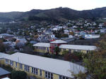
Images for Future Christchurch; more images...
Fairfax Video, May 2013 (9)
Videos, UC QuakeStudies
A video of Principal Tony Simpson announcing to staff and parents at Phillipstown School that the Ministry of Education has decided to merge the school with Woolston School. The video also includes an interview with Tony Simpson about the merger, and his hopes for education in Christchurch in the future.
A Tale of Two Suburbs: Earthquake recovery and civil society in Christchur…
Research papers, University of Canterbury Library
This study followed two similarly affected, but socio-economically disparate suburbs as residents responded to and attempted to recover from the devastating 6.3 magnitude earthquake that struck Christchurch, New Zealand, on February 22, 2011. More specifically, it focuses on the role of local churches, community-based organisations (CBOs) and non-governmental organisations (NGOs), here referred to broadly as civil society, in meeting the immediate needs of local residents and assisting with the longer-term recovery of each neighbourhood. Despite considerable socioeconomic differences between the two neighbourhoods, civil society in both suburbs has been vital in addressing the needs of locals in the short and long term following the earthquake. Institutions were able to utilise local knowledge of both residents and the extent of damage in the area to a) provide a swifter local response than government or civil defence and then help direct the relief these agencies provided locally; b) set up central points for distribution of supplies and information where locals would naturally gather; c) take action on what were perceived to be unmet needs; and d) act as a way of bridging locals to a variety of material, informational, and emotional resources. However the findings also support literature which indicates that other factors are also important in understanding neighbourhood recovery and the role of civil society, including: local leadership; a shared, place-based identity; the type and form of civil society organizations; social capital; and neighbourhood- and household-level indicators of relative vulnerability and inequality. The intertwining of these various factors seems to influence how these neighbourhoods have coped with and taken steps in recovering from this disaster. It is recommended that future research be directed at developing a better understanding of how this occurs. It is suggested that a model similar to Yasui’s (2007) Community Vulnerability and Capacity model be developed as a useful way to approach future research in this area.
ADA Mesh Cities: Network, Space and Memory in the Transitional City
Research papers, University of Canterbury Library
In the aftermath of the 2010 and 2011 earthquakes, Christchurch, New Zealand is framed as a ‘transi- tional’ city, moving from its demolished past to a speculative future. The ADA Mesh Cities project asks what role media art and networks may play in the transitional city, and the practices of remembering, and reimagining space.
Implications of the Canterbury earthquake sequence for Adelaide, South Aus…
Research papers, The University of Auckland Library
The city of Christchurch has experienced over 10,000 aftershocks since the 4th of September 2010 earthquake of which approximately 50 have been greater than magnitude 5. The damage caused to URM buildings in Christchurch over this sequence of earthquakes has been well documented. Due to the similarity in age and construction of URM buildings in Adelaide, South Australia and Christchurch (they are sister cities, of similar age and heritage), an investigation was conducted to learn lessons for Adelaide based on the Christchurch experience. To this end, the number of URM buildings in the central business districts of both cities, the extent of seismic strengthening that exists in both cities, and the relative earthquake hazards for both cities were considered. This paper will report on these findings and recommend strategies that the city of Adelaide could consider to significantly reduce the seismic risk posed by URM buildings in future earthquake.
Exploring the concept of Christchurch as a ‘super city’ from a sustainabil…
Research Papers, Lincoln University
Group case study report prepared for lecturers Ton Buhrs and Roy Montgomery by students of ERST 635 at Lincoln University, 2013.The New Zealand Government’s decision to establish a unitary authority in the Auckland Region has provided much of the context and impetus for this review of current governance arrangements in the Canterbury region, to determine whether or not they are optimal for taking the communities of greater Christchurch into the future. A number of local governance academics, as well as several respected political pundits, have prophesised that the Auckland ‘Super City’ reforms of 2009 will have serious implications and ramifications for local governance arrangements in other major cities, particularly Wellington and Christchurch. Wellington councils have already responded to the possibility of change by undertaking a series of reports on local governance arrangements, as well as a major review led by Sir Geoffrey Palmer, to investigate options for governance reform. Alongside these developments, the Christchurch earthquakes beginning in September 2010 have raised a myriad of new and complex governance issues, which may or may not be able to be addressed under the status quo, while the replacement of Regional Councillors’ with centrally-appointed Commissioners is suggestive of government dissatisfaction with current arrangements. With these things in mind, the research group has considered local government in Canterbury and the greater Christchurch area in the wider governance context. It does not limit discussion to only the structure of local government in Canterbury but rather, as the brief (Appendix 1) indicates, considers more broadly the relationship between central, regional, and local tiers of government, as well as the relationship between local government and local communities.
Impacts of liquefaction and lateral spreading on bridge pile foundations f…
Research papers, University of Canterbury Library
The Mw 6.2 February 22nd 2011 Christchurch earthquake (and others in the 2010-2011 Canterbury sequence) provided a unique opportunity to study the devastating effects of earthquakes first-hand and learn from them for future engineering applications. All major events in the Canterbury earthquake sequence caused widespread liquefaction throughout Christchurch’s eastern suburbs, particularly extensive and severe during the February 22nd event. Along large stretches of the Avon River banks (and to a lesser extent along the Heathcote) significant lateral spreading occurred, affecting bridges and the infrastructure they support. The first stage of this research involved conducting detailed field reconnaissance to document liquefaction and lateral spreading-induced damage to several case study bridges along the Avon River. The case study bridges cover a range of ages and construction types but all are reinforced concrete structures which have relatively short, stiff decks. These factors combined led to a characteristic deformation mechanism involving deck-pinning and abutment back-rotation with consequent damage to the abutment piles and slumping of the approaches. The second stage of the research involved using pseudo-static analysis, a simplified seismic modelling tool, to analyse two of the bridges. An advantage of pseudo-static analysis over more complicated modelling methods is that it uses conventional geotechnical data in its inputs, such as SPT blowcount and CPT cone resistance and local friction. Pseudo-static analysis can also be applied without excessive computational power or specialised knowledge, yet it has been shown to capture the basic mechanisms of pile behaviour. Single pile and whole bridge models were constructed for each bridge, and both cyclic and lateral spreading phases of loading were investigated. Parametric studies were carried out which varied the values of key parameters to identify their influence on pile response, and computed displacements and damages were compared with observations made in the field. It was shown that pseudo-static analysis was able to capture the characteristic damage mechanisms observed in the field, however the treatment of key parameters affecting pile response is of primary importance. Recommendations were made concerning the treatment of these governing parameters controlling pile response. In this way the future application of pseudo-static analysis as a tool for analysing and designing bridge pile foundations in liquefying and laterally spreading soils is enhanced.
The Effects of the Earthquakes on the Classical Musical Life of Christchur…
Research papers, University of Canterbury Library
As part of the Canterbury Earthquake Digital Archive, this thesis documents the effects of the earthquakes on the musical life of Christchurch. It concentrates, primarily, on the classical music scene. The thesis examines the difficulties experienced by musical organisations, individual musicians, and teachers as they sought to bring music to the broken city, together with the measures that were necessary in order to overcome those difficulties. It examines how those organisations have worked to re-establish themselves in their particular musical fields. It charts the progress made, to date, along the path to recovery and offers suggestions regarding precautionary measures which, if instituted, could reduce the after-effects of a future disaster. Recognising that not all of the difficulties encountered were directly related to the earthquakes, this thesis also examines the effects on music and musicians, of decision making associated with the recovery effort. The thesis also demonstrates how a destructive event can provide the inspiration for creativity. It recognises the importance of music in maintaining a sense of normality for people, whether they realise it or not, as well as its influences in providing emotional relief in times of stress. Hopefully, it may become a useful guide to which other cities that may be faced with some natural disaster, could refer.
Post-Disaster Mobilities: Exploring Household Relocation after the Canterb…
Research papers, University of Canterbury Library
During 2010 and 2011, a series of major earthquakes caused widespread damage in the city of Christchurch, New Zealand. The magnitude 6.3 quake in February 2011 caused 185 fatalities. In the ensuing months, the government progressively zoned residential land in Christchurch on the basis of its suitability for future occupation (considering damage from these quakes and future earthquake risk). Over 6,000 homes were placed in the ‘red-zone’, meaning that property owners were forced to sell their land to the Crown. This study analysed patterns of residential mobility amongst thirty-one red-zone households from the suburb of Southshore, Christchurch. Drawing on interviews and surveys, the research traced their experience from the zoning announcement until they had moved to a new residence. The research distinguished between short (before the zoning announcement) and long term (post the red zone ‘deadline’) forms of household relocation. The majority of households in the study were highly resistant to short term movement. Amongst those which did relocate before the zoning decision, the desire to maintain a valued social connection with a person outside of the earthquake environment was often an important factor. Some households also moved out of perceived necessity (e.g. due to lack of power or water). In terms of long-term relocation, concepts of affordability and safety were much more highly valued by the sample when purchasing post-quake property. This resulted in a distinct patterning of post-quake housing location choices. Perceived control over the moving process, relationship with government organisations and insurance companies, and time spent in the red-zone before moving all heavily influenced participants’ disaster experience. Contrary to previous studies, households in this study recorded higher levels of subjective well-being after relocating. The study proposed a typology of movers in the Christchurch post-disaster environment. Four mobility behaviours, or types, are identified: the Committed Stayers (CSs), the Environment Re-Creators (ERCs), the Resigned Acceptors (RAs), and the Opportunistic Movers (OMs). The CSs were defined by their immobility rather than their relocation aspirations, whilst the ERCs attempted to recreate or retain aspects of Southshore through their mobility. The RAs expressed a form of apathy towards the post-quake environment, whereas, on the other hand, the OMs moved relative to pre-earthquake plans, or opportunities that arose from the earthquake itself. Possibilities for further research include examining household adaptability to new residential environments and tracking further mobility patterns in the years following relocation from the red- zone.
Improving regulatory frameworks for earthquake risk mitigation
Research papers, The University of Auckland Library
New Zealand's devastating Canterbury earthquakes provided an opportunity to examine the efficacy of existing regulations and policies relevant to seismic strengthening of vulnerable buildings. The mixed-methods approach adopted, comprising both qualitative and quantitative approaches, revealed that some of the provisions in these regulations pose as constraints to appropriate strengthening of earthquake-prone buildings. Those provisions include the current seismic design philosophy, lack of mandatory disclosure of seismic risks and ineffective timeframes for strengthening vulnerable buildings. Recommendations arising from these research findings and implications for pre-disaster mitigation for future earthquake and Canterbury's post-disaster reconstruction suggest: (1) a reappraisal of the requirements for earthquake engineering design and construction, (2) a review and realignment of all regulatory frameworks relevant to earthquake risk mitigation, and (3) the need to develop a national programme necessary to achieve consistent mitigation efforts across the country. These recommendations are important in order to present a robust framework where New Zealand communities such as Christchurch can gradually recover after a major earthquake disaster, while planning for pre-disaster mitigation against future earthquakes. AM - Accepted Manuscript
Vulnerabilities to Seismic Hazards in Coastal and River Environments: Less…
Research papers, University of Canterbury Library
Coastal and river environments are exposed to a number of natural hazards that have the potential to negatively affect both human and natural environments. The purpose of this research is to explain that significant vulnerabilities to seismic hazards exist within coastal and river environments and that coasts and rivers, past and present, have played as significant a role as seismic, engineering or socio-economic factors in determining the impacts and recovery patterns of a city following a seismic hazard event. An interdisciplinary approach was used to investigate the vulnerability of coastal and river areas in the city of Christchurch, New Zealand, following the Canterbury Earthquake Sequence, which began on the 4th of September 2010. This information was used to identify the characteristics of coasts and rivers that make them more susceptible to earthquake induced hazards including liquefaction, lateral spreading, flooding, landslides and rock falls. The findings of this research are applicable to similar coastal and river environments elsewhere in the world where seismic hazards are also of significant concern. An interdisciplinary approach was used to document and analyse the coastal and river related effects of the Canterbury earthquake sequence on Christchurch city in order to derive transferable lessons that can be used to design less vulnerable urban communities and help to predict seismic vulnerabilities in other New Zealand and international urban coastal and river environments for the future. Methods used to document past and present features and earthquake impacts on coasts and rivers in Christchurch included using maps derived from Geographical Information Systems (GIS), photographs, analysis of interviews from coastal, river and engineering experts, and analysis of secondary data on seismicity, liquefaction potential, geology, and planning statutes. The Canterbury earthquake sequence had a significant effect on Christchurch, particularly around rivers and the coast. This was due to the susceptibility of rivers to lateral spreading and the susceptibility of the eastern Christchurch and estuarine environments to liquefaction. The collapse of river banks and the extensive cracking, tilting and subsidence that accompanied liquefaction, lateral spreading and rock falls caused damage to homes, roads, bridges and lifelines. This consequently blocked transportation routes, interrupted electricity and water lines, and damaged structures built in their path. This study found that there are a number of physical features of coastal and river environments from the past and the present that have induced vulnerabilities to earthquake hazards. The types of sediments found beneath eastern Christchurch are unconsolidated fine sands, silts, peats and gravels. Together with the high water tables located beneath the city, these deposits made the area particularly susceptible to liquefaction and liquefaction-induced lateral spreading, when an earthquake of sufficient size shook the ground. It was both past and present coastal and river processes that deposited the types of sediments that are easily liquefied during an earthquake. Eastern Christchurch was once a coastal and marine environment 6000 years ago when the shoreline reached about 6 km inland of its present day location, which deposited fine sand and silts over this area. The region was also exposed to large braided rivers and smaller spring fed rivers, both of which have laid down further fine sediments over the following thousands of years. A significant finding of this study is the recognition that the Canterbury earthquake sequence has exacerbated existing coastal and river hazards and that assessments and monitoring of these changes will be an important component of Christchurch’s future resilience to natural hazards. In addition, patterns of recovery following the Canterbury earthquakes are highlighted to show that coasts and rivers are again vulnerable to earthquakes through their ability to recovery. This city’s capacity to incorporate resilience into the recovery efforts is also highlighted in this study. Coastal and river areas have underlying physical characteristics that make them increasingly vulnerable to the effects of earthquake hazards, which have not typically been perceived as a ‘coastal’ or ‘river’ hazard. These findings enhance scientific and management understanding of the effects that earthquakes can have on coastal and river environments, an area of research that has had modest consideration to date. This understanding is important from a coastal and river hazard management perspective as concerns for increased human development around coastlines and river margins, with a high seismic risk, continue to grow.
Helping, caring and learning: strengths in new entrants settling into and …
Research papers, University of Canterbury Library
Christchurch has experienced a series of over 13,500 earthquakes between September 2010 and January 2012. Some children who have been exposed to earthquakes may experience post-traumatic stress disorder symptoms (PTSD) including difficulty concentrating, feeling anxious, restlessness and confusion. Other children may be resilient to the effects of disaster. Western models of resilience relate to a child’s social support and their capacity to cope. The Māori model of wellbeing relates to whanau (family), wairua (spiritual connections), tinana (the physical body) and hinengaro (the mind and emotions). Children’s concepts of helping, caring and learning may provide insight into resilience without introducing the topic of earthquakes into the conversation, which in itself may provoke an episode of stress. Many researchers have studied the effects of earthquakes on children. However, few studies have examined positive outcomes and resilience or listened to the children’s voices. The objective of this study was to listen to the voices of children who experienced the Canterbury earthquake period in order to gain a deeper understanding of the ideas associated resilience. Individual interviews were conducted with 17 five-year-old participants during their first term of primary school. After the interviews, the teacher shared demographic information and reports on the children’s stress and coping. Six children were identified as New Zealand European and eleven children identified as New Zealand Māori. Children had different views of helping, caring and learning. Themes of resilience from Western and Kaupapa Māori models were identified in transcripts of the children's voices and drawings. Māori children voiced more themes of resilience associated with the Western model, and in the Tapa Whā model, Māori children's transcripts were more likely to be inclusive of all four components of well-being. How five-year-old children, having experienced an earthquake disaster during their preschool years, talk or draw pictures about helping, caring and learning can provide insight into resilience, especially in situations where it is not advisable to re-traumatise children by discussing the disaster event. Future research should interview parents/caregivers and whānau to gain further insights. Considering information from both a Western and a Tapa Whā perspective can also provide new insights into resilience in young children. A limitation of this study is that qualitative studies are not always free from a researcher’s interpretation and are, therefore, subjective.
Review of End-of-life Options for Structural Timber Buildings in New Zeala…
Research papers, University of Canterbury Library
Deconstruction, at the end of the useful life of a building, produces a considerable amount of materials which must be disposed of, or be recycled / reused. At present, in New Zealand, most timber construction and demolition (C&D) material, particularly treated timber, is simply waste and is placed in landfills. For both technical and economic reasons (and despite the increasing cost of landfills), this position is unlikely to change in the next 10 – 15 years unless legislation dictates otherwise. Careful deconstruction, as opposed to demolition, can provide some timber materials which can be immediately re-used (eg. doors and windows), or further processed into other components (eg. beams or walls) or recycled (‘cascaded’) into other timber or composite products (e.g. fibre-board). This reusing / recycling of materials is being driven slowly in NZ by legislation, the ‘greening’ of the construction industry and public pressure. However, the recovery of useful material can be expensive and uneconomic (as opposed to land-filling). In NZ, there are few facilities which are able to sort and separate timber materials from other waste, although the soon-to-be commissioned Burwood Resource Recovery Park in Christchurch will attempt to deal with significant quantities of demolition waste from the recent earthquakes. The success (or otherwise) of this operation should provide good information as to how future C&D waste will be managed in NZ. In NZ, there are only a few, small scale facilities which are able to burn waste wood for energy recovery (e.g. timber mills), and none are known to be able to handle large quantities of treated timber. Such facilities, with constantly improving technology, are being commissioned in Europe (often with Government subsidies) and this indicates that similar bio-energy (co)generation will be established in NZ in the future. However, at present, the NZ Government provides little assistance to the bio-energy industry and the emergence worldwide of shale-gas reserves is likely to push the economic viability of bio-energy further into the future. The behaviour of timber materials placed in landfills is complex and poorly understood. Degrading timber in landfills has the potential to generate methane, a potent greenhouse gas, which can escape to the atmosphere and cancel out the significant benefits of carbon sequestration during tree growth. Improving security of landfills and more effective and efficient collection and utilisation of methane from landfills in NZ will significantly reduce the potential for leakage of methane to the atmosphere, acting as an offset to the continuing use of underground fossil fuels. Life cycle assessment (LCA), an increasingly important methodology for quantifying the environmental impacts of building materials (particularly energy, and global warming potential (GWP)), will soon be incorporated into the NZ Green Building Council Greenstar rating tools. Such LCA studies must provide a level playing field for all building materials and consider the whole life cycle. Whilst the end-of-life treatment of timber by LCA may establish a present-day base scenario, any analysis must also present a realistic end-of-life scenario for the future deconstruction of any 6 new building, as any building built today will be deconstructed many years in the future, when very different technologies will be available to deal with construction waste. At present, LCA practitioners in NZ and Australia place much value on a single research document on the degradation of timber in landfills (Ximenes et al., 2008). This leads to an end-of-life base scenario for timber which many in the industry consider to be an overestimation of the potential negative effects of methane generation. In Europe, the base scenario for wood disposal is cascading timber products and then burning for energy recovery, which normally significantly reduces any negative effects of the end-of-life for timber. LCA studies in NZ should always provide a sensitivity analysis for the end-of-life of timber and strongly and confidently argue that alternative future scenarios are realistic disposal options for buildings deconstructed in the future. Data-sets for environmental impacts (such as GWP) of building materials in NZ are limited and based on few research studies. The compilation of comprehensive data-sets with country-specific information for all building materials is considered a priority, preferably accounting for end-of-life options. The NZ timber industry should continue to ‘champion’ the environmental credentials of timber, over and above those of the other major building materials (concrete and steel). End-of-life should not be considered the ‘Achilles heel’ of the timber story.
Developing a Client/Server Architecture for a Mobile AR Urban Design Appli…
Research papers, University of Canterbury Library
This thesis describes research into developing a client/server ar- chitecture for a mobile Augmented Reality (AR) application. Following the earthquakes that have rocked Christchurch the city is now changed forever. CityViewAR is an existing mobile AR application designed to show how the city used to look before the earthquakes. In CityViewAR 3D virtual building models are overlaid onto video captured by a smartphone camera. However the current version of CityViewAR only allows users to browse information stored on the mobile device. In this research the author extends the CityViewAR application to a client-server model so that anyone can upload models and annotations to a server and have this information viewable on any smartphone running the application. In this thesis we describe related work on AR browser architectures, the system we developed, a user evaluation of the prototype system and directions for future work.
Key elements of sectoral recovery and resilience after the Canterbury eart…
Research papers, University of Canterbury Library
The Canterbury region of New Zealand experienced four earthquakes greater than MW 6.0 between September 2010 and December 2011. This study employs system dynamics as well as hazard, recovery and organisational literature and brings together data collected via surveys, case studies and interviews with organisations affected by the earthquakes. This is to show how systemic interactions and interdependencies within and between industry and geographic sectors affect their recovery post-disaster. The industry sectors in the study are: construction for its role in the rebuild, information and communication technology which is a regional high-growth industry, trucking for logistics, critical infrastructure, fast moving consumer goods (e.g. supermarkets) and hospitality to track recovery through non-discretionary and discretionary spend respectively. Also in the study are three urban centres including the region’s largest Central Business District, which has been inaccessible since the earthquake of 22 February 2011 to the time of writing in February 2013. This work also highlights how earthquake effects propagated between sectors and how sectors collaborated to mitigate difficulties such as product demand instability. Other interacting factors are identified that influence the recovery trajectories of the different industry sectors. These are resource availability, insurance payments, aid from central government, and timely and quality recovery information. This work demonstrates that in recovering from disaster it is crucial for organisations to identify what interacting factors could affect their operations. Also of importance are efforts to reduce the organisation’s vulnerability and increase their resilience to future crises and in day-to-day operations. Lastly, the multi-disciplinary approach to understanding the recovery and resilience of organisations and industry sectors after disaster, leads to a better understanding of effects as well as more effective recovery policy.
Initial demographic and economic changes for Maori in a post-disaster land…
Research Papers, Lincoln University
The city of Ōtautahi/Christchurch experienced a series of earthquakes that began on September 4th, 2010. The most damaging event occurred on February 22nd, 2011 but significant earthquakes also occurred on June 13th and December 23rd with aftershocks still occurring well into 2012. The resulting disaster is the second deadliest natural disaster in New Zealand’s history with 185 deaths. During 2011 the Canterbury earthquakes were one of the costliest disasters worldwide with an expected cost of up to $NZ30 billion. Hundreds of commercial buildings and thousands of houses have been destroyed or are to be demolished and extensive repairs are needed for infrastructure to over 100,000 homes. As many as 8,900 people simply abandoned their homes and left the city in the first few months after the February event (Newell, 2012), and as many as 50,000 may leave during 2012. In particular, young whānau and single young women comprised a disproportionate number of these migrants, with evidence of a general movement to the North Island. Te Puni Kōkiri sought a mix of quantitative and qualitative research to examine the social and economic impacts of the Christchurch earthquakes on Māori and their whānau. The result of this work will be a collection of evidence to inform policy to support and assist Māori and their whānau during the recovery/rebuild phases. To that end, this report triangulates available statistical and geographical information with qualitative data gathered over 2010 and 2011 by a series of interviews conducted with Māori who experienced the dramatic events associated with the earthquakes. A Māori research team at Lincoln University was commissioned to undertake the research as they were already engaged in transdisciplinary research (began in the May 2010), that focused on quickly gathering data from a range of Māori who experienced the disaster, including relevant economic, environmental, social and cultural factors in the response and recovery of Māori to these events. Participants for the qualitative research were drawn from Māori whānau who both stayed and left the city. Further data was available from ongoing projects and networks that the Lincoln research team was already involved in, including interviews with Māori first responders and managers operating in the CBD on the day of the February event. Some limited data is also available from younger members of affected whānau. Māori in Ōtautahi/Christchurch City have exhibited their own culturally-attuned collective responses to the disaster. However, it is difficult to ascertain Māori demographic changes due to a lack of robust statistical frameworks but Māori outward migration from the city is estimated to range between 560 and 1,100 people. The mobility displayed by Māori demonstrates an important but unquantified response by whānau to this disaster, with emigration to Australia presenting an attractive option for young Māori, an entrenched phenomenon that correlates to cyclical downturns and the long-term decline of the New Zealand economy. It is estimated that at least 315 Māori have emigrated from the Canterbury region to Australia post-quake, although the disaster itself may be only one of a series of events that has prompted such a decision. Māori children made up more than one in four of the net loss of children aged 6 to 15 years enrolled in schools in Greater Christchurch over the year to June 2011. Research literature identifies depression affecting a small but significant number of children one to two years post-disaster and points to increasing clinical and organisational demands for Māori and other residents of the city. For those residents in the eastern or coastal suburbs – home to many of the city’s Māori population - severe damage to housing, schools, shops, infrastructure, and streets has meant disruption to their lives, children’s schooling, employment, and community functioning. Ongoing abandonment of homes by many has meant a growing sense of unease and loss of security, exacerbated by arson, burglaries, increased drinking, a stalled local and national economy, and general confusion about the city’s future. Māori cultural resilience has enabled a considerable network of people, institutions, and resources being available to Māori , most noticeably through marae and their integral roles of housing, as a coordinating hub, and their arguing for the wider affected communities of Christchurch. Relevant disaster responses need to be discussed within whānau, kōhanga, kura, businesses, communities, and wider neighbourhoods. Comprehensive disaster management plans need to be drafted for all iwi in collaboration with central government, regional, and city or town councils. Overall, Māori are remarkably philosophical about the effects of the disaster, with many proudly relishing their roles in what is clearly a historic event of great significance to the city and country. Most believe that ‘being Māori’ has helped cope with the disaster, although for some this draws on a collective history of poverty and marginalisation, features that contribute to the vulnerability of Māori to such events. While the recovery and rebuild phases offer considerable options for Māori and iwi, with Ngāi Tahu set to play an important stakeholder in infrastructural, residential, and commercial developments, some risk and considerable unknowns are evident. Considerable numbers of Māori may migrate into the Canterbury region for employment in the rebuild, and trades training strategies have already been established. With many iwi now increasingly investing in property, the risks from significant earthquakes are now more transparent, not least to insurers and the reinsurance sector. Iwi authorities need to be appraised of insurance issues and ensure sufficient coverage exists and investments and developments are undertaken with a clear understanding of the risks from natural hazards and exposure to future disasters.
Fine grained sediment clean-up in a modern urban environment
Research papers, University of Canterbury Library
Fine grained sediment deposition in urban environments during natural hazard events can impact critical infrastructure and properties (urban terrain) leading to reduced social and economic function and potentially adverse public health effects. Therefore, clean-up of the sediments is required to minimise impacts and restore social and economic functionality as soon as possible. The strategies employed to manage and coordinate the clean-up significantly influence the speed, cost and quality of the clean-up operation. Additionally, the physical properties of the fine grained sediment affects the clean-up, transport, storage and future usage of the sediment. The goals of the research are to assess the resources, time and cost required for fine grained sediment clean-up in an urban environment following a disaster and to determine how the geotechnical properties of sediment will affect urban clean-up strategies. The thesis focuses on the impact of fine grained sediment (<1 mm) deposition from three liquefaction events during the Canterbury earthquake sequence (2010-2011) on residential suburbs and transport networks in Christchurch. It also presents how geotechnical properties of the material may affect clean-up strategies and methods by presenting geotechnical analysis of tephra material from the North Island of New Zealand. Finally, lessons for disaster response planning and decision making for clean-up of sediment in urban environments are presented. A series of semi-structured interviews of key stakeholders supported by relevant academic literature and media reports were used to record the clean-up operation coordination and management and to make a preliminary qualification of the Christchurch liquefaction ejecta clean-up (costs breakdown, time, volume, resources, coordination, planning and priorities). Further analysis of the costs and resources involved for better accuracy was required and so the analysis of Christchurch City Council road management database (RAMM) was done. In order to make a transition from general fine sediment clean-up to specific types of fine disaster sediment clean-up, adequate information about the material properties is required as they will define how the material will be handled, transported and stored. Laboratory analysis of young volcanic tephra from the New Zealand’s North Island was performed to identify their geotechnical properties (density, granulometry, plasticity, composition and angle of repose). The major findings of this research were that emergency planning and the use of the coordinated incident management system (CIMS) system during the emergency were important to facilitate rapid clean-up tasking, management of resources and ultimately recovery from widespread and voluminous liquefaction ejecta deposition in eastern Christchurch. A total estimated cost of approximately $NZ 40 million was calculated for the Christchurch City clean-up following the 2010-2011 Canterbury earthquake sequence with a partial cost of $NZ 12 million for the Southern part of the city, where up to 33% (418 km) of the road network was impacted by liquefaction ejecta and required clearing of the material following the 22 February 2011 earthquake. Over 500,000 tonnes of ejecta has been stockpiled at Burwood landfill for all three liquefaction inducing earthquake events. The average cost per kilometre for the event clean-up was $NZ 5,500/km (4 September 2010), $NZ 11,650/km (22 February 2011) and $NZ 11,185/km (13 June 2011). The duration of clean-up time of residential properties and the road network was approximately two to three months for each of the three liquefaction ejecta events; despite events volumes and spatial distribution of ejecta. Interviews and quantitative analysis of RAMM data revealed that the experience and knowledge gained from the Darfield earthquake (4 September 2010) clean-up increased the efficiency of the following Christchurch earthquake induced liquefaction ejecta clean-up events. Density, particle size, particle shape, clay content and moisture content, are the important geotechnical properties that need to be considered when planning for a clean-up method that incorporates collection, transport and disposal or storage. The geotechnical properties for the tephra samples were analysed to increase preparedness and reaction response of potentially affected North Island cities from possible product from the active volcanoes in their region. The geotechnical results from this study show that volcanic tephra could be used in road or construction material but the properties would have to be further investigated for a New Zealand context. Using fresh volcanic material in road, building or flood control construction requires good understanding of the material properties and precaution during design and construction to extra care, but if well planned, it can be economically beneficial.
Performance of posttensioned seismic retrofit of two stone masonry buildin…
Research papers, The University of Auckland Library
Seismic retrofitting of unreinforced masonry buildings using posttensioning has been the topic of many recent experimental research projects. However, the performance of such retrofit designs in actual design level earthquakes has previously been poorly documented. In 1984 two stone masonry buildings within The Arts Centre of Christchurch received posttensioned seismic retrofits, which were subsequently subjected to design level seismic loads during the 2010/2011 Canterbury earthquake sequence. These 26 year old retrofits were part of a global scheme to strengthen and secure the historic building complex and were subject to considerable budgetary constraints. Given the limited resources available at the time of construction and the current degraded state of the steel posttension tendons, the posttensioned retrofits performed well in preventing major damage to the overall structure of the two buildings in the Canterbury earthquakes. When compared to other similar unretrofitted structures within The Arts Centre, it is demonstrated that the posttensioning significantly improved the in-plane and out-of-plane wall strength and the ability to limit residual wall displacements. The history of The Arts Centre buildings and the details of the Canterbury earthquakes is discussed, followed by examination of the performance of the posttension retrofits and the suitability of this technique for future retrofitting of other historic unreinforced masonry buildings. http://www.aees.org.au/downloads/conference-papers/2013-2/
Stable isotopes as indicators of nitrate attenuation across landscapes
Research Papers, Lincoln University
Mitigating the cascade of environmental damage caused by the movement of excess reactive nitrogen (N) from land to sea is currently limited by difficulties in precisely and accurately measuring N fluxes due to variable rates of attenuation (denitrification) during transport. This thesis develops the use of the natural abundance isotopic composition of nitrate (δ15N and δ18O of NO₃-) to integrate the spatialtemporal variability inherent to denitrification, creating an empirical framework for evaluating attenuation during land to water NO₃- transfers. This technique is based on the knowledge that denitrifiers kinetically discriminate against 'heavy' forms of both N and oxygen (O), creating a parallel enrichment in isotopes of both species as the reaction progresses. This discrimination can be quantitatively related to NO₃- attenuation by isotopic enrichment factors (εdenit). However, while these principles are understood, use of NO₃- isotopes to quantify denitrification fluxes in non-marine environments has been limited by, 1) poor understanding of εdenit variability, and, 2) difficulty in distinguishing the extent of mixing of isotopically distinct sources from the imprint of denitrification. Through a combination of critical literature analysis, mathematical modelling, mesocosm to field scale experiments, and empirical studies on two river systems over distance and time, these short comings are parametrised and a template for future NO₃- isotope based attenuation measurements outlined. Published εdenit values (n = 169) are collated in the literature analysis presented in Chapter 2. By evaluating these values in the context of known controllers on the denitrification process, it is found that the magnitude of εdenit, for both δ15N and δ18O, is controlled by, 1) biology, 2) mode of transport through the denitrifying zone (diffusion v. advection), and, 3) nitrification (spatial-temporal distance between nitrification and denitrification). Based on the outcomes of this synthesis, the impact of the three factors identified as controlling εdenit are quantified in the context of freshwater systems by combining simple mathematical modelling and lab incubation studies (comparison of natural variation in biological versus physical expression). Biologically-defined εdenit, measured in sediments collected from four sites along a temperate stream and from three tropical submerged paddy fields, varied from -3‰ to -28‰ depending on the site’s antecedent carbon content. Following diffusive transport to aerobic surface water, εdenit was found to become more homogeneous, but also lower, with the strength of the effect controlled primarily by diffusive distance and the rate of denitrification in the sediments. I conclude that, given the variability in fractionation dynamics at all levels, applying a range of εdenit from -2‰ to -10‰ provides more accurate measurements of attenuation than attempting to establish a site-specific value. Applying this understanding of denitrification's fractionation dynamics, four field studies were conducted to measure denitrification/ NO₃- attenuation across diverse terrestrial → freshwater systems. The development of NO₃- isotopic signatures (i.e., the impact of nitrification, biological N fixation, and ammonia volatilisation on the isotopic 'imprint' of denitrification) were evaluated within two key agricultural regions: New Zealand grazed pastures (Chapter 4) and Philippine lowland submerged rice production (Chapter 5). By measuring the isotopic composition of soil ammonium, NO₃- and volatilised ammonia following the bovine urine deposition, it was determined that the isotopic composition of NO₃ - leached from grazed pastures is defined by the balance between nitrification and denitrification, not ammonia volatilisation. Consequently, NO₃- created within pasture systems was predicted to range from +10‰ (δ15N)and -0.9‰ (δ18O) for non-fertilised fields (N limited) to -3‰ (δ15N) and +2‰ (δ18O) for grazed fertilised fields (N saturated). Denitrification was also the dominant determinant of NO₃- signatures in the Philippine rice paddy. Using a site-specific εdenit for the paddy, N inputs versus attenuation were able to be calculated, revealing that >50% of available N in the top 10 cm of soil was denitrified during land preparation, and >80% of available N by two weeks post-transplanting. Intriguingly, this denitrification was driven by rapid NO₃- production via nitrification of newly mineralised N during land preparation activities. Building on the relevant range of εdenit established in Chapters 2 and 3, as well as the soil-zone confirmation that denitrification was the primary determinant of NO₃- isotopic composition, two long-term longitudinal river studies were conducted to assess attenuation during transport. In Chapter 6, impact and recovery dynamics in an urban stream were assessed over six months along a longitudinal impact gradient using measurements of NO₃- dual isotopes, biological populations, and stream chemistry. Within 10 days of the catastrophic Christchurch earthquake, dissolved oxygen in the lowest reaches was <1 mg l⁻¹, in-stream denitrification accelerated (attenuating 40-80% of sewage N), microbial biofilm communities changed, and several benthic invertebrate taxa disappeared. To test the strength of this method for tackling the diffuse, chronic N loading of streams in agricultural regions, two years of longitudinal measurements of NO₃- isotopes were collected. Attenuation was negatively correlated with NO₃- concentration, and was highly dependent on rainfall: 93% of calculated attenuation (20 kg NO₃--N ha⁻¹ y⁻¹) occurred within 48 h of rainfall. The results of these studies demonstrate the power of intense measurements of NO₃- stable isotope for distinguishing temporal and spatial trends in NO₃ - loss pathways, and potentially allow for improved catchment-scale management of agricultural intensification. Overall this work now provides a more cohesive understanding for expanding the use of NO₃- isotopes measurements to generate accurate understandings of the controls on N losses. This information is becoming increasingly important to predict ecosystem response to future changes, such the increasing agricultural intensity needed to meet global food demand, which is occurring synergistically with unpredictable global climate change.