
Search
found 251 results
Images for Earthquakes; more images...


Question Time for 16 November 2016
Audio, Radio New Zealand
NUK KORAKO to the Minister of Finance: How does New Zealand’s growing economy and the Government’s commitment to responsible fiscal management mean New Zealand is well-placed to respond to the Kaikōura earthquake? ANDREW LITTLE to the Prime Minister: Has he spoken to relevant Ministers about the lessons learned from the Canterbury earthquakes to ensure people affected by the recent earthquakes have an easier and faster recovery? STUART SMITH to the Minister of Civil Defence: What update can he provide about the Government’s response to the Kaikōura earthquake? RON MARK to the Prime Minister: Can he update the House on the situation in quake-affected areas in the South Island? JAMES SHAW to the Prime Minister: Is he committed to all his Government’s policies? Hon ANNETTE KING to the Minister of Health: Does he stand by his statement that following the Valentine’s Day earthquake this year in Canterbury, “it was timely to review whether any additional mental health and wellbeing support was needed”; if so, will he consider reviewing whether any additional support is needed for Canterbury and Nelson-Marlborough district health boards as a result of the recent earthquakes? JACQUI DEAN to the Minister of Transport: What updates has he received on damage to transport infrastructure following the Kaikōura earthquake? JAN LOGIE to the Minister for Workplace Relations and Safety: What is his response to yesterday’s call from members of the Joint Working Group on Pay Equity Principles for the Government to “immediately right this historic wrong and implement the JWG principles”? JACINDA ARDERN to the Minister for Economic Development: When is he likely to announce a recovery or support package for small businesses in earthquake-affected areas? KANWALJIT SINGH BAKSHI to the Minister of Police: What are New Zealand Police doing to support the Kaikōura community? CHRIS HIPKINS to the Minister of Education: When did she first discuss the potential impact of Monday’s 7.5 earthquake on NCEA and Scholarship exams with the New Zealand Qualifications Authority? IAN McKELVIE to the Minister for Primary Industries: What recent reports has he received on the impact of the recent earthquakes on the primary sector?
Alpine Fault quake would severely damage Canterbury
Audio, Radio New Zealand
New research says Canterbury would suffer severe damage in an Alpine Fault earthquake.
Christchurch mental health services struggle with demand
Audio, Radio New Zealand
The number of emergency psychiatric assessments in Christchurch has more than doubled since the earthquakes struck.
Insight for 31 January 2016 - Christchurch 5 Years On
Audio, Radio New Zealand
Belinda McCammon tracks progress in Christchurch 5 years after the earthquake that killed 185 people
Testing of Reinforced Concrete Frames Extracted from a Building Damaged du…
Research papers, The University of Auckland Library
In the aftermath of the 2010-2011 Canterbury earthquakes in New Zealand, the residual capacity and reparability of damaged reinforced concrete (RC) structures was an issue pertinent to building owners, insurers, and structural engineers. Three precast RC moment-resisting frame specimens were extracted during the demolition of the Clarendon Tower in Christchurch after sustaining earthquake damage. These specimens were subjected to quasi-static cyclic testing as part of a research program to determine the reparability of the building. It was concluded that the precast RC frames were able to be repaired and retrofitted to an enhanced strength capacity with no observed reduction in displacement capacity, although the frames with “shear-ductile” detailing exhibited less displacement ductility capacity and energy dissipation capacity than the more conventionally detailed RC frames. Furthermore, the cyclic test results from the earthquake-damaged RC frames were used to verify the predicted inelastic demands applied to the specimens during the 2010-2011 Canterbury earthquakes. https://www.concrete.org/publications/acistructuraljournal.aspx
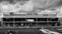
20160104_1608_7D2-20 Porritt Park (004/366)
Images, eqnz.chch.2010
Porritt Park was, before the earthquakes, the headquarters of hockey in this region. Two astro-turf fields (the main one was other side of the building), and corporate offices etc. The earthquakes buckled all the playing surfaces and damaged the buildings; a couple of smaller ones have been removed. Hockey shifted the other side of the city t...
Canterbury mental health worries dominate committee debate
Audio, Radio New Zealand
Worries about the mental health impacts of the Canterbury earthquakes dominated a fiery meeting at Parliament today.
150 yr-old tree felled for CHCH memorial
Audio, Radio New Zealand
Should a 150 year-old tree have been cut down to make way for Christchurch's earthquake memorial?
Christchurch's Divine Cakes rebuilds post quake
Audio, Radio New Zealand
Divine Cakes in Christchurch has had a tough past five years building up again after the 2011 earthquakes.
Work on Christchurch Town Hall nears half way mark
Audio, Radio New Zealand
Repair work on Christchurch's iconic Town Hall, badly damaged in the earthquakes, has nearly hit the halfway mark.
Christchurch's Bridge of Remembrance reopens
Audio, Radio New Zealand
People can walk over Christchurch's Bridge of Remembrance once again, after nearly seven million dollars in earthquake repairs.
Hybrid Broadband Ground Motion Simulations of Porters Pass Earthquakes
Research papers, University of Canterbury Library
We present ground motion simulations of the Porters Pass (PP) fault in the Canterbury region of New Zealand; a major active source near Christchurch city. The active segment of the PP fault has an inferred length of 82 km and a mostly strike-slip sense of movement. The PP fault slip makes up approximately 10% of the total 37 mm/yr margin-parallel plate motion and also comprises a significant proportion of the total strain budget in regional tectonics. Given that the closest segment of the fault is less than 45 km from Christchurch city, the PP fault is crucial for accurate earthquake hazard assessment for this major population centre. We have employed the hybrid simulation methodology of Graves and Pitarka (2010, 2015), which combines low (f<1 Hz) and high (f>1 Hz) frequencies into a broadband spectrum. We have used validations from three moderate magnitude events (𝑀𝑤4.6 Sept 04, 2010; 𝑀𝑤4.6 Nov 06, 2010; 𝑀𝑤4.9 Apr 29, 2011) to build confidence for the 𝑀𝑤 > 7 PP simulations. Thus far, our simulations include multiple rupture scenarios which test the impacts of hypocentre location and the finite-fault stochastic rupture representation of the source itself. In particular, we have identified the need to use location-specific 1D 𝑉𝑠/𝑉𝑝 models for the high frequency part of the simulations to better match observations.
Chch social enterprises not losing momentum
Audio, Radio New Zealand
The grass roots organisations that sprang up after the 2011 Canterbury earthquake are showing little sign of fading away.
Business group attacks rebuild slow-down
Audio, Radio New Zealand
Christchurch's leading business group is criticising city council plans to slow down its earthquake rebuild programme. Conan Young reports.
Cantabrians weigh with their preferences for anchor projects
Audio, Radio New Zealand
Christchurch businesses are calling on the council to keep the New Brighton pier open while earthquake repairs are completed.
Chch businesses call on council to keep Brighton pier open
Audio, Radio New Zealand
Christchurch businesses are calling on the council to keep the New Brighton pier open while earthquake repairs are completed.
The use of critical state soil mechanics to characterise Christchurch soil…
Research papers, The University of Auckland Library
The majority of current procedures used to deduce liquefaction potential of soils rely on empirical methods. These methods have been proven to work in the past, but these methods are known to overestimate the liquefaction potential in certain regions of Christchurch due to a whole range of factors, and the theoretical basis behind these methods cannot be explained scientifically. Critical state soil mechanics theory was chosen to provide an explanation for the soil's behaviour during the undrained shearing. Soils from two sites in Christchurch were characterised at regular intervals for the critical layers and tested for the critical state lines (CSL). Various models and relationships were then used to predict the CSL and compared with the actual CSL. However none of the methods used managed to predict the CSL accurately, and a separate Christchurch exclusive relationship was proposed. The resultant state parameter values could be obtained from shear-wave velocity plots and were then developed into cyclic resistance ratios (CRR). These were subsequently compared with cyclic stress ratios (CSR) from recent Christchurch earthquakes to obtain the factor of safety. This CSL-based approach was compared with other empirical methods and was shown to yield a favourable relationship with visual observations at the sites' locations following the earthquake.
People in Disasters Conference - Canterbury Primary Care Response to Earth…
Videos, UC QuakeStudies
A video of a presentation by Dr Phil Schroeder, Managing Director of Rolleston Central Health, during the second plenary of the 2016 People in Disasters Conference. The presentation is titled, "Canterbury Primary Care Response to Earthquakes in 2010/2011".
Requests pour in for EQC to review repairs
Audio, Radio New Zealand
The Earthquake Commission could have a big job on its hands fixing quake damaged Christchurch homes for a second time.
300 at EQC botched repairs meeting
Audio, Radio New Zealand
More than 300 people turned out to a meeting in Christchurch last night to hear about botched Earthquake Commission repairs.
The City of the Fugitives: Does Selective Preservation of Disaster Memorie…
Research papers, University of Canterbury Library
We’ll never know why the thirteen people whose corpses were discovered in Pompeii’s Garden of the Fugitives hadn’t fled the city with the majority of the population when Vesuvius turned deadly in AD79. But surely, thanks to 21st century technology, we know just about everything there is to know about the experiences of the people who went through the Canterbury Earthquakes. Or has the ubiquity of digital technology, combined with seemingly massive online information flows and archives, created a false sense that Canterbury’s earthquake stories, images and media are being secured for posterity? In this paper Paul Millar makes reference to issues experienced while creating the CEISMIC Canterbury Earthquakes Digital Archive (www.ceismic.org.nz) to argue that rather than having preserved all the information needed to fully inform recovery, the record of the Canterbury earthquakes’ impacts, and the subsequent response, is incomplete and unrepresentative. While CEISMIC has collected and curated over a quarter of a million earthquake-related items, Millar is deeply concerned about the material being lost. Like Pompeii, this disaster has its nameless, faceless, silenced victims; people whose stories must be heard, and whose issues must be addressed, if recovery is to be meaningful.
Lianne Dalziel on Christchurch, 2011, and now
Audio, Radio New Zealand
Christchurch Mayor Lianne Dalziel has experienced her fair share of earthquakes as a resident, MP and then Mayor. She joins Checkpoint.
Pigeon poo damaging Christchurch Cathedral
Audio, Radio New Zealand
The Cathedral has been in a state of limbo since the Christchurch earthquakes. Now roosting pigeons are adding to the damage.
Cost to build a home rises
Audio, Radio New Zealand
The cost of building a home in New Zealand's main cities has risen by 20 per cent since the Canterbury earthquakes.
Homeowners fight Southern Response over pay-out costs
Audio, Radio New Zealand
Forty Christchurch homeowners have headed back to court, as they seek to take a class action against earthquake insurer Southern Response.
CERA closing its doors after five years.
Audio, Radio New Zealand
Five years after being created the Canterbury Earthquake Recovery Authority, commonly known as CERA, will officially close its doors on Monday.
20160307_6634_7D2-82 Really Wild!
Images, eqnz.chch.2010
A section of retaining wall that tilted in the Christchurch 2011 earthquake. At the Edmunds Band Rotunda sight. Still not repaired,
Seismics in the City 2016 - Anchors Aweigh
Videos, UC QuakeStudies
A video of a presentation by Ross Butler, Chair of Otakaro Limited, at the 2016 Seismics in the City Conference. The presentation is titled, "Anchors Aweigh".The abstract for the presentation reads, "A review and preview of the development of the city's anchor projects once the Canterbury Earthquake Recovery Authority is disbanded in April."
Christchurch container crackdown
Audio, Radio New Zealand
Many Christchurch residents have used shipping containers and other temporary structures to store belongings in while repairs were carried out after the earthquakes. But the Christchurch City Council says it's had an increase in complaints from residents about containers and other temporary structures obscuring neighbours' views or obstructing council berms. Chairman of the council's regulation and consents committee David East says if earthquake repairs are completed, the container may have to go.
Soil liquefaction and its effects on structures: lessons learned from the …
Research papers, The University of Auckland Library
Many large-scale earthquakes all over the world have highlighted the impact of soil liquefaction to the built environment, but the scale of liquefaction-induced damage experienced in Christchurch and surrounding areas following the 2010-2011 Canterbury earthquake sequence (CES) was unparalleled, especially in terms of impact to an urban area. The short time interval between the large earthquakes presented a very rare occasion to examine liquefaction mechanism in natural deposits. The re-liquefaction experienced by the city highlighted the high liquefaction susceptibility of soil deposits in Christchurch, and presented a very challenging problem not only to the local residents but to the geotechnical engineering profession. This paper summarises the lessons learned from CES, and the impacts of the observations made to the current practice of liquefaction assessment and mitigation.