Search
found 1476 results
Images for Christchurch street; more images...


Fairfax Video, November 2011 (4)
Videos, UC QuakeStudies
A video of a tour through the Christchurch central city Red Zone. The video includes footage of Colombo Street, ChristChurch Cathedral, Warners Hotel, the Hotel Grand Chancellor, Cashel Mall, the former Bus Exchange, Tuam Street, Manchester Street, the Mackenzie & Willis store, High Street, Plume, and The Globe café.
Fairfax Video, February 2012 (11)
Videos, UC QuakeStudies
A video of a tour of the Christchurch central city Red Zone. The video shows footage of the Edmond's Band Rotunda, Gloucester Street, the CTV building site, Poplar Lane, the McKenzie & Willis building, High Street, Lichfield Street, Colombo Street, Cathedral Square, and ChristChurch Cathedral.
Register Record for the Cranmer Centre (former Christchurch Girls High), 4…
Articles, UC QuakeStudies
Register Record for the Cranmer Centre (former Christchurch Girls High), 40 Armagh Street, Christchurch
Roading contractor start repairing Christchurch streets
Audio, Radio New Zealand
Roading contractors are already repairing many Christchurch streets damaged by last week's earthquake.
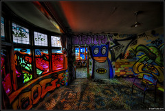
Street art renewal for Christchurch
Audio, Radio New Zealand
Street art has played a major role in bringing life back to Christchurch post-Earthquakes. A major player has been Watch This Space. They are a charitable trust established almost 10 years ago that organises and maintains public art projects in Christchurch, updates their interactive map helping people explore the city, and runs tours. Dr Reuben Woods is the creative director of Watch this Space.
Corner Colombo/Hereford Street, Christchurch
Images, eqnz.chch.2010
20130827_2654_1D3-24 Corner Colombo/Hereford Street, Christchurch The same view as the previous photo. Building demolished after the earthquake of 2011! #4156
Christchurch Earthquake – Street Cone Commemoration
Images, eqnz.chch.2010
Commemorating our one year anniversary of the 22 February 2011 Christchurch 6.3 earthquake.
Bridge Street bridge, Christchurch earthquake
Images, eqnz.chch.2010
20100904_3322_1D3-200 Bridge Street bridge, Christchurch earthquake South Brighton Bridge. See the gap between the abutment and the bridge itself (just to right of lower person). #377
Bridge Street cracking - Christchurch earthquake
Images, eqnz.chch.2010
20100905_3346_1D3-24 Bridge Street cracking - Christchurch earthquake The city side of the South Brighton bridge. Approaches on both sides will need extensive work before this bridge can re-open. #379
Colombo Street
Images, eqnz.chch.2010
December 2011
Manchester Street
Images, eqnz.chch.2010
Cordon Barrier on Manchester Street South as the clean-up of the CBD continues after the 6.3 earthquake hit Christchurch 22 February 2011.
Von Sierakowski & Co, Corner of Colombo and Tuam Streets 1906
Articles, Lost Christchurch
Oscar von Sierakowski’s factory and shop was built on the corner of Colombo and Tuam Streets in 1906. It boasted that it was the largest wire work factory in the colonies, producing decorati…
Cobb & Co. Corner of Cashel and High Streets, 1872
Articles, Lost Christchurch
Cobb & Co.’s booking office on the corner of Cashel and High Streets was a hub of activity. Here the proprietor, W. R. Mitchell took charge of the bookings and service on this site since…
Christchurch City’s Heart – the Cashel and High Street Intersection
Articles, Lost Christchurch
This intriguing photograph taken at the junction of Cashel and High Street draws us back to a typical summer day in Edwardian Christchurch in February 1913. A summer rain fall has just cleared, all…
Christchurch earthquake
Images, eqnz.chch.2010
20100904_3310_1D3-24 Christchurch earthquake Birch Street flooded from burst water main #371
Christchurch: The Transitional City Pt IV, pages 268-269: CCC Temporary St…
Articles, UC QuakeStudies
A PDF copy of pages 268-269 of the book Christchurch: The Transitional City Pt IV. The pages document the transitional project 'CCC Temporary Street Furniture'. Photos with permission: F3 Design
A humble home
Articles, Christchurch uncovered
Today’s post presents the story of William Bowen, a prominent Christchurch builder, as told by his residence at 441 Madras Street. Archaeologists recorded this building using building archaeology techniques before and during its post-earthquake demolition. 441 Madras Street was initially … ...
The Bank of New Zealand, corner of Cathedral Square, Hereford and Colombo …
Articles, Lost Christchurch
The impressive Bank of New Zealand building occupied a large corner of Cathedral Square and junction of Hereford and Colombo Streets. The Bank of New Zealand was first established in Auckland in 18…
St. Luke’s Anglican Church, Kilmore and Manchester Street corner
Articles, Lost Christchurch
The wooden church of St Luke the Evangelist, stood in Manchester Street, just north of the Avon, from 1858 until it was pulled down in 1908 to make way for a larger stone and brick structure, faced…
Danger sign, corner Cranford and Westminster Streets
Images, eqnz.chch.2010
None
Christchurch Earthquake 2011 - Manchester and High Streets
Images, eqnz.chch.2010
Showing Ruben Blades (top-right section of image) on the corner of Lichfield and Manchester Streets after the 6.3 quake hit Christchurch 22 February 2011 and the building being demolished along with many others. This image also shows the remains of the very heavy snow fall we had on Monday 25 July 2011. The centre of the city is still cordoned o...
Colombo Street, Sydenham.
Images, eqnz.chch.2010
former site of sweet shop, Christchurch City Mission charity shop and Soul Food Cafe
Bridge Reinforcements in Christchurch
Images, UC QuakeStudies
Detail of steel bracing supporting the Colombo Street overpass. The photographer comments, "After the earthquake in Christchurch the Colombo St overpass got damaged and they used reinforcing steel beams to hold it up".
Christchurch’s First Town Hall, High Street
Articles, Lost Christchurch
During the year 1857, developments moved closer towards making colonial Christchurch a working city. The Bridle Path opening in March, provided emigrants direct access to and from Lyttelton, on a s…
Fairfax Video, July 2011 (2)
Videos, UC QuakeStudies
A video of a tour through the Christchurch central city Red Zone in July 2011. The video includes footage of Colombo Street, Gloucester Street, the ChristChurch Cathedral, Worcester Street, the Press Building, the Whitcoulls Building, Cashel Mall, and High Street. It also includes an interview with Earthquake Recovery Minister Gerry Brownlee.
Building Record Form for 1 Eversleigh Street, Christchurch
Articles, UC QuakeStudies
Building Record Form for 1 Eversleigh Street, Christchurch
Building Record Form for 236 Cashel Street, Christchurch
Articles, UC QuakeStudies
Building Record Form for 236 Cashel Street, Christchurch.
The light fantastic
Articles, Christchurch uncovered
In last week’s blog post, we talked about the use of light in Christchurch’s city streets and public spaces, from oil lamps to gas lights to electricity in the early 20th century. This week, we step out of the street and … Continue reading →
Christchurch: The Transitional City Pt IV, pages 40-41: Temporary City Lib…
Articles, UC QuakeStudies
A PDF copy of pages 40-41 of the book Christchurch: The Transitional City Pt IV. The pages document the transitional project 'Temporary City Libraries'. Photo: Tim Church. With permission: Christchurch City Council.
Christchurch: The Transitional City Pt IV, pages 74-75: Nom Nom and Best D…
Articles, UC QuakeStudies
A PDF copy of pages 74-75 of the book Christchurch: The Transitional City Pt IV. The pages document the transitional project 'Nom Nom and Best Demo 2012'. Photo: Reuben Woods