
Search
found 104 results
Images for Canterbury Earthquake 2010; more images...

Observed performance of residential masonry veneer construction in the 201…
Research papers, The University of Auckland Library
Following the 2010/2011 Canterbury, New Zealand earthquakes, a detailed door-to-door survey was conducted in the Christchurch region to establish the earthquake performance of lightweight timber-framed residential dwellings with a masonry veneer external cladding system. The post-earthquake survey involved documenting the condition of dwellings in areas that had experienced different levels of earthquake shaking, allowing comparison between the performance of different veneer systems and different shaking intensities. In total, just fewer than 1,100 residential dwellings were inspected throughout the wider Christchurch area. The survey included parameters such as level of veneer damage, type of veneer damage, observed crack widths, and level of repair required. It is concluded that based on observed earthquake performance at the shaking intensities matching or exceeding ultimate limit state loading, the post-1996 veneer fixing details performed satisfactorily and continued use of the detail is recommended without further modification. AM - Accepted Manuscript
EQC respond to claims of inadequate assessments
Audio, Radio New Zealand
EQC's manager for the Canterbury home repair programme, Reid Stiven, respondes to claims of misleading estimates of damage to household foundations from the 2010 and 2011 earthquakes.
Lessons Learned for Steel Seismic Design from the 2010/2011 Canterbury Ear…
Research papers, The University of Auckland Library
The Canterbury earthquake series of 2010/2011 has turned the city of Christchurch into a full scale natural laboratory testing the structural and non-structural response of buildings under moderate to very severe earthquake shaking. The lessons learned from this, which have come at great cost socially and economically, are extremely valuable in increasing our understanding of whole building performance in severe earthquakes. Given current initiatives underway on both sides of the Tasman towards developing joint Australasian steel and composite steel/concrete design and construction standards that would span a very wide range of geological conditions and seismic zones, these lessons are relevant to both countries. This paper focusses on the performance of steel framed buildings in Christchurch city, with greatest emphasis on multi-storey buildings, but also covering single storey steel framed buildings and light steel framed housing. It addresses such issues as the magnitude and structural impact of the earthquake series, importance of good detailing, lack of observed column base hinging, the excellent performance of composite floors and it will briefly cover research underway to quantify some of these effects for use in design.
Human response to earthquake shaking: Analysis of video footage of the 201…
Research papers, University of Canterbury Library
None
Building natural disaster response capacity: sound workforce strategies fo…
Research papers, University of Canterbury Library
This report examines and compares case studies of labour market policy responses in APEC economies to natural disasters. It first reviews the policies and practice within APEC economies and internationally in managing the labour market effects of natural disasters. By using comparative case studies, the report then compares recent disaster events in the Asia-Pacific region, including: - the June 2013 Southern Alberta floods in Canada; - the 2010 and 2011 Queensland floods in Australia; - the 2010 and 2011 Canterbury earthquakes in New Zealand; - the 2011 Great East Japan Earthquake and Tsunami in Japan; and - the 2008 Wenchuan earthquake in China.
20131231_8485_EOS M-22 Quake City exhibit
Images, eqnz.chch.2010
Another city walk around, this time with my brother-in-law from Auckland. Also went to the Quake City exhibition in the city organised by the Canterbury Museum. First fine day for a while.
The role of insurance in organisational recovery following the 2010 and 20…
Research papers, University of Canterbury Library
Insurance is widely acknowledged as a key component in an organisation's disaster preparedness and resilience. But how effective is insurance in aiding business recovery following a major disaster? The aim of this research was to summarise the experiences of both the insurance industry and businesses dealing with commercial insurance claims following the 2010 and 2011 Canterbury earthquakes.
Systematic ground motion observations in the Canterbury earthquakes and re…
Research papers, University of Canterbury Library
Ground motion observations from the most significant 10 events in the 2010-2011 Canterbury earthquake sequence at near-source sites are utilized to scrutinize New Zealand (NZ)-specific pseudo-spectral acceleration (SA) empirical ground motion prediction equations (GMPE) (Bradley 2010, Bradley 2013, McVerry et al. 2006). Region-specific modification factors based on relaxing the conventional ergodic assumption in GMPE development were developed for the Bradley (2010) model. Because of the observed biases with magnitude and source-to-site distance for the McVerry et al. (2006) model it is not possible to develop region-specific modification factors in a reliable manner. The theory of non-ergodic empirical ground motion prediction is then outlined, and applied to this 10 event dataset to determine systematic effects in the between- and within-event residuals which lead to modifications in the predicted median and standard deviation of the GMPE. By examining these systematic effects over sub-regions containing a total of 20 strong motion stations within the Canterbury area, modification factors for use in region-specific ground motion prediction are proposed. These modification factors, in particular, are suggested for use with the Bradley et al. (2010) model in Canterbury-specific probabilistic seismic hazard analysis (PSHA) to develop revised design response, particularly for long vibration periods.
Vulnerabilities to Seismic Hazards in Coastal and River Environments: Less…
Research papers, University of Canterbury Library
Coastal and river environments are exposed to a number of natural hazards that have the potential to negatively affect both human and natural environments. The purpose of this research is to explain that significant vulnerabilities to seismic hazards exist within coastal and river environments and that coasts and rivers, past and present, have played as significant a role as seismic, engineering or socio-economic factors in determining the impacts and recovery patterns of a city following a seismic hazard event. An interdisciplinary approach was used to investigate the vulnerability of coastal and river areas in the city of Christchurch, New Zealand, following the Canterbury Earthquake Sequence, which began on the 4th of September 2010. This information was used to identify the characteristics of coasts and rivers that make them more susceptible to earthquake induced hazards including liquefaction, lateral spreading, flooding, landslides and rock falls. The findings of this research are applicable to similar coastal and river environments elsewhere in the world where seismic hazards are also of significant concern. An interdisciplinary approach was used to document and analyse the coastal and river related effects of the Canterbury earthquake sequence on Christchurch city in order to derive transferable lessons that can be used to design less vulnerable urban communities and help to predict seismic vulnerabilities in other New Zealand and international urban coastal and river environments for the future. Methods used to document past and present features and earthquake impacts on coasts and rivers in Christchurch included using maps derived from Geographical Information Systems (GIS), photographs, analysis of interviews from coastal, river and engineering experts, and analysis of secondary data on seismicity, liquefaction potential, geology, and planning statutes. The Canterbury earthquake sequence had a significant effect on Christchurch, particularly around rivers and the coast. This was due to the susceptibility of rivers to lateral spreading and the susceptibility of the eastern Christchurch and estuarine environments to liquefaction. The collapse of river banks and the extensive cracking, tilting and subsidence that accompanied liquefaction, lateral spreading and rock falls caused damage to homes, roads, bridges and lifelines. This consequently blocked transportation routes, interrupted electricity and water lines, and damaged structures built in their path. This study found that there are a number of physical features of coastal and river environments from the past and the present that have induced vulnerabilities to earthquake hazards. The types of sediments found beneath eastern Christchurch are unconsolidated fine sands, silts, peats and gravels. Together with the high water tables located beneath the city, these deposits made the area particularly susceptible to liquefaction and liquefaction-induced lateral spreading, when an earthquake of sufficient size shook the ground. It was both past and present coastal and river processes that deposited the types of sediments that are easily liquefied during an earthquake. Eastern Christchurch was once a coastal and marine environment 6000 years ago when the shoreline reached about 6 km inland of its present day location, which deposited fine sand and silts over this area. The region was also exposed to large braided rivers and smaller spring fed rivers, both of which have laid down further fine sediments over the following thousands of years. A significant finding of this study is the recognition that the Canterbury earthquake sequence has exacerbated existing coastal and river hazards and that assessments and monitoring of these changes will be an important component of Christchurch’s future resilience to natural hazards. In addition, patterns of recovery following the Canterbury earthquakes are highlighted to show that coasts and rivers are again vulnerable to earthquakes through their ability to recovery. This city’s capacity to incorporate resilience into the recovery efforts is also highlighted in this study. Coastal and river areas have underlying physical characteristics that make them increasingly vulnerable to the effects of earthquake hazards, which have not typically been perceived as a ‘coastal’ or ‘river’ hazard. These findings enhance scientific and management understanding of the effects that earthquakes can have on coastal and river environments, an area of research that has had modest consideration to date. This understanding is important from a coastal and river hazard management perspective as concerns for increased human development around coastlines and river margins, with a high seismic risk, continue to grow.
Empirical analysis of near-fault forward-directivity effects in the 2010-1…
Research papers, University of Canterbury Library
In this paper, the characteristics of near-fault ground motions recorded during the Mw7.1 Darfield and Mw 6.2 Christchurch earthquakes are examined and compared with existing empirical models. The characteristics of forward-directivity effects are first examined using a wavelet-based pulse-classification algorithm. This is followed by an assessment of the adequacy of empirical models which aim to capture the effect of directivity effects on amplifying the acceleration response spectra; and the period and peak velocity of the forward-directivity pulse. It is illustrated that broadband directivity models developed by Somerville et al. (1997) and Abrahamson (2000) generally under-predict the observed amplification of response spectral ordinates at longer vibration periods. In contrast, a recently developed narrowband model by Shahi and Baker (2011) provides significantly improved predictions by amplifying the response spectra within a small range of periods surrounding the directivity pulse period. Although the empirical predictions of the pulse period are generally favourable for the Christchurch earthquake, the observations from the Darfield earthquake are significantly under-predicted. The elongation in observed pulse periods is inferred as being a result of the soft sedimentary soils of the Canterbury basin. However, empirical predictions of the observed peak velocity associated with the directivity pulse are generally adequate for both events.
Doyle, Martin, 1956- :'Hold tight, Kiwi - this will shock the living crap …
Images, Alexander Turnbull Library
Commentary from the cartoonist 'The Earthquake Commission's leak of 83,000 files is like a storyline from Alfred Hitchcock: : a loon attempts to shock a nation that has already been rendered braindead from previous shocks.Note: EQC is ued here as an 'echo' of the term ECT [electro convulsive therapy...ie shock treatment].' In March 2013, there was a massive leak of of some 83,000 EQC files relating to individual claims relating to the Christchurch earthquakes. Quantity: 1 digital cartoon(s).
The influence of near-fault motions on liquefaction triggering during the …
Research papers, University of Canterbury Library
The objective of this study is to examine the influence of near-fault motions on liquefaction triggering in Christchurch and neighboring towns during the 2010-2011 Canterbury earthquake sequence (CES). The CES began with the 4 September 2010, Mw7.1 Darfield earthquake and included up to ten events that triggered liquefaction. However, most notably, widespread liquefaction was induced by the Darfield earthquake and the Mw6.2, 22 February 2011 Christchurch earthquake. Of particular relevance to this study is the forward directivity effects that were prevalent in the motions recorded during the Darfield earthquake, and to a much lesser extent, during the Christchurch earthquake. A 2D variant of the Richart-Newmark fatigue theory was used to compute the equivalent number of cycles (neq) for the ground motions, where volumetric strain was used as the damage metric. This study is unique because it considers the contribution and phasing of both the fault-normal and fault-parallel components of motion on neq and the magnitude scaling factor (MSF). It was found that when the fault-normal and fault-parallel motions were treated individually, the former yielded a lower neq than the latter. Additionally, when the combined effects of fault-normal and fault-parallel components were considered, it was found that the MSF were higher than those commonly used. This implies that motions containing near-fault effects are less demanding on the soil than motions that do not. This may be one of several factors that resulted in less severe liquefaction occurring during the Darfield earthquake than the Christchurch earthquake.
EQC level assessments questioned
Audio, Radio New Zealand
Some Canterbury homeowners say their houses have dropped in value because the damage to their properties was inadequately assessed by the Earthquake Commission after the 2010 and 2011 earthquakes. Independent land surveyor, Adrian Cowie, and a Burwood homeowner affected by the quakes, Selwyn Stafford, talk about the issues facing them.
Sensitivity of predicted liquefaction-induced lateral displacements from t…
Research papers, University of Canterbury Library
The 2010 Darfield and 2011 Christchurch Earthquakes triggered extensive liquefaction-induced lateral spreading proximate to streams and rivers in the Christchurch area, causing significant damage to structures and lifelines. A case study in central Christchurch is presented and compares field observations with predicted displacements from the widely adopted empirical model of Youd et al. (2002). Cone penetration testing (CPT), with measured soil gradation indices (fines content and median grain size) on typical fluvial deposits along the Avon River were used to determine the required geotechnical parameters for the model input. The method presented attempts to enable the adoption of the extensive post-quake CPT test records in place of the lower quality and less available Standard Penetration Test (SPT) data required by the original Youd model. The results indicate some agreement between the Youd model predictions and the field observations, while the majority of computed displacements error on the side of over-prediction by more than a factor of two. A sensitivity analysis was performed with respect to the uncertainties used as model input, illustrating the model’s high sensitivity to the input parameters, with median grain size and fines content among the most influential, and suggesting that the use of CPT data to quantify these parameters may lead to variable results.
20131231_8484_EOS M-22 Quake City exhibit
Images, eqnz.chch.2010
20131231_8484_EOS M-22 Quake City exhibit Another city walk around, this time with my brother-in-law from Auckland. Also went to the Quake City exhibition in the city organised by the Canterbury Museum. First fine day for a while. #4502
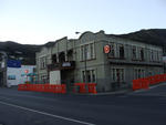
20131231_8503_EOS M-22 From Cashel Street
Images, eqnz.chch.2010
20131231_8503_EOS M-22 From Cashel Street Another city walk around, this time with my brother-in-law from Auckland. Also went to the Quake City exhibition in the city organised by the Canterbury Museum. First fine day for a while. #4504
The Effects of the Earthquakes on the Classical Musical Life of Christchur…
Research papers, University of Canterbury Library
As part of the Canterbury Earthquake Digital Archive, this thesis documents the effects of the earthquakes on the musical life of Christchurch. It concentrates, primarily, on the classical music scene. The thesis examines the difficulties experienced by musical organisations, individual musicians, and teachers as they sought to bring music to the broken city, together with the measures that were necessary in order to overcome those difficulties. It examines how those organisations have worked to re-establish themselves in their particular musical fields. It charts the progress made, to date, along the path to recovery and offers suggestions regarding precautionary measures which, if instituted, could reduce the after-effects of a future disaster. Recognising that not all of the difficulties encountered were directly related to the earthquakes, this thesis also examines the effects on music and musicians, of decision making associated with the recovery effort. The thesis also demonstrates how a destructive event can provide the inspiration for creativity. It recognises the importance of music in maintaining a sense of normality for people, whether they realise it or not, as well as its influences in providing emotional relief in times of stress. Hopefully, it may become a useful guide to which other cities that may be faced with some natural disaster, could refer.
Nisbet, Alastair, 1958- :[West east]. 10 May 2013
Images, Alexander Turnbull Library
A signpost pointing 'West' and 'East'. The sign pointing West is intact; that indicating East is broken and barely hanging on to the post. Refers to the condition of Christchurch City after the earthquakes of 2010 and 2011; the western wealthier suburbs were less damaged than the poorer Eastern suburbs. Also, progress on repair and rehabilitation of eastern housing had been slow. The redesign of the city centre seemed to be a western suburb priority which ignored the poverty and misery of living conditions on the east. Quantity: 1 digital cartoon(s).
An inventory of community-led and non-governmental organisations and initi…
Research papers, Lincoln University
The impact of the Canterbury earthquake sequence of 2010-12 and its aftermath has been enormous. This inventory lists some of the thousands of community-led groups and initiatives across the region that have developed or evolved as a result of the quake. This inventory is the third such inventory to have been produced. The Christchurch Earthquake Activity Inventory was released by Landcare Research in May 2011, three months after the devastating 22 February 2011 earthquake. The second inventory, entitled An Inventory of Community-led Recovery Initiatives in Canterbury, was collated by Bailey Peryman and Dr Suzanne Vallance (Lincoln University) approximately one year after the February earthquake. The research for this third inventory was undertaken over a four month period from June to September 2013, and was conducted primarily through online searches.This research was undertaken with funding support from the Natural Hazards Platform and GNS, New Zealand.
Smith, Ashley W, 1948- :[Bob Parker and Jim Anderton]. 20 September 2010
Images, Alexander Turnbull Library
Depicts Christchurch Mayor Bob Parker striking a pose under a spotlight while standing astride broken masonry. He is being interviewed by media. On the right of frame, Progressive Party leader and MP Jim Anderton is under dark clouds and caught under the Beehive. Refers to the 2010 Christchurch mayoral elections in which Parker won over Anderton. Prior to the 2010 Canterbury earthquake, Anderton was ahead in the polls. The quake devastation was said to have given Parker a bigger profile than Anderton and been a factor in his win (TV3 9 October 2010). Quantity: 1 digital cartoon(s).
20131231_8511_EOS M-22 Forsyth Barr building for sale, under the archway
Images, eqnz.chch.2010
20131231_8511_EOS M-22 Forsyth Barr building for sale, under the archway Another city walk around, this time with my brother-in-law from Auckland. Also went to the Quake City exhibition in the city organised by the Canterbury Museum. First fine day for a while. #4507
Implications of the Canterbury earthquake sequence for Adelaide, South Aus…
Research papers, The University of Auckland Library
The city of Christchurch has experienced over 10,000 aftershocks since the 4th of September 2010 earthquake of which approximately 50 have been greater than magnitude 5. The damage caused to URM buildings in Christchurch over this sequence of earthquakes has been well documented. Due to the similarity in age and construction of URM buildings in Adelaide, South Australia and Christchurch (they are sister cities, of similar age and heritage), an investigation was conducted to learn lessons for Adelaide based on the Christchurch experience. To this end, the number of URM buildings in the central business districts of both cities, the extent of seismic strengthening that exists in both cities, and the relative earthquake hazards for both cities were considered. This paper will report on these findings and recommend strategies that the city of Adelaide could consider to significantly reduce the seismic risk posed by URM buildings in future earthquake.
The impacts of the Canterbury earthquakes on educational inequalities and …
Research papers, University of Canterbury Library
During 2010 and 2011, major earthquakes caused widespread damage and the deaths of 185 people in the city of Christchurch. Damaged school buildings resulted in state intervention which required amendment of the Education Act of 1989, and the development of ‘site sharing agreements’ in undamaged schools to cater for the needs of students whose schools had closed. An effective plan was also developed for student assessment through establishing an earthquake impaired derived grade process. Previous research into traditional explanations of educational inequalities in the United Kingdom, the United States of America, and New Zealand were reviewed through various processes within three educational inputs: the student, the school and the state. Research into the impacts of urban natural disasters on education and education inequalities found literature on post disaster education systems but nothing could be found that included performance data. The impacts of the Canterbury earthquakes on educational inequalities and achievement were analysed over 2009-2012. The baseline year was 2009, the year before the first earthquake, while 2012 is seen as the recovery year as no schools closed due to seismic events and there was no state intervention into the education of the region. National Certificate of Educational Achievement (NCEA) results levels 1-3 from thirty-four secondary schools in the greater Christchurch region were graphed and analysed. Regression analysis indicates; in 2009, educational inequalities existed with a strong positive relationship between a school’s decile rating and NCEA achievement. When schools were grouped into decile rankings (1-10) and their 2010 NCEA levels 1-3 results were compared with the previous year, the percentage of change indicates an overall lower NCEA achievement in 2010 across all deciles, but particularly in lower decile schools. By contrast, when 2011 NCEA results were compared with those of 2009, as a percentage of change, lower decile schools fared better. Non site sharing schools also achieved higher results than site sharing schools. State interventions, had however contributed towards student’s achieving national examinations and entry to university in 2011. When NCEA results for 2012 were compared to 2009 educational inequalities still exist, however in 2012 the positive relationship between decile rating and achievement is marginally weaker than in 2009. Human ethics approval was required to survey one Christchurch secondary school community of students (aged between 12 and 18), teachers and staff, parents and caregivers during October 2011. Participation was voluntary and without incentives, 154 completed questionnaires were received. The Canterbury earthquakes and aftershocks changed the lives of the research participants. This school community was displaced to another school due to the Christchurch earthquake on 22 February 2011. Research results are grouped under four geographical perspectives; spatial impacts, socio-economic impacts, displacement, and health and wellbeing. Further research possibilities include researching the lag effects from the Canterbury earthquakes on school age children.
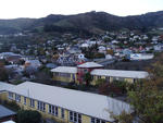
20130125_1760_1D3-115 Road Closed 2
Images, eqnz.chch.2010
This is the Summit Road below Mt Cavendish and shows a few remaining high buildings in the central city beyond (in setting sun). Just above centre is the doomed AMI Stadium (1) aka Lancaster Park, home to Canterbury cricket and rugby till the erathquakes.
20131231_8509_EOS M-22 Forsyth Barr building with remains of PWC just behi…
Images, eqnz.chch.2010
20131231_8509_EOS M-22 Forsyth Barr building with remains of PWC just behind the green fence (across river) Another city walk around, this time with my brother-in-law from Auckland. Also went to the Quake City exhibition in the city organised by the Canterbury Museum. First fine day for a while. #4506
The Canterbury Royal Commission : Impacts on the property market
Research papers, Lincoln University
The earthquake swarm that has struck Canterbury, New Zealand from September 2010 has led to widespread destruction and loss of life in the city of Christchurch. In response to this the New Zealand government convened a Royal Commission under the Commissions of Inquiry Act 1908. The terms of reference for this enquiry were wide ranging, and included inquiry into legal and best-practice requirements for earthquake-prone buildings and associated risk management strategies. The Commission produced a final report on earthquake-prone buildings and recommendations which was made public on the 7th December 2012. Also on the 7th of December 2012 the Ministry of Business, Innovation and Employment (MBIE) released a Consultation Document that includes many of the recommendations put forward by the Royal Commission. This paper examines the evidence presented to the Royal Commission and reviews their recommendations and those of MBIE in relation to the management of earthquake-prone buildings. An analysis of the likely impacts of the recommendations and proposals on both the property market and society in general is also undertaken.
The Performance of House Foundations in the Canterbury Earthquakes
Research papers, University of Canterbury Library
The Canterbury Earthquakes of 2010-2011, in particular the 4th September 2010 Darfield earthquake and the 22nd February 2011 Christchurch earthquake, produced severe and widespread liquefaction in Christchurch and surrounding areas. The scale of the liquefaction was unprecedented, and caused extensive damage to a variety of man-made structures, including residential houses. Around 20,000 residential houses suffered serious damage as a direct result of the effects of liquefaction, and this resulted in approximately 7000 houses in the worst-hit areas being abandoned. Despite the good performance of light timber-framed houses under the inertial loads of the earthquake, these structures could not withstand the large loads and deformations associated with liquefaction, resulting in significant damage. The key structural component of houses subjected to liquefaction effects was found to be their foundations, as these are in direct contact with the ground. The performance of house foundations directly influenced the performance of the structure as a whole. Because of this, and due to the lack of research in this area, it was decided to investigate the performance of houses and in particular their foundations when subjected to the effects of liquefaction. The data from the inspections of approximately 500 houses conducted by a University of Canterbury summer research team following the 4th September 2010 earthquake in the worst-hit areas of Christchurch were analysed to determine the general performance of residential houses when subjected to high liquefaction loads. This was followed by the detailed inspection of around 170 houses with four different foundation types common to Christchurch and New Zealand: Concrete perimeter with short piers constructed to NZS3604, concrete slab-on-grade also to NZS3604, RibRaft slabs designed by Firth Industries and driven pile foundations. With a focus on foundations, floor levels and slopes were measured, and the damage to all areas of the house and property were recorded. Seven invasive inspections were also conducted on houses being demolished, to examine in more detail the deformation modes and the causes of damage in severely affected houses. The simplified modelling of concrete perimeter sections subjected to a variety of liquefaction-related scenarios was also performed, to examine the comparative performance of foundations built in different periods, and the loads generated under various bearing loss and lateral spreading cases. It was found that the level of foundation damage is directly related to the level of liquefaction experienced, and that foundation damage and liquefaction severity in turn influence the performance of the superstructure. Concrete perimeter foundations were found to have performed most poorly, suffering high local floor slopes and being likely to require foundation repairs even when liquefaction was low enough that no surface ejecta was seen. This was due to their weak, flexible foundation structure, which cannot withstand liquefaction loads without deforming. The vulnerability of concrete perimeter foundations was confirmed through modelling. Slab-on-grade foundations performed better, and were unlikely to require repairs at low levels of liquefaction. Ribraft and piled foundations performed the best, with repairs unlikely up to moderate levels of liquefaction. However, all foundation types were susceptible to significant damage at higher levels of liquefaction, with maximum differential settlements of 474mm, 202mm, 182mm and 250mm found for concrete perimeter, slab-on-grade, ribraft and piled foundations respectively when subjected to significant lateral spreading, the most severe loading scenario caused by liquefaction. It was found through the analysis of the data that the type of exterior wall cladding, either heavy or light, and the number of storeys, did not affect the performance of foundations. This was also shown through modelling for concrete perimeter foundations, and is due to the increased foundation strengths provided for heavily cladded and two-storey houses. Heavy roof claddings were found to increase the demands on foundations, worsening their performance. Pre-1930 concrete perimeter foundations were also found to be very vulnerable to damage under liquefaction loads, due to their weak and brittle construction.
Seismic Response of the UC Physics Building in the Canterbury Earthquakes
Research papers, University of Canterbury Library
The purpose of this thesis is to evaluate the seismic response of the UC Physics Building based on recorded ground motions during the Canterbury earthquakes, and to use the recorded response to evaluate the efficacy of various conventional structural analysis modelling assumptions. The recorded instrument data is examined and analysed to determine how the UC Physics Building performed during the earthquake-induced ground motions. Ten of the largest earthquake events from the 2010-11 Canterbury earthquake sequence are selected in order to understand the seismic response under various levels of demand. Peak response amplitude values are found which characterise the demand from each event. Spectral analysis techniques are utilised to find the natural periods of the structure in each orthogonal direction. Significant torsional and rocking responses are also identified from the recorded ground motions. In addition, the observed building response is used to scrutinise the adequacy of NZ design code prescriptions for fundamental period, response spectra, floor acceleration and effective member stiffness. The efficacy of conventional numerical modelling assumptions for representing the UC Physics Building are examined using the observed building response. The numerical models comprise of the following: a one dimensional multi degree of freedom model, a two dimensional model along each axis of the building and a three dimensional model. Both moderate and strong ground motion records are used to examine the response and subsequently clarify the importance of linear and non-linear responses and the inclusion of base flexibility. The effects of soil-structure interaction are found to be significant in the transverse direction but not the longitudinal direction. Non-linear models predict minor in-elastic behaviour in both directions during the 4 September 2010 Mw 7.1 Darfield earthquake. The observed torsional response is found to be accurately captured by the three dimensional model by considering the interaction between the UC Physics Building and the adjacent structure. With the inclusion of adequate numerical modelling assumptions, the structural response is able to be predicted to within 10% for the majority of the earthquake events considered.
The Spatial and Temporal Patterns of Anxiety and Chest Pain Resulting From…
Research papers, University of Canterbury Library
The aim of this thesis was to examine the spatial and the temporal patterns of anxiety and chest pain resulting from the Canterbury, New Zealand earthquaeks. Three research objectives were identified: examine any spatial or termporal clusters of anxiety and chest pain; examine the associations between anxiety, chest pain and damage to neighbourhood; and determine any statistically significant difference in counts of anxiety and chest pain after each earthquake or aftershock which resulted in severe damage. Measures of the extent of liquefaction the location of CERA red-zones were used as proxy measures for earthquake damage. Cases of those who presented to Christchurch Public Hospital Emergency Department with either anxiety or chest pain between May 2010 and April 2012 were aggregated to census area unit (CAU) level for analysis. This thesis has taken a unique approach to examining the spatial and spatio-temporal variations of anxiety and chest pain after an earthquake and offers unique results. This is the first study of its kind to use a GIS approach when examining Canterbury specific earthquake damage and health variables at a CAU level after the earthquakes. Through the use of spatio-termporal scan modelling, negative and linear regression modelling and temporal linear modelling with dummy variables this research was able to conclude there are significant spatial and temporal variations in anxiety and chest pain resulting from the earthquakes. The spatio-termporal scan modelling identified a hot cluster of both anxiety and chest pain within Christchurch at the same time the earthquakes occurred. The negative binomial model found liquefaction to be a stronger predictor of anxiety than the Canterbury Earthquake Recovery Authority's (CERA) land zones. The linear regression model foun chest pain to be positively associated with all measures of earthquake damage with the exception of being in the red-zone. The temporal modelling identified a significant increase in anxiety cases one month after a major earthquake, and chest pain cases spiked two weeks after an earthquake and gradually decreased over the following five weeks. This research was limited by lack of control period data, limited measures of earthquake damage, ethical restrictions, and the need for population tracking data. The findings of this research will be useful in the planning and allocation of mental wellbeing resources should another similar event like the Canterbury Earthquakes occur in New Zealand.
20131231_8504_EOS M-22 Looking up Cashel Street
Images, eqnz.chch.2010
20131231_8504_EOS M-22 Looking up Cashel Street Another city walk around, this time with my brother-in-law from Auckland. Also went to the Quake City exhibition in the city organised by the Canterbury Museum. First fine day for a while. For 36 years I worked in a now gone building where that red car is parked (on the left). and would have wa...