
Search
found 108 results
Images for 4 September 2011; more images...


Digital Photograph: North side of London Street, Lyttelton
Images, Canterbury Museum
One landscape colour digital photograph taken on 19 November 2011 showing part of the north side of London Street. The properties visible from left to right are: Himalaya Design (obscured), Coffee Culture (downstairs), J Voyce and Co Ships Providore (upstairs), empty shop, and Lyttel Piko Organic and Wholefoods The Lyttelton streetscape has cha...
Digital Photograph: North side of London Street, Lyttelton
Images, Canterbury Museum
One landscape colour digital photograph taken on 19 November 2011 showing part of the north side of London Street. The properties visible from left to right are: part of Lyttel Piko Organic and Wholefoods, Satchmo Café Pizzabar, Milly May and Snoclothes New Zealand. The empty section was formerly occupied by No. 6 Cafe. The Lyttelton streetsc...
Digital Photograph: Irish Pub, south side of London Street, Lyttelton
Images, Canterbury Museum
One landscape colour digital photograph taken on 19 November 2011 showing earthquake repairs being undertaken to the Irish Pub on the south side of London Street. The Lyttelton streetscape has changed dramatically from its pre-earthquake appearance and will continue to change as new buildings are erected on empty sections. In this photograph Lo...
Digital Photograph: Lyttelton Coffee Company, London Street, Lyttelton
Images, Canterbury Museum
One portrait colour digital photograph taken on 19 November 2011 showing the framework of the Lyttelton Coffee Company Building surrounded by safety fencing. On the fencing are election hoardings and an advertisement for Samo, the café established by employees of the Lyttelton Coffee Company. Prior earthquake strengthening enabled the Lyttelton...
Digital Photograph: Looking east from Norwich Quay, Lyttelton
Images, Canterbury Museum
One landscape colour digital photograph taken on 19 November 2011 looking east from Norwich Quay from approximately the base of Canterbury Street. Visible in the photograph are the partially deconstructed former Lyttelton Harbour Board Offices, the Holcim Cement Silos, the Oxford Street Railway Overbridge, Lyttelton Port of Christchurch's storag...
Digital Photograph: Shadbolt House, Norwich Quay, Lyttelton
Images, Canterbury Museum
One portrait colour digital photograph taken on 19 November 2011 showing Shadbolt House prior to its demolition. Architect Lyttelton's tallest building before its demolition was built in 1961 as the offices of the Lyttelton Harbour Board. At the time it was demolished the building was known as Shadbolt House and was owned by Independent Fisherie...
Digital Photograph: Lyttelton Ambulance Station, north side of London Stre…
Images, Canterbury Museum
One landscape colour digital photograph taken on 19 November 2011 showing buildings on London Street. Visible in the photograph (left to right) are Lyttelton Ambulance Station and Bells Pharmacy - relocated into a converted house with law firm MacTodd on the upper floor. Discussions have been held between Lyttelton Police, St John Ambulance and...
Digital Photograph: Lyttelton Fire Station, London Street, Lyttelton
Images, Canterbury Museum
One landscape colour digital photograph taken on 19 November 2011 showing the Lyttelton Fire Station. The building is fenced off and unused due to earthquake damage. To the right of the photograph the front of one of the Fire Appliances and the shipping containers set up in the rear car park to provide temporary facilities can be seen. Followin...
Digital Photograph: Grubb Cottage, London Street, Lyttelton
Images, Canterbury Museum
One landscape colour digital photograph taken on 19 November 2011 showing Grubb Cottage on London Street. The rear portion of this building was built in 1851 and is regarded as one of the oldest buildings in Canterbury. It was sold in 2006 to the Christchurch City Council and vested in the Grubb Cottage Heritage Trust. In August 2013 the buildi...
Digital Photograph: Temporary Bank of New Zealand Branch, north side of Lo…
Images, Canterbury Museum
One landscape colour digital photograph taken on 19 November 2011 showing the temporary premises of the Bank of New Zealand in a relocatable building on the footpath. The sign above the tellers window read "Lyttel Bank" The Lyttelton streetscape has changed dramatically from its pre-earthquake appearance and will continue to change as new build...
Digital Photograph: Corner of London and Canterbury Streets, Lyttelton
Images, Canterbury Museum
One landscape colour digital photograph taken on 19 November 2011 showing the corner of London and Canterbury Streets. Visible in the photograph (left to right) are the Lyttelton Library, Freemans Dining Room, Ray White Real Estate and Min Sargison Real Estate on London Street. The photograph is looking to the southeast. The site of the Timebal...
Digital Photograph: Temporary Artwork on the corner of London and Canterbu…
Images, Canterbury Museum
One landscape colour digital photograph taken on 19 November 2011 showing a temporary artwork on the site of the Albion Hotel/ Ground Delicatessen. After the demolition of the building the site was used for a Gap Filler initiative called the Lyttelton Petanque Club. The photograph shows a temporary artwork created from used bricks, probably from...
Digital Photograph: The Loons (Lyttelton Working Mens' Club), Canterbury S…
Images, Canterbury Museum
One landscape colour digital photograph taken on 19 November 2011 showing temporary propping of the Lyttelton Working Mens' Club/ The Loons. Built in 1909 the building has had a variety of uses including a garage and the Lyttelton Waterside Workers Social Club. More recently the Lyttelton Working Mens' Club has provided rehearsal and performanc...
Digital Photograph: Lyttelton Sea Foods, Norwich Quay, Lyttelton
Images, Canterbury Museum
One landscape colour digital photograph taken on 19 November 2011 showing the temporary premises of Lyttelton Sea Foods in a relocatable building on Norwich Quay. The building is located on the site of the Lyttelton Hotel. Also visible in the photograph are (left to right) the side of Shadbolt House, the rear of the Pacifica Building which was t...
Digital Photograph: Lyttelton Bakery, corner Norwich Quay and Canterbury S…
Images, Canterbury Museum
One landscape colour digital photograph taken on 19 November 2011 showing the temporary premises of Lyttelton Bakery in a relocatable building on Norwich Quay. The building is located on the site of the Royal Hotel. Also visible in the photograph are (left to right up Canterbury Street) Lyttelton Service Station, Samo, Lyttelton Telephone Exchan...
Digital Photograph: Earthquake Damage to Lyttelton Historical Museum, Glad…
Images, Canterbury Museum
One landscape colour digital photograph taken on 25 September 2011 showing the site of the Lyttelton Historical Museum on the corner of Gladstone Quay and Donald Street. The photograph shows the temporary fencing around the levelled site. The building visible at the rear is the former Municipal Stables on Donald Street. To the right of the phot...
Digital Photograph: Artwork on the Site of the Harbourlight Theatre, Londo…
Images, Canterbury Museum
One portrait colour digital photograph taken on 23 July 2011 showing the artwork by Trent Hiles erected on the site of the Harbourlight Theatre on London Street. The artwork presents part of James K Baxter's poem 'High Country Weather' using the international code of signal flags. The artwork was installed as a Gap Filler project. The artwork r...
Digital Photograph: Earthquake damage to Church of the Most Holy Trinity, …
Images, Canterbury Museum
One landscape colour digital photograph taken on 15 June 2011 showing earthquake damage to the Anglican Church of The Most Holy Trinity in Winchester Street, Lyttelton. Photograph shows collapsed roof of the nave and north transept. Photograph taken from the north side of the church. Architect The collapse of the Church of the Most Holy Trinity ...
Digital Photograph: Earthquake Damage to Lyttelton Roman Catholic and Diss…
Images, Canterbury Museum
One landscape colour digital photograph taken on 30 June 2011 showing earthquake damage to graves in Lyttelton Roman Catholic and Dissenters (Public) Cemeteries in Reserve Terrace. Most of the headstones and grave surrounds in the photograph show damage. Looking east in the Dissenters (Public) section of the cemetery. The Lyttelton cemeteries a...
Digital Photograph: Earthquake Damage to Lyttelton Roman Catholic and Diss…
Images, Canterbury Museum
One landscape colour digital photograph taken on 30 June 2011 showing signs warning of the danger posed by unstable headstones in Lyttelton Roman Catholic and Dissenters (Public) Cemeteries in Reserve Terrace. Several toppled headstones and collapsed grave surrounds are visible in the photograph. Looking east from the main gate. The Lyttelton c...
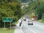
Digital Photograph: Earthquake damage to a retaining wall, Lyttelton
Images, Canterbury Museum
One landscape colour digital photograph taken on 30 June 2011 showing earthquake damage to a section of retaining wall in Sumner Road. Plastic sheeting installed to stabilise previous damage and protect from water erosion is visible to the right of the photograph. Also visible in the photograph is a boarded up broken window and temporary safety ...
Digital Photograph: Earthquake damage to Church of the Most Holy Trinity, …
Images, Canterbury Museum
One landscape colour digital photograph taken on 15 June 2011 showing earthquake damage to the Anglican Church of The Most Holy Trinity in Winchester Street, Lyttelton. Photograph shows collapsed roof of the nave and north transept. Photograph taken from the northwest corner of the church. Architect The collapse of the Church of the Most Holy Tr...
Digital Photograph: Demolition of former Library and Fire Station, corner …
Images, Canterbury Museum
One landscape colour digital photograph taken on 6 September 2011 showing the demolition of 2 Sumner Road, the former library and fire station. This building was a private residence at the time of its demolition. Photograph taken looking north on Oxford Street. Also visible in the photograph are the Lyttelton Information Centre, an entrance to ...
Digital Photograph: Former Convent of Our Lady of Mercy, Exeter Street, an…
Images, Canterbury Museum
One landscape colour digital photograph taken on 30 June 2011 showing earthquake damage to the former Convent of Our Lady of Mercy and to the Catholic Church of St Joseph the Worker. Photograph taken from St. Davids Street The sense of loss felt when confronted with the collapse or demolition of an historic building is compounded when that bui...
Digital Photograph: Temporary Premises of Lyttelton Bakery, corner of Norw…
Images, Canterbury Museum
One landscape colour digital photograph taken on 16 June 2011 showing the Lyttelton Bakery operating from a portable building on the Corner of Canterbury Street and Norwich Quay. This portable building has been placed on the site of the Royal Hotel. Also visible in the photograph are Shadbolt House and the rear of the buildings on the south side...
Digital Photograph: Mitre Hotel
Images, Canterbury Museum
One landscape colour digital photograph taken on 26 May 2013 on the corner of Norwich Quay and Canterbury Street, Lyttelton. The photograph shows the Mitre Hotel surrounded by temporary fencing. Three years after the 2010-2011 earthquakes there are still many uncertainties about which buildings can or will be retained. These buildings, or parts...
Digital Photograph: Lyttelton Main School
Images, Canterbury Museum
One landscape colour digital photograph taken on 26 May 2013 of Lyttelton Main School. The photograph is taken from St Davids Street looking northwest. One of the broader consequences of the 2010-2011 Canterbury earthquakes has been the Ministry of Education’s Shaping Education – Future Direction Review of Schools in the Greater Christchurch Ar...
T-shirt: Band Together Concert for Canterbury
Images, Canterbury Museum
One white cotton t-shirt with red printed guitar logo on front and ‘Band / Together / Concert / for / Canterbury // 23rd October / Hagley Park’ in black and red writing, guitar logo and names of performers on the reverse. This concert was a free morale booster following the 4 September 2010 earthquake. The 4 September 2010 earthquake unsettled ...
Memorial Guitar: Kia Kaha
Images, Canterbury Museum
One white over-painted hand-made electric guitar made primarily from ash and maple timbers, also incorporating wood from a variety of historic buildings in Canterbury damaged or destroyed in the 2010 - 2011 earthquakes including the Arts Centre, Kutwell’s Warehouse, Lyttleton main street pub, Timeball Station, Carlton Hotel, Merivale shops, bui...
3-D Model: Greendale and Associated Faults
Images, Canterbury Museum
One oblong perspex covered 3-D model of the fault plains associated with the 4 September 2010 Darfield earthquake; top of the model also acts as a map overlay. Geologists continue to study the 4 September 2010 earthquake and consider it is likely to have been a complex event with several faults rupturing simultaneously. This model provides one ...