
Search
found 87 results
Images for 2011 Christchurch earthquake; more images...
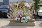
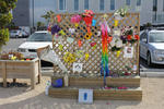

CTV families hold protest in Christchurch
Audio, Radio New Zealand
Some of the families of the 115 people who dies in the CTV building during the 2011 Canterbury earthquake protested in Latimer Square yesterday over the police decision not to prosecute the designers of the CTV building. They say they do want to see a prosecution go ahead, and they are seeking legal advice about what their options are.
Insurance as a Double-Edged Sword: Quantitative Evidence from the 2011 Chr…
Research papers, Victoria University of Wellington
We examine the role of business interruption (BI) insurance in business recovery following the Christchurch earthquake in 2011. First, we ask whether BI insurance increases the likelihood of business survival in the immediate (3-6 months) aftermath of a disaster. We find positive but statistically insignificant evidence that those firms that had incurred damage, but were covered by BI insurance, had higher likelihood of survival post-quake compared with those firms that did not have any insurance. For the medium-term (2-3 years) survival of firms, our results show a more explicit role for insurance. Firms with BI insurance experience increased productivity and improved performance following a catastrophe. Furthermore, we find that those organisations that receive prompt and full payments of their claims have a better recovery than those that had protracted or inadequate claims payments, but this difference between the two groups is not statistically significant. We find no statistically significant evidence that the latter group (inadequate payment) did any better than those organisations that had damage but no insurance coverage. In general, our analysis indicates the importance not only of adequate insurance coverage, but also of an insurance system that delivers prompt claim payments. This is a post-peer-review, pre-copyedit version of an article published in 'The Geneva Papers on Risk and Insurance - Issues and Practice'. The final authenticated version is available online at: https://doi.org/10.1057/s41288-017-0067-y. The following terms of use apply: https://www.springer.com/gp/open-access/publication-policies/aam-terms-of-use.
20171103_5588_1D3-70 Cabbage Tree in the Red Zone
Images, eqnz.chch.2010
An impressive Cabbage Tree (Cordyline australis) that was in someone's back yard prior to the demolition of houses post the 2011 earthquake.
An empirical analysis of the Christchurch residential mortgage market: pos…
Research papers, Lincoln University
The housing and mortgage market in Christchurch experienced significant changes since the 2011 earthquake, especially after the reconstruction of the city. The increasing speed of Christchurch average house price exceed the average house price of the whole country, as well as the number of new dwellings. By this regard, this study surveyed the households in Christchurch to analyze the effect of the earthquake on housing and mortgage market. This includes factors such as housing price, interest rate, government policy and socioeconomic factors in terms of age, gender, educational attainment, income, marital status and family life cycle. Logistic regression model is used to analyze the data. The study provides an overview of the housing market and mortgage market in Christchurch. The logistic regression, results show changes on sensitivity between the socio-economic factors and house purchase, as well as mortgage borrowing pre- and post-earthquake. The result indicates that the earthquake in Christchurch has affected households’ decision on house purchase and mortgage borrowing.
30,000 to watch Springsteen on eve of quake anniversary
Audio, Radio New Zealand
People have been queuing for days for the Bruce Springsteen concert in Christchurch tonight, ahead of the sixth anniversary of the 2011 earthquake. Glenn McCartney is at the front of the queue.
Civil justice responses to natural disaster: New Zealand’s Christchurch Hi…
Research papers, The University of Auckland Library
The Canterbury earthquakes of 2010 and 2011 generated hundreds of thousands of insurance claims, many of which were disputed. The New Zealand justice system faced the same challenge encountered by other jurisdictions following a natural disaster: how to resolve these disputes quickly and at minimal cost but also fairly, to avoid compounding the disaster with injustice? The thesis is of this article is that although the earthquakes were catastrophic for New Zealand, they also created a unique opportunity to design an innovative civil justice process—the Christchurch High Court Earthquake List—and to test, over a relatively short timeframe, how well that process works. This article describes the Christchurch High Court Earthquake List and analyses it by reference to civil justice theory about the relative normative values of public adjudication and private settlement and the dialogic relationship between them. It then evaluates the List, using statistics available five years on from the earthquakes and by reference to the author’s own experience mediating earthquake disputes.
Shattered dreams – inner city revitalisation, gentrification and the Chris…
Research papers, Lincoln University
The major earthquakes of 2010 and 2011 brought to an abrupt end a process of adaptive reuse, revitalisation and gentrification that was underway in the early 20th century laneways and buildings located in the south eastern corner of the Christchurch Central Business District. Up until then, this location was seen as an exemplar of how mixed use could contribute to making the central city an attractive and viable alternative to the suburban living experience predominant in New Zealand. This thesis is the result of a comprehensive case study of this “Lichfield Lanes” area, which involved in depth interviews with business owners, observation of public meetings and examination of documents and the revitalisation research literature. Findings were that many of the factors seen to make this location successful pre-earthquakes mirror the results of similar research in other cities. These factors include: the importance of building upon historic architecture and the eclectic spaces this creates; a wide variety of uses generating street life; affordable rental levels; plus the dangers of uniformity of use brought about by focussing on business types that pay the most rent. Also critical is co-operation between businesses to create and effectively market and manage an identifiable precinct that has a coherent style and ambience that differentiates the location from competing suburban malls. In relation to the latter, a significant finding of this project was that the hospitality and retail businesses key to the success of Lichfield Lanes were not typical and could be described as quirky, bohemian, chaotic, relatively low rent, owner operated and appealing to the economically important “Creative Class” identified by Richard Florida (2002) and others. In turn, success for many of these businesses can be characterised as including psychological and social returns rather than simply conventional economic benefits. This has important implications for inner city revitalisation, as it contrasts with the traditional focus of local authorities and property developers on physical aspects and tenant profitability as measures of success. This leads on to an important conclusion from this research, which is that an almost completely inverted strategy from that applied to suburban mall development, may be most appropriate for successful inner city revitalisation. It also highlights a disconnection between the focus and processes of regulatory authorities and the outcomes and processes most acceptable to the people likely to frequent the central city. Developers are often caught in the middle of this conflicted situation. Another finding was early commitment by businesses to rebuild the case study area in the same style, but over time this waned as delay, demolition, insurance problems, political and planning uncertainty plus other issues made participation by the original owners and tenants impossible or uneconomic. In conclusion, the focus of inner city revitalisation is too often on buildings rather than the people that use them and what they now desire from the central city.
Resilience through Building Back Better: Assessing Christchurch Recovery f…
Research papers, The University of Auckland Library
Disasters, either man-made or natural, are characterised by a multiplicity of factors including loss of property, life, environmental degradation, and psychosocial malfunction of the affected community. Although much research has been undertaken on proactive disaster management to help reduce the impacts of natural and man-made disasters, many challenges still remain. In particular, the desire to re-house the affected as quickly as possible can affect long-term recovery if a considered approach is not adopted. Promoting recovery activities, coordination, and information sharing at national and international levels are crucial to avoid duplication. Mannakkara and Wilkinson’s (2014) modified “Build Back Better” (BBB) concept aims for better resilience by incorporating key resilience elements in post-disaster restoration. This research conducted an investigation into the effectiveness of BBB in the recovery process after the 2010–2011 earthquakes in greater Christchurch, New Zealand. The BBB’s impact was assessed in terms of its five key components: built environment, natural environment, social environment, economic environment, and implementation process. This research identified how the modified BBB propositions can assist in disaster risk reduction in the future, and used both qualitative and quantitative data from both the Christchurch and Waimakariri recovery processes. Semi-structured interviews were conducted with key officials from the Christchurch Earthquake Recovery Authority, and city councils, and supplemented by reviewing of the relevant literature. Collecting data from both qualitative and quantitative sources enabled triangulation of the data. The interviewees had directly participated in all phases of the recovery, which helped the researcher gain a clear understanding of the recovery process. The findings led to the identification of best practices from the Christchurch and Waimakariri recovery processes and underlined the effectiveness of the BBB approach for all recovery efforts. This study contributed an assessment tool to aid the measurement of resilience achieved through BBB indicators. This tool provides systematic and structured approach to measure the performance of ongoing recovery.
Christchurch city is a recovery of two halves
Audio, Radio New Zealand
The immediate aftermath of the devastating 2011 Christchurch earthquake and its ongoing impact on residents' mental health is being described as a recovery of two halves. The latest wellbeing survey from the Canterbury District Health Board shows that one in five people, predominantly those living in the eastern suburbs, say they experience stress most or all of the time.
From darkness comes light: music as a reflection of the lived experience o…
Research papers, University of Canterbury Library
Context of the project: On 4 September 2010, 22 February 2011, 13 June 2011 and 23 December 2011 Christchurch suffered major earthquakes and aftershocks (well over 10,000) that have left the central city in ruins and many of the eastern suburbs barely habitable even now. The earthquakes on 22 February caused catastrophic loss of life with 185 people killed. The toll this has taken on the residents of Christchurch has been considerable, not least of all for the significant psychological impact and disruption it has had on the children. As the process of rebuilding the city commenced, it became clear that the arts would play a key role in maintaining our quality of life during difficult times. For me, this started with the children and the most expressive of all the art forms – music.
Laying down foundations: reflecting on disaster management planning in mus…
Research papers, University of Canterbury Library
This thesis looks at the protocols museums and galleries adopt for the safeguarding of art, artefacts and cultural heritage. In particular, it analyses these procedures in relation to the 2010 and 2011 earthquakes in Christchurch, and considers how these events shaped the preventative conservation measures in place in museum and gallery institutions. Through gathering, assessing, and comparing this information about Christchurch’s institutions to disaster management best practices in national and international organisations, this thesis gauges the extent to which disaster management was changed in response to the events in Christchurch. This thesis first considers the growth in disaster management as a field, before examining what are considered best practices within this sector. Finally, it looks at specific institutions in Christchurch, including the Christchurch Art Gallery Te Puna o Waiwhetu, Canterbury Museum, and the Air Force Museum of New Zealand.
Fans of The Boss ready themselves for Chch concert tonight
Audio, Radio New Zealand
The sounds of Bruce Springsteen will ring out around Christchurch tonight, ahead of the sixth anniversary of the deadly February 2011 earthquake in the region. Long time fans join us to discuss what they're expecting from tonight's gig.
Psychologist: More support needed for young quake victims
Audio, Radio New Zealand
Children not even born when the city was devastated by the 2011 earthquake are showing signs of quake-related stress. A Christchurch-based clinical psychologist Catherine Gallagher says the children are living with the ongoing impact of the quakes.
Understanding post-earthquake decisions on multi-storey concrete buildings…
Research papers, The University of Auckland Library
The 2010–2011 Canterbury earthquakes, which involved widespread damage during the February 2011 event and ongoing aftershocks near the Christchurch Central Business District, left this community with more than $NZD 40 billion in losses (~20 % GDP), demolition of approximately 60 % of multi-storey concrete buildings (3 storeys and up), and closure of the core business district for over 2 years. The aftermath of the earthquake sequence has revealed unique issues and complexities for the owners of commercial and multi-storey residential buildings in relation to unexpected technical, legal, and financial challenges when making decisions regarding the future of their buildings impacted by the earthquakes. The paper presents a framework to understand the factors influencing post-earthquake decisions (repair or demolish) on multi-storey concrete buildings in Christchurch. The study, conducted in 2014, includes in-depth investigations on 15 case-study buildings using 27 semi-structured interviews with various property owners, property managers, insurers, engineers, and government authorities in New Zealand. The interviews revealed insights regarding the multitude of factors influencing post-earthquake decisions and losses. As expected, the level of damage and repairability (cost to repair) generally dictated the course of action. There is strong evidence, however, that other variables have significantly influenced the decision on a number of buildings, such as insurance, business strategies, perception of risks, building regulations (and compliance costs), and government decisions. The decision-making process for each building is complex and unique, not solely driven by structural damage. Furthermore, the findings have put the spotlight on insurance policy wordings and the paradoxical effect of insurance on the recovery of Christchurch, leading to other challenges and issues going forward.
Christchurch 'superhero' seeks funding to boost work
Audio, Radio New Zealand
Christchurch has its own social superhero and he's gone cap in hand to the council for funding. The self-styled lycra-clad superhero, known only at 'Flat Man', has been dropping care packages to people since the 2011 Canterbury earthquake. He also wants to be able to help schoolkids and anxious and stressed residents through their troubles. And to do this, he's now asking the Christchurch City Council for funding. He joins us now, and says "a cape is a must".
Alternative Radio : exhibiting radio and music heritage after the Christch…
Research papers, University of Canterbury Library
This article examines the representation of Christchurch, New Zealand, student radio station RDU in the exhibition Alternative Radio at the Canterbury Museum in 2016. With the intention of ‘making visible what is invisible’ about radio broadcasting, the exhibition articulated RDU as a point of interconnection between the technical elements of broadcasting, the social and musical culture of station staff and volunteers, and the broader local and national music scenes. This paper is grounded in observations of the exhibitions and associated public programmes, and interviews with the key participants in the exhibition including the museum's exhibition designer and staff from RDU, who acted as independent practitioners in collaboration with the museum. Alternative Radio also addressed the aftermath of the major earthquake of 22 February 2011, when RDU moved into a customised horse truck after losing its broadcast studio. The exhibition came about because of the cultural resonance of the post-quake story, but also emphasised the long history of the station before that event, and located this small student radio station in the broader heritage discourse of the Canterbury museum, activating the historical, cultural, and personal memories of the station's participants and audiences.
Trees in the Red Zone (307/365)
Images, eqnz.chch.2010
20171103_5582_1D3-38 Trees in the Red Zone (307/365) In what used to be sections with houses and yards. Between late 2011 and 2014 the houses (well 95% of them) were removed due to land dropping in the 2011 earthquakes and the proximity of the Avon River, tidal in this area. #8859
Before/after : the governance of urban tourist spaces in the context of th…
Research papers, University of Canterbury Library
Research in the governance of urban tourist spaces is characterized by a lack of argumentative inquiry and scant use of critical theory. This is evident, particularly, in the study of tourism and post-disaster urban recovery, with very few contributions assessing the phenomenon from a social theory perspective. This thesis examines the complex phenomenon of planning and governance for urban tourism spaces in contexts facing physical recovery from natural disasters. It does so by looking at the governance dynamics and the mechanism of decision- making put in place before and after triggering events like earthquakes and tsunamis. This thesis provides evidence from Christchurch, New Zealand, by focusing on the policies and strategies for the regeneration of the city centre put in place before and after the disruptive earthquakes of 2010 and 2011. The thesis looks at power relations, structures and ideologies through a Lukesian appraisal of pre-and-post disaster governance from two relevant urban tourist spaces located in the Christchurch central city area: the Arts Centre of Christchurch and the Town Hall and Performing Arts Precinct. The research strategy adopted for the study combined archival research, interviews with key stakeholders and fieldwork notes over a period of two years. The research deployed a comparative case study methodology that focuses on projects taking place within a spatially defined area of the city centre where special legislation was enacted as result of the earthquakes. The findings from the interviews and their triangulation with documents retrieved from national and local authorities suggest that the earthquakes affected the engagement among stakeholders and the mechanisms of decision-making. Also, the findings show patterns of disaster capitalism in post-earthquake governance for urban tourist spaces in the Christchurch CBD, with episodes of exclusion, lobbying and amendment of rules and legislation that directly benefited the interests of a narrow group of privileged stakeholders. Overall, the study shows that the earthquakes of 2010 and 2011 accelerated neoliberal practices of site development in Christchurch, with the seismic events used as a pretext to implement market-oriented site projects in the CBD area.
Scrutinising The Prediction of Liquefaction Through New Zealand Case Histo…
Research papers, University of Canterbury Library
Background Liquefaction induced land damage has been identified in more than 13 notable New Zealand earthquakes within the past 150 years, as presented on the timeline below. Following the 2010-2011 Canterbury Earthquake Sequence (CES), the consequences of liquefaction were witnessed first-hand in the city of Christchurch and as a result the demand for understanding this phenomenon was heightened. Government, local councils, insurers and many other stakeholders are now looking to research and understand their exposure to this natural hazard.
A major ice-calving event at Tasman Glacier terminus, Southern Alps, 22 Fe…
Research papers, The University of Auckland Library
Terminus calving of icebergs is a common mass-loss mechanism from water-terminating glaciers globally, including the lake-calving glaciers in New Zealand’s central Southern Alps. Calving rates can increase dramatically in response to increases in ice velocity and/or retreat of the glacier margin. Here, we describe a large calving event (c. 4.5 × 10⁶ m3) observed at Tasman Glacier, which initiated around 30 min after the MW 6.2 Christchurch earthquake of 22 February 2011. The volume of this calving event was equalled or exceeded only once in a subsequent 13-month-long study. While the temporal association with the earthquake remains intriguing, the effects of any preconditioning factors remain unclear.
Empirical vulnerability assessment of reinforced concrete frame with mason…
Research papers, The University of Auckland Library
During the 2010/2011 Canterbury earthquakes, Reinforced Concrete Frame with Masonry Infill (RCFMI) buildings were subjected to significant lateral loads. A survey conducted by Christchurch City Council (CCC) and the Canterbury Earthquake Recovery Authority (CERA) documented 10,777 damaged buildings, which included building characteristics (building address, the number of storeys, the year of construction, and building use) and post-earthquake damage observations (building safety information, observed damage, level of damage, and current state of the buildings). This data was merged into the Canterbury Earthquake Building Assessment (CEBA) database and was utilised to generate empirical fragility curves using the lognormal distribution method. The proposed fragility curves were expected to provide a reliable estimation of the mean vulnerability for commercial RCFMI buildings in the region. http://www.13thcms.com/wp-content/uploads/2017/05/Symposium-Info-and-Presentation-Schedule.pdf VoR - Version of Record
Fragility functions for buried pipelines in liquefiable soils based on New…
Research papers, University of Canterbury Library
This poster aims to present fragility functions for pipelines buried in liquefaction-prone soils. Existing fragility models used to quantify losses can be based on old data or use complex metrics. Addressing these issues, the proposed functions are based on the Christchurch network and soil and utilizes the Canterbury earthquake sequence (CES) data, partially represented in Figure 1. Figure 1 (a) presents the pipe failure dataset, which describes the date, location and pipe on which failures occurred. Figure 1 (b) shows the simulated ground motion intensity median of the 22nd February 2011 earthquake. To develop the model, the network and soil characteristics have also been utilized
Fragility functions for buried pipelines in liquefaction-prone areas based…
Research papers, University of Canterbury Library
Motivation This poster aims to present fragility functions for pipelines buried in liquefaction-prone soils. Existing fragility models used to quantify losses can be based on old data or use complex metrics. Addressing these issues, the proposed functions are based on the Christchurch network and soil and utilizes the Canterbury earthquake sequence (CES) data, partially represented in Figure 1. Figure 1 (a) presents the pipe failure dataset, which describes the date, location and pipe on which failures occurred. Figure 1 (b) shows the simulated ground motion intensity median of the 22nd February 2011 earthquake. To develop the model, the network and soil characteristics have also been utilized.
Geologic and anthropogenic influences on rockfall and liquefaction in the …
Research papers, University of Canterbury Library
Geologic phenomena produced by earthquake shaking, including rockfalls and liquefaction features, provide important information on the intensity and spatiotemporal distribution of earthquake ground motions. The study of rockfall and liquefaction features produced in contemporary well- instrumented earthquakes increases our knowledge of how natural and anthropogenic environments respond to earthquakes and improves our ability to deduce seismologic information from analogous pre-contemporary (paleo-) geologic features. The study of contemporary and paleo- rockfall and liquefaction features enables improved forecasting of environmental responses to future earthquakes. In this thesis I utilize a combination of field and imagery-based mapping, trenching, stratigraphy, and numerical dating techniques to understand the nature and timing of rockfalls (and hillslope sedimentation) and liquefaction in the eastern South Island of New Zealand, and to examine the influence that anthropogenic activity has had on the geologic expressions of earthquake phenomena. At Rapaki (Banks Peninsula, NZ), field and imagery-based mapping, statistical analysis and numerical modeling was conducted on rockfall boulders triggered by the fatal 2011 Christchurch earthquakes (n=285) and compared with newly identified prehistoric (Holocene and Pleistocene) boulders (n=1049) deposited on the same hillslope. A significant population of modern boulders (n=26) travelled farther downslope (>150 m) than their most-travelled prehistoric counterparts, causing extensive damage to residential dwellings at the foot of the hillslope. Replication of prehistoric boulder distributions using 3-dimensional rigid body numerical models requires the application of a drag-coefficient, attributed to moderate to dense slope vegetation, to account for their spatial distribution. Radiocarbon dating provides evidence for 17th to early 20th century deforestation at the study site during Polynesian and European colonization and after emplacement of prehistoric rockfalls. Anthropocene deforestation enabled modern rockfalls to exceed the limits of their prehistoric predecessors, highlighting a shift in the geologic expression of rockfalls due to anthropogenic activity. Optical and radiocarbon dating of loessic hillslope sediments in New Zealand’s South Island is used to constrain the timing of prehistoric rockfalls and associated seismic events, and quantify spatial and temporal patterns of hillslope sedimentation including responses to seismic and anthropogenic forcing. Luminescence ages from loessic sediments constrain timing of boulder emplacement to between ~3.0 and ~12.5 ka, well before the arrival of Polynesians (ca AD 1280) and Europeans (ca AD 1800) in New Zealand, and suggest loess accumulation was continuing at the study site until 12-13 ka. Large (>5 m3) prehistoric rockfall boulders preserve an important record of Holocene hillslope sedimentation by creating local traps for sediment aggradation and upbuilding soil formation. Sediment accumulation rates increased considerably (>~10 factor increase) following human arrival and associated anthropogenic burning of hillslope vegetation. New numerical ages are presented to place the evolution of loess-mantled hillslopes in New Zealand’s South Island into a longer temporal framework and highlight the roles of earthquakes and humans on hillslope surface process. Extensive field mapping and characterization for 1733 individual prehistoric rockfall boulders was conducted at Rapaki and another Banks Peninsula site, Purau, to understand their origin, frequency, and spatial and volumetric distributions. Boulder characteristics and distributions were compared to 421 boulders deposited at the same sites during the 2010-2011 Canterbury earthquake sequence. Prehistoric boulders at Rapaki and Purau are comprised of two dominant lithofacies types: volcanic breccia and massive (coherent) lava basalt. Volcanic breccia boulders are found in greatest abundance (64-73% of total mapped rockfall) and volume (~90-96% of total rockfall) at both locations and exclusively comprise the largest boulders with the longest runout distances that pose the greatest hazard to life and property. This study highlights the primary influence that volcanic lithofacies architecture has on rockfall hazard. The influence of anthropogenic modifications on the surface and subsurface geologic expression of contemporary liquefaction created during the 2010-2011 Canterbury earthquake sequence (CES) in eastern Christchurch is examined. Trench observations indicate that anthropogenic fill layer boundaries and the composition/texture of discretely placed fill layers play an important role in absorbing fluidized sand/silt and controlling the subsurface architecture of preserved liquefaction features. Surface liquefaction morphologies (i.e. sand blows and linear sand blow arrays) display alignment with existing utility lines and utility excavations (and perforated pipes) provided conduits for liquefaction ejecta during the CES. No evidence of pre-CES liquefaction was identified within the anthropogenic fill layers or underlying native sediment. Radiocarbon dating of charcoal within the youngest native sediment suggests liquefaction has not occurred at the study site for at least the past 750-800 years. The importance of systematically examining the impact of buried infrastructure on channelizing and influencing surface and subsurface liquefaction morphologies is demonstrated. This thesis highlights the importance of using a multi-technique approach for understanding prehistoric and contemporary earthquake phenomena and emphasizes the critical role that humans play in shaping the geologic record and Earth’s surface processes.
Understanding the longer-term experience of community inclusion for wheelc…
Research papers, University of Canterbury Library
Background The 2010/2011 Canterbury earthquakes and aftershocks in New Zealand caused unprecedented destruction to the physical, social, economic, and community fabric of Christchurch city. The recovery phase in Christchurch is on going, six years following the initial earthquake. Research exploring how disabled populations experience community inclusion in the longer-term recovery following natural disasters is scant. Yet such information is vital to ensure that recovering communities are inclusive for all members of the affected population. This thesis specifically examined how people who use wheelchairs experienced community inclusion four years following the 2010/2011 Canterbury earthquakes. Aims The primary research aim was to understand how one section of the disability community – people who use wheelchairs – experienced community inclusion over the four years following the 2010/2011 Canterbury earthquakes and aftershocks. A secondary aim was to test a novel sampling approach, Respondent Driven Sampling, which had the potential to enable unbiased population-based estimates. This was motivated by the lack of an available sampling frame for the target population, which would inhibit recruitment of a representative sample. Methodology and methods An exploratory sequential mixed methods design was used, beginning with a qualitative phase (Phase One), which informed a second quantitative phase (Phase Two). The qualitative phase had two stages. First, a small sample of people who use wheelchairs participated in an individual, semi-structured interview. In the second stage, these participants were then invited to a group interview to clarify and prioritise themes identified in the individual interviews. The quantitative phase was a cross-sectional survey developed from the findings from Phase One. Initially, Respondent Driven Sampling was employed to conduct a national, electronic cross-sectional survey that aimed to recruit a sample that may provide unbiased population-based estimates. Following the unsuccessful application of Respondent Driven Sampling, a region-specific convenience sampling approach was used. The datasets from the qualitative and quantitative phases were integrated to address the primary aim of the research. Results In Phase One 13 participants completed the individual interviews, and five of them contributed to the group interview. Thematic analysis of individual and group interview data suggested that participants felt the 2010/11 earthquakes magnified many pre-existing barriers to community inclusion, and also created an exciting opportunity for change. This finding was encapsulated in five themes: 1) earthquakes magnified barriers, 2) community inclusion requires energy, 3) social connections are important, 4) an opportunity lost, and 5) an opportunity found. The findings from Phase One informed the development of a survey instrument to investigate how these findings generalised to a larger sample of individuals who use wheelchairs. In Phase Two, the Respondent Driven Sampling approach failed to recruit enough participants to satisfy the statistical requirements needed to reach equilibrium, thereby enabling the calculation of unbiased population estimates. The subsequent convenience sampling approach recruited 49 participants who, combined with the 15 participants from the Respondent Driven Sampling approach that remained eligible for the region-specific sample, resulted in the total of 64 individuals who used wheelchairs and were residents of Christchurch. Participants reported their level of community inclusion at three time periods: the six months prior to the first earthquake in September 2010 (time one), the six months following the first earthquake in September 2010 (time two), and the six months prior to survey completion (between October 2015 and March 2016, (time three)). Survey data provided some precision regarding the timing in which the magnified barriers developed. Difficulty with community inclusion rose significantly between time one and time two, and while reducing slightly, was still present during time three, and had not returned to the time one baseline. The integrated findings from Phase One and Phase Two suggested that magnified barriers to community inclusion had been sustained four years post-earthquake, and community access had not returned to pre-earthquake levels, let alone improved beyond pre-earthquake levels. Conclusion Findings from this mixed methods study suggest that four years following the initial earthquake, participants were still experiencing multiple magnified barriers, which contributed to physical and social exclusion, as well as fatigue, as participants relied on individual agency to negotiate such barriers. Participants also highlighted the exciting opportunity to create an accessible city. However because they were still experiencing barriers four years following the initial event, and were concerned that this opportunity might be lost if the recovery proceeds without commitment and awareness from the numerous stakeholders involved in guiding the recovery. To truly realise the opportunity to create an accessible city following a disaster, the transition from the response phase to a sustainable longer-term recovery must adopt a new model of community engagement where decision-makers partner with people living with disability to co-produce a vision and strategy for creating an inclusive community. Furthermore, despite the unsuccessful use of Respondent Driven Sampling in this study, future research exploring the application of RDS with wheelchair users is recommended before discounting this sampling approach in this population.
Previsione degli effetti di liquefazione su scala urbana
Research papers, University of Canterbury Library
Nel presente articolo si illustra una procedura per il processamento automatizzato di prove CPT, il calcolo di vari indici di liquefazione e la rappresentazione dei dati su mappa. La procedura è applicata al caso studio del terremoto di Christchurch, Nuova Zelanda, del 22 febbraio 2011 (magnitudo momento, Mw = 6.2). Dall’analisi spaziale dei risultati emerge una buona correlazione tra le mappe ottenute per l’indicatore degli effetti al suolo e i danni osservati (su terreni e strutture). Tuttavia, per confermare la validità di tale procedura, sarà necessario esaminare ulteriori casi studio nel mondo.
A comparison of CPT-Vs correlations using a liquefaction case history data…
Research papers, University of Canterbury Library
This study uses 44 high quality liquefaction case histories taken from 22 locations affected by the 2010-2011 Canterbury earthquake sequence to evaluate four commonly used CPT-VS correlations (i.e., Robertson, 2009; Hegazy and Mayne, 2006; Andrus et al., 2007; McGann et al., 2015b). Co-located CPT soundings and VS profiles, developed from surface wave testing, were obtained at 22 locations and case histories were developed for the Mw 7.1, 4 September 2010 Darfield and Mw 6.2, 22 February 2011 Christchurch earthquakes. The CPT soundings are used to generate VS profiles using each of four CPT-VS correlations. These correlated VS profiles are used to estimate the factor of safety against liquefaction using the Kayen et al. (2013) VS-based simplified liquefaction evaluation procedure. An error index is used to quantify the predictive capabilities of these correlations in relation to the observations of liquefaction (or the lack thereof). Additionally, the error indices from the CPT-correlated VS profiles are compared to those obtained using: (1) the Kayen et al. (2013) procedure with surface wave-derived VS profiles, and (2) the Idriss and Boulanger (2008) CPT-based liquefaction evaluation procedure. Based on the error indices, the evaluation procedures based on direct measurements of either CPT or VS provided more accurate liquefaction triggering estimates than those obtained from any of the CPT-VS correlations. However, the performance of the CPT-VS correlations varied, with the Robertson (2009) and Hegazy and Mayne (2006) correlations performing relatively poorly for the Christchurch soils and the Andrus et al. (2007) and McGann et al. (2015b) correlations performing better. The McGann et al. (2015b) correlation had the lowest error indices of the CPT-VS correlations tested, however, none of the CPT-VS correlations provided accurate enough VS predictions to be used for the evaluation of liquefaction triggering using the VS-based liquefaction evaluation procedures.
What is the place of nature in the urban regeneration of central Christchu…
Research papers, Lincoln University
Please contact supervisor Lin Roberts at Lincoln University to request a copy of this dissertation to read.Cities around the world are becoming greener, with many striving to make their cities as green as possible. Christchurch was devastated by an Earthquake in 2011, which resulted in many fatalities. Though this impacted the city negatively, this sad event was used as an opportunity for the broken city to become a better one. The Christchurch City Council (CCC) ran an exercise called ‘Share an Idea’, which asked the public what they wanted the new city to look like. The main theme extrapolated by researchers was that people wanted the city to be greener. A draft plan was created by the CCC but was deemed not good enough and replaced by a new plan called the Blueprint Plan created by the government. Through the process of public consultation to the finalized plan and the implementation of the finalized plan, there were many changes made to the inclusion of nature into Central Christchurch’s urban regeneration. The aim of this research is to assess the role of nature in the urban regeneration of Christchurch, by evaluating the recovery process, and comparing the level of greenness the public wanted by looking at what they said in Share an Idea, and then seeing how that translated into the proposed plans, and then finally looking at what is being implemented.
The Simple Lateral Mechanism Analysis (SLaMA) for the seismic performance …
Research papers, University of Canterbury Library
Research report N. 2016-2This report presents the simplified seismic assessment of a case study reinforced concrete (RC) building following the newly developed and refined NZSEE/MBIE guidelines on seismic assessment (NZSEE/MBIE, semi-final draft 26 October 2016). After an overview of the step-by-step ‘diagnostic’ process, including an holistic and qualitative description of the expected vulnerabilities and of the assessment strategy/methodology, focus is given, whilst not limited, to the implementation of a Detailed Seismic Assessment (DSA) (NZSEE/MBIE, 2016c). The DSA is intended to provide a more reliable and consistent outcome than what can be provided by an initial seismic assessment (ISA). In fact, while the Initial Seismic Assessment (ISA), of which the Initial Evaluation Procedure is only a part of, is the more natural and still recommended first step in the overall assessment process, it is mostly intended to be a coarse evaluation involving as few resources as reasonably possible. It is thus expected that an ISA will be followed by a Detailed Seismic Assessment (DSA) not only where the threshold of 33%NBS is not achieved but also where important decisions are intended that are reliant on the seismic status of the building. The use of %NBS (% New Building Standard) as a capacity/demand ratio to describe the result of the seismic assessment at all levels of assessment procedure (ISA through to DSA) is deliberate by the NZSEE/MBIE guidelines (Part A) (NZSEE/MBIE 2016a). The rating for the building needs only be based on the lowest level of assessment that is warranted for the particular circumstances. Discussion on how the %NBS rating is to be determined can be found in Section A3.3 (NZSEE/MBIE 2016a), and, more specifically, in Part B for the ISA (NZSEE/MBIE 2016b) and Part C for the DSA (NZSEE/MBIE 2016c). As per other international approaches, the DSA can be based on several analysis procedures to assess the structural behaviour (linear, nonlinear, static or dynamic, force or displacement-based). The significantly revamped NZSEE 2016 Seismic Assessment Guidelines strongly recommend the use of an analytical (basically ‘by hand’) method, referred to the Simple Lateral Mechanism Analysis (SLaMA) as a first phase of any other numerically-based analysis method. Significant effort has thus been dedicated to provide within the NZSEE 2016 guidelines (NZSEE/MBIE 2016c) a step-by-step description of the procedure, either in general terms (Chapter 2) or with specific reference to Reinforced Concrete Buildings (Chapter 5). More specifically, extract from the guidelines, NZSEE “recommend using the Simple Lateral Mechanism Analysis (SLaMA) procedure as a first step in any assessment. While SLaMA is essentially an analysis technique, it enables assessors to investigate (and present in a simple form) the potential contribution and interaction of a number of structural elements and their likely effect on the building’s global capacity. In some cases, the results of a SLaMA will only be indicative. However, it is expected that its use should help assessors achieve a more reliable outcome than if they only carried out a detailed analysis, especially if that analysis is limited to the elastic range For complex structural systems, a 3D dynamic analysis may be necessary to supplement the simplified nonlinear Simple Lateral Mechanism Analysis (SLaMA).” This report presents the development of a full design example for the the implementation of the SLaMA method on a case study buildings and a validation/comparison with a non-linear static (pushover) analysis. The step-by-step-procedure, summarized in Figure 1, will be herein demonstrated from a component level (beams, columns, wall elements) to a subassembly level (hierarchy of strength in a beam-column joint) and to a system level (frame, C-Wall) assuming initially a 2D behaviour of the key structural system, and then incorporating a by-hand 3D behaviour (torsional effects).
Post-earthquake decision-making on sewer recovery and the roles of damage …
Research papers, University of Canterbury Library
Decision making on the reinstatement of the Christchurch sewer system after the Canterbury (New Zealand) earthquake sequence in 2010–2011 relied strongly on damage data, in particular closed circuit television (CCTV). This paper documents that process and considers how data can influence decision making. Data are analyzed on 33,000 pipes and 13,000 repairs and renewals. The primary findings are that (1) there should be a threshold of damage per pipe set to make efficient use of CCTV; (2) for those who are estimating potential damage, care must be taken in direct use of repair data without an understanding of the actual damage modes; and (3) a strong correlation was found between the ratio of faults to repairs per pipe and the estimated peak ground velocity. Taken together, the results provide evidence of the extra benefit that damage data can provide over repair data for wastewater networks and may help guide others in the development of appropriate strategies for data collection and wastewater pipe decisions after disasters.