
Search
found 108 results
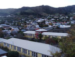
Images for 2010-2011 Christchurch earthquakes; more images...


Digital Photograph: North side of London Street, Lyttelton
Images, Canterbury Museum
One landscape colour digital photograph taken on 19 November 2011 showing part of the north side of London Street. The properties visible in the photograph are (from left to right) Tommy Changs Café, Canterbury Street, site of theatre erected for the Loons Circus Theatre Company production of Macbeth (being dismantled), Lyttel Arthouse (closed),...
Digital Photograph: North side of London Street, Lyttelton
Images, Canterbury Museum
One landscape colour digital photograph taken on 19 November 2011 showing buildings on London Street. Visible in the photograph (left to right) are Bells Pharmacy - relocated into a converted house with law firm MacTodd on the upper floor, Portico (gift shop), Tommy Changs Cafe, and the edge of the Lyttelton Petanque Club Gap Filler initiative. ...
Digital Photograph: Corner of London and Canterbury Streets, Lyttelton
Images, Canterbury Museum
One landscape colour digital photograph taken on 19 November 2011 showing the site of the Albion Hotel/ Ground Delicatessen. After the demolition of the building the site was used for a Gap Filler initiative called the Lyttelton Petanque Club. The photograph shows the temporary furniture, landscaping and public Petanque court. The site formerl...
Digital Photograph: North side of London Street, Lyttelton
Images, Canterbury Museum
One landscape colour digital photograph taken on 19 November 2011 showing part of the north side of London Street. The properties visible from left to right are: Himalaya Design (obscured), Coffee Culture (downstairs), J Voyce and Co Ships Providore (upstairs), empty shop, and Lyttel Piko Organic and Wholefoods The Lyttelton streetscape has cha...
Digital Photograph: North side of London Street, Lyttelton
Images, Canterbury Museum
One landscape colour digital photograph taken on 19 November 2011 showing part of the north side of London Street. The properties visible from left to right are: part of Lyttel Piko Organic and Wholefoods, Satchmo Café Pizzabar, Milly May and Snoclothes New Zealand. The empty section was formerly occupied by No. 6 Cafe. The Lyttelton streetsc...
Digital Photograph: Shadbolt House, Norwich Quay, Lyttelton
Images, Canterbury Museum
One portrait colour digital photograph taken on 19 November 2011 showing Shadbolt House prior to its demolition. Architect Lyttelton's tallest building before its demolition was built in 1961 as the offices of the Lyttelton Harbour Board. At the time it was demolished the building was known as Shadbolt House and was owned by Independent Fisherie...
Digital Photograph: Earthquake damage to searchlight emplacements, Godley …
Images, Canterbury Museum
One landscape colour digital photograph taken on 26 May 2013 showing the southern cliffs of Godley Head. Taken from the middle of the shipping channel. Some earthquake damage to the cliffs is visible. There were several major rock falls along the coastal cliffs near Christchurch and Lyttelton Harbour. At Godley Head these caused damage to the W...
Digital Photograph: Godley Head
Images, Canterbury Museum
One landscape colour digital photograph taken on 26 May 2013 showing the southern cliffs of Godley Head, taken from the middle of the shipping channel. Some earthquake damage to the cliffs is visible. There were several major rock falls along the coastal cliffs near Christchurch and Lyttelton Harbour. At Godley Head these caused damage to the ...
Digital Photograph: Flyers in the Window of the Lyttelton Information Cent…
Images, Canterbury Museum
One portrait colour digital photograph taken on 19 November 2011 showing the flyers in the window of the Lyttelton Information Centre on Oxford Street. The building was closed from 22 February 2011 until April 2013 due to the danger posed by the neighbouring building and then while repairs were scheduled and carried out. The flyers provided a sn...
Photographs of central Christchurch after the 2010 and 2011 earthquakes
Images, Alexander Turnbull Library
Photographs of central Christchurch after the 2010-2012 earthquakes taken 25 February 2012 by Sean McMahon. Locations are chiefly Manchester, Saint Asaph, Cashel, Columbo and Lichfield Streets, and the Bridge of Remembrance. Images show fencing around areas closed to the public, damaged and collapsed commercial buildings, cleared sites, re-opened Cashel Street area with shops and a cafe. Source of title - Title supplied by Library Quantity: 34 digital photograph(s).
Music CD: Te Huaki Puanaki Presents Otautahi Christchurch Rise Up
Images, Canterbury Museum
One music CD entitled 'Te Huaki Puanaki presents Ōtautahi Christchurch Rise Up' featuring three songs in response to the 22 February 2011 earthquake. This music CD titled ‘Te Huaki Puanaki presents Ōtautahi Christchurch Rise Up’ symbolically records the changes, emotions and challenges faced by the people of Canterbury following the 2010-2011 e...
Digital Photograph: Former Convent of Our Lady of Mercy, Exeter Street, an…
Images, Canterbury Museum
One landscape colour digital photograph taken on 30 June 2011 showing earthquake damage to the former Convent of Our Lady of Mercy and to the Catholic Church of St Joseph the Worker. Photograph taken from St. Davids Street The sense of loss felt when confronted with the collapse or demolition of an historic building is compounded when that bui...
Digital Photograph: Lyttelton Ambulance Station, north side of London Stre…
Images, Canterbury Museum
One landscape colour digital photograph taken on 19 November 2011 showing buildings on London Street. Visible in the photograph (left to right) are Lyttelton Ambulance Station and Bells Pharmacy - relocated into a converted house with law firm MacTodd on the upper floor. Discussions have been held between Lyttelton Police, St John Ambulance and...
Digital Photograph: Corner of London and Canterbury Streets, Lyttelton
Images, Canterbury Museum
One landscape colour digital photograph taken on 19 November 2011 showing the corner of London and Canterbury Streets. Visible in the photograph (left to right) are the Lyttelton Library, Freemans Dining Room, Ray White Real Estate and Min Sargison Real Estate on London Street. The photograph is looking to the southeast. The site of the Timebal...
Digital Photograph: Temporary Artwork on the corner of London and Canterbu…
Images, Canterbury Museum
One landscape colour digital photograph taken on 19 November 2011 showing a temporary artwork on the site of the Albion Hotel/ Ground Delicatessen. After the demolition of the building the site was used for a Gap Filler initiative called the Lyttelton Petanque Club. The photograph shows a temporary artwork created from used bricks, probably from...
Digital Photograph: The Loons (Lyttelton Working Mens' Club), Canterbury S…
Images, Canterbury Museum
One landscape colour digital photograph taken on 19 November 2011 showing temporary propping of the Lyttelton Working Mens' Club/ The Loons. Built in 1909 the building has had a variety of uses including a garage and the Lyttelton Waterside Workers Social Club. More recently the Lyttelton Working Mens' Club has provided rehearsal and performanc...
Digital Photograph: Lyttelton Sea Foods, Norwich Quay, Lyttelton
Images, Canterbury Museum
One landscape colour digital photograph taken on 19 November 2011 showing the temporary premises of Lyttelton Sea Foods in a relocatable building on Norwich Quay. The building is located on the site of the Lyttelton Hotel. Also visible in the photograph are (left to right) the side of Shadbolt House, the rear of the Pacifica Building which was t...
Digital Photograph: Lyttelton Bakery, corner Norwich Quay and Canterbury S…
Images, Canterbury Museum
One landscape colour digital photograph taken on 19 November 2011 showing the temporary premises of Lyttelton Bakery in a relocatable building on Norwich Quay. The building is located on the site of the Royal Hotel. Also visible in the photograph are (left to right up Canterbury Street) Lyttelton Service Station, Samo, Lyttelton Telephone Exchan...
Digital Photograph: Artwork on the Site of the Harbourlight Theatre, Londo…
Images, Canterbury Museum
One portrait colour digital photograph taken on 23 July 2011 showing the artwork by Trent Hiles erected on the site of the Harbourlight Theatre on London Street. The artwork presents part of James K Baxter's poem 'High Country Weather' using the international code of signal flags. The artwork was installed as a Gap Filler project. The artwork r...
Digital Photograph: Demolition of former Library and Fire Station, corner …
Images, Canterbury Museum
One landscape colour digital photograph taken on 6 September 2011 showing the demolition of 2 Sumner Road, the former library and fire station. This building was a private residence at the time of its demolition. Photograph taken looking north on Oxford Street. Also visible in the photograph are the Lyttelton Information Centre, an entrance to ...
Digital Photograph: Earthquake Damage to Lyttelton Times Building, Gladsto…
Images, Canterbury Museum
One landscape colour digital photograph taken on 3 March 2011 showing earthquake damage to the Lyttelton Times Building on Gladstone Quay. Also visible on the left of the photograph is the side of the adjoining British Hotel. Three years after the 2010-2011 earthquakes there are still many uncertainties about which buildings can or will be ret...
Digital Photograph: London and Oxford Streets
Images, Canterbury Museum
One landscape colour digital photograph taken on 27 May 2013 of London Street in Lyttelton. Taken from Sumner Road looking west across the intersection of London and Oxford Streets. The photograph shows several empty sections and the remaining buildings. The Lyttelton streetscape has changed dramatically from its pre-earthquake appearance and w...
Digital Photograph: Godley Head, Lyttelton Harbour
Images, Canterbury Museum
One landscape colour digital photograph taken on 26 May 2013 off Godley Head looking north to Boulder Bay and Taylors Mistake. Rock which fell from the cliffs is heaped at the waters edge. Volcanic banding is visible in the face of the cliffs. There were several major rock falls along the coastal cliffs near Christchurch and Lyttelton Harbour....
Digital Photograph: Sumner Head
Images, Canterbury Museum
One landscape colour digital photograph taken on 26 May 2013 off Godley Head looking north towards Sumner Head. There were several major rock falls along the coastal cliffs near Christchurch and Lyttelton Harbour. In and around the suburb of Sumner some of these falls necessitated the abandonment of houses in areas where cliffs had given way or...
Rover 3 Sub-floor Remote Inspection Unit
Images, Canterbury Museum
One six-wheeled Rover 3 remote controlled vehicle in hard-shell storage box and one handset control unit (transmitter), colour monitor with cabling (and A/V receiver) and three batteries in a second smaller hard-shell storage box.
Digital Photograph: Demolition of the Empire Hotel, London Street, Lyttelt…
Images, Canterbury Museum
One landscape colour digital photograph taken on 19 April 2011 showing the demolition of the Empire Hotel on London Street. The photograph shows the façade of the hotel supported by the framework installed to brace the building after the 4 September 2010 earthquake. A crane is being used to enable the east wall to be demolished by hand to avoid...
Digital Photograph: Earthquake damage to the Lyttelton Timeball Station
Images, Canterbury Museum
One landscape colour digital photograph taken on 25 February 2011 showing earthquake damage to the Lyttelton Timeball Station. Also visible is damage to some of the houses in the foreground such as temporarily patched holes in roofs where chimneys have fallen. Architect The Lyttelton Timeball Station was completed in 1876. Its function was to p...
T-shirt: Seismograph pattern of Christchurch Cathedral
Images, Canterbury Museum
One white cotton t-shirt with black seismograph-like patterns in the shape of ChristChurch Cathedral. Produced to commemorate the 7.1 magnitude earthquake that struck Canterbury at 4.35am on 4 September 2010. This t-shirt was designed and manufactured by Auckland based t-shirt company Mr Vintage in October 2010 to commemorate the 7.1 magnitude ...
Architectural Feature: Corner Bracket
Images, Canterbury Museum
One carved wooden corner bracket from Hadleigh House. Owner of Hadleigh House 1904-1921
Digital Photograph: Temporary Premises of Lyttelton Bakery, corner of Norw…
Images, Canterbury Museum
One landscape colour digital photograph taken on 16 June 2011 showing the Lyttelton Bakery operating from a portable building on the Corner of Canterbury Street and Norwich Quay. This portable building has been placed on the site of the Royal Hotel. Also visible in the photograph are Shadbolt House and the rear of the buildings on the south side...