
Search
found 348 results
Images for 1D3; more images...


Christchurch earthquake
Images, eqnz.chch.2010
20100904_3304_1D3-24 Christchurch earthquake CD racks and bookshelf in lounge. Amazing that the glass vase on the glass topped coffee table didn't move! #368
Seabreeze Close - Christchurch earthquake
Images, eqnz.chch.2010
20100905_3357_1D3-105 Seabreeze Close - Christchurch earthquake Annette Preen's house in background. See the angle the front of house is on. This maybe a write off as it is trashed inside with liquification occurring right under the house and bursting through concrete floor. Annette was featured on TV3 news tonight. Go to TV3 website to see ne...
Removing liquefaction silt - Christchurch earthquake
Images, eqnz.chch.2010
20100908_3393_1D3-28 Removing liquefaction silt - Christchurch earthquake The cleanup continues. #383
Ascot TV in Sydenham - Christchurch earthquake
Images, eqnz.chch.2010
20100904_3326_1D3-24 Ascot TV in Sydenham - Christchurch earthquake #375
20120118_7814_1D3-17F East on Cashel.
Images, eqnz.chch.2010
17mm M42 Takumar Fisheye on a Canon 1D MkIII (1.3x crop factor) via an adaptor ring.
20130921_3607_1D3-200 Last light on Castle Rock
Images, eqnz.chch.2010
A very different looking Castle Rock to what was there pre earthquakes.
20140112_7509_1D3-70 Remains (My City in Ruins) (SH 8)
Images, eqnz.chch.2010
Scavenger Hunt 101 - SH 8 (abandoned building or ruin) The ruins/remains of what was the third highest building in Christchurch, pre earthquakes, the Price Waterhouse Coopers building in Armagh Street. At 76.3 metres ( 21 floors) the demolition has left the basement (now flooded) and these supports. Just one of many photos from Christchurch ...
20130524_7209_1D3-65 Table thrown away in Culver Place.
Images, eqnz.chch.2010
All red zoned and it looked like no one is living anywhere in Culver Place. All awaiting demolition.
20130524_7220_1D3-45 Pump house and pipes
Images, eqnz.chch.2010
None
20130211_2703_1D3-96 Parenga Place house move
Images, eqnz.chch.2010
Moving from the Bexley "Red Zone" to?
20130130_1825_1D3-40 Football in the red zone
Images, eqnz.chch.2010
Football turf has now gone and the area fenced off again.
20130130_1954_1D3-95 Cunningham Tropical House
Images, eqnz.chch.2010
Closed due to earthquake damage.
20130207_2231_1D3-165 Sumner and "container alley"
Images, eqnz.chch.2010
Nearly 80 40 foot containers (most two high) protect Wakefield Avenue in Sumner from further rock falls. Behind these (to the left) are houses, church, bowling club, RSA (Returned Servicemens Association) and other community buildings that have been isolated now for nearly two years now. On the right upper third boundary (just behind two stand a...
20130130_1826_1D3-40 Colombo and Hereford
Images, eqnz.chch.2010
None
20111229_7210_1D3-195 Bexley Wetlands and Pacific Park
Images, eqnz.chch.2010
The flooded Bexley Wetlands, now about 1 - 1.5metre below pre earthquake level. The short length of fence (mid ground) was on the "river track" that the council closed about three years ago. The whole track in this view is now under about 500mm water at high tide. The main track in front of the houses was, prior to earthquakes, below the leve...
20130130_1817_1D3-40 Colombo and Cashel
Images, eqnz.chch.2010
None
20130106_1240_1D3-60 Medway Street footbridge-2
Images, eqnz.chch.2010
Earthquake damage. As a result of the September 2010 earthquake, with further damage from the February 2011 event.
20130130_1811_1D3-17 ANZ Port-A-Com
Images, eqnz.chch.2010
When this building was first brought on site I spent a few hours removing the tape/paper that had been covering every window.
20111230_7222_1D3-70 New Brighton
Images, eqnz.chch.2010
20111230_7222_1D3-70 New Brighton Further damage to the bank following the two quakes on 23/12/11. The sewer line broke here and was repaired (patched) by council staff on Christmas Eve. It is hard to beleve that this rock wall was level with the land here, before any of the quakes. #2004
20120321_2416_1D3-24 Fallen Cone
Images, eqnz.chch.2010
A month after the 1st anniversary of the deadly Christchurch earthquake (22/02/11) a road cone lies on New Brighton Road, alongside the Avon River. Part of the earthquake 1st anniversary remembrance was for people to place flowers in road cones (and there are hundreds of thousands in the city). Many had flowers in them, as this one did. Photo ...
20130130_1812_1D3-17 Outside the Tap Room
Images, eqnz.chch.2010
None
20130130_1814_1D3-40 Wilson City
Images, eqnz.chch.2010
None
20130106_1239_1D3-75 Medway Street footbridge-3
Images, eqnz.chch.2010
Earthquake damage. As a result of the September 2010 earthquake, with further damage from the February 2011 event.
20130130_1813_1D3-28 Gap Filler
Images, eqnz.chch.2010
None
20130106_1238_1D3-60 Medway Street footbridge-1
Images, eqnz.chch.2010
Earthquake damage. As a result of the September 2010 earthquake, with further damage from the February 2011 event.
Ground movement Pacific Park - Christchurch earthquake
Images, eqnz.chch.2010
20100905_3336_1D3-24 Ground movement Pacific Park - Christchurch earthquake A house in Pacific Park (Bexley) that borders the Bexley Wetlands. Land moved towards the wetlands and the closer to wetlands the more severe the damage. #382
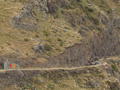
20121018_9144_1D3-60 Tunnel building
Images, eqnz.chch.2010
Built in the early 1960s for the Lyttelton Road Tunnel, it was severley damaged in the February 2011 earthquake and is not currently used.
20130805_2212_1D3-120 Broken and closed
Images, eqnz.chch.2010
The South New Brighton Domain jetty into the Avon-Heathcote Estuary. A new jetty replaced an older one about 6-8 years ago, then the earthquakes happened! Before the earthquakes it was straight and level and open!
New Brighton bridge
Images, eqnz.chch.2010
20130808_2293_1D3-40 New Brighton bridge Still awaiting a repair, but with so many bridges closed or partially closed we are lucky this one had what maybe minor damage. #4074
20120805_7566_1D3-600 Newstalk ZB building starting to go down 131
Images, eqnz.chch.2010
None