
Search
found 5385 results
Images for February 2011; more images...


Photograph by Jocelyn Kinghorn 290
Images, UC QuakeStudies
The side wall of a building has been spray painted after it was cleared by a USAR team. This system was used following the February earthquake to mark buildings that have been checked.
New Zealand Defence Force photograph 055
Images, UC QuakeStudies
Damage to Christchurch city following the 22 February earthquake 2011. A collapsed building on the corner of Ferry Road and Lancaster Street. The brick walls of the building have crumbled, bringing the roof down with them. The wall of the building opposite has been exposed, and there is now a doorway to nowhere.
Photograph by Neil Macbeth 506
Images, UC QuakeStudies
Members of the Student Volunteer Army helping themselves to free snacks inside the UCSA's "Big Top" tent. The tent was erected to provide support for students at the University of Canterbury in the aftermath of the 22 February 2011 earthquake. The volunteers have returned from a day of clearing liquefaction from Christchurch properties.
Dan Neely WEMO Photograph 27
Images, UC QuakeStudies
A photograph of members of Civil Defence and other organisations helping with the emergency response to the Canterbury earthquakes. They are standing on the corner of Montreal and Gloucester Streets outside the Christchurch Art Gallery. The Art Gallery served as the headquarters for the Civil Defence after the 22 February 2011 earthquake.
Message from Timor for the people of Christchurch
Videos, UC QuakeStudies
A video about the service held in East Timor for personnel in the New Zealand and Australian Defence Force and the police. The service was held in honour of the people who lost their lives in the 22 February 2011 earthquake, as well as to acknowledge the people providing relief back in Christchurch.
Christchurch Earthquake 22/02/11
Images, eqnz.chch.2010
Manchester Street looking south-ish, near the corner of Worcester Street. The is the Trinity Building, which housed a restaurant and live music venue called Octagon Live.
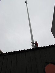
WEMO ERT Team Set 1 - April 2011 - Photograph 7
Images, UC QuakeStudies
A photograph of a map used by emergency management personnel to inspect buildings after the 22 February 2011 earthquake. The map is of the block bordered by Barbadoes Street, Worcester Street, Gloucester Street, and Fitzgerald Avenue. Many of the buildings have been highlighted in blue, with some smaller buildings highlighted in orange. Two blocks of buildings have been outlined in dark-blue felt-tip pen. Numbers and messages have been written on the map with biro.
New Zealand Defence Force photograph 673
Images, UC QuakeStudies
A member of the Los Angeles County Fire Department Search and Rescue Team looking at the maps at the entrance to 'Camp Hollywood', the headquarters of the American Civil Defence Forces in Latimer Square. After the 22 February 2011 earthquake, emergency service agencies set up their headquarters in Latimer Square.
New Zealand Defence Force photograph 669
Images, UC QuakeStudies
The entrance to 'Camp Hollywood', the American Civil Defence Force headquarters in Latimer Square. After the 22 February 2011 earthquake, emergency service agencies set up their headquarters in Latimer Square. The entrance way has a wooden sign reading, "Camp Hollywood" and a series of maps of Christchurch and New Zealand.
New Zealand Defence Force photograph 671
Images, UC QuakeStudies
A member of the Los Angeles County Fire Department Search and Rescue Team looking at the maps at the entrance to 'Camp Hollywood', the headquarters of the American Civil Defence Forces in Latimer Square. After the 22 February 2011 earthquake, emergency service agencies set up their headquarters in Latimer Square.
New Zealand Defence Force photograph 672
Images, UC QuakeStudies
A member of the Los Angeles County Fire Department Search and Rescue Team with an Australian Police Officer at the entrance to 'Camp Hollywood', the headquarters of the American Civil Defence Forces in Latimer Square. After the 22 February 2011 earthquake, emergency service agencies set up their headquarters in Latimer Square.
Photograph by Neil Macbeth 569
Images, UC QuakeStudies
A view across Battersea Street in Sydenham to Churchill's Tavern, which has been badly damaged in the 22 February 2011 earthquake. Masonry from the building's top storey has collapsed onto the footpath and several of its windows have fallen out. A member of the New Zealand Police Force is walking across Colombo Street in the background.
TEU Canterbury Branch Post-Earthquake Member Survey: Summary of Themes
Articles, UC QuakeStudies
Following the February 2011 earthquake, the Canterbury Branch of the TEU surveyed members to determine the psychological and physical impact of the earthquakes on members, in particular on their working conditions and ability to participate in consultation processes. 90 members responded, and this report gives a summary of the responses to short-answer questions and overall themes.
TEU Canterbury Branch Post-Earthquake Member Survey: Summary of Responses
Articles, UC QuakeStudies
Following the February 2011 earthquake, the Canterbury Branch of the TEU surveyed members to determine the psychological and physical impact of the earthquakes on members, in particular on their working conditions and ability to participate in consultation processes. 90 members responded, and this report gives a summary of the percentage of responses received for each survey question.
Photograph by Neil Macbeth 172
Images, UC QuakeStudies
A car mired in liquefaction in a car park on Chester Street in the aftermath of the 22 February earthquake. Behind it, the collapsed Durham Street Methodist Church can be seen.
Photograph by Neil Macbeth 515
Images, UC QuakeStudies
Volunteers dispensing energy drinks, soft drinks and snacks inside the UCSA's "Big Top" tent. The tent was erected in the UCSA car park to provide support for students in the aftermath of the 22 February 2011 earthquake. The students have spent the day clearing liquefaction from Christchurch properties as part of the Student Volunteer Army.
Performance of Bridges during the 2010 Darfield and 2011 Christchurch Eart…
Research papers, The University of Auckland Library
The region in and around Christchurch, encompassing Christchurch city and the Selwyn and Waimakariri districts, contains more than 800 road, rail, and pedestrian bridges. Most of these bridges are reinforced concrete, symmetric, and have small to moderate spans (15–25 m). The 22 February 2011 moment magnitude (Mw) 6.2 Christchurch earthquake induced high levels of localized ground shaking (Bradley and Cubrinovski 2011, page 853 of this issue; Guidotti et al. 2011, page 767 of this issue; Smyrou et al. 2011, page 882 of this issue), with damage to bridges mainly confined to the central and eastern parts of Christchurch. Liquefaction was evident over much of this part of the city, with lateral spreading affecting bridges spanning both the Avon and Heathcote rivers.
Photographs of central Christchurch after the 2010 and 2011 earthquakes
Images, Alexander Turnbull Library
Photographs of central Christchurch after the 2010-2012 earthquakes taken 25 February 2012 by Sean McMahon. Locations are chiefly Manchester, Saint Asaph, Cashel, Columbo and Lichfield Streets, and the Bridge of Remembrance. Images show fencing around areas closed to the public, damaged and collapsed commercial buildings, cleared sites, re-opened Cashel Street area with shops and a cafe. Source of title - Title supplied by Library Quantity: 34 digital photograph(s).
Hubbard, James, 1949- :[Looter problems following the Christchurch earthqu…
Images, Alexander Turnbull Library
The cartoon shows the lid of a sewer that has been dislodged allowing cockroaches labelled 'looter' to crawl out. Context - The very severe Christchurch earthquake of 22 February 2011 in which probably more than 200 people died and an enormous amount of structural damage has been done. There are inevitably people taking advantage of the fact that there are many abandoned homes which offer rich pickings. Quantity: 1 digital cartoon(s).
The Princess Cinema in New Brighton
Images, UC QuakeStudies
The brick facade has fallen from the former Princess Cinema in New Brighton, exposing the rooms inside, and crushing a car parked below. The photographer comments, "The front of the old Princess Cinema in New Brighton after the earthquake in Christchurch, New Zealand on 22 February. Under the pile of bricks is a luckily unoccupied blue car. The word CLEAR on the broken facade is to show that there is no one in the car. This building has now been knocked down as it was so dangerous".
NicksPlace Photograph 224
Images, UC QuakeStudies
Building rubble behind cordon fencing at the corner of Salisbury and Montreal Streets. In the background is the Victoria Clock Tower, with the clock stopped at 12:51, the time of the 22 February earthquake.
New Zealand Defence Force photograph 074
Images, UC QuakeStudies
Damage to Lyttelton following the 22 February 2011 earthquake. Ground Culinary Centre on the corner of London and Canterbury Streets. The wall on the top storey has crumbled into the street, covering the footpath in bricks. Large cracks can be seen above the door, coming out from the corners of the window.
Environmental Health Officers from the New Zealand Army testing water in C…
Videos, UC QuakeStudies
A video about the New Zealand Army testing the quality of water across Christchurch. After the 4 September 2010 earthquake, the NZ Army developed ties with the Canterbury District Health Board. This relationship continued after the 22 February 2011 earthquake with the NZ Army taking on the role of examining Christchurch's water quality.
The Air Force creates an 'Air Bridge' to support Christchurch after the ea…
Videos, UC QuakeStudies
A video about the 'air bridge' set up by the Royal New Zealand Air Force after the 22 February 2011 earthquake. The 'air bridge' was made up of Boeing 757s and Hercules C-130s which travelled from Christchurch to the rest of the country, transporting people and picking up supplies.
Sonja Farmer Photograph 13
Images, UC QuakeStudies
A photographs of members of a China Urban Search and Rescue team on Worcester Street near the Christchurch Art Gallery. The art gallery served as the temporary headquarters for Civil Defence after the 22 February 2011 earthquake. In the background, the earthquake damage to the dome of the Regent Theatre can be seen.
Man was killed by a falling concrete wall
Audio, Radio New Zealand
The Royal Commission investigating the Canterbury earthquakes has heard that the premises where a man was killed by a falling concrete wall was not inspected by structural engineers between the September and February quakes.
US Embassy Photograph 6
Images, UC QuakeStudies
Deputy Administrator for Protection and National Preparedness at the Federal Emergency Management Agency, Tim Manning, and Michael Layne from the US Embassy in Wellington, speaking to Ray Kennedy, an Area Manager from the New Zealand Fire Service, in the Christchurch Art Gallery about the 22 February 2011 earthquake.
22 February Earthquake - Photograph 61
Images, UC QuakeStudies
Flooding and liquefaction outside a house on Edward Avenue in St Albans.
22 February Earthquake - Photograph 92
Images, UC QuakeStudies
Damage to the Dallington Discount Market, the facade of which has collapsed.
Elizabeth Ackermann Photograph 185
Images, UC QuakeStudies
A photograph of a dusty monitor in an earthquake-damaged building on Poplar Street taken during the Residential Access Project. The Residential Access Project gave residents temporary access within the red-zone cordon in order to retrieve items from their homes after the 22 February 2011 earthquake. Dislodged bricks can also be seen around the monitor.