Search
found 5389 results
Images for February; more images...
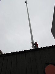


Photograph by Neil Macbeth 170
Images, UC QuakeStudies
The ruins of the historic Durham Street Methodist Church in the aftermath of the 22 February 2011 earthquake. The only parts of the building still upright are those supported by steel braces placed there after the 4 September 2010 earthquake to strengthen the building as it awaited repairs. Rubble has spilled out onto the street, knocking over the safety fences that were also erected after September. Silt from liquefaction has covered the road around the church.
Photograph by Neil Macbeth 526
Images, UC QuakeStudies
UCSA President Kohan McNab addressing students at the University of Canterbury inside the UCSA's "Big Top" tent. The tent was erected in the UCSA car park to provide support for students in the aftermath of the 22 February 2011 earthquake. The students have spent the day clearing liquefaction from Christchurch properties as part of the Student Volunteer Army. To the right of McNab, a local musician who has been entertaining the students can be seen.
Focus on Politics for 8 April 2011
Audio, Radio New Zealand
In quake-ravaged Christchurch businesses are tentatively restarting, and infrastructure is being restored, but there's ongoing uncertainty about job losses and how people will survive financially. Within six days of the February earthquake; the Government had introduced a subsidy scheme for businesses and their employees, as well as people who'd found themselves out of a job. Now there's growing disquiet about what will happen to thousands of Cantabrians when that support scheme finishes at the end of May.
BeckerFraserPhotos April 2011 photograph 397
Images, UC QuakeStudies
A plaque on the ground in front of the 'Passing Time' sculpture on the corner of Madras Street and St Asaph Street. The 'Passing Time' sculpture was installed outside the CPIT Building for the 6th SCAPE (a contemporary public art programme in Christchurch) a few days prior to the 22 February 2011 earthquake. The work features twisting boxes depicting each year between 1906 (the founding of CPIT) and 2010 (the date of the sculpture's production).
WEMO ERT Team Set 1 - April 2011 - Photograph 7
Images, UC QuakeStudies
A photograph of a map used by emergency management personnel to inspect buildings after the 22 February 2011 earthquake. The map is of the block bordered by Barbadoes Street, Worcester Street, Gloucester Street, and Fitzgerald Avenue. Many of the buildings have been highlighted in blue, with some smaller buildings highlighted in orange. Two blocks of buildings have been outlined in dark-blue felt-tip pen. Numbers and messages have been written on the map with biro.
Scott, Thomas, 1947- : "Bob darling, the chances of a news crew bursting i…
Images, Alexander Turnbull Library
The cartoon shows Christchurch mayor Bob Parker and his wife in bed. Bob Parker's wife says 'Bob darling, the chances of a news crew bursting in here at this time of night are virtually nil, so please take that bloody jacket off...' Context - Bob Parker, it is true, seems to be wearing the same trendy orange and black 'site manager's jacket for the very many photo opportunities afforded post earthquake of 22 February 2011. Quantity: 1 digital cartoon(s).
Winter, Mark 1958-:[Christchurch earthquake] "These deaths are our greates…
Images, Alexander Turnbull Library
The cartoon shows the name in large capital letters 'Christchurch' with the 't' drawn as the Christian cross symbol. Below is text reading '"These deaths are our greatest loss. They remind us that buildings are just buildings, roads just roads, but people are irreplaceable" John Key' Context - The very severe Christchurch earthquake of 22 February 2011 in which probably more than 200 people died. Two versions of this cartoon are available Quantity: 1 digital cartoon(s).
Evans, Malcolm, 1945-:[Christchurch earthquake] 27 February 2011
Images, Alexander Turnbull Library
The word 'CANTERBURY' is printed in large letters on the cartoon in the region's colours of red and black stripes. The 'CAN' part of the name is in larger print and is above the rest of the word. Context is 22 February 2011 earthquake in Christchurch. The cartoon refers to reports of courage, generosity and 'can do' attitude of the people. Colour and black and white versions of this cartoon are available Quantity: 2 digital cartoon(s).
Seismic Performance of Reinforced Concrete Buildings in the 22 February Ch…
Research papers, University of Canterbury Library
Six months after the 4 September 2010 Mw 7.1 Darfield (Canterbury) earthquake, a Mw 6.2 Christchurch (Lyttelton) aftershock struck Christchurch on the 22 February 2011. This earthquake was centred approximately 10km south-east of the Christchurch CBD at a shallow depth of 5km, resulting in intense seismic shaking within the Christchurch central business district (CBD). Unlike the 4 Sept earthquake when limited-to-moderate damage was observed in engineered reinforced concrete (RC) buildings [35], in the 22 February event a high number of RC Buildings in the Christchurch CBD (16.2 % out of 833) were severely damaged. There were 182 fatalities, 135 of which were the unfortunate consequences of the complete collapse of two mid-rise RC buildings. This paper describes immediate observations of damage to RC buildings in the 22 February 2011 Christchurch earthquake. Some preliminary lessons are highlighted and discussed in light of the observed performance of the RC building stock. Damage statistics and typical damage patterns are presented for various configurations and lateral resisting systems. Data was collated predominantly from first-hand post-earthquake reconnaissance observations by the authors, complemented with detailed assessment of the structural drawings of critical buildings and the observed behaviour. Overall, the 22 February 2011 Mw 6.2 Christchurch earthquake was a particularly severe test for both modern seismically-designed and existing non-ductile RC buildings. The sequence of earthquakes since the 4 Sept 2010, particularly the 22 Feb event has confirmed old lessons and brought to life new critical ones, highlighting some urgent action required to remedy structural deficiencies in both existing and “modern” buildings. Given the major social and economic impact of the earthquakes to a country with strong seismic engineering tradition, no doubt some aspects of the seismic design will be improved based on the lessons from Christchurch. The bar needs to and can be raised, starting with a strong endorsement of new damage-resisting, whilst cost-efficient, technologies as well as the strict enforcement, including financial incentives, of active policies for the seismic retrofit of existing buildings at a national scale.
WEMO ERT Set 3 - February 2011 - Photograph 260
Images, UC QuakeStudies
A photograph of building rubble on the footpath outside the Caffe Roma restaurant on Oxford Terrace.
WEMO ERT Set 1 - February 2011 - Photograph 34
Images, UC QuakeStudies
A photograph of USAR and emergency management personnel lining up for lunch in Latimer Square.
WEMO ERT Set 3 - February 2011 - Photograph 001
Images, UC QuakeStudies
A photograph of a WRFF Helitack Rappel Crew emergency response vehicle in Wellington.
WEMO ERT Set 1 - February 2011 - Photograph 33
Images, UC QuakeStudies
A photograph of USAR and emergency management personnel lining up for lunch in Latimer Square.
WEMO ERT Set 3 - February 2011 - Photograph 041
Images, UC QuakeStudies
A photograph of a camouflaged armoured vehicle on St Asaph Street.
WEMO ERT Set 3 - February 2011 - Photograph 042
Images, UC QuakeStudies
A photograph of a camouflaged armoured vehicle on St Asaph Street.
WEMO ERT Set 3 - February 2011 - Photograph 088
Images, UC QuakeStudies
A photograph of a wooden frame covered by a tarpaulin on Worcester Street, near Latimer Square.
WEMO ERT Set 3 - February 2011 - Photograph 113
Images, UC QuakeStudies
A photograph of emergency management personnel inside the Canterbury Television Building on Gloucester Street.
WEMO ERT Set 3 - February 2011 - Photograph 246
Images, UC QuakeStudies
A photograph of the collapsed PGC Building, taken from Oxford Terrace across the Avon River.
WEMO ERT Set 3 - February 2011 - Photograph 226
Images, UC QuakeStudies
A photograph of USAR codes spray-painted on the front doors of several businesses on Armagh Street.
WEMO ERT Set 1 - February 2011 - Photograph 32
Images, UC QuakeStudies
A photograph of members of Urban Search and Rescue teams eating lunch in Latimer Square.
WEMO ERT Set 3 - February 2011 - Photograph 040
Images, UC QuakeStudies
A photograph of road works on St Asaph Street near the Canterbury Brewery.
Performance of Masonry Buildings and Churches in the 22 February 2011 Chri…
Research papers, The University of Auckland Library
As part of the 'Project Masonry' Recovery Project funded by the New Zealand Natural Hazards Research Platform, commencing in March 2011, an international team of researchers was deployed to document and interpret the observed earthquake damage to masonry buildings and to churches as a result of the 22nd February 2011 Christchurch earthquake. The study focused on investigating commonly encountered failure patterns and collapse mechanisms. A brief summary of activities undertaken is presented, detailing the observations that were made on the performance of and the deficiencies that contributed to the damage to approximately 650 inspected unreinforced clay brick masonry (URM) buildings, to 90 unreinforced stone masonry buildings, to 342 reinforced concrete masonry (RCM) buildings, to 112 churches in the Canterbury region, and to just under 1100 residential dwellings having external masonry veneer cladding. In addition, details are provided of retrofit techniques that were implemented within relevant Christchurch URM buildings prior to the 22nd February earthquake and brief suggestions are provided regarding appropriate seismic retrofit and remediation techniques for stone masonry buildings. http://www.nzsee.org.nz/publications/nzsee-quarterly-bulletin/
WEMO ERT Set 1 - February 2011 - Photograph 12
Images, UC QuakeStudies
A photograph of members of the Wellington Emergency Management Office Emergency Response Team inside a workshop in Christchurch.
WEMO ERT Set 1 - February 2011 - Photograph 64
Images, UC QuakeStudies
A photograph of the broken windows of the Press House on Gloucester Street.
WEMO ERT Set 3 - February 2011 - Photograph 022
Images, UC QuakeStudies
A photograph of emergency management personnel in Latimer Square. In the background is the USAID headquarters.
WEMO ERT Set 1 - February 2011 - Photograph 91
Images, UC QuakeStudies
A photograph of a pile of sledge hammers in Latimer Square with various nicknames written in vivid on the handles.
WEMO ERT Set 3 - February 2011 - Photograph 116
Images, UC QuakeStudies
A photograph of USAR codes spray-painted on the side of a building in the Christchurch central city.
WEMO ERT Set 3 - February 2011 - Photograph 155
Images, UC QuakeStudies
A photograph of a car on Hereford Street which has been crushed by falling bricks and other rubble.
WEMO ERT Set 3 - February 2011 - Photograph 198
Images, UC QuakeStudies
A photograph of the earthquake damage to a section of the ceiling of the Crowne Plaza Hotel.
WEMO ERT Set 3 - February 2011 - Photograph 098
Images, UC QuakeStudies
A photograph of a red sticker on the side of a building. The sticker indicates that the building is unsafe to enter.