
Search
found 453 results
Images for 2010; more images...


View over Armagh St
Images, eqnz.chch.2010
None
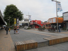
The Latimer Hotel
Images, eqnz.chch.2010
Just being finished.
Hereford and Latimer Sq.
Images, eqnz.chch.2010
None
Facade on Manchester St
Images, eqnz.chch.2010
Protected with bracing behind shipping containers
Colombo St
Images, eqnz.chch.2010
Ballantynes on Rt. Illusionist Artwork on side of over ramp
Art Installation in Gloucester St
Images, eqnz.chch.2010
None
Cardboard Cathedral
Images, eqnz.chch.2010
A temporary (5year) construction of giant cardboard tubes to be in use until the new or restored Christ Church Cathedral is back in the Square
Memorial
Images, eqnz.chch.2010
There is one chair for each of the 185 people who lost their lives in the quakes
High St.
Images, eqnz.chch.2010
Looking towards Manchester St
Remains of Poplar Lane
Images, eqnz.chch.2010
None
In High St.
Images, eqnz.chch.2010
None
Memorial
Images, eqnz.chch.2010
This is in Madras St, The CTV building ws on the right far corner
In Madras St.
Images, eqnz.chch.2010
None
High St
Images, eqnz.chch.2010
Back towards the Square
Forsyth Barr Building
Images, eqnz.chch.2010
from Gloucester St.
Gloucester St and Worcester St corner
Images, eqnz.chch.2010
None
Worcester St
Images, eqnz.chch.2010
None
Facade
Images, eqnz.chch.2010
All that remains of the Theatre Royal plus the interior dome under plastic wrap at the back
High St.
Images, eqnz.chch.2010
Looking toward the hills
Demolition of the BNZ building
Images, eqnz.chch.2010
This will open up the street to the Avon River
High St Hereford St. corner.
Images, eqnz.chch.2010
None
Dust and Water from the demolition
Images, eqnz.chch.2010
None
4,A Place for the People
Images, eqnz.chch.2010
None
Shaky Town Blues
Other, National Library of New Zealand
Blog from Christchurch business-owner Nicky Arts detailing the rebuild of the Christchurch CBD following the earthquakles of 2010 and 2011.
Smith, Ashley W, 1948- :[Bob Parker and Jim Anderton]. 20 September 2010
Images, Alexander Turnbull Library
Depicts Christchurch Mayor Bob Parker striking a pose under a spotlight while standing astride broken masonry. He is being interviewed by media. On the right of frame, Progressive Party leader and MP Jim Anderton is under dark clouds and caught under the Beehive. Refers to the 2010 Christchurch mayoral elections in which Parker won over Anderton. Prior to the 2010 Canterbury earthquake, Anderton was ahead in the polls. The quake devastation was said to have given Parker a bigger profile than Anderton and been a factor in his win (TV3 9 October 2010). Quantity: 1 digital cartoon(s).
Stopbank Performance during the 2010 - 2011 Canterbury Earthquake Sequence
Research papers, University of Canterbury Library
In the period between September 2010 and December 2011, Christchurch was shaken by a series of strong earthquakes including the MW7.1 4 September 2010, Mw 6.2 22 February 2011, MW6.2 13 June 2011 and MW6.0 23 December 2011 earthquakes. These earthquakes produced very strong ground motions throughout the city and surrounding areas that resulted in soil liquefaction and lateral spreading causing substantial damage to buildings, infrastructure and the community. The stopbank network along the Kaiapoi and Avon River suffered extensive damage with repairs projected to take several years to complete. This presented an opportunity to undertake a case-study on a regional scale of the effects of liquefaction on a stopbank system. Ultimately, this information can be used to determine simple performance-based concepts that can be applied in practice to improve the resilience of river protection works. The research presented in this thesis draws from data collected following the 4th September 2010 and 22nd February 2011 earthquakes. The stopbank damage is categorised into seven key deformation modes that were interpreted from aerial photographs, consultant reports, damage photographs and site visits. Each deformation mode provides an assessment of the observed mechanism of failure behind liquefaction-induced stopbank damage and the factors that influence a particular style of deformation. The deformation modes have been used to create a severity classification for the whole stopbank system, being ‘no or low damage’ and ‘major or severe damage’, in order to discriminate the indicators and factors that contribute to ‘major to severe damage’ from the factors that contribute to all levels of damage a number of calculated, land damage, stopbank damage and geomorphological parameters were analysed and compared at 178 locations along the Kaiapoi and Avon River stopbank systems. A critical liquefiable layer was present at every location with relatively consistent geotechnical parameters (cone resistance (qc), soil behaviour type (Ic) and Factor of Safety (FoS)) across the study site. In 95% of the cases the critical layer occurred within two times the Height of the Free Face (HFF,). A statistical analysis of the geotechnical factors relating to the critical layer was undertaken in order to find correlations between specific deformation modes and geotechnical factors. It was found that each individual deformation mode involves a complex interplay of factors that are difficult to represent through correlative analysis. There was, however, sufficient data to derive the key factors that have affected the severity of deformation. It was concluded that stopbank damage is directly related to the presence of liquefaction in the ground materials beneath the stopbanks, but is not critical in determining the type or severity of damage, instead it is merely the triggering mechanism. Once liquefaction is triggered it is the gravity-induced deformation that causes the damage rather than the shaking duration. Lateral spreading and specifically the depositional setting was found to be the key aspect in determining the severity and type of deformation along the stopbank system. The presence or absence of abandoned or old river channels and point bar deposits was found to significantly influence the severity and type of deformation. A review of digital elevation models and old maps along the Kaiapoi River found that all of the ‘major to severe’ damage observed occurred within or directly adjacent to an abandoned river channel. Whilst a review of the geomorphology along the Avon River showed that every location within a point bar deposit suffered some form of damage, due to the depositional environment creating a deposit highly susceptible to liquefaction.
Misleading EQC level estimates a worry for house values
Audio, Radio New Zealand
Some Canterbury homeowners say their houses are dropping in value because of misleading estimates of damage to foundations from the 2010 and 2011 earthquakes.
Canterbury Residential Rebuild
Other, National Library of New Zealand
Information on damage caused by the Canterbury earthquakes of 2010 and 2011, for homeowners, tenants, insurers, lawyers, realtors, builders, developers, engineers and building consent authorities.
EQC respond to claims of inadequate assessments
Audio, Radio New Zealand
EQC's manager for the Canterbury home repair programme, Reid Stiven, respondes to claims of misleading estimates of damage to household foundations from the 2010 and 2011 earthquakes.
Digital Photograph: Mitre Hotel
Images, Canterbury Museum
One landscape colour digital photograph taken on 26 May 2013 on the corner of Norwich Quay and Canterbury Street, Lyttelton. The photograph shows the Mitre Hotel surrounded by temporary fencing. Three years after the 2010-2011 earthquakes there are still many uncertainties about which buildings can or will be retained. These buildings, or parts...