Search
found 358 results
Images for Tectonics; more images...

IMG_2439
Images, eqnz.chch.2010
The faultline cuts across Telegraph Road, leaving a kink in its originally straight alignment; aftermath of the magnitude 7.1 earthquake in mid-Canterbury on Saturday 4 September 2010.
IMG_2392
Images, eqnz.chch.2010
Efforts are being made to shore up and strengthen this building (corner of Hereford Street / Manchester Street) to save it from demolition after it suffered structural damage in the magnitude 7.1 earthquake that struck Christchurch on Saturday 4 September 2010.
IMG_2426
Images, eqnz.chch.2010
This originally straight farm fence has been laterally displaced at least 2 metres where it crosses the previously unknown faultline from which the Saturday 4 September 2010 earthquake originated.
IMG_2431
Images, eqnz.chch.2010
This originally straight farm fence has been laterally displaced at least 2 metres where it crosses the previously unknown faultline from which the Saturday 4 September 2010 earthquake originated.
IMG_2422
Images, eqnz.chch.2010
Looking along this previously unknown faultline that runs through this paddock, note how the ground had heaved and subsided; magnitude 7.1 earthquake in mid-Canterbury on Saturday 4 September 2010.
IMG_2440
Images, eqnz.chch.2010
The faultline cuts across Telegraph Road, leaving a kink in its originally straight alignment; aftermath of the magnitude 7.1 earthquake in mid-Canterbury on Saturday 4 September 2010.
IMG_2154
Images, eqnz.chch.2010
Falling gable of the Anglican Community of the Sacred Name building left a gaping hole in the roof in the magnitude 7.1 earthquake that hit Christchurch on 4 September 2010. The chimney would have toppled as well had it not been braced.
Structure, seismicity and tectonics of the Porter's Pass-Amberley fault zo…
Research papers, University of Canterbury Library
The Porter's Pass-Amberley Fault Zone (PPAFZ) is a complex zone of anastomosing faults and folds bounding the south-eastern edge of the transition from subducting Pacific Plate to continental collision on the Australia Plate boundary. This study combines mapping of a 2000 km2 zone from the Southern Alps northeast to the coast near Amberley, 40 km north of metropolitan Christchurch, with an analysis of seismicity and a revision of regional seismic hazard. Three structural styles: 1) a western strike-slip, and 2) a more easterly thrust and reverse domain, pass into 3) a northwest verging fold belt on the northern Canterbury Plains, reflecting the structural levels exposed and the evolving west to east propagation. Basal remnants of a Late Cretaceous-Cenozoic, largely marine sedimentary cover sequence are preserved as outliers that unconformably overlie Mesozoic basement (greywacke and argillite of the Torlesse terrain) in the mountains of the PPAFZ and are underlain by a deeply leached zone which is widely preserved. Structure contouring of the unconformity surface indicates maximum, differential uplift of c.2600 m in the southwest, decreasing to c.1200 m in the coastal fold belt to the northeast. Much lower rates (or reversal) of uplift are evident a few kilometres southeast of the PPAFZ range-front escarpment. The youngest elements of the cover sequence are basement-derived conglomerates of Plio-Pleistocene age preserved on the SE margin. The source is more distant than the intervening mountains of the PPAFZ, probably from the Southern Alps, to the west and northwest. The absence of another regional unconformity on Mesozoic basement, older than Pleistocene, indicates that this uplift is post-Pliocene. Late Pleistocene(<100 kyr) differential uplift rates of c.0.5-2.7 m/kyr from uplifted marine terraces at the east coast, and rates of 2.5-3.3 m/kyr for tectonically-induced river-down cutting further west, suggest that uplift commenced locally during the last 1 Ma, and possibly within the last 0.5 Ma, if average rates are assumed to be uniform over time. Analysis of seismicity, recorded during a 10 week regional survey of micro earthquakes in 1990, identified two seismic zones beneath North Canterbury: 1) a sub-horizontal zone of activity restricted to the upper crust (≤12 km); and 2) a seismic zone in the lower crust (below a ceiling of ≤17 km), that broadens vertically to the north and northwest to a depth of c.40 km, with a bottom edge which dips 10°N and 15°NW, respectively. No events were recorded at depths between 12 km and 17 km, which is interpreted as a relatively aseismic, mid-crustal ductile layer. Marked differences (up to 60°) in the trend of strain axes for events above and below the inferred ductile layer are observed only north of the PPAFZ. A fundamental, north-to-south increase in the Wave-length of major geological structures occurs across the PPAFZ, and is interpreted as evidence that the upper crust beneath the Canterbury Plains is coupled to the lower crust, whereas the upper crust further north is not. Most of the recorded micro earthquakes <12 km deep beneath the PPAFZ have strike-slip mechanisms. It is probable that faults splay upward into the thrusts and folds at the surface as an evolving transpression zone in response to deep shear in basement. There have been no historic surface ruptures of the PPAFZ, but the zone has been characterised historically by frequent small earthquakes. Paleoseismic data (dated landslides and surface ruptures) compiled in this study, indicate a return period of 1500-1900 years between the last two M>7-7.5 earthquakes, and 500-700 years have elapsed since the last. The magnitudes of these events are estimated at c.M7.5, which represents a probable maximum magnitude for the PPAFZ. There are insufficient data to determine whether or not the frequency of large earthquakes conforms to a recognised model of behaviour, but comparison of the paleoseismic data with the historic record of smaller earthquakes, suggests that the magnitudes of the largest earthquakes in this zone are not exponentially distributed. A seismicity model for the PPAFZ (Elder et al., 1991) is reviewed, and a b-value of 1.0 is found to be consistent with the newly acquired paleoseismic data. This b-value reduces the predicted frequency of large earthquakes (M≥7.0) in this zone by a factor of 3.5, while retaining a conservative margin that allows for temporal variations in the frequency of large events and the possibility that the geological database is incomplete, suggesting grounds for revising the hazard model for Christchurch.
Tectonic geomorphology and paleoseismology of the Lake Heron and Torlesse …
Research papers, University of Canterbury Library
A number of reverse and strike-slip faults are distributed throughout mid-Canterbury, South Island, New Zealand, due to oblique continental collision. There is limited knowledge on fault interaction in the region, despite historical multi-fault earthquakes involving both reverse and strike-slip faults. The surface expression and paleoseismicity of these faults can provide insights into fault interaction and seismic hazards in the region. In this thesis, I studied the Lake Heron and Torlesse faults to better understand the key differences between these two adjacent faults located within different ‘tectonic domains’. Recent activity and surface expression of the Lake Heron fault was mapped and analysed using drone survey, Structure-from-Motion (SfM) derived Digital Surface Model (DSM), aerial image, 5 m-Digital Elevation Model (DEM), luminescence dating technique, and fold modelling. The results show a direct relationship between deformation zone width and the thickness of the gravel deposits in the area. Fold modelling using fault dip, net slip and gravel thickness produces a deformation zone comparable to the field, indicating that the fault geometry is sound and corroborating the results. This result Is consistent with global studies that demonstrate deposit (or soil thickness) correlates to fault deformation zone width, and therefore is important to consider for fault displacement hazard. A geomorphological study on the Torlesse fault was conducted using SfM-DSM, DEM and aerial images Ground Penetrating Radar (GPR) survey, trenching, and radiocarbon and luminescence dating. The results indicate that the Torlesse fault is primarily strike-slip with some dip slip component. In many places, the bedding-parallel Torlesse fault offsets post-glacial deposits, with some evidence of flexural slip faulting due to folding. Absolute dating of offset terraces using radiocarbon dating and slip on fault determined from lateral displacement calculating tool demonstrates the fault has a slip rate of around 0.5 mm/year to 1.0 mm/year. The likelihood of multi-fault rupture in the Torlesse Range has been characterised using paleoseismic trenching, a new structural model, and evaluation of existing paleoseismic data on the Porters Pass fault. Identification of overlapping of paleoseismic events in main Torlesse fault, flexural-slip faults and the Porters Pass fault in the Torlesse Range shows the possibility of distinct or multi-fault rupture on the Torlesse fault. The structural connectivity of the faults in the Torlesse zone forming a ‘flower structure’ supports the potential of multi-fault rupture. Multi-fault rupture modelling carried out in the area shows a high probability of rupture in the Porters Pass fault and Esk fault which also supports the co-rupture probability of faults in the region. This study offers a new understanding of the chronology, slip distribution, rupture characteristics and possible structural and kinematic relationship of Lake Heron fault and Torlesse fault in the South Island, New Zealand.
IMG_2399
Images, eqnz.chch.2010
Steel frames are being used to shore the unstable facade of the St John the Baptist Church at Latimer Square while the building is being repaired and strengthened following the magnitude 7.1 earthquake that struck Christchurch on Saturday 4 September 2010.
IMG_2319
Images, eqnz.chch.2010
Damage to the St John The Evangelist Catholic Church in Leeston suffered during the magnitude 7.1 earthquake that struck mid-Canterbury on Saturday 4 September 2010.
IMG_2271
Images, eqnz.chch.2010
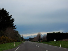
Hehehe ..... did the surveyors get the road setout wrong? This previously straight road is now kinked across this previously unknown faultline along which the Saturday 4 September 2010 magnitude 7.1 earthquake originated.
IMG_2272
Images, eqnz.chch.2010
Hehehe ..... did the surveyors get the road setout wrong? This previously straight road is now kinked across this previously unknown faultline along which the Saturday 4 September 2010 magnitude 7.1 earthquake originated.
IMG_2274
Images, eqnz.chch.2010
The farmers in this area swore that this road was straight when they were returning from the pub on Friday 3 September 2010, the night before the magnitude 7.1 earthquake struck.
IMG_2273
Images, eqnz.chch.2010
The farmers in this area swore that this road was straight when they were returning from the pub on Friday 3 September 2010, the night before the magnitude 7.1 earthquake struck.
Geotechnical Aspects of the 2010 Darfield (Canterbury) Earthquake
Research papers, University of Canterbury Library
On 4 September 2010, a magnitude Mw 7.1 earthquake struck the Canterbury region on the South Island of New Zealand. The epicentre of the earthquake was located in the Darfield area about 40 km west of the city of Christchurch. Extensive damage was inflicted to lifelines and residential houses due to widespread liquefaction and lateral spreading in areas close to major streams, rivers and wetlands throughout Christchurch and Kaiapoi. Unreinforced masonry buildings also suffered extensive damage throughout the region. Despite the severe damage to infrastructure and residential houses, fortunately, no deaths occurred and only two injuries were reported in this earthquake. From an engineering viewpoint, one may argue that the most significant aspects of the 2010 Darfield Earthquake were geotechnical in nature, with liquefaction and lateral spreading being the principal culprits for the inflicted damage. Following the earthquake, an intensive geotechnical reconnaissance was conducted to capture evidence and perishable data from this event. This paper summarizes the observations and preliminary findings from this early reconnaissance work.
IMG_2320
Images, eqnz.chch.2010
The St John The Evangelist Catholic Church in Leeston was cordoned off due to damage suffered during the magnitude 7.1 earthquake that struck mid-Canterbury on Saturday 4 September 2010.
IMG_2317
Images, eqnz.chch.2010
The St John The Evangelist Catholic Church in Leeston was cordoned off due to damage suffered during the magnitude 7.1 earthquake that struck mid-Canterbury on Saturday 4 September 2010.
IMG_2269
Images, eqnz.chch.2010
The farmer swore that his fence was erected in a straingt line, but mother nature had other ideas! Aftermath of the Saturday 4 September 2010 magnitude 7.1 earthquake at the previously unknown faultline along which the quake originated.
IMG_2268
Images, eqnz.chch.2010
The farmer swore that his hedge was planted in a straingt line, but mother nature had other ideas! Aftermath of the Saturday 4 September 2010 magnitude 7.1 earthquake at the previously unknown faultline along which the quake originated.
IMG_2318
Images, eqnz.chch.2010
The magnitude 7.1 earthquake that struck mid-Canterbury on Saturday 4 September 2010 broke the tip of the spire of the St John The Evangelist Catholic Church in Leeston
IMG_2270
Images, eqnz.chch.2010
The farmer swore that his fence was erected in a straingt line, but mother nature had other ideas! Aftermath of the Saturday 4 September 2010 magnitude 7.1 earthquake at the previously unknown faultline along which the quake originated.
Rethinking PSHA
Research papers, University of Canterbury Library
Since the early 1980s seismic hazard assessment in New Zealand has been based on Probabilistic Seismic Hazard Analysis (PSHA). The most recent version of the New Zealand National Seismic Hazard Model, a PSHA model, was published by Stirling et al, in 2012. This model follows standard PSHA principals and combines a nation-wide model of active faults with a gridded point-source model based on the earthquake catalogue since 1840. These models are coupled with the ground-motion prediction equation of McVerry et al (2006). Additionally, we have developed a time-dependent clustering-based PSHA model for the Canterbury region (Gerstenberger et al, 2014) in response to the Canterbury earthquake sequence. We are now in the process of revising that national model. In this process we are investigating several of the fundamental assumptions in traditional PSHA and in how we modelled hazard in the past. For this project, we have three main focuses: 1) how do we design an optimal combination of multiple sources of information to produce the best forecast of earthquake rates in the next 50 years: can we improve upon a simple hybrid of fault sources and background sources, and can we better handle the uncertainties in the data and models (e.g., fault segmentation, frequency-magnitude distributions, time-dependence & clustering, low strain-rate areas, and subduction zone modelling)? 2) developing revised and new ground-motion predictions models including better capturing of epistemic uncertainty – a key focus in this work is developing a new strong ground motion catalogue for model development; and 3) how can we best quantify if changes we have made in our modelling are truly improvements? Throughout this process we are working toward incorporating numerical modelling results from physics based synthetic seismicity and ground-motion models.
Morphostructural and paleo-seismic analysis of fault interactions in the O…
Research papers, University of Canterbury Library
This study investigates evidence for linkages and fault interactions centred on the Cust Anticline in Northwest Canterbury between Starvation Hill to the southwest and the Ashley and Loburn faults to the northeast. An integrated programme of geologic, geomorphic, paleo-seismic and geophysical analyses was undertaken owing to a lack of surface exposures and difficulty in distinguishing active tectonic features from fluvial and/or aeolian features across the low-relief Canterbury Plains. LiDAR analysis identified surface expression of several previously unrecognised active fault traces across the low-relief aggradation surfaces of the Canterbury Plains. Their presence is consistent with predictions of a fault relay exploiting the structural mesh across the region. This is characterised by interactions of northeast-striking contractional faults and a series of re-activating inherited Late Cretaceous normal faults, the latter now functioning as E–W-striking dextral transpressive faults. LiDAR also allowed for detailed analysis of the surface expression of individual faults and folds across the Cust Anticline contractional restraining bend, which is evolving as a pop-up structure within the newly established dextral shear system that is exploiting the inherited, now re-activated, basement fault zone. Paleo-seismic trenches were located on the crest of the western arm of the Cust Anticline and across a previously unrecognised E–W-striking fault trace, immediately southwest of the steeply plunging Cust Anticline termination. These studies confirmed the location and structural style of north-northeast-striking faults and an E–W-striking fault associated with the development of this structural culmination. A review of available industry seismic reflection lines emphasised the presence of a series of common structural styles having the same underlying structural drivers but with varying degrees of development and expression, both in the seismic profiles and in surface elevations across the study area. Based on LiDAR surface mapping and preliminary re-analysis of industry seismic reflection data, four fault zones are identified across the restraining bend structural culminations, which together form the proposed Oxford–Cust–Ashley Fault System. The 2010–2012 Canterbury Earthquake Sequence showed many similarities to the structural pattern established across the Oxford–Cust–Ashley Fault System, emphasising the importance of identification and characterization of presently hidden fault sources, and the understanding of fault network linkages, in order to improve constraints on earthquake source potential. Improved understanding of potentially-interactive fault sources in Northwest Canterbury, with the potential for combined initial fault rupture and spatial and temporal rupture propagation across this fault system, can be used in probabilistic seismic hazard analysis for the region, which is essential for the suitability and sustainability of future social and economic development.
Feature Guest - Mark Quigley
Audio, Radio New Zealand
Canadian-born Mark Quigley is a senior lecturer in Active Tectonics and Geomorphology at the Department of Geological Sciences at the University of Canterbury. He's become an unwitting star as the go-to scientific voice throughout the Canterbury earthquakes, using plain language to help people understand what's behind the earthquake sequence. He's also had his own personal quake story - his Avonside home was badly damaged and is in the red zone.
Victoria experiences earthquake, causes structural damage
Audio, Radio New Zealand
Victorian Authorities are warning residents of significant aftershocks following on from the magnitude 5.8 earthquake which shook Melbourne around 9am yesterday, causing significant structural damage across the city. The University of Melbourne's Dr Mark Quigley is a professor of tectonics, who became a familiar voice and face through the Christchurch quakes. Our producer Matthew Theunissen asked him how yesterday's quake compared to those he experienced in Christchurch.
IMG_2267
Images, eqnz.chch.2010
The farmer swore that his fence and hedge were in a straingt line, but mother nature had other ideas! Aftermath of the Saturday 4 September 2010 magnitude 7.1 earthquake at the previously unknown faultline along which the quake originated.
IMG_2232
Images, eqnz.chch.2010
The ground slipped laterally at this previously unknown faultline across Highfield Road in mid-Canterbury, resulting in a relative displacement of at least 2 metres and the magnitude 7.1 earthquake on Saturday 4 September 2010. Note the now misaligned fence posts, hedge and road.
IMG_2395
Images, eqnz.chch.2010
Cracks have ripped through external columns of this 7 storey building (corner of Hereford Street / Manchester Street), and efforts are being made to shore up and strengthen it to save it from demolition after it suffered structural damage in the magnitude 7.1 earthquake that struck Christchurch on Saturday 4 September 2010.
IMG_2396
Images, eqnz.chch.2010
Cracks have ripped through external columns of this 7 storey building (corner of Hereford Street / Manchester Street), and efforts are being made to shore up and strengthen it to save it from demolition after it suffered structural damage in the magnitude 7.1 earthquake that struck Christchurch on Saturday 4 September 2010.