
Search
found 4186 results
Images for Christchurch street; more images...


Crack'd for Christchurch Photograph 224
Images, UC QuakeStudies
A photograph of the members of Crack'd for Christchurch during the launch of the Green Room garden. The members have gathered next to their armchair and ottoman artwork in the garden. The armchair and ottoman are covered in white sheets and tied with a blue bow. They will be unveiled for the first time during the launch.
20130827_2654_1D3-24 Corner Colombo/Hereford Street, Christchurch
Images, eqnz.chch.2010
The same view as the previous photo. Building demolished after the earthquake of 2011!
20100904_3322_1D3-200 Bridge Street bridge, Christchurch earthquake
Images, eqnz.chch.2010
20100904_3322_1D3-200 Bridge Street bridge, Christchurch earthquake South Brighton Bridge. See the gap between the abutment and the bridge itself (just to right of lower person).
20100905_3346_1D3-24 Bridge Street cracking - Christchurch earthquake
Images, eqnz.chch.2010
The city side of the South Brighton bridge. Approaches on both sides will need extensive work before this bridge can re-open.
Fairfax Video, February 2011 (4)
Videos, UC QuakeStudies
Aerial footage of Christchurch recorded the day after the 22 February 2011 earthquake. The footage shows damage to the Smith City car park, the Cathedral of the Blessed Sacrament, the CTV Building, the PGC Building, the Durham Street Methodist Church, the Lyttelton Timeball Station, the roads alongside the Avon River, and the ChristChurch Cathedral. It also shows New Zealand Army road blocks outside the hospital, crushed buses on Colombo Street, a Royal New Zealand Navy vessel in Lyttelton Harbour, rock fall on the Summit Road, collapsed cliffs in Sumner and Redcliffs, tents set up in a park, flooding in New Brighton, and liquefaction in QEII Park.
New Zealand Defence Force photograph 699
Images, UC QuakeStudies
The west side of the British Hotel on Oxford Street. The brick wall at the top of the building has crumbled onto the street below, bringing part of the roof down with it. Wire fencing has been used to create a cordon around the building.
New Zealand Defence Force photograph 698
Images, UC QuakeStudies
Damage to the Fuze Restaurant and Cafe on the corner of Oxford Street and Norwich Quay. The facade around the top of the building has crumbled into the street below. Wire fencing has been used to create a cordon around the building.
New Zealand Defence Force photograph 702
Images, UC QuakeStudies
Damage to the former Lyttelton Public Library on the corner of Oxford Street and Sumner Road. The facade along the top of the building has crumbled into the street. Tape and road cones have been used to create a cordon around the building.
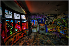
LUXCITY Photograph 12
Images, UC QuakeStudies
A photograph of an installation titled 'In Your Face'. The installation is part of the LUXCITY event. Tutor: Fraser Horton
LUXCITY Photograph 15
Images, UC QuakeStudies
An artist's impression of the installation 'eLITE', created as part of the LUXCITY event. Tutors: Cameron Rowe, Kate Rogan
Homage to the Lost Spaces Photograph 4
Images, UC QuakeStudies
A photograph of Mike Hewson's installation 'Homage to the Lost Spaces' being installed on plywood covering the earthquake-damaged Cranmer Courts building.
Homage to the Lost Spaces Photograph 5
Images, UC QuakeStudies
A photograph of Mike Hewson's installation 'Homage to the Lost Spaces' being installed on plywood covering the earthquake-damaged Cranmer Courts building.
Homage to the Lost Spaces Photograph 6
Images, UC QuakeStudies
A photograph of part of Mike Hewson's installation 'Homage to the Lost Spaces' on the earthquake-damaged Cranmer Courts building.
Homage to the Lost Spaces Photograph 1
Images, UC QuakeStudies
A photograph of Mike Hewson's installation 'Homage to the Lost Spaces' being installed on plywood covering the earthquake-damaged Cranmer Courts building.
Homage to the Lost Spaces Photograph 3
Images, UC QuakeStudies
A photograph of Mike Hewson's installation 'Homage to the Lost Spaces' being installed on plywood covering the earthquake-damaged Cranmer Courts building.
LUXCITY Photograph 14
Images, UC QuakeStudies
An artist's impression of the installation 'In Your Face', created as part of the LUXCITY event. Tutor: Fraser Horton
LUXCITY Photograph 9
Images, UC QuakeStudies
An artist's impression of the installation 'Atmosphere', created as part of the LUXCITY event. Tutor: Sue Hillery
Exterior of Clarendon Hotel, from Oxford Terrace, Worcester Street corner
Images, UC QuakeStudies
A black and white historic photograph of the exterior Clarendon Hotel, designed by J.C. Maddison. The photograph was taken from the corner of Oxford Terrace and Worcester Street, [1903].
Gap Filler #1 Photograph 7
Images, UC QuakeStudies
A photograph of a decorated fence. A sign on the fence advertises Gap Filler's first project. Behind the fence, an excavator is demolishing a building on Colombo Street.
BeckerFraserPhotos June 2012 photograph 174
Images, UC QuakeStudies
Photograph captioned by BeckerFraserPhotos, "An empty site at 140-144 Gloucester Street which used to be the Star building and the Coachman Hotel".
Homage to the Lost Spaces Photograph 2
Images, UC QuakeStudies
A photograph of Mike Hewson's installation 'Homage to the Lost Spaces' being installed on plywood covering the earthquake-damaged Cranmer Courts building.
Reconstruction of T. Armstrong & Co. premises, corner of Colombo and Armag…
Images, UC QuakeStudies
A black and white historic photograph of the reconstruction of Armstrong & Co., a major department store on the corner of Colombo and Armagh Streets, [ca. 1930].
LUXCITY Photograph 13
Images, UC QuakeStudies
An artist's impression of the installation 'In Your Face', created as part of the LUXCITY event. Tutor: Fraser Horton
Christchurch: The Transitional City Pt IV, pages 210-211: St Luke's Labyri…
Articles, UC QuakeStudies
A PDF copy of pages 210-211 of the book Christchurch: The Transitional City Pt IV. The pages document the transitional project 'St Luke's Labyrinth'. Page 210 photos: Irene Boles. Page 211 photos: Peter Walker, Three Chairs Photography. With permission from Student Volunteer Army Foundation.
Christchurch: The Transitional City Pt IV, pages 70-71: Bandaid Artwork
Articles, UC QuakeStudies
A PDF copy of pages 70-71 of the book Christchurch: The Transitional City Pt IV. The pages document the transitional project 'Bandaid Artwork'. Photographs: Heather Hayward (top left), Reuben Woods (top right), Jenna Lynn Brown (bottom left and right)
Photograph by Neil Macbeth 074
Images, UC QuakeStudies
A damaged footpath along Worcester Boulevard outside the Christchurch Art Gallery. In several places along the footpath, the tiles have lifted, leaving an uneven surface. In the distance are crowds of people leaving the central city.
Christchurch Press Image: Dean Kozanic 2010:10:18 15:31:44
Images, UC QuakeStudies
Photograph captioned by Fairfax, "City Care workers repair broken water pipes on Matipo Street, probably caused by the morning's earthquake".
Christchurch Mail Image: Luke Thomas 2010:10:05 12:55:24
Images, UC QuakeStudies
Photograph captioned by Fairfax, "The canopy of a Sydenham shop has collapsed onto the sidewalk on Colombo Street in Sydenham".
Christchurch Press Image: Kirk Hargreaves 2010:11:29 14:04:47
Images, UC QuakeStudies
Photograph captioned by Fairfax, "Post-earthquake demolition. Materials from a building on St Asaph Street still waiting to be cleared".
Digital Photograph: Earthquake damage in Oxford Street, Lyttelton
Images, Canterbury Museum
One landscape colour digital photograph taken on 25 February 2011 showing earthquake damage on eastern side of Oxford Street, Lyttelton Taken from the footpath looking downhill from opposite Lyttelton Main School. The Buildings visible are the premises of Moda Fotografica (former Library and Council Chambers), a private residence (former Libra...