Search
found 302 results
Images for [empty query]; more images...


Shaken, not stirred : networked sensemaking of disaster in context of the …
Research papers, University of Canterbury Library
Social media have changed disaster response and recovery in the way people inform themselves, provide community support and make sense of unfolding and past events online. During the Canterbury earthquakes of 2010 and 2011 social media platforms such as Facebook and Twitter became part of the story of the quakes in the region, as well as a basis for ongoing public engagement during the rebuild efforts in Christchurch. While a variety of research has been conducted on the use of social media in disaster situations (Bruns & Burgess, 2012; Potts, Seitzinger, Jones, & Harrison, 2011; Shklovski, Palen, & Sutton, 2008), studies about their uses in long-term disaster recovery and across different platforms are underrepresented. This research analyses networked practices of sensemaking around the Canterbury earthquakes over the course of disaster response, recovery and rebuild, focussing on Facebook and Twitter. Following a mixed methodological design data was gathered in interviews with people who started local Facebook pages, and through digital media methods of data collection and computational analysis of public Facebook pages and a historical Twitter dataset gathered around eight different earthquake-related events between 2010 and 2013. Data is further analysed through discursive and narrative tools of inquiry. This research sheds light on communication practices in the drawn-out process of disaster recovery on the ground in connecting different modes of discourse. Examining the ongoing negotiation of networked identities through technologically mediated social practices during Canterbury’s rebuild, the connection between online environments and the city of Christchurch, as a physical place, is unpacked. This research subsequently develops a new methodology to study social media platforms and provide new and detailed information on both the communication practices in issue-based online publics and the ongoing negotiation of the impact of the Canterbury earthquakes through networked digital means.
Decision support framework for post-earthquake restoration of sewerage pip…
Research papers, University of Canterbury Library
Sewerage systems convey sewage, or wastewater, from residential or commercial buildings through complex reticulation networks to treatment plants. During seismic events both transient ground motion and permanent ground deformation can induce physical damage to sewerage system components, limiting or impeding the operability of the whole system. The malfunction of municipal sewerage systems can result in the pollution of nearby waterways through discharge of untreated sewage, pose a public health threat by preventing the use of appropriate sanitation facilities, and cause serious inconvenience for rescuers and residents. Christchurch, the second largest city in New Zealand, was seriously affected by the Canterbury Earthquake Sequence (CES) in 2010-2011. The CES imposed widespread damage to the Christchurch sewerage system (CSS), causing a significant loss of functionality and serviceability to the system. The Christchurch City Council (CCC) relied heavily on temporary sewerage services for several months following the CES. The temporary services were supported by use of chemical and portable toilets to supplement the damaged wastewater system. The rebuild delivery agency -Stronger Christchurch Infrastructure Rebuild Team (SCIRT) was created to be responsible for repair of 85 % of the damaged horizontal infrastructure (i.e., water, wastewater, stormwater systems, and roads) in Christchurch. Numerous initiatives to create platforms/tools aiming to, on the one hand, support the understanding, management and mitigation of seismic risk for infrastructure prior to disasters, and on the other hand, to support the decision-making for post-disaster reconstruction and recovery, have been promoted worldwide. Despite this, the CES in New Zealand highlighted that none of the existing platforms/tools are either accessible and/or readable or usable by emergency managers and decision makers for restoring the CSS. Furthermore, the majority of existing tools have a sole focus on the engineering perspective, while the holistic process of formulating recovery decisions is based on system-wide approach, where a variety of factors in addition to technical considerations are involved. Lastly, there is a paucity of studies focused on the tools and frameworks for supporting decision-making specifically on sewerage system restoration after earthquakes. This thesis develops a decision support framework for sewerage pipe and system restoration after earthquakes, building on the experience and learning of the organisations involved in recovering the CSS following the CES in 2010-2011. The proposed decision support framework includes three modules: 1) Physical Damage Module (PDM); 2) Functional Impact Module (FIM); 3) Pipeline Restoration Module (PRM). The PDM provides seismic fragility matrices and functions for sewer gravity and pressure pipelines for predicting earthquake-induced physical damage, categorised by pipe materials and liquefaction zones. The FIM demonstrates a set of performance indicators that are categorised in five domains: structural, hydraulic, environmental, social and economic domains. These performance indicators are used to assess loss of wastewater system service and the induced functional impacts in three different phases: emergency response, short-term recovery and long-term restoration. Based on the knowledge of the physical and functional status-quo of the sewerage systems post-earthquake captured through the PDM and FIM, the PRM estimates restoration time of sewer networks by use of restoration models developed using a Random Forest technique and graphically represented in terms of restoration curves. The development of a decision support framework for sewer recovery after earthquakes enables decision makers to assess physical damage, evaluate functional impacts relating to hydraulic, environmental, structural, economic and social contexts, and to predict restoration time of sewerage systems. Furthermore, the decision support framework can be potentially employed to underpin system maintenance and upgrade by guiding system rehabilitation and to monitor system behaviours during business-as-usual time. In conjunction with expert judgement and best practices, this framework can be moreover applied to assist asset managers in targeting the inclusion of system resilience as part of asset maintenance programmes.
Recycling disaster waste: Feasibility, method and effectiveness
Research papers, University of Canterbury Library
Recycling is often employed as part of a disaster waste management system. However, the feasibility, method and effectiveness of recycling varies between disaster events. This qualitative study is based on literature reviews, expert interviews and active participatory research of five international disaster events in developed countries (2009 Victorian Bushfires, Australia; 2009 L’Aquila earthquake, Italy; 2005 Hurricane Katrina, United States; 2010 and 2011 Canterbury earthquakes, New Zealand; 2011 Great East Japan earthquake) to answer three questions: What are the main factors that affect the feasibility of recycling post-disaster? When is on-site or off-site separation more effective? What management approaches improve recycling effectiveness? Seven disaster-specific factors need to be assessed to determine the feasibility of disaster waste recycling programmes: volume of waste; degree of mixing of waste; human and environmental health hazards; areal extent of the waste; community priorities; funding mechanisms; and existing and disaster-specific regulations. The appropriateness of on or off-site waste separation depends on four factors: time constraints; resource availability; degree of mixing of waste and human and public health hazards. Successful recycling programmes require good management including clear and well enforced policies (through good contracts or regulations) and pre-event planning. Further research into post-disaster recycling markets, funding mechanisms and recycling in developing countries is recommended.
Tool academy: Māori artefacts from Redcliffs
Articles, Christchurch uncovered
Kia ora, Recently we had some great finds from Te Rae Kura/Redcliffs. Unbeknownst to many folks making their daily commute along the Port Hills’ Main Road, a nationally significant Māori archaeological site lies beneath their car wheels, capped by hard … Continue reading →
20160104_1608_7D2-20 Porritt Park (004/366)
Images, eqnz.chch.2010
Porritt Park was, before the earthquakes, the headquarters of hockey in this region. Two astro-turf fields (the main one was other side of the building), and corporate offices etc. The earthquakes buckled all the playing surfaces and damaged the buildings; a couple of smaller ones have been removed. Hockey shifted the other side of the city t...
Porritt Park
Images, eqnz.chch.2010
20160104_1602_7D2-20 Porritt Park Porritt Park was, before the earthquakes, the headquarters of hockey in this region. Two astro-turf fields (the main one was to the left of the building), and corporate offices etc. The earthquakes buckled all the playing surfaces and damaged the buildings; a couple of smaller ones have been removed. Hocke...
Red Zone Closures
Images, eqnz.chch.2010
20160415_0029_1D3-24 Red Zone Closures The permanent closure (to motor vehicles) of the Bexley red zone streets has started. This was once the main south-north route just west of the Avon River in the New Brighton area, till an expressway (ring road) was built about 80m to the west (right) about 12-13 years ago. Then it became just another ...
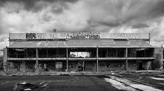
20160307_6607_7D2-110 Interior removal
Images, eqnz.chch.2010
The Forsyth Barr building has stood silent and empty (except the occasional intruder and pigeons) since the February 2011 earthquake. It was sold "as is" and I understand that it is now going to be fitted out as a hotel. This is the building that had severe stairwell damage during the quake necessitating people being lowered via ropes etc on t...
20160415_0039_1D3-40 The Wobbly Jetty - 1 (106/366) [Explored]
Images, eqnz.chch.2010
20160415_0039_1D3-40 The Wobbly Jetty - 1 (106/366) [Explored] The South New Brighton jetty was rebuilt a couple of years before the 2010 and 2011 earthquakes wrecked it. Then, it was straight, level and all railings on left side were intact. Was closed to the public for about four years but is open now. #7221
20160307_6619_7D2-125 Covering up
Images, eqnz.chch.2010
One of the most beautiful pieces of wall art (added to the blank walls after buildings were demolished following the earthquakes) in Christchurch, is now being hidden by a new building in front of it. www.flickr.com/photos/johnstewartnz/15499321681/in/...
20160307_0036_EOS M-41 Summit Road closed
Images, eqnz.chch.2010
None
The Wobbly Jetty - 2
Images, eqnz.chch.2010
20160415_0044_1D3-38 The Wobbly Jetty - 2 The South New Brighton jetty was rebuilt a couple of years before the earthquakes wrecked it. Was closed to the public for about four years but is open now. #7222
20160307_0012_1D3-32 Subway is closed (067/366)
Images, eqnz.chch.2010
The Subway shop in the High Street Mall has not operated since lunch time on the 22nd February 2011 when the most damaging of Christchurch and Canterbury's earthquakes struck. I assume the building is still to be demolished.
20160307_6634_7D2-82 Really Wild!
Images, eqnz.chch.2010
A section of retaining wall that tilted in the Christchurch 2011 earthquake. At the Edmunds Band Rotunda sight. Still not repaired,
20160307_6626_7D2-200 Pigeon City
Images, eqnz.chch.2010
Pigeons sit on the remains of one of the tallest buildings in Christchurch that was 95% demolished two or three years ago. The basement (now filled with water) and the columns remain. Demolished due to damage from the Christchurch 2011 earthquake.
20160419_7732_7D2-400 The City is in Rebuild phase (110/366)
Images, eqnz.chch.2010
20160419_7732_7D2-400 The City is in Rebuild phase (110/366) A totally different view to a few years ago. Most of the tall buildings have gone and construction is underway on a lot of new buildings, View from across the Estuary in Redcliffs. A couple of days ago the government agency controlling the post-earthquake work (CERA - Canterbury Ea...
20160703_144759_GT-S7275T-04 New sea wall at Redcliffs (185/366)
Images, eqnz.chch.2010
20160703_144759_GT-S7275T-04 New sea wall at Redcliffs (185/366) I went for a drive in my second car mainly to charge the battery up and forgot to take my camera gear so only had my phone. This is the new rock wall to replace the severely damaged previous one (in the February 2011 earthquake). Work is still underway on the car parking and p...
20160612_8429_1D3-40 Abandoned and maybe forgotten
Images, eqnz.chch.2010
AMI Stadium (Lancaster Park), not used since the February 2011 earthquake. It was used predominantly for rugby and cricket. We are still waiting to see what the outcome is for this stadium. Government want a new one closer to the CBD, so there is talk of this being demolished, while others want it repaired. The concrete pad lower left is ...
20160613_0044_7D2-100 Jetty Closed
Images, eqnz.chch.2010
The South New Brighton jetty has been closed for 3 or 4 years (fenced off) then the fence was removed and it was "open", but nothing has happened to it since the earthquakes, but it is closed again now, although it looks like a home made sign!
20160612_8434_1D3-40 Ticket Sales (164/366)
Images, eqnz.chch.2010
The ticket office at Lancaster Park (AMI Stadium), not used since the February 2011 earthquake. Windows broken and door boarded up. We are still waiting to see what the outcome is for this stadium. Government want a new one closer to the CBD, so there is talk of this being demolished, while others want it repaired.
20161018_9063_7D2-70 Restricted Area (292/366)
Images, eqnz.chch.2010
In the suburban red zone on Avonside Drive.
20161112_9965_7D2-24 Another view of part of the Cultivate Christchurch in…
Images, eqnz.chch.2010
None
The future face of Christchurch?
Images, eqnz.chch.2010
20161112_9961_7D2-70 The future face of Christchurch? Cultivate Christchurch is operating this urban farm in the city, about 5-10 minutes walk to Cathedral Square. Many of the buildings in this area were demolished after the earhquakes, and in the background is a new building on Kilmore Street.
Six years on
Images, eqnz.chch.2010
20161211_0216_1D3-24 Six years on A view that was impossible six years ago. There was a group of buildings including another high-rise in the vacant area in the middle ground. #7986
Post-disaster indigenous mental health support: Tangata whaiora networks a…
Research Papers, Lincoln University
This paper identifies and analyses the networks of support for tangata whaiora (mental health clients) utilising a kaupapa Mäori health service following the Ötautahi/Christchurch earthquakes in Aotearoa New Zealand from 2010 to 2012. Semi- structured interviews were undertaken with 39 participants, comprising clients (Mäori and Päkehä), staff, managers and board members of a kaupapa Mäori provider in the city. Selected quotes are presented alongside a social network analysis of the support accessed by all participants. Results show the signifi cant isolation of both Mäori and Päkehä mental health clients post- disaster and the complexity of individuals and collectives dealing with temporally and spatially overlapping hazards and disasters at personal, whänau and community level.
Liquefaction features produced by the 2010-2011 Canterbury earthquake sequ…
Research Papers, Lincoln University
Liquefaction features and the geologic environment in which they formed were carefully studied at two sites near Lincoln in southwest Christchurch. We undertook geomorphic mapping, excavated trenches, and obtained hand cores in areas with surficial evidence for liquefaction and areas where no surficial evidence for liquefaction was present at two sites (Hardwick and Marchand). The liquefaction features identified include (1) sand blows (singular and aligned along linear fissures), (2) blisters or injections of subhorizontal dikes into the topsoil, (3) dikes related to the blows and blisters, and (4) a collapse structure. The spatial distribution of these surface liquefaction features correlates strongly with the ridges of scroll bars in meander settings. In addition, we discovered paleoliquefaction features, including several dikes and a sand blow, in excavations at the sites of modern liquefaction. The paleoliquefaction event at the Hardwick site is dated at A.D. 908-1336, and the one at the Marchand site is dated at A.D. 1017-1840 (95% confidence intervals of probability density functions obtained by Bayesian analysis). If both events are the same, given proximity of the sites, the time of the event is A.D. 1019-1337. If they are not, the one at the Marchand site could have been much younger. Taking into account a preliminary liquefaction-triggering threshold of equivalent peak ground acceleration for an Mw 7.5 event (PGA7:5) of 0:07g, existing magnitude-bounded relations for paleoliquefaction, and the timing of the paleoearthquakes and the potential PGA7:5 estimated for regional faults, we propose that the Porters Pass fault, Alpine fault, or the subduction zone faults are the most likely sources that could have triggered liquefaction at the study sites. There are other nearby regional faults that may have been the source, but there is no paleoseismic data with which to make the temporal link.
Bottom-up governance after a natural disaster: a temporary post-earthquake…
Research Papers, Lincoln University
Creative temporary or transitional use of vacant urban open spaces is seldom foreseen in traditional urban planning and has historically been linked to economic or political disturbances. Christchurch, like most cities, has had a relatively small stock of vacant spaces throughout much of its history. This changed dramatically after an earthquake and several damaging aftershocks hit the city in 2010 and 2011; temporary uses emerged on post-earthquake sites that ran parallel to the “official” rebuild discourse and programmes of action. The paper examines a post-earthquake transitional community-initiated open space (CIOS) in central Christchurch. CIOS have been established by local community groups as bottom-up initiatives relying on financial sponsorship, agreements with local landowners who leave their land for temporary projects until they are ready to redevelop, and volunteers who build and maintain the spaces. The paper discusses bottom-up governance approaches in depth in a single temporary post-earthquake community garden project using the concepts of community resilience and social capital. The study analyses and highlights the evolution and actions of the facilitating community organisation (Greening the Rubble) and the impact of this on the project. It discusses key actors’ motivations and values, perceived benefits and challenges, and their current involvement with the garden. The paper concludes with observations and recommendations about the initiation of such projects and the challenges for those wishing to study ephemeral social recovery phenomena.
The Harcourts Building : A 'seismic' shift?
Research Papers, Lincoln University
Purpose - The purpose of this paper is to identify through the application of Actor Network Theory (ANT) the issues and impediments to the implementation of mandatory seismic retrofitting policies proposed by the New Zealand Government. In particular the tension between the heritage protection objectives contained in the Resource Management Act 1991 and the earthquake mitigation measures contained in the Building Act 2004 are examined. Design/methodology/approach - The paper uses a case study approach based on the Harcourts Building in Wellington New Zealand and the case law relating to attempts to demolish this particular building. Use is made of ANT as a 'lens' to identify and study the controversies around mandatory seismic retrofitting of heritage buildings. The concept of translation is used to draw network diagrams.
Tram vs Bus in 1930s Crush
Articles, Lost Christchurch
The busiest intersection in the central city heaves under a rush of pedestrians, buses, trams, cyclists and private motor cars, pushing passed each other as they head for various parts of the city.
A Great Pilgrimage Over the Clouds
Articles, Lost Christchurch
Imagine an event so exciting, so spectacular, that 38 trains were required travelling at 28 minute intervals to convey curious sightseers to Lyttelton in order to witness it. The roads from Christc…