Search
found 302 results
Images for [empty query]; more images...


The Addington Times, July 2016
Articles, UC QuakeStudies
An electronic copy of the July 2016 edition of the Addington Times newsletter.
Seismics in the City 2016 - The Trajectory of Post-disaster Recovery and R…
Videos, UC QuakeStudies
A video of a keynote presentation by Professor David Johnston, Senior Scientist at GNS Science, at the 2016 Seismics in the City Conference. The presentation is titled, "The Trajectory of Post-disaster Recovery and Regeneration: The social dimension".The abstract for the presentation reads, "A consideration of social regeneration and what that means for Canterbury moving forward plus current recovery trajectories and ways of measuring progress."
St Albans News, June/July 2016
Articles, UC QuakeStudies
An electronic copy of the June/July 2016 edition of the St Albans News newsletter.
The Addington Times, February 2016
Articles, UC QuakeStudies
An electronic copy of the February 2016 edition of the Addington Times newsletter.
2016 Civic Earthquake Memorial Service
Videos, UC QuakeStudies
A video of the 2016 Civic Earthquake Memorial Service, held to mark the fifth anniversary of the 22 February 2011 earthquake. The service was held on the Archery Lawn in the Christchurch Botanic Gardens at midday on 22 February 2016. The service was filmed for the Christchurch City Council by Alan Radford of Multicam TV.
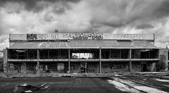
Ilam Fields
Images, UC QuakeStudies
A photograph of four UCSA Exec members hosting a barbecue on Ilam Fields in September 2016.
St Albans News, December 2016
Articles, UC QuakeStudies
An electronic copy of the December 2016 edition of the St Albans News newsletter.
The Addington Times, August 2016
Articles, UC QuakeStudies
An electronic copy of the August 2016 edition of the Addington Times newsletter.
The Addington Times, December 2016
Articles, UC QuakeStudies
An electronic copy of the December 2016 edition of the Addington Times newsletter.
The Addington Times, March 2016
Articles, UC QuakeStudies
An electronic copy of the March 2016 edition of the Addington Times newsletter.
St Albans News, August/September 2016
Articles, UC QuakeStudies
An electronic copy of the August/September 2016 edition of the St Albans News newsletter.
St Albans News, October/November 2016
Articles, UC QuakeStudies
An electronic copy of the October/November 2016 edition of the St Albans News newsletter.
Seismics in the City 2016 - Panel (Part 1)
Videos, UC QuakeStudies
A video of a presentation by Hon. Nicky Wagner, Associate Minister for Canterbury Earthquake Recovery, during a panel at the 2016 Seismics in the City Conference. The panel has three themes:A City on the Move: Collaboration and Regeneration: "'Christchurch is now moving rapidly from the recovery phase into a regeneration stage with Central and Local Government working with the wider community, including the business community to ensure we get optimal outcomes for greater Christchurch' (CECC)."Looking Back: Remembering and Learning: "What are the milestones? What are the millstones? What have we learnt? What have we applied?"Looking Forward: Visioning and Building: "What do we aspire to? What are the roadblocks? What is the way forward?"
Seismics in the City 2016 - The Role of the Fourth Estate in the Post-Quak…
Videos, UC QuakeStudies
A video of a presentation by Amanda Cropp, Christchurch Business Bureau Chief for Fairfax Media, at the 2016 Seismics in the City Conference. The presentation is titled, "The Role of the Fourth Estate in the Post-Quake Era".
Seismics in the City 2016 - Reinventing the Organisation
Videos, UC QuakeStudies
A video of a presentation by Kay Giles, Chief Executive of CPIT Aoraki, at the 2016 Seismics in the City Conference. The presentation is titled, "Reinventing the Organisation".The abstract for the presentation reads, "How my organisation has done things differently after the earthquakes as a response to the new needs of the city and region and how it is taking the opportunity to re-examine and reinvent itself."
Seismics in the City 2016 - Starters
Videos, UC QuakeStudies
A video of the opening remarks made by Lyall Lukey, Coordinator of SmartNet, at the 2016 Seismics in the City Conference.
Seismics in the City 2016 - Transport Roles in Helping Shape Canterbury's …
Videos, UC QuakeStudies
A video of a presentation by Professor Chris Kissling, Fellow of the Chartered Institute of Logistics and Transport, at the 2016 Seismics in the City Conference. The presentation is titled, "Transport Roles in Helping Shape Canterbury's Post-earthquakes Future".The abstract for the presentation reads, "The necessity for embracing integrated transportation solutions to meet emerging societal needs."
Seismics in the City 2016 - Open Forum
Videos, UC QuakeStudies
A video of the open forum at the 2016 Seismics in the City Conference, facilitated by Brendon Burns, Communications Consultant at Brendon Burns and Associates.
Seismics in the City 2016 - Pictures of a Re-imagined Otautahi-Christchurc…
Videos, UC QuakeStudies
A video of a presentation by Colin Meurk, Research Associate at Landcare Research, at the 2016 Seismics in the City Conference. The presentation is titled, "Pictures of a Re-imagined Otautahi-Christchurch City".
Seismics in the City 2016 - Factors Shaping the Industrial and Commercial …
Videos, UC QuakeStudies
A video of a presentation by Justin Kean, Director of Research and Consulting at JLL, at the 2016 Seismics in the City Conference. The presentation is titled, "Factors Shaping the Industrial and Commercial Evolution of Greater Christchurch".
Seismics in the City 2016 - Working Together Strengthens Understanding
Videos, UC QuakeStudies
A video of a presentation by Hugh Cowan, General Manager of Reinsurance, Research and Education at EQC, at the 2016 Seismics in the City Conference. The presentation is titled, "Working Together Strengthens Understanding".The abstract for the presentation reads, "Hear how EQC led a collaborative research project in Canterbury that involved diverse stakeholders from government, council officials and insurers to homeowners, and why collaboration means that Canterbury's geotechnical data is now helping to inform research locally, nationally and around the world."
Archaeological challenges in the Hundred Acre Wood
Articles, Christchurch uncovered
Hello everyone! Belated happy new year and welcome back. We’ve decided to begin the year by talking about problems (just to start on a positive note). Well, sort of. We’re participating in an international round-up of blog posts this month … Continue reading →
Ironing out the creases
Articles, Christchurch uncovered
Sometimes we come across such a spectacular artefact, that we are inspired to look a little deeper into the historical industry from which it was used. The discovery of a charcoal clothes iron got me thinking about the domestic lives … Continue reading →
Earthquake impacts on immigrant participation in the Greater Christchurch …
Research papers, Lincoln University
The Canterbury earthquakes that happened in 2010 and 2011 have attracted many migrant workers to the region to assist with the rebuilding effort. However, research on the impact of influx of migrants on the labour market outcomes of a local industry post-disaster is limited internationally and locally. The main objective of this study is to examine the impact of the Canterbury earthquakes on the changes in demographic composition and occupational structure for the local and foreign workers in the Greater Christchurch construction industry. Replicating the discrete dependent variable regression methods used in the study by Sisk and Bankston III (2014), this study also aimed to compare their findings on the impact of the influx of migrants on the New Orleans construction industry with outcomes in Greater Christchurch. Customised data from New Zealand Censuses 2006 and 2013 were used to represent the pre- and post-earthquake periods. This study found that the rebuild has provided opportunities for migrant workers to enter the Greater Christchurch construction industry. The increased presence of migrant construction workers did not displace the locals. In fact, the likelihoods for both locals’ and migrants’ participation in the industry improved post-earthquakes. The earthquakes also increased overall workers’ participation at the lowest end of the occupational structure. However, the earthquakes created few significant changes to the distribution of local and migrant workers at the various occupational levels in the industry. Local workers still dominated all occupational levels post-earthquakes. The aggregated education levels of the construction workers were higher post-earthquakes, particularly among the migrant workers. Overall, migrant workers in the Greater Christchurch construction industry were more diverse, more educated and participated in higher occupational levels than migrants assisting in the New Orleans rebuild, due possibly to differences in immigration policies between New Zealand and the United States of America.
Understanding residential infill: a Christchurch case study of typologies …
Research papers, Lincoln University
Advocates for Compact City, Smart Growth and New Urbanism claim intensification of land use as a means to achieve sustainability imperatives, manage urbanisation and curb peripheral sprawl. It appears policy makers and planners have taken this perspective into consideration over the last two decades as intensification appears more prevalent in policy and planning. Literature points to residential infill as a method of providing for housing development within city limits. While residential infill is recognised in literature, little is known about what it consists of and the different stakeholders involved. This study will document different types of infill, identify various stakeholders associated with the different types and how their roles align and conflict.
Expanding the conversational terrain: Using a choice experiment to assess …
Research papers, Lincoln University
The Canterbury region of New Zealand was shaken by major earthquakes on the 4th September 2010 and 22nd February 2011. The quakes caused 185 fatalities and extensive land, infrastructure and building damage, particularly in the Eastern suburbs of Christchurch city. Almost 450 ha of residential and public land was designated as a ‘Red Zone’ unsuitable for residential redevelopment because land damage was so significant, engineering solutions were uncertain, and repairs would be protracted. Subsequent demolition of all housing and infrastructure in the area has left a blank canvas of land stretching along the Avon River corridor from the CBD to the sea. Initially the Government’s official – but enormously controversial – position was that this land would be cleared and lie fallow until engineering solutions could be found that enabled residential redevelopment. This paper presents an application of a choice experiment (CE) that identified and assessed Christchurch residents’ preferences for different land use options of this Red Zone. Results demonstrated strong public support for the development of a recreational reserve comprising a unique natural environment with native fauna and flora, healthy wetlands and rivers, and recreational opportunities that align with this vision. By highlighting the value of a range of alternatives, the CE provided a platform for public participation and expanded the conversational terrain upon which redevelopment policy took place. We conclude the method has value for land use decision-making beyond the disaster recovery context.
Post-disaster indigenous mental health support: Tangata whaiora networks a…
Research papers, Lincoln University
This paper identifies and analyses the networks of support for tangata whaiora (mental health clients) utilising a kaupapa Mäori health service following the Ötautahi/Christchurch earthquakes in Aotearoa New Zealand from 2010 to 2012. Semi- structured interviews were undertaken with 39 participants, comprising clients (Mäori and Päkehä), staff, managers and board members of a kaupapa Mäori provider in the city. Selected quotes are presented alongside a social network analysis of the support accessed by all participants. Results show the signifi cant isolation of both Mäori and Päkehä mental health clients post- disaster and the complexity of individuals and collectives dealing with temporally and spatially overlapping hazards and disasters at personal, whänau and community level.
Liquefaction features produced by the 2010-2011 Canterbury earthquake sequ…
Research papers, Lincoln University
Liquefaction features and the geologic environment in which they formed were carefully studied at two sites near Lincoln in southwest Christchurch. We undertook geomorphic mapping, excavated trenches, and obtained hand cores in areas with surficial evidence for liquefaction and areas where no surficial evidence for liquefaction was present at two sites (Hardwick and Marchand). The liquefaction features identified include (1) sand blows (singular and aligned along linear fissures), (2) blisters or injections of subhorizontal dikes into the topsoil, (3) dikes related to the blows and blisters, and (4) a collapse structure. The spatial distribution of these surface liquefaction features correlates strongly with the ridges of scroll bars in meander settings. In addition, we discovered paleoliquefaction features, including several dikes and a sand blow, in excavations at the sites of modern liquefaction. The paleoliquefaction event at the Hardwick site is dated at A.D. 908-1336, and the one at the Marchand site is dated at A.D. 1017-1840 (95% confidence intervals of probability density functions obtained by Bayesian analysis). If both events are the same, given proximity of the sites, the time of the event is A.D. 1019-1337. If they are not, the one at the Marchand site could have been much younger. Taking into account a preliminary liquefaction-triggering threshold of equivalent peak ground acceleration for an Mw 7.5 event (PGA7:5) of 0:07g, existing magnitude-bounded relations for paleoliquefaction, and the timing of the paleoearthquakes and the potential PGA7:5 estimated for regional faults, we propose that the Porters Pass fault, Alpine fault, or the subduction zone faults are the most likely sources that could have triggered liquefaction at the study sites. There are other nearby regional faults that may have been the source, but there is no paleoseismic data with which to make the temporal link.
Bottom-up governance after a natural disaster: a temporary post-earthquake…
Research papers, Lincoln University
Creative temporary or transitional use of vacant urban open spaces is seldom foreseen in traditional urban planning and has historically been linked to economic or political disturbances. Christchurch, like most cities, has had a relatively small stock of vacant spaces throughout much of its history. This changed dramatically after an earthquake and several damaging aftershocks hit the city in 2010 and 2011; temporary uses emerged on post-earthquake sites that ran parallel to the “official” rebuild discourse and programmes of action. The paper examines a post-earthquake transitional community-initiated open space (CIOS) in central Christchurch. CIOS have been established by local community groups as bottom-up initiatives relying on financial sponsorship, agreements with local landowners who leave their land for temporary projects until they are ready to redevelop, and volunteers who build and maintain the spaces. The paper discusses bottom-up governance approaches in depth in a single temporary post-earthquake community garden project using the concepts of community resilience and social capital. The study analyses and highlights the evolution and actions of the facilitating community organisation (Greening the Rubble) and the impact of this on the project. It discusses key actors’ motivations and values, perceived benefits and challenges, and their current involvement with the garden. The paper concludes with observations and recommendations about the initiation of such projects and the challenges for those wishing to study ephemeral social recovery phenomena.
The Harcourts Building : A 'seismic' shift?
Research papers, Lincoln University
Purpose - The purpose of this paper is to identify through the application of Actor Network Theory (ANT) the issues and impediments to the implementation of mandatory seismic retrofitting policies proposed by the New Zealand Government. In particular the tension between the heritage protection objectives contained in the Resource Management Act 1991 and the earthquake mitigation measures contained in the Building Act 2004 are examined. Design/methodology/approach - The paper uses a case study approach based on the Harcourts Building in Wellington New Zealand and the case law relating to attempts to demolish this particular building. Use is made of ANT as a 'lens' to identify and study the controversies around mandatory seismic retrofitting of heritage buildings. The concept of translation is used to draw network diagrams.