Search
found 316 results
Images for [empty query]; more images...


Are athletes on the right track? The effect of availability of an all-weat…
Research papers, University of Canterbury Library
In February of 2011, an earthquake destroyed the only all-weather athletics track in the city of Christchurch (New Zealand). The track has yet to be replaced, and so since the loss of the track, local Christchurch athletes have only had a grass track for training and preparation for championship events. This paper considers what effect the loss of the training facility has had on the performance of athletes from Christchurch at national championship events. Not surprisingly, the paper finds that there has been a deterioration in the performance in events that are heavily dependent upon the all-weather surface. However, somewhat more surprisingly, the loss of the track appears to have caused a significant improvement in the performance of Christchurch athletes in events that, while on the standard athletics program, are not heavily track dependent.
Experimental validation of a non-contact, non-line of sight displacement s…
Research papers, University of Canterbury Library
This work investigates the possibility of developing a non-contact, non-line of sight sensor to measure interstorey drift through simulation and experimental validation. • The method uses frequency-modulated continuous wave (FMCW) radar to measure displacement. This method is commonly in use in a number of modern applications, including aircraft altimeters and automotive parking sensors. • The technique avoids numerous problems found in contemporary structural health monitoring methods, namely integral drift errors and structural modification requirements. • The smallest achievable detection error in displacement was found to be as low as 0.26%, through simulated against the displacement response of a single degree of freedom structure subject to ground motion excitation. • This was verified during experimentation, when a corner-style reflector was placed on a shake table running ground motion data taken from the 4th September 2010 earthquake in Christchurch. These results confirmed the conclusions drawn from simulation.
Post-earthquake decision-making on sewer recovery and the roles of damage …
Research papers, University of Canterbury Library
Decision making on the reinstatement of the Christchurch sewer system after the Canterbury (New Zealand) earthquake sequence in 2010–2011 relied strongly on damage data, in particular closed circuit television (CCTV). This paper documents that process and considers how data can influence decision making. Data are analyzed on 33,000 pipes and 13,000 repairs and renewals. The primary findings are that (1) there should be a threshold of damage per pipe set to make efficient use of CCTV; (2) for those who are estimating potential damage, care must be taken in direct use of repair data without an understanding of the actual damage modes; and (3) a strong correlation was found between the ratio of faults to repairs per pipe and the estimated peak ground velocity. Taken together, the results provide evidence of the extra benefit that damage data can provide over repair data for wastewater networks and may help guide others in the development of appropriate strategies for data collection and wastewater pipe decisions after disasters.
Laying down foundations: reflecting on disaster management planning in mus…
Research papers, University of Canterbury Library
This thesis looks at the protocols museums and galleries adopt for the safeguarding of art, artefacts and cultural heritage. In particular, it analyses these procedures in relation to the 2010 and 2011 earthquakes in Christchurch, and considers how these events shaped the preventative conservation measures in place in museum and gallery institutions. Through gathering, assessing, and comparing this information about Christchurch’s institutions to disaster management best practices in national and international organisations, this thesis gauges the extent to which disaster management was changed in response to the events in Christchurch. This thesis first considers the growth in disaster management as a field, before examining what are considered best practices within this sector. Finally, it looks at specific institutions in Christchurch, including the Christchurch Art Gallery Te Puna o Waiwhetu, Canterbury Museum, and the Air Force Museum of New Zealand.
Fragility functions for buried pipelines in liquefiable soils based on New…
Research papers, University of Canterbury Library
This poster aims to present fragility functions for pipelines buried in liquefaction-prone soils. Existing fragility models used to quantify losses can be based on old data or use complex metrics. Addressing these issues, the proposed functions are based on the Christchurch network and soil and utilizes the Canterbury earthquake sequence (CES) data, partially represented in Figure 1. Figure 1 (a) presents the pipe failure dataset, which describes the date, location and pipe on which failures occurred. Figure 1 (b) shows the simulated ground motion intensity median of the 22nd February 2011 earthquake. To develop the model, the network and soil characteristics have also been utilized
Liquefaction Evaluation in Stratified Soils
Research papers, University of Canterbury Library
The Canterbury Earthquake Sequence 2010-2011 (CES) induced widespread liquefaction in many parts of Christchurch city. Liquefaction was more commonly observed in the eastern suburbs and along the Avon River where the soils were characterised by thick sandy deposits with a shallow water table. On the other hand, suburbs to the north, west and south of the CBD (e.g. Riccarton, Papanui) exhibited less severe to no liquefaction. These soils were more commonly characterised by inter-layered liquefiable and non-liquefiable deposits. As part of a related large-scale study of the performance of Christchurch soils during the CES, detailed borehole data including CPT, Vs and Vp have been collected for 55 sites in Christchurch. For this subset of Christchurch sites, predictions of liquefaction triggering using the simplified method (Boulanger & Idriss, 2014) indicated that liquefaction was over-predicted for 94% of sites that did not manifest liquefaction during the CES, and under-predicted for 50% of sites that did manifest liquefaction. The focus of this study was to investigate these discrepancies between prediction and observation. To assess if these discrepancies were due to soil-layer interaction and to determine the effect that soil stratification has on the develop-ment of liquefaction and the system response of soil deposits.
Scrutinising The Prediction of Liquefaction Through New Zealand Case Histo…
Research papers, University of Canterbury Library
Background Liquefaction induced land damage has been identified in more than 13 notable New Zealand earthquakes within the past 150 years, as presented on the timeline below. Following the 2010-2011 Canterbury Earthquake Sequence (CES), the consequences of liquefaction were witnessed first-hand in the city of Christchurch and as a result the demand for understanding this phenomenon was heightened. Government, local councils, insurers and many other stakeholders are now looking to research and understand their exposure to this natural hazard.
A System Dynamic Model of Post-Earthquake Reconstruction pathways
Research papers, University of Canterbury Library
Objectives • To develop a system dynamics model of Christchurch post-quake reconstruction process that captures all the critical dynamics influencing its pathway • To investigate the implications of current rebuild pathway • To build a reconstruction module to be integrated in MERIT (Measuring the Economics of Resilient Infrastructure Tool)
Fragility functions for buried pipelines in liquefaction-prone areas based…
Research papers, University of Canterbury Library
Motivation This poster aims to present fragility functions for pipelines buried in liquefaction-prone soils. Existing fragility models used to quantify losses can be based on old data or use complex metrics. Addressing these issues, the proposed functions are based on the Christchurch network and soil and utilizes the Canterbury earthquake sequence (CES) data, partially represented in Figure 1. Figure 1 (a) presents the pipe failure dataset, which describes the date, location and pipe on which failures occurred. Figure 1 (b) shows the simulated ground motion intensity median of the 22nd February 2011 earthquake. To develop the model, the network and soil characteristics have also been utilized.
Christchurch Earthquake Recovery - An Example of Resilience and Sustainabi…
Research papers, University of Canterbury Library
The term resilience‘’is increasingly being used in a multitude of contexts. Seemingly the latest buzz‘’word, it can mean many things to many people, in many different situations. In a natural hazard context, the terms sustainable planning‘’, and resilience‘planning are now’being used, often interchangeably. This poster provides an overview of resilience and sustainability within a land use planning and natural hazard context, and discusses how they are interrelated in the situation of the earthquake impacted city of Christchurch, New Zealand.
3D Ground Motion Simulations for the Christchurch Area Including the Surfa…
Research papers, University of Canterbury Library
We present initial results from a set of three-dimensional (3D) deterministic earthquake ground motion simulations for the northern Canterbury plains, Christchurch and the Banks Peninsula region, which explicitly incorporate the effects of the surface topography. The simu-lations are done using Hercules, an octree-based finite-element parallel software for solving 3D seismic wave propagation problems in heterogeneous media under kinematic faulting. We describe the efforts undertaken to couple Hercules with the South Island Velocity Model (SIVM), which included changes to the SIVM code in order to allow for single repetitive que-ries and thus achieve a seamless finite-element meshing process within the end-to-end ap-proach adopted in Hercules. We present our selection of the region of interest, which corre-sponds to an area of about 120 km × 120 km, with the 3D model reaching a depth of 60 km. Initial simulation parameters are set for relatively high minimum shear wave velocity and a low maximum frequency, which we are progressively scaling up as computing resources permit. While the effects of topography are typically more important at higher frequencies and low seismic velocities, even at this initial stage of our efforts (with a maximum of 2 Hz and a mini-mum of 500 m/s), it is possible to observe the importance of the topography in the response of some key locations within our model. To highlight these effects we compare the results of the 3D topographic model with respect to those of a flat (squashed) 3D model. We draw rele-vant conclusions from the study of topographic effects during earthquakes for this region and describe our plans for future work.
Simulation and Validation of Topographic Effectds on Mt Pleasant, Christch…
Research papers, University of Canterbury Library
Damage distribution maps from strong earthquakes and recorded data from field experiments have repeatedly shown that the ground surface topography and subsurface stratigraphy play a decisive role in shaping the ground motion characteristics at a site. Published theoretical studies qualitatively agree with observations from past seismic events and experiments; quantitatively, however, they systematically underestimate the absolute level of topographic amplification up to an order of magnitude or more in some cases. We have hypothesized in previous work that this discrepancy stems from idealizations of the geometry, material properties, and incident motion characteristics that most theoretical studies make. In this study, we perform numerical simulations of seismic wave propagation in heterogeneous media with arbitrary ground surface geometry, and compare results with high quality field recordings from a site with strong surface topography. Our goal is to explore whether high-fidelity simulations and realistic numerical models can – contrary to theoretical models – capture quantitatively the frequency and amplitude characteristics of topographic effects. For validation, we use field data from a linear array of nine portable seismometers that we deployed on Mount Pleasant and Heathcote Valley, Christchurch, New Zealand, and we compute empirical standard spectral ratios (SSR) and single-station horizontal-to-vertical spectral ratios (HVSR). The instruments recorded ambient vibrations and remote earthquakes for a period of two months (March-April 2017). We next perform two-dimensional wave propagation simulations using the explicit finite difference code FLAC. We construct our numerical model using a high-resolution (8m) Digital Elevation Map (DEM) available for the site, an estimated subsurface stratigraphy consistent with the geomorphology of the site, and soil properties estimated from in-situ and non-destructive tests. We subject the model to in-plane and out-of-plane incident motions that span a broadband frequency range (0.1-20Hz). Numerical and empirical spectral ratios from our blind prediction are found in very good quantitative agreement for stations on the slope of Mount Pleasant and on the surface of Heathcote Valley, across a wide range of frequencies that reveal the role of topography, soil amplification and basin edge focusing on the distribution of ground surface motion.
From darkness comes light: music as a reflection of the lived experience o…
Research papers, University of Canterbury Library
Context of the project: On 4 September 2010, 22 February 2011, 13 June 2011 and 23 December 2011 Christchurch suffered major earthquakes and aftershocks (well over 10,000) that have left the central city in ruins and many of the eastern suburbs barely habitable even now. The earthquakes on 22 February caused catastrophic loss of life with 185 people killed. The toll this has taken on the residents of Christchurch has been considerable, not least of all for the significant psychological impact and disruption it has had on the children. As the process of rebuilding the city commenced, it became clear that the arts would play a key role in maintaining our quality of life during difficult times. For me, this started with the children and the most expressive of all the art forms – music.
Creating healthy urban communities: lessons from Christchurch’s earthquake…
Research papers, University of Canterbury Library
Previsione degli effetti di liquefazione su scala urbana
Research papers, University of Canterbury Library
Nel presente articolo si illustra una procedura per il processamento automatizzato di prove CPT, il calcolo di vari indici di liquefazione e la rappresentazione dei dati su mappa. La procedura è applicata al caso studio del terremoto di Christchurch, Nuova Zelanda, del 22 febbraio 2011 (magnitudo momento, Mw = 6.2). Dall’analisi spaziale dei risultati emerge una buona correlazione tra le mappe ottenute per l’indicatore degli effetti al suolo e i danni osservati (su terreni e strutture). Tuttavia, per confermare la validità di tale procedura, sarà necessario esaminare ulteriori casi studio nel mondo.
The Great Outdoors - Peter Langlands
Audio, Radio New Zealand
Conservationist, forager, angler and former fisheries observer Peter Langlands talks about the many threats to our lakes and waterways. Lynn Freeman asked the Cantabrian how the earthquakes affected Christchurch birds, as there was talk that they left the city.
Recycling: Tim McGurk
Audio, Radio New Zealand
Over the summer on The Weekend we've been talking to recyclers and upcyclers, people who like the Wombles, are making good use of the things that they find, things that the everyday folks leave behind. This is true of Christchurch builder, artist and furniture maker, Tim McGurk. He says he works with whatever junk and materials he can find. Tim crafted several items from the materials salvaged from an earthquake damaged Christchurch house, as part of the Whole House Reuse project. He also made the news when he made a Star Wars inspired X-wing sculpture/lamp out of salvaged rimu.
Sign of the Kiwi re-opens in Christchurch - locals delight
Audio, Radio New Zealand
Built in June 1917, the popular 'Sign of the Kiwi' heritage building in Christchurch's Port Hills has re-opened today after being closed for six years due to earthquake damage.
Phoenix Rising
Audio, Radio New Zealand
The Christchurch earthquakes caused devastating damage to many of the city’s creative spaces. But rising from the rubble has been the Isaac Theatre Royal under the watchful eye of Neil Cox. He’s directed the resurrection of one of the premiere performance spaces in the country.
Earthquake survivor says Wgtn must cordon around unsafe sites
Audio, Radio New Zealand
A woman crushed to within milimetres of her life in the Christchurch earthquake says it is murderously cavalier for Wellington's council not to cordon off weak or prone buildings.
Chch's new super school opens in Aranui with a bumper roll
Audio, Radio New Zealand
Haeata is the first public school in Christchurch to cater for all ages, replacing three eastern suburbs schools that were closed after the earthquakes. RNZ joined more than 900 students for the first day.
Life soon to return to Christchurch's Cathedral square
Audio, Radio New Zealand
Cathederal Square has remained largely untouched by developers since the 2011 earthquake. That is about to change, with work beginning on a series of hotels.
Quake claims affect Suncorp NZ result
Audio, Radio New Zealand
The insurance arms of Suncorp New Zealand have reported lower profits off the back of the Kaikoura earthquake and a rise in Canterbury earthquake claims. .
The Week In Review for week ending Fri Feb 3 2017
Audio, Radio New Zealand
A review of the week's news including... a major health alert in Pukekohe after two and a half thousand children were exposed to contaminated water, the Prime Minister kicks off election year with a pledge to spend more than half a billion dollar on crime-fighting, is New Zealand citizenship for sale? several former employees of the Canterbury Earthquake Recovery Authority are being investigated, international Indian students to be deported, more alleged mistreatment of animals revealed at another New Zealand rodeo event, a women's sexual abuse group says the judge got it wrong when he ruled in favour of a man who posted photos of his half naked wife on Facebook, people increasingly find ways to get around petrol prices that they think are too high, should an unofficial white chair memorial to the victims of the 2011 Christchurch quake be moved? the scientific test results which reveal exactly how Havelock North's drinking water supply was contaminated, the Maori Party backs calls from a group of local councils campaigning to keep their regions free from genetic modification, a film producer is caught out by a recent law change banning anyone travelling from America from entering New Zealand with medicinal cannabis and an update on a seriously unwell albatross chick.
Repairs underway for quake-damaged statue of Antarctica's Scott
Audio, Radio New Zealand
The statue of the Antarctic explorer, Robert Falcon Scott, that toppled from its plinth and snapped at its ankles in the Christchurch earthquake is being repaired. all going well it will be reinstated later this year, just in time for the Antarctic summer.
30,000 to watch Springsteen on eve of quake anniversary
Audio, Radio New Zealand
People have been queuing for days for the Bruce Springsteen concert in Christchurch tonight, ahead of the sixth anniversary of the 2011 earthquake. Glenn McCartney is at the front of the queue.
Christchurch cycleways disastrous for St Albans business
Audio, Radio New Zealand
The Christchurch City Council is investing $156 million in 13 cycleways across the city, in a post-earthquake overhaul of the city's transport network.
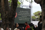
Memorial for quake victims to be revealed on 6th anniversary
Audio, Radio New Zealand
A memorial for the 185 people who died in the 2011 Christchurch earthquake will be blessed tonight, ahead of the unveiling tomorrow, on the sixth anniversary.
Bruce Springsteen fans queue for days ahead of SI show
Audio, Radio New Zealand
Some Bruce Springsteen fans have queued for days ahead of the Boss' show in Christchurch tomorrow night - on the eve of the sixth anniversary of the 2011 earthquake.
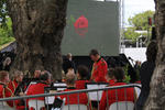
Christchurch remembers the deadly quake six years ago today
Audio, Radio New Zealand
Christchurch remembers six years on from the deadly earthquake.