
Search
found 139 results
Images for September 2010 Canterbury Earthquake; more images...


Architectural Feature: Lintel
Images, Canterbury Museum
One carved wooden lintel that decorated a doorway at Hadleigh House. Owner of Hadleigh House 1904-1921
Architectural Feature: Lintel
Images, Canterbury Museum
One carved wooden lintel that decorated a doorway in Hadleigh House. Owner of Hadleigh House 1904-1921
Architectural Feature: Fireplace Carvings
Images, Canterbury Museum
Twelve carved elements from a fireplace carving at Hadleigh House. Owner of Hadleigh House 1904-1921
Architectural Feature: Lintel
Images, Canterbury Museum
One carved wooden lintel that decorated a doorway in Hadleigh House. Owner of Hadleigh House 1904-1921
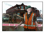
Digital Photograph: Demolition of the Former Convent of Our Lady of Mercy,…
Images, Canterbury Museum
One landscape colour digital photograph taken on 6 September 2011 showing demolition of the former Convent of Our Lady of Mercy. St Mary's School, run by the Sisters of Mercy, was also housed in this building. At the time of the 4 September 2010 earthquake the building was a private residence. Three years after the 2010-2011 earthquakes there a...
Digital Photograph: Earthquake damage to the Lyttelton Timeball Station
Images, Canterbury Museum
One landscape colour digital photograph taken on 25 February 2011 showing earthquake damage to the Lyttelton Timeball Station. Also visible is damage to some of the houses in the foreground such as temporarily patched holes in roofs where chimneys have fallen. Architect The Lyttelton Timeball Station was completed in 1876. Its function was to p...
T-shirt: Seismograph pattern of Christchurch Cathedral
Images, Canterbury Museum
One white cotton t-shirt with black seismograph-like patterns in the shape of ChristChurch Cathedral. Produced to commemorate the 7.1 magnitude earthquake that struck Canterbury at 4.35am on 4 September 2010. This t-shirt was designed and manufactured by Auckland based t-shirt company Mr Vintage in October 2010 to commemorate the 7.1 magnitude ...
Memorial Guitar: Kia Kaha
Images, Canterbury Museum
One white over-painted hand-made electric guitar made primarily from ash and maple timbers, also incorporating wood from a variety of historic buildings in Canterbury damaged or destroyed in the 2010 - 2011 earthquakes including the Arts Centre, Kutwell’s Warehouse, Lyttleton main street pub, Timeball Station, Carlton Hotel, Merivale shops, bui...
Architectural Feature: Lintel
Images, Canterbury Museum
One carved wooden lintel that decorated a doorway at Hadleigh House. Features a cross on shield motif. Owner of Hadleigh House 1904-1921
Digital Photograph: Demolition of the Empire Hotel, London Street, Lyttelt…
Images, Canterbury Museum
One landscape colour digital photograph taken on 19 April 2011 showing the demolition of the Empire Hotel on London Street. The photograph shows the façade of the hotel supported by the framework installed to brace the building after the 4 September 2010 earthquake. A crane is being used to enable the east wall to be demolished by hand to avoid...
Certificate: The Press Champion Canterbury Supreme Award
Images, Canterbury Museum
One framed certificate issued to SCIRT in 2013 to mark winning The Press Champion Canterbury Supreme Award in the Medium-Large Enterprise category.
Award: Canstruction Christchurch
Images, Canterbury Museum
One glass trophy presented to SCIRT IST to mark winning the Jurors Favourite Category in the 2014 Canstruction Christchurch competition.
Digital Photograph: Mitre Hotel
Images, Canterbury Museum
One landscape colour digital photograph taken on 26 May 2013 on the corner of Norwich Quay and Canterbury Street, Lyttelton. The photograph shows the Mitre Hotel surrounded by temporary fencing. Three years after the 2010-2011 earthquakes there are still many uncertainties about which buildings can or will be retained. These buildings, or parts...
Digital Photograph: Lyttelton Main School
Images, Canterbury Museum
One landscape colour digital photograph taken on 26 May 2013 of Lyttelton Main School. The photograph is taken from St Davids Street looking northwest. One of the broader consequences of the 2010-2011 Canterbury earthquakes has been the Ministry of Education’s Shaping Education – Future Direction Review of Schools in the Greater Christchurch Ar...
Digital Photograph: Irish Pub, south side of London Street, Lyttelton
Images, Canterbury Museum
One landscape colour digital photograph taken on 19 November 2011 showing earthquake repairs being undertaken to the Irish Pub on the south side of London Street. The Lyttelton streetscape has changed dramatically from its pre-earthquake appearance and will continue to change as new buildings are erected on empty sections. In this photograph Lo...
Digital Photograph: Earthquake damage to the Lyttelton Timeball Station.
Images, Canterbury Museum
One landscape colour digital photograph taken on 16 June 2011 showing the site of the Timeball Station after its collapse. Part of the ground floor remains visible. Photograph taken from Oxford Street Overbridge. Architect The 13 June 2011 earthquakes caused the collapse of the already damaged Lyttelton Timeball Station. After the 22 February ...
Chimney: Replica
Images, Canterbury Museum
Replica chimney comprising a chimney pot atop a lightweight brick chimney. The chimney is contextualised by a portion of slate roof, guttering and bricked house exterior below.
Award: The Press Champion Canterbury Supreme Award
Images, Canterbury Museum
One green koru shaped trophy issued to SCIRT in 2013 to mark winning The Press Champion Canterbury Supreme Award in the Medium-Large Enterprise category. Includes storage box, envelope and leaflet.
Spade: Student Volunteer Army
Images, Canterbury Museum
One black metal spade with plastic handle; white band towards handle. Spade is well used and features remnants of liquefaction. Used by Student Volunteer Army in the clean up after 4 September 2010 earthquake. It is estimated that 1,750 spades similar to this one were used in the cleanup of Christchurch after both the 4 September 2010 and 22 Fe...
Wine Bottle: The Day the Ground Moved Like Jelly
Images, Canterbury Museum
One 750ml green wine bottle with red coloured metal screw cap containing Mud House 2010 Marlborough Sauvignon Blanc ‘The Day the Ground Moved Like Jelly’; the front label has a drawing of an earthquake damaged house on a white background by Bella Kingi, while the label on the reverse details the fundraising effort supported by the sale of the bo...
3-D Model: Greendale and Associated Faults
Images, Canterbury Museum
One oblong perspex covered 3-D model of the fault plains associated with the 4 September 2010 Darfield earthquake; top of the model also acts as a map overlay. Geologists continue to study the 4 September 2010 earthquake and consider it is likely to have been a complex event with several faults rupturing simultaneously. This model provides one ...
Lunch Bag: Rechurch
Images, Canterbury Museum
One expandable oblong brown fabric bag produced by Christchurch church group Rechurch; black and green writing on the front and back. Used to deliver lunch to Student Volunteer Army clean up parties after the 4 September 2010 earthquake. This reusable fabric bag from the church group Rechurch, Christchurch was used to deliver lunches to the stu...
Dust Mask: 3M
Images, Canterbury Museum
One white dust mask with elastic strap to secure around the head. Black printing on the front reads: '3M 8000 / P1 / AS/NZS 1716'. Used by Student Volunteer Army in the clean up after 4 September 2010 earthquake. Face masks were recommended by Christchurch Public Health staff as a safety precaution for those handling liquefaction. Liquefaction ...
Wheelbarrow: Kelso
Images, Canterbury Museum
One black plastic barrelled wheelbarrow with a blue metal frame, black rubber handles and a pneumatic tyre; manufacturer's name in white on long sides and torn promotional label on short side near handles. Barrel is well used and contains remnants of liquefaction. Used by Student Volunteer Army in the clean up after 4 September 2010 earthquake. ...
Digital Photograph: Earthquake damage to searchlight emplacements, Godley …
Images, Canterbury Museum
One landscape colour digital photograph taken on 26 May 2013 showing the southern cliffs of Godley Head. Taken from the middle of the shipping channel. Some earthquake damage to the cliffs is visible. There were several major rock falls along the coastal cliffs near Christchurch and Lyttelton Harbour. At Godley Head these caused damage to the W...
Digital Photograph: Earthquake damage to Church of the Most Holy Trinity, …
Images, Canterbury Museum
One landscape colour digital photograph taken on 15 June 2011 showing earthquake damage to the Anglican Church of The Most Holy Trinity in Winchester Street, Lyttelton. Photograph shows collapsed roof of the nave and north transept. Photograph taken from the north side of the church. Architect The collapse of the Church of the Most Holy Trinity ...
Digital Photograph: Earthquake Damage to Lyttelton Roman Catholic and Diss…
Images, Canterbury Museum
One landscape colour digital photograph taken on 30 June 2011 showing earthquake damage to graves in Lyttelton Roman Catholic and Dissenters (Public) Cemeteries in Reserve Terrace. Most of the headstones and grave surrounds in the photograph show damage. Looking east in the Dissenters (Public) section of the cemetery. The Lyttelton cemeteries a...
Digital Photograph: Earthquake damage to a retaining wall, Lyttelton
Images, Canterbury Museum
One landscape colour digital photograph taken on 30 June 2011 showing earthquake damage to a section of retaining wall in Sumner Road. Plastic sheeting installed to stabilise previous damage and protect from water erosion is visible to the right of the photograph. Also visible in the photograph is a boarded up broken window and temporary safety ...
Digital Photograph: Earthquake damage to Church of the Most Holy Trinity, …
Images, Canterbury Museum
One landscape colour digital photograph taken on 15 June 2011 showing earthquake damage to the Anglican Church of The Most Holy Trinity in Winchester Street, Lyttelton. Photograph shows collapsed roof of the nave and north transept. Photograph taken from the northwest corner of the church. Architect The collapse of the Church of the Most Holy Tr...
Medal: The Brunel Medal
Images, Canterbury Museum
One silver medal awarded to SCIRT in October 2013 from the Institution of Civil Engineers in the United Kingdom in recognition of the excellent in civil engineering. Includes storage case and explanation sheet.