
Search
found 57 results
Images for 4; more images...


Digital Photograph: Flyers in the Window of the Lyttelton Information Cent…
Images, Canterbury Museum
One portrait colour digital photograph taken on 19 November 2011 showing the flyers in the window of the Lyttelton Information Centre on Oxford Street. The building was closed from 22 February 2011 until April 2013 due to the danger posed by the neighbouring building and then while repairs were scheduled and carried out. The flyers provided a sn...
Digital Photograph: The Loons (Lyttelton Working Mens' Club), Canterbury S…
Images, Canterbury Museum
One landscape colour digital photograph taken on 19 November 2011 showing temporary propping of the Lyttelton Working Mens' Club/ The Loons. Built in 1909 the building has had a variety of uses including a garage and the Lyttelton Waterside Workers Social Club. More recently the Lyttelton Working Mens' Club has provided rehearsal and performanc...
Digital Photograph: Lyttelton Sea Foods, Norwich Quay, Lyttelton
Images, Canterbury Museum
One landscape colour digital photograph taken on 19 November 2011 showing the temporary premises of Lyttelton Sea Foods in a relocatable building on Norwich Quay. The building is located on the site of the Lyttelton Hotel. Also visible in the photograph are (left to right) the side of Shadbolt House, the rear of the Pacifica Building which was t...
Digital Photograph: Lyttelton Bakery, corner Norwich Quay and Canterbury S…
Images, Canterbury Museum
One landscape colour digital photograph taken on 19 November 2011 showing the temporary premises of Lyttelton Bakery in a relocatable building on Norwich Quay. The building is located on the site of the Royal Hotel. Also visible in the photograph are (left to right up Canterbury Street) Lyttelton Service Station, Samo, Lyttelton Telephone Exchan...
Digital Photograph: Corner of London and Oxford Streets, Lyttelton
Images, Canterbury Museum
One landscape colour digital photograph taken on 19 November 2011 showing the site of the old Lyttelton Library, Council Chambers and Magistrates' Court on the corner of Oxford Street and Sumner Road. At the time of the 22 February 2011 Earthquake the building was in private ownership and was the premises of Moda Fotografica and a private resid...
Digital Photograph: Looking east from Norwich Quay, Lyttelton
Images, Canterbury Museum
One landscape colour digital photograph taken on 19 November 2011 looking east from Norwich Quay from approximately the base of Canterbury Street. Visible in the photograph are the partially deconstructed former Lyttelton Harbour Board Offices, the Holcim Cement Silos, the Oxford Street Railway Overbridge, Lyttelton Port of Christchurch's storag...
Digital Photograph: Posters in the Window of Leslie's Bookshop, London Str…
Images, Canterbury Museum
One landscape colour digital photograph taken on 19 November 2011 showing posters for the outdoor theatre production 'The Pirates of Corsair Bay' and the 2011 Lyttelton Summer Festival events scheduled for February and March 2011. The posters remained in the window of the red stickered building until it was demolished in early September 2012. A...
Digital Photograph: Shadbolt House, Norwich Quay, Lyttelton
Images, Canterbury Museum
One portrait colour digital photograph taken on 19 November 2011 showing Shadbolt House prior to its demolition. Architect Lyttelton's tallest building before its demolition was built in 1961 as the offices of the Lyttelton Harbour Board. At the time it was demolished the building was known as Shadbolt House and was owned by Independent Fisherie...
Digital Photograph: Earthquake Damage to Lyttelton Historical Museum, Glad…
Images, Canterbury Museum
One landscape colour digital photograph taken on 25 September 2011 showing the site of the Lyttelton Historical Museum on the corner of Gladstone Quay and Donald Street. The photograph shows the temporary fencing around the levelled site. The building visible at the rear is the former Municipal Stables on Donald Street. To the right of the phot...
Digital Photograph: Earthquake Damage to Lyttelton Historical Museum on Gl…
Images, Canterbury Museum
One landscape colour digital photograph taken on 14 July 2011 showing damage to the Lyttelton Historical Museum on the corner of Gladstone Quay and Donald Street. The photograph shows the safety fencing and containers installed after the 22 February 2011 earthquakes. Architect Closed after the September 2010 earthquakes, the Lyttelton Museum bu...
Digital Photograph: Artwork on the Site of the Harbourlight Theatre, Londo…
Images, Canterbury Museum
One portrait colour digital photograph taken on 23 July 2011 showing the artwork by Trent Hiles erected on the site of the Harbourlight Theatre on London Street. The artwork presents part of James K Baxter's poem 'High Country Weather' using the international code of signal flags. The artwork was installed as a Gap Filler project. The artwork r...
Digital Photograph: Former Convent of Our Lady of Mercy, Exeter Street, an…
Images, Canterbury Museum
One landscape colour digital photograph taken on 30 June 2011 showing earthquake damage to the former Convent of Our Lady of Mercy and to the Catholic Church of St Joseph the Worker. Photograph taken from St. Davids Street The sense of loss felt when confronted with the collapse or demolition of an historic building is compounded when that bui...
Digital Photograph: Temporary Premises of Lyttelton Bakery, corner of Norw…
Images, Canterbury Museum
One landscape colour digital photograph taken on 16 June 2011 showing the Lyttelton Bakery operating from a portable building on the Corner of Canterbury Street and Norwich Quay. This portable building has been placed on the site of the Royal Hotel. Also visible in the photograph are Shadbolt House and the rear of the buildings on the south side...
Digital Photograph: Earthquake damage to the Lyttelton Timeball Station.
Images, Canterbury Museum
One landscape colour digital photograph taken on 16 June 2011 showing the site of the Timeball Station after its collapse. Part of the ground floor remains visible. Photograph taken from Oxford Street Overbridge. Architect The 13 June 2011 earthquakes caused the collapse of the already damaged Lyttelton Timeball Station. After the 22 February ...
Digital Photograph: Earthquake damage to Church of the Most Holy Trinity, …
Images, Canterbury Museum
One landscape colour digital photograph taken on 15 June 2011 showing earthquake damage to the Anglican Church of The Most Holy Trinity in Winchester Street, Lyttelton. Photograph shows collapsed roof of the nave and north transept. Photograph taken from the north side of the church. Architect The collapse of the Church of the Most Holy Trinity ...
Digital Photograph: Earthquake Damage to Lyttelton Roman Catholic and Diss…
Images, Canterbury Museum
One landscape colour digital photograph taken on 30 June 2011 showing earthquake damage to graves in Lyttelton Roman Catholic and Dissenters (Public) Cemeteries in Reserve Terrace. Most of the headstones and grave surrounds in the photograph show damage. Looking east in the Dissenters (Public) section of the cemetery. The Lyttelton cemeteries a...
Digital Photograph: Earthquake Damage to Lyttelton Roman Catholic and Diss…
Images, Canterbury Museum
One landscape colour digital photograph taken on 30 June 2011 showing signs warning of the danger posed by unstable headstones in Lyttelton Roman Catholic and Dissenters (Public) Cemeteries in Reserve Terrace. Several toppled headstones and collapsed grave surrounds are visible in the photograph. Looking east from the main gate. The Lyttelton c...
Digital Photograph: Earthquake damage to a retaining wall, Lyttelton
Images, Canterbury Museum
One landscape colour digital photograph taken on 30 June 2011 showing earthquake damage to a section of retaining wall in Sumner Road. Plastic sheeting installed to stabilise previous damage and protect from water erosion is visible to the right of the photograph. Also visible in the photograph is a boarded up broken window and temporary safety ...
Digital Photograph: Earthquake damage to Church of the Most Holy Trinity, …
Images, Canterbury Museum
One landscape colour digital photograph taken on 15 June 2011 showing earthquake damage to the Anglican Church of The Most Holy Trinity in Winchester Street, Lyttelton. Photograph shows collapsed roof of the nave and north transept. Photograph taken from the northwest corner of the church. Architect The collapse of the Church of the Most Holy Tr...
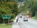
Digital Photograph: Demolition of former Library and Fire Station, corner …
Images, Canterbury Museum
One landscape colour digital photograph taken on 6 September 2011 showing the demolition of 2 Sumner Road, the former library and fire station. This building was a private residence at the time of its demolition. Photograph taken looking north on Oxford Street. Also visible in the photograph are the Lyttelton Information Centre, an entrance to ...
Book: Christchurch, A Nostalgic Tribute
Images, Canterbury Museum
One multi-coloured softcover book titled 'Christchurch, A Nostalgic Tribute' with colour photographs and text by Peter Morath, published by the Caxton Press, Christchurch, 2011. Christchurch city was badly damaged during the 4 September 2010 and 22 February 2011 earthquakes and will change dramatically as rebuilding progresses. ‘Christchurch: A...
Book: Quaky Cat
Images, Canterbury Museum
One blue soft cover children’s book titled 'Quaky Cat' with text by Diana Noonan and colour illustrations by Gavin Bishop. The earthquakes and accompanying aftershocks in Canterbury proved to be a very frightening experience, especially for children. This book was written in response to the 4 September 2010 earthquake to help children understan...
Ireos Search Light: White Light of Hope
Images, Canterbury Museum
One Space Cannon VH Ireos 7000 search light with pan and tilt ability and 7000 watt Xenon lamp. Reading on hour meter 02954.75 hours. One of the White Lights of Hope used as a symbol of support for Christchurch following the 22 February 2011 earthquake. The White Lights of Hope lit up the skies of Christchurch every night from 4 September 2011 ...
Digital Photograph: Former Convent of Our Lady of Mercy, Exeter Street, Ly…
Images, Canterbury Museum
One landscape colour digital photograph taken on 12 April 2011 showing earthquake damage to the former Convent of Our Lady of Mercy. St Mary's School, run by the Sisters of Mercy, was also housed in this building. At the time of the 4 September 2010 earthquake the building was a private residence. The sense of loss felt when confronted with the...
Digital Photograph: Former Convent of Our Lady of Mercy, Exeter Street, Ly…
Images, Canterbury Museum
One landscape colour digital photograph taken on 25 September 2011 showing the remaining portion of the former Convent of Our Lady of Mercy. St Mary's School, run by the Sisters of Mercy, was also housed in this building. At the time of the 4 September 2010 earthquake the building was a private residence. The picture shows the perimeter wall, t...
Book: My 26 Hours in a Concrete Coffin
Images, Canterbury Museum
Soft cover 57 page publication detailing the experience and rescue of Ann Bodkin from the Pyne Gould Corporation building following the 22 February 2011 earthquake. Account of her experiences of being trapped post 22 February 2011 earthquake.
Heart for Christchurch: Purple with Pink Rose
Images, Canterbury Museum
One felted purple 'Heart for Christchurch' decorated with a pink rose with green leaves and an orange loop at the top centre so the item can be displayed. Faint stitched inscription 'we are / with you' on reverse. Made for the people of Christchurch following the 22 February earthquake. Jill Gunn contributed this ‘Heart for Christchurch’ as a g...