Search

Digital Photograph: Earthquake damage to the London Street Restaurant on L…
Images, Canterbury Museum
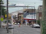
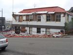
One landscape colour digital photograph taken on 27 April 2011 showing damage to the London Street Restaurant. Photograph taken looking west from the intersection of London Street with Oxford Street and Sumner Road. Adaptability and quick thinking has become a key part of business survival in post earthquake Canterbury. The owner of this bui...

Digital Photograph: Earthquake Damage and Demolition Work on London Street…
Images, Canterbury Museum
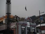
One landscape colour digital photograph taken on 27 April 2011 showing damage to London Street and demolition work being undertaken on the Harbourlight Theatre. Photograph taken looking west from the intersection of London Street with Oxford Street and Sumner Road. Architect In Christchurch's Central Business District many of the high profile d...

Digital Photograph: Earthquake damage on corner of Canterbury and London S…
Images, Canterbury Museum
One landscape colour digital photograph taken on 25 February 2011 showing earthquake damage to the corner of Canterbury and London Streets. The photograph is taken from Canterbury Street looking down hill. The buildings visible are The Volcano Restaurant, the Lyttelton Library, the Lyttelton Working Mens' Club (The Loons), and the Royal Hotel (o...

Digital Photograph: Earthquake Damage to the Norton Buildings on Oxford St…
Images, Canterbury Museum
One landscape colour digital photograph taken on 25 February 2011 showing damage to the Norton Buildings on Oxford Street. The photograph shows part of the first floor of the building and the façade collapsed onto the ground floor and out onto the street. The photograph was taken from St Davids Street looking west. Also visible in the photogra...

Digital Photograph: Victoria Street
Images, Canterbury Museum
One landscape colour digital photograph taken on 6 September 2010 showing earthquake damage to buildings on Victoria Street near Bealey Avenue. The red brick building is the Knox Church; it still stands on the corner of Bealey Avenue and Victoria Street following the earthquake, though some extreme measures were taken to make it safe. The red b...

Digital Photograph: The site of the Harbourlight Theatre, London Street, L…
Images, Canterbury Museum
One landscape colour digital photograph taken on 8 June 2011 showing the site of the Harbourlight Theatre on London Street. The site is fenced off, on the fence is the same heart shape which appears tied to a fence in a different part of London Street in 2013.17.39 A white painted wooden cross has been placed in the ground with 24 [street numbe...

Digital Photograph: Earthquake damage in Oxford Street, Lyttelton
Images, Canterbury Museum
One landscape colour digital photograph taken on 25 February 2011 showing earthquake damage on western side of Oxford Street, Lyttelton Taken from the footpath looking downhill from Lyttelton Main School. The buildings visible (from the foreground) are: London Street Restaurant; Bells Pharmacy; Maritime House (McKay - ISS Limited, Shipping Ag...

Digital Photograph: Earthquake damage on corner of Canterbury and London S…
Images, Canterbury Museum
One landscape colour digital photograph taken on 25 February 2011 showing earthquake damage to the premises of Ground Delicatessen on the corner of Canterbury and London Streets. The photograph shows the building's Canterbury Street façade. This building was initially built around 1864 as the Albion Hotel. After many modifications and changes ...

Digital Photograph: Earthquake damage on Canterbury Street, Lyttelton
Images, Canterbury Museum
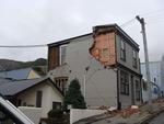
One landscape colour digital photograph taken on 25 February 2011 showing earthquake damage to houses on the western side of Canterbury Street between London and Winchester Streets. The photograph shows large sections of a brick firewall which have fallen onto the roof of the neighbouring house. The close proximity of buildings in Lyttelton led...

Digital Photograph: London Street, Lyttelton
Images, Canterbury Museum
One landscape colour digital photograph taken on 25 February 2011 showing damage to the Lyttelton Police Station on Sumner Road and London Street. Photograph taken looking west from St Davids Street. In December 2011, the New Zealand Police decided that the Lyttelton Police Station would be demolished. The building, which opened in 1882 was re...

Digital Photograph: Winchester Street, Lyttelton
Images, Canterbury Museum
One landscape colour digital photograph taken on 26 May 2013 on Winchester Street, Lyttelton. The photograph is taken looking south from the site of the Catholic Church of St Joseph the Worker to the site of the Anglican Church of the Most Holy Trinity. Visible are the removed top of the bell tower and porch. The damaged vicarage is at the weste...

Digital Photograph: Earthquake damage to St Joseph's Church, Winchester St…
Images, Canterbury Museum
One landscape colour digital photograph taken on 25 February 2011 showing earthquake damage to the Catholic Church of St Joseph the Worker in Winchester Street Lyttelton. Photograph shows the eastern side of the church. Photograph taken from St Davids Street. The earthquake damaged eastern wall of the Catholic Church of St Joseph the Worker sho...

Digital Photograph: Demolition on the corner of Canterbury and London Stre…
Images, Canterbury Museum
One landscape colour digital photograph taken on 27 April 2011 showing the demolition of the premises of Ground Delicatessen on the corner of Canterbury and London Streets. The photograph is taken from Canterbury Street. The site formerly occupied by Ground Delicatessen was made available for a Gap Filler initiative called the Lyttelton Petanqu...

Digital Photograph: Demolition of Coastal Living, London Street, Lyttelton
Images, Canterbury Museum
One landscape colour digital photograph taken on 15 April 2011 showing the demolition of Coastal Living Design Store on London Street. In Christchurch's Central Business District many of the high profile demolitions took place out of public view in the Red Zone. By contrast, the demolitions on London Street after the 22 February 2011 earthquake...

Digital Photograph: Earthquake Damage to Lyttelton Coffee Company, London …
Images, Canterbury Museum
One landscape colour digital photograph taken on 9 March 2011 showing earthquake damage to the Lyttelton Coffee Company Building on London Street. The photograph shows a fenced off section of the south side of London Street. Also visible in the photograph are the Lyttelton Four Square, and the gateway leading to the Wunderbar. Due to prior eart...

Digital Photograph: Vacant site on the corner of Canterbury and London Str…
Images, Canterbury Museum
One landscape colour digital photograph taken on 27 April 2011 showing the site occupied by the Volcano Restaurant, the Lava Bar, Lyttelton Fisheries and Coastal Living Design Store on London Street. The demolition of the Harbourlight Theatre is visible to the left of the photograph. The photograph is taken from Canterbury Street. The small siz...

Digital Photograph: Gaol Steps and Lyttelton Main School, Oxford Street, L…
Images, Canterbury Museum
One landscape colour digital photograph taken on 13 May 2011 showing the damage to the Gaol Steps between Oxford and St Davids Streets and the upper playground of Lyttelton Main School. The Gaol Steps are a pedestrian link between Oxford and St Davids Streets. In October 2013 these steps were closed and barricaded with temporary fencing because...

Digital Photograph: Earthquake Damage to Canterbury Hotel and shops. Oxfor…
Images, Canterbury Museum
One landscape colour digital photograph taken on 15 June 2011 showing earthquake damage to the former Canterbury Hotel and adjoining row of shops on Oxford Street. This photograph was taken on Oxford Street and shows the collapsed façade of the row of shops behind safety fencing, the interior of the building is exposed. Shadbolt House is visib...

Digital Photograph: Earthquake Damage to Canterbury Hotel and shops. Oxfor…
Images, Canterbury Museum
One landscape colour digital photograph taken on 15 June 2011 showing earthquake damage to the former Canterbury Hotel and adjoining row of shops on Oxford Street. This photograph was taken on Oxford Street and shows the collapsed façade of the row of shops behind safety fencing, the interior of the building is exposed. The design of many older...
Intersection of Colombo and High Streets
Images, UC QuakeStudies
A black and white historic photograph of the intersection of Colombo and High Streets, with the Fishers' building visible on the left, [ca. 1884].

Digital Photograph: North side of London Street, Lyttelton
Images, Canterbury Museum
One landscape colour digital photograph taken on 19 November 2011 showing part of the north side of London Street. The properties visible in the photograph are (from left to right) Tommy Changs Café, Canterbury Street, site of theatre erected for the Loons Circus Theatre Company production of Macbeth (being dismantled), Lyttel Arthouse (closed),...

Digital Photograph: London and Oxford Streets
Images, Canterbury Museum
One landscape colour digital photograph taken on 27 May 2013 of London Street in Lyttelton. Taken from Sumner Road looking west across the intersection of London and Oxford Streets. The photograph shows several empty sections and the remaining buildings. The Lyttelton streetscape has changed dramatically from its pre-earthquake appearance and w...

Digital Photograph: Elevated view of London Street, Lyttelton
Images, Canterbury Museum
One landscape colour digital photograph taken on 26 May 2013 of London Street, Lyttelton. The photograph was taken from St Davids Street looking west. The roofs of the portable buildings forming the temporary Lyttelton Police station are visible in the foreground. The Lyttelton Port Company offices and Tunnel Portal are prominent in the midgrou...

Digital Photograph: Decoration on Safety Fence surrounding the Royal Hotel…
Images, Canterbury Museum
One landscape colour digital photograph taken on 9 March 2011 showing a string of handmade bunting made from a cream woollen blanket with "KIA KAHA LYTTELTON" stitched onto the pennants in red wool. The Fence was located around the street frontages of the Royal Hotel on the Corner of Norwich Quay and Canterbury Street. Also visible in the photo...
View of Tuam Street, Christchurch, to the east
Images, UC QuakeStudies
A black and white historic photograph of Tuam Street, ca. 1884, with the Odeon Theatre on the right and White's Furnishing Warehouse visible in the distance.
Photographs of central Christchurch after the 2010 and 2011 earthquakes
Images, Alexander Turnbull Library
Photographs of central Christchurch after the 2010-2012 earthquakes taken 25 February 2012 by Sean McMahon. Locations are chiefly Manchester, Saint Asaph, Cashel, Columbo and Lichfield Streets, and the Bridge of Remembrance. Images show fencing around areas closed to the public, damaged and collapsed commercial buildings, cleared sites, re-opened Cashel Street area with shops and a cafe. Source of title - Title supplied by Library Quantity: 34 digital photograph(s).

Digital Photograph: Corner of London and Canterbury Streets, Lyttelton
Images, Canterbury Museum
One landscape colour digital photograph taken on 19 November 2011 showing the corner of London and Canterbury Streets. Visible in the photograph (left to right) are the Lyttelton Library, Freemans Dining Room, Ray White Real Estate and Min Sargison Real Estate on London Street. The photograph is looking to the southeast. The site of the Timebal...
Exterior of Clarendon Hotel, from Oxford Terrace, Worcester Street corner
Images, UC QuakeStudies
A black and white historic photograph of the exterior Clarendon Hotel, designed by J.C. Maddison. The photograph was taken from the corner of Oxford Terrace and Worcester Street, [1903].
Reconstruction of T. Armstrong & Co. premises, corner of Colombo and Armag…
Images, UC QuakeStudies
A black and white historic photograph of the reconstruction of Armstrong & Co., a major department store on the corner of Colombo and Armagh Streets, [ca. 1930].

Digital Photograph: Former Convent of Our Lady of Mercy, Exeter Street, an…
Images, Canterbury Museum
One landscape colour digital photograph taken on 30 June 2011 showing earthquake damage to the former Convent of Our Lady of Mercy and to the Catholic Church of St Joseph the Worker. Photograph taken from St. Davids Street The sense of loss felt when confronted with the collapse or demolition of an historic building is compounded when that bui...
