
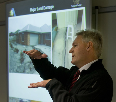
Photograph captioned by Fairfax, "Nick Rogers, geotechnical specialist, explains the EQC plan to remediate land damaged in the Canterbury earthquake".
Photograph captioned by Fairfax, "Nick Rogers, geotechnical specialist, explains the EQC plan to remediate land damaged in the Canterbury earthquake".

Photograph captioned by Fairfax, "Nick Rogers, geotechnical specialist, explains the EQC plan to remediate land damaged in the Canterbury earthquake".

Photograph captioned by Fairfax, "Nick Rogers, geotechnical specialist, explains the EQC plan to remediate land damaged in the Canterbury earthquake".

Photograph captioned by Fairfax, "Nick Rogers, geotechnical specialist, explains the EQC plan to remediate land damaged in the Canterbury earthquake".

A photograph of the helicopter used by a team from Geotechnical Extreme Events Reconnaissance (GEER) to take aerial photographs of Canterbury following the 4 September earthquake.

Photograph captioned by Fairfax, "Gerry Brownlee (left), EQC CEO Ian Simpson, and geotechnical specialist Nick Rogers explain the EQC plan to remediate land damaged in the Canterbury earthquake".

An aerial photograph of Christchurch following the 4 September earthquake, taken from a helicopter.

An aerial photograph of rural Canterbury following the 4 September earthquake, taken from a helicopter.

An aerial photograph of the port of Lyttelton following the 4 September earthquake, taken from a helicopter.

An aerial photograph of rural Canterbury following the 4 September earthquake, taken from a helicopter.

An aerial photograph of Canterbury following the 4 September earthquake, taken from a helicopter.

An aerial photograph of Canterbury and the Waimakariri River following the 4 September earthquake, taken from a helicopter.

An aerial photograph of Canterbury following the 4 September earthquake, taken from a helicopter.

An aerial photograph of Canterbury and the Waimakariri River following the 4 September earthquake, taken from a helicopter.

An aerial photograph of Canterbury following the 4 September earthquake, taken from a helicopter.

An aerial photograph of Canterbury following the 4 September earthquake, taken from a helicopter.

An aerial photograph of the port of Lyttelton following the 4 September earthquake, taken from a helicopter.

An aerial photograph of the port of Lyttelton following the 4 September earthquake, taken from a helicopter.

An aerial photograph of the port of Lyttelton following the 4 September earthquake, taken from a helicopter.

An aerial photograph of the port of Lyttelton following the 4 September earthquake, taken from a helicopter.

An aerial photograph of rural Canterbury following the 4 September earthquake, taken from a helicopter.

An aerial photograph of rural Canterbury following the 4 September earthquake, taken from a helicopter.

An aerial photograph of rural Canterbury following the 4 September earthquake, taken from a helicopter.

An aerial photograph of rural Canterbury following the 4 September earthquake, taken from a helicopter.

An aerial photograph of rural Canterbury following the 4 September earthquake, taken from a helicopter.

An aerial photograph of rural Canterbury following the 4 September earthquake, taken from a helicopter.

An aerial photograph of rural Canterbury following the 4 September earthquake, taken from a helicopter.

An aerial photograph of rural Canterbury following the 4 September earthquake, taken from a helicopter.

An aerial photograph of rural Canterbury following the 4 September earthquake, taken from a helicopter.