Search
Vulnerability to Seismic Hazards in Coastal and Riverside Communities, map…
Images, UC QuakeStudies
A map of the Christchurch landscape.
Paul and Sam Corliss's Street Art Photograph (2015:03:22 14:49:40)
Images, UC QuakeStudies
A photograph of street art painted on a fence at Central New Brighton School. The artwork depicts a landscape.
Paul and Sam Corliss's Street Art Photograph (2015:03:22 14:49:34)
Images, UC QuakeStudies
A photograph of street art painted on a fence at Central New Brighton School. The artwork depicts a landscape.
Paul and Sam Corliss's Street Art Photograph (2015:03:22 14:53:14)
Images, UC QuakeStudies
A photograph of street art painted on a fence at Central New Brighton School. The artwork depicts a landscape.
Paul and Sam Corliss's Street Art Photograph (2015:03:22 14:49:25)
Images, UC QuakeStudies
A photograph of street art painted on a fence at Central New Brighton School. The artwork depicts a landscape.
Paul and Sam Corliss's Street Art Photograph (2015:03:22 14:49:36)
Images, UC QuakeStudies
A photograph of street art painted on a fence at Central New Brighton School. The artwork depicts a landscape.

Digital Photograph: Corner of London and Canterbury Streets, Lyttelton
Images, Canterbury Museum
One landscape colour digital photograph taken on 19 November 2011 showing the site of the Albion Hotel/ Ground Delicatessen. After the demolition of the building the site was used for a Gap Filler initiative called the Lyttelton Petanque Club. The photograph shows the temporary furniture, landscaping and public Petanque court. The site formerl...
Christchurch Press Infographic: 27 December 2012 (1)
Images, UC QuakeStudies
The front page layout for the Summer Press section of the Press, featuring an essay about a love affair with the Canterbury landscape.
BeckerFraserPhotos June 2011 photograph 343
Images, UC QuakeStudies
Fallen rocks from a landscape feature in front of an apartment building on Ferry Road. Liquefaction silt can be seen on the driveway.
Paul and Sam Corliss's Street Art Photograph (2015:03:22 14:34:52)
Images, UC QuakeStudies
A photograph of street art on the wall of S&S Warehouse between Brighton Mall and Hawke Street. It depicts a fantasy landscape.
Nisbet, Alastair, 1958- :'Looks like drought on the landscape!' 9 March 20…
Images, Alexander Turnbull Library
The New Zealand public contemplate a dead drought stricken landscape. As well as lack of water, there is a lack of moderate pay scales for CEOs, satisfaction with EQC, quality TV, generous insurance companies, brilliant Solid Energy management, the integrity of John Banks (and by implication that of other MPs), quality education ministers, worthwhile overseas trips by the Prime Minister, 'clever' NZ First MPs and a boost for the West Coast among others. Considered from a Canterbury perspective, the drought of early 2013 becomes a symbol for many of the recent political and social ailments afflicting the land. Quantity: 1 digital cartoon(s).
Paul and Sam Corliss's Street Art Photograph (2015:03:22 14:35:30)
Images, UC QuakeStudies
A photograph of a section of a piece of street art on the wall of a building between Brighton Mall and Hawke Street. This section of the artwork depicts a landscape.
Paul and Sam Corliss's Street Art Photograph (2015:03:22 14:35:26)
Images, UC QuakeStudies
A photograph of a section of a piece of street art on the wall of a building between Brighton Mall and Hawke Street. This section of the artwork depicts a landscape.
Paul and Sam Corliss's Street Art Photograph (2015:03:22 14:35:28)
Images, UC QuakeStudies
A photograph of a section of a piece of street art on the wall of a building between Brighton Mall and Hawke Street. This section of the artwork depicts a landscape.
Canterbury from the air... AFTERSHOCKS. 6 September 2010
Images, Alexander Turnbull Library
The word 'AFTERSHOCKS' appears printed across the Canterbury landscape. Text reads 'Canterbury from the air...' Refers to the earthquake of 4th September and the frequent aftershocks that continued for at least two weeks. Quantity: 1 digital cartoon(s).

Quilt: Re-emergence
Images, Canterbury Museum
Semi-circular quilt made from cotton, silk and bandage material to commemorate the 22 February 2011 earthquake. The quilt references Christchurch landscape features, buildings and soil profiles and displays 185 sewn crosses, eight facial profiles and a Harakeke (flax).

Digital Photograph: Looking east from Norwich Quay, Lyttelton
Images, Canterbury Museum
One landscape colour digital photograph taken on 19 November 2011 looking east from Norwich Quay from approximately the base of Canterbury Street. Visible in the photograph are the partially deconstructed former Lyttelton Harbour Board Offices, the Holcim Cement Silos, the Oxford Street Railway Overbridge, Lyttelton Port of Christchurch's storag...

Digital Photograph: Earthquake damage in Oxford Street, Lyttelton
Images, Canterbury Museum
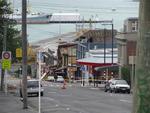
One landscape colour digital photograph taken on 25 February 2011 showing earthquake damage on western side of Oxford Street, Lyttelton Taken from the footpath looking downhill from Lyttelton Main School. The buildings visible (from the foreground) are: London Street Restaurant; Bells Pharmacy; Maritime House (McKay - ISS Limited, Shipping Ag...

Digital Photograph: Earthquake damage in Oxford Street, Lyttelton
Images, Canterbury Museum
One landscape colour digital photograph taken on 25 February 2011 showing earthquake damage on eastern side of Oxford Street, Lyttelton Taken from the footpath looking downhill from opposite Lyttelton Main School. The Buildings visible are the premises of Moda Fotografica (former Library and Council Chambers), a private residence (former Libra...

Digital Photograph: Earthquake Damage on Norwich Quay, Lyttelton
Images, Canterbury Museum
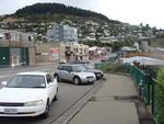
One landscape colour digital photograph taken on 25 February 2011 showing earthquake damage on Norwich Quay. The photograph is taken from approximately the intersection of Sutton and Norwich Quays looking east along Norwich Quay. The photograph also shows the eastern slope of Lyttelton and the damaged Timeball Station. Norwich Quay’s streetscap...
The River Photograph 2013:10:26 (2)
Images, UC QuakeStudies
A photograph of a floating installation on the Avon River. The installation consists of four chairs and a table situated on a grass-covered platform. It was created by students from Lincoln University's School of Landscape Architecture for Canterbury Tales, a carnivalesque procession and the main event of FESTA 2013.

Digital Photograph: Earthquake damage on corner of Canterbury and London S…
Images, Canterbury Museum
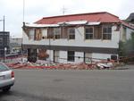
One landscape colour digital photograph taken on 25 February 2011 showing earthquake damage to the premises of Ground Delicatessen on the corner of Canterbury and London Streets. The photograph shows the building's Canterbury Street façade. This building was initially built around 1864 as the Albion Hotel. After many modifications and changes ...

Digital Photograph: Earthquake Damage to Lyttelton Historical Museum on Gl…
Images, Canterbury Museum
One landscape colour digital photograph taken on 25 February 2011 showing damage to the Lyttelton Historical Museum on the corner of Gladstone Quay and Donald Street. The photograph shows bracing and safety fencing installed after the September 2010 earthquakes. Architect Closed after the September 2010 earthquakes, the Lyttelton Museum buildin...

Digital Photograph: Hagley Park
Images, Canterbury Museum
One landscape colour digital photograph taken on 6 September 2010 showing water table alteration in Hagley Park from near the Armagh Street bridge. Localised flooding was an almost immediate after effect of the 2010-2011 Canterbury earthquakes. Some areas of Christchurch were submerged, sometimes for several days, following the earthquake espec...

Digital Photograph: Van outside Christchurch Chinese Methodist Church
Images, Canterbury Museum
One landscape colour digital photograph taken on 6 September 2010 showing earthquake damage to a van caused by red bricks from the Christchurch Chinese Methodist Church, 165 Papanui Road. The Christchurch Chinese Methodist Church on Papanui Road sustained severe damage during the 4 September 2010 earthquake. Constructed from unreinforced red br...
The River Photograph 2013:10:27 (2)
Images, UC QuakeStudies
A photograph of a floating installation titled The River on the Avon River. The installation consists of four chairs and a table situated on a grass-covered platform. It was created by students from Lincoln University's School of Landscape Architecturefor Canterbury Tales, a carnivalesque procession and the main event of FESTA 2013.
The River Photograph 2013:10:27 (1)
Images, UC QuakeStudies
A photograph of a floating installation titled The River on the Avon River. The installation consists of four chairs and a table situated on a grass-covered platform. It was created by students from Lincoln University's School of Landscape Architecturefor Canterbury Tales, a carnivalesque procession and the main event of FESTA 2013.

Digital Photograph: Earthquake damage to Church of the Most Holy Trinity, …
Images, Canterbury Museum
One landscape colour digital photograph taken on 25 February 2011 showing earthquake damage to the Anglican Church of The Most Holy Trinity in Winchester Street Lyttelton. Photograph shows the bracing to the northern transept erected after the 4 September 2010 earthquake. Architect The earthquake damaged northern wall of the Anglican Church of t...

Digital Photograph: Earthquake damage on corner of Canterbury and London S…
Images, Canterbury Museum
One landscape colour digital photograph taken on 25 February 2011 showing earthquake damage to the corner of Canterbury and London Streets. The photograph is taken from Canterbury Street looking down hill. The buildings visible are The Volcano Restaurant, the Lyttelton Library, the Lyttelton Working Mens' Club (The Loons), and the Royal Hotel (o...
