Search

Digital Photograph: Earthquake Damage on Norwich Quay, Lyttelton
Images, Canterbury Museum
One landscape colour digital photograph taken on 25 February 2011 showing earthquake damage on Norwich Quay. The photograph is taken from approximately the intersection of Sutton and Norwich Quays looking east along Norwich Quay. The photograph also shows the eastern slope of Lyttelton and the damaged Timeball Station. Norwich Quay’s streetscap...

Digital Photograph: Earthquake damage to St Joseph's Church, Winchester St…
Images, Canterbury Museum
One portrait colour digital photograph taken on 25 February 2011 showing earthquake damage to the Catholic Church of St Joseph the Worker in Winchester Street Lyttelton. Photograph shows the main doors and roof at southern end of church. Nineteenth century stone buildings are particularly vulnerable to earthquake damage as the individual compon...
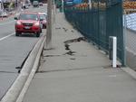
Digital Photograph: Earthquake Damage to Road on Norwich Quay, Lyttelton
Images, Canterbury Museum
One landscape colour digital photograph taken on 25 February 2011 showing earthquake damage to the road, footpath and retaining wall on Norwich Quay. The photograph is taken from below the intersection of Norwich Quay and Canterbury Street looking east along Norwich Quay. Unlike most areas of Christchurch, land damage on the Port Hills was due ...

Digital Photograph: Earthquake damage to St Joseph's Church, Winchester St…
Images, Canterbury Museum
One landscape colour digital photograph taken on 25 February 2011 showing earthquake damage to the Catholic Church of St Joseph the Worker in Winchester Street Lyttelton. Photograph shows the eastern side of the church. Photograph taken from St Davids Street. The earthquake damaged eastern wall of the Catholic Church of St Joseph the Worker sho...

Digital Photograph: Earthquake Damage to Dry Dock Pump House, Lyttelton
Images, Canterbury Museum
One portrait colour digital photograph taken on 1 March 2011 showing earthquake damage to the Dry Dock Pump House. Photograph taken from Dampiers Bay Pile Moorings showing the eastern end of the building and the Cassion. Engineer The brick pump house for the Lyttelton Graving or Dry Dock was damaged in the 22 February 2011 earthquake. Lyttelton...

Digital Photograph: Earthquake Damage to Buildings and Car on Norwich Quay…
Images, Canterbury Museum
One portrait colour digital photograph taken on 25 February 2011 showing the damaged façade of a two storey shop on Norwich Quay. The brick wall has completely fallen off the top storey and crushed a car parked on the footpath outside. Damage to the Lyttelton Hotel is visible to the left of the photo. The design of many older commercial build...

Digital Photograph: Car damaged by chimney
Images, Canterbury Museum
One landscape colour digital photograph taken on 1 December 2010 showing a chimney, dislodged by the 4 September 2010 earthquake, atop a 1972 Toyota Crown car. The car to Andrie Woodroffe of 82 Hartley Avenue, Strowan. Car belonged to The chimney that crushed this car in Strowan, Christchurch was thrown from the roof of the house behind it, show...

Digital Photograph: Car damaged by chimney
Images, Canterbury Museum
One portrait colour digital photograph taken on 1 December 2010 showing a chimney, dislodged by the 4 September 2010 earthquake, atop a 1972 Toyota Crown car. The car to Andrie Woodroffe of 82 Hartley Avenue, Strowan. Car belonged to The chimney that crushed this car in Strowan, Christchurch was thrown from the roof of the house behind it, showi...

Digital Photograph: Earthquake damage to Church of the Most Holy Trinity, …
Images, Canterbury Museum
One landscape colour digital photograph taken on 25 February 2011 showing earthquake damage to the Anglican Church of The Most Holy Trinity in Winchester Street Lyttelton. Photograph shows the bracing to the northern transept erected after the 4 September 2010 earthquake. Architect The earthquake damaged northern wall of the Anglican Church of t...

Digital Photograph: Earthquake damage to the Lyttelton Timeball Station
Images, Canterbury Museum
One landscape colour digital photograph taken on 25 February 2011 showing earthquake damage to the Lyttelton Timeball Station. Also visible is damage to some of the houses in the foreground such as temporarily patched holes in roofs where chimneys have fallen. Architect The Lyttelton Timeball Station was completed in 1876. Its function was to p...

Digital Photograph: Earthquake damage to searchlight emplacements, Godley …
Images, Canterbury Museum
One landscape colour digital photograph taken on 26 May 2013 showing the southern cliffs of Godley Head. Taken from the middle of the shipping channel. Some earthquake damage to the cliffs is visible. There were several major rock falls along the coastal cliffs near Christchurch and Lyttelton Harbour. At Godley Head these caused damage to the W...
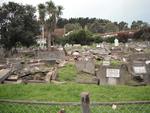
Digital Photograph: Earthquake Damage to Lyttelton Roman Catholic and Diss…
Images, Canterbury Museum
One landscape colour digital photograph taken on 30 June 2011 showing earthquake damage to graves in Lyttelton Roman Catholic and Dissenters (Public) Cemeteries in Reserve Terrace. Most of the headstones and grave surrounds in the photograph show damage. Looking east in the Dissenters (Public) section of the cemetery. The Lyttelton cemeteries a...

Digital Photograph: Earthquake damage to a retaining wall, Lyttelton
Images, Canterbury Museum
One landscape colour digital photograph taken on 30 June 2011 showing earthquake damage to a section of retaining wall in Sumner Road. Plastic sheeting installed to stabilise previous damage and protect from water erosion is visible to the right of the photograph. Also visible in the photograph is a boarded up broken window and temporary safety ...
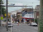
Digital Photograph: Earthquake damage in Oxford Street, Lyttelton
Images, Canterbury Museum
One landscape colour digital photograph taken on 25 February 2011 showing earthquake damage on western side of Oxford Street, Lyttelton Taken from the footpath looking downhill from Lyttelton Main School. The buildings visible (from the foreground) are: London Street Restaurant; Bells Pharmacy; Maritime House (McKay - ISS Limited, Shipping Ag...

Digital Photograph: Earthquake damage in Oxford Street, Lyttelton
Images, Canterbury Museum
One landscape colour digital photograph taken on 25 February 2011 showing earthquake damage on eastern side of Oxford Street, Lyttelton Taken from the footpath looking downhill from opposite Lyttelton Main School. The Buildings visible are the premises of Moda Fotografica (former Library and Council Chambers), a private residence (former Libra...
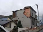
Digital Photograph: Earthquake damage on Canterbury Street, Lyttelton
Images, Canterbury Museum
One landscape colour digital photograph taken on 25 February 2011 showing earthquake damage to houses on the western side of Canterbury Street between London and Winchester Streets. The photograph shows large sections of a brick firewall which have fallen onto the roof of the neighbouring house. The close proximity of buildings in Lyttelton led...
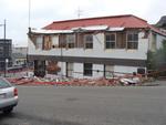
Digital Photograph: Earthquake damage on corner of Canterbury and London S…
Images, Canterbury Museum
One landscape colour digital photograph taken on 25 February 2011 showing earthquake damage to the premises of Ground Delicatessen on the corner of Canterbury and London Streets. The photograph shows the building's Canterbury Street façade. This building was initially built around 1864 as the Albion Hotel. After many modifications and changes ...

Digital Photograph: Exterior of Christchurch Chinese Methodist Church
Images, Canterbury Museum
One portrait colour digital photograph taken on 6 September 2010 showing earthquake damage to the red brick building of the Christchurch Chinese Methodist Church, 165 Papanui Road. The Christchurch Chinese Methodist Church on Papanui Road sustained severe damage during the 4 September 2010 earthquake. The church still stands although financial ...

Digital Photograph: Red brick fence
Images, Canterbury Museum
One landscape colour digital photograph taken on 6 September 2010 showing earthquake damage to a red brick fence on Bealey Avenue. Unreinforced brick masonry was particularly susceptible to damage during the 2010-2011 Canterbury earthquakes. Walls and fences constructed from on many properties were shaken loose causing piles of rubble to litter...

Digital Photograph: Earthquake Damage and Demolition Work on London Street…
Images, Canterbury Museum
One landscape colour digital photograph taken on 27 April 2011 showing damage to London Street and demolition work being undertaken on the Harbourlight Theatre. Photograph taken looking west from the intersection of London Street with Oxford Street and Sumner Road. Architect In Christchurch's Central Business District many of the high profile d...
Earthquake damage to the road from Cheviot to Port Robinson
Images, Alexander Turnbull Library
Earthquake damage to the road from Cheviot to Port Robinson, 1901. Taken by an unidentified photographer. This is a copy of a photograph from `The Weekly Press', Nov 27, 1901 Note on back of file print reads: "Fissures on the road from Cheviot to Port Robinson. There is a creek on the right side of the road, and below the fissure the road has fallen towards it.....and is 2 1/2' below its proper level. The fissures are 2 1/2' deep" (Probably the caption from `The Weekly Press') Quantity: 1 b&w original negative(s).
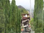
Digital Photograph: Earthquake damage to the old Vicarage, Lyttelton
Images, Canterbury Museum
One landscape colour digital photograph taken on 25 February 2011 showing the damage to the former Anglican Vicarage on Ripon Street Lyttelton. Taken from the footpath. Architect The sense of loss felt when confronted with the collapse or demolition of an historic building is compounded when that building is also a home. While the community sees...

Digital Photograph: Earthquake damage to St John's Church, Winchester Stre…
Images, Canterbury Museum
One landscape colour digital photograph taken on 25 February 2011 showing earthquake damage to the Presbyterian Church of St John in Winchester Street Lyttelton. Photograph shows the main doors, roof and collapsed tower at southern end of church. Architect St John's Lyttelton was one of the oldest Presbyterian Churches in Canterbury. The New Ze...
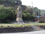
Digital Photograph: Earthquake Damage to Lyttelton Cenotaph on Simeon Quay…
Images, Canterbury Museum
One landscape colour digital photograph taken on 1 March 2011 showing earthquake damage to the Lyttelton Cenotaph on Simeon Quay. Designer The New Zealand Flag at the Lyttelton War Memorial, along with those around the country, flew at half mast for several days following the 22 February 2011 earthquakes. Following further aftershocks the Cenota...

Digital Photograph: Van outside Christchurch Chinese Methodist Church
Images, Canterbury Museum
One landscape colour digital photograph taken on 6 September 2010 showing earthquake damage to a van caused by red bricks from the Christchurch Chinese Methodist Church, 165 Papanui Road. The Christchurch Chinese Methodist Church on Papanui Road sustained severe damage during the 4 September 2010 earthquake. Constructed from unreinforced red br...

Digital Photograph: Exterior of Christchurch Chinese Methodist Church
Images, Canterbury Museum
One landscape colour digital photograph taken on 6 September 2010 showing earthquake damage to the red brick building of the Christchurch Chinese Methodist Church, 165 Papanui Road. The Christchurch Chinese Methodist Church on Papanui Road sustained severe damage during the 4 September 2010 earthquake. The red placards placed on the door of the...

Digital Photograph: Exterior of Christchurch Chinese Methodist Church
Images, Canterbury Museum
One landscape colour digital photograph taken on 6 September 2010 showing earthquake damage and a red placard on the red brick building of the Christchurch Chinese Methodist Church, 165 Papanui Road. The Christchurch Chinese Methodist Church on Papanui Road sustained severe damage during the 4 September 2010 earthquake. The red placards placed ...

Digital Photograph: Earthquake damage to the London Street Restaurant on L…
Images, Canterbury Museum
One landscape colour digital photograph taken on 27 April 2011 showing damage to the London Street Restaurant. Photograph taken looking west from the intersection of London Street with Oxford Street and Sumner Road. Adaptability and quick thinking has become a key part of business survival in post earthquake Canterbury. The owner of this bui...

Digital Photograph: Earthquake damage to St John's Church, Winchester Stre…
Images, Canterbury Museum
One landscape colour digital photograph taken on 15 June 2011 showing earthquake damage to the Presbyterian Church of St John in Winchester Street, Lyttelton. Photograph shows the collapsed roof and tower. The photograph is taken from the southeast corner of the church. Architect St John's Lyttelton was one of the oldest Presbyterian Churches in...

Pipe: Sewage
Images, Canterbury Museum
Brown ceramic sewage pipe damaged by the 22 February 2011 and 13 June 2011 earthquakes.
