Cordoned off after damage from the earthquakes.

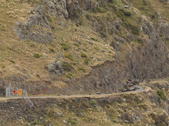
Obvious seeing why the Summit Road has been closed below Mt Cavendish since the February 22 2011 earthquake. There are some large rocks there!

Obvious seeing why the Summit Road has been closed below Mt Cavendish since the February 22 2011 earthquake. There are some large rocks there!

17mm M42 Takumar Fisheye on a Canon 1D MkIII (1.3x crop factor) via an adaptor ring.

Went into this cafe a few times in years gone by (all on camera club field trips or photowalks). It was a nice two-storey building then. Not now after the earthquakes of 2010 and 2011.

None

None

Built in the early 1960s for the Lyttelton Road Tunnel, it was severley damaged in the February 2011 earthquake and is not currently used.

None

None

None

None

20120805_7441_1D3-600 Newstalk ZB building starting to go down 06
#2642

20120805_7586_1D3-600 30 seconds later the dust drifts across the city.
Following the demolition of the earthquake damaged Newstalk ZB building.
#2649

Houses teeter over the edge above Redcliffs School.

20120131_8174_1D3-400 Eathquake damage
Houses above Main Road, Sumner.
#2153

Damaged houses above Shag Rock.

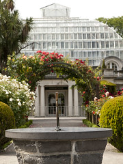
Cunningham House at the Christchurch Botanic Gardens is still closed due to earthquake damage. I wonder if it will ever re-open or suffer the demolition fate many other iconic structures in Christchurch have.

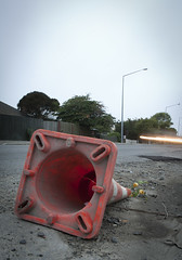
A month after the 1st anniversary of the deadly Christchurch earthquake (22/02/11) a road cone lies on New Brighton Road, alongside the Avon River.
Part of the earthquake 1st anniversary remembrance was for people to place flowers in road cones (and there are hundreds of thousands in the city). Many had flowers in them, as this one did.
Photo ...

Part of a house that fell can be seen on the rocks above right hand containers.

Part of the container wall to stop rock falls on Main Road, Sumner.

The small wharf area of the now gone Pleasant Point Yacht Club has already been taken over by the Pied Shags (cormorants).
It is under water now except for low tide. Note the dead pine tree in background. Many have died because of the salt water their roots are in.

Shot from up Hunstbury Hill with a 600mm f/4 on a very grey morning. 8am demolition. The guy behind me only looked up when the sounds of the explosion reahed us and the building was half way down!

The sea wall at Beachville Road, Redcliffs, after the earthquake. It used to be straight and level - not now!
As a teenager I went fishing off this wall.

What more can one say except that Shag Rock is now about one third it's original height. Whitewash Head in the background with the road that now drops over a cliff.

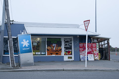
20120321_2397_1D3-47 Beachcomber Dairy
Corner of New Brighton Road and Rawson Street, New Brighton. This diary is inside the suburban red zone and will probably be demolished some time in the future. See how the earthquakes have moved the footpath - the post and phone box used to stand straight! This is one of the Teleccom Wi-Fi hotspot boo...

Demolition of the relatively new seven-storey Waters Edge Apartments in Ferrymead continues. CERES Environmental NZ are doing the job for CERA (Canterbury Earthquake Recovery Authority).
Some will be pleased to see this block go as there was lot of resentment to it being built on the site of the old Ferrymead Tavern,
Selected for Explore, #347...
