Toppled grain silos on the outskirts of Darfield near the epicentre of the magnitude 7,1 earthquake that struck on Saturday 4 September 2010.

Tension cracks at least 300 mm deep, on the previously unknown faultline from which the Saturday 4 September 2010 earthquake originated.

This beautiful building on Madras Street is red stickered and may be condemned if the structural damage it suffered in the magnitude 7,1 earthquake on Saturday 4 September 2010 cannot be repaired.

Toppled grain silos on the outskirts of Darfield near the epicentre of the magnitude 7,1 earthquake that struck on Saturday 4 September 2010.

This beautiful building on Madras Street is red stickered and may be condemned if the structural damage it suffered in the magnitude 7,1 earthquake on Saturday 4 September 2010 cannot be repaired.

Very sad - was a nice looking building. This is near the top of the building and there is signs of the top being displaced horizontally.

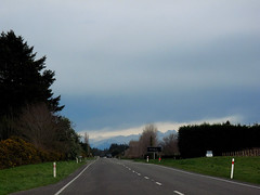
On the way to Darfield to locate the faultline where the tectonic plates slipped, causing the magnitude 7.1 earthquake on Saturday 4 September 2010.

This beautiful building on Madras Street is red stickered and may be condemned if the structural damage it suffered in the magnitude 7,1 earthquake on Saturday 4 September 2010 cannot be repaired.

Even though the library is closed due to the earthquake customers are still happy using the free Wi Fi
File Reference: CCL-CE-2010-09-07-DSC01931
From the collection of Christchurch City Libraries

Even though the library is closed due to the earthquake customers are still happy using the free Wi Fi
File Reference: CCL-CE-2010-09-07-DSC01928
From the collection of Christchurch City Libraries

Even though the library is closed due to the earthquake customers are still happy using the free Wi Fi
File Reference: CCL-CE-2010-09-07-DSC01932
From the collection of Christchurch City Libraries

This is the pedestrian bridge in Kaiapoi close to Christchurch. Not the best angle but the whole bridge on the right hand side is twisted and looks like some kind of rollercoaster. Taken one month after the Quake
Twitter |

There are quite a few signs like this around Christchurch after the Quake. This is one of them. Off shot to the right is a leveled patch of ground where the owners furniture restoration shop used to be.
Twitter |

The Christchurch Methodist Church van takes a hit from the falling gable end of the church.

Oxford Terrace Baptist Church on the corner of Madras St and Oxford Terrace, and alongside the Central City Fire Station on Kilmore St.

Oxford Terrace Baptist Church on the corner of Madras St and Oxford Terrace, and alongside the Central City Fire Station on Kilmore St.

Laura, Nicola, and Debra watch a sand volcano build in the Wyn Street gutter.

Oxford Terrace Baptist Church on the corner of Madras St and Oxford Terrace, and alongside the Central City Fire Station on Kilmore St.

The 7.1 magnitude earthquake struck at about 4:35 am. Thankfully, the day was warm and still (unlike the cold driving rain and hail of yesterday afternoon).

If you look very closely, running from the nearest right desk to the second desk on the left hand side, you can see my 'fault-line', - the crack that runs the length of the classroom under the lino.

(I righted the bird bath after the initial earthquake. None of the after-shocks were sufficient to knock it over again.)

Bruce and his cage were sitting on top of the small wooden table on the right before the earthquake. He was understandably alarmed.

Looking across the faultline where the Saturday 4 September 2010 magnitude 7.1 earthquake originated. Note how much the previously straight fence is now out of alignment.

The historic Provincial Hotel at the Barbadoes Street / Cashel Street corner has been cordoned off for fear of collapse; aftermath of the magnitude 7.1 earthquake that struck Christchurch on Saturday 4 September 2010.

A view after the 7.1 magnitude earthquake in Christchurch.
Corner of Colombo and Battersea Streets.
Given a bit of a HDR process to add "feeling".

Looking across the faultline where the Saturday 4 September 2010 magnitude 7.1 earthquake originated. Note how much the previously straight fence is now out of alignment.

This building at the corner of Barbadoes Street / St Asaph Street was so badly damaged in the magnitude 7.1 earthquake that struck Christchurch on Saturday 4 September 2010 that it had to be demolished

Damaged Christchurch building (old Para Rubber building - see earlier photo from just after quake), partially demolished, after Sept 4th 2010 Christchurch earthquake.
Has been sitting on 666 views for a while!

Can't believe how much of this rock fell off! Its looks totally different - no longer a castle. Sad but very glad that the huge rock did not hit anything on the way down!

The center of the river has slumped and the two banks have moved about a meter closer together which caused this footbridge to be so twisted. There is a suggestion that this be left as a memorial to the earthquake.
