
Aerial image of the Cathedral of the Blessed Sacrament on Barbadoes Street, taken by the Royal New Zealand Air Force for the Earthquake Commission.

A photograph of members of the Wellington Emergency Management Office Emergency Response Team outside a building in the Christchurch city centre. One of the men is holding bolt cutters.

Residents from one of Christchurch's eastern suburbs collecting a chemical toilet from the Army. Their suburb has been without water and power for over ten days.
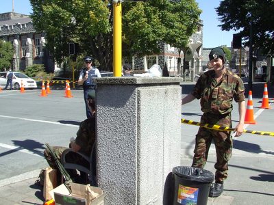
A photograph of members of the New Zealand Police and Army guarding a cordon on the corner of Gloucester Street and Park Terrace.

A photograph looking north up Barbadoes Street from the intersection of Gloucester Street. In the distance there is a cloud of dust and a partially-collapsed fish-and-chip store.

A mobile toilet unit set up on Gloucester Street, outside the Christchurch Art Gallery. The art gallery was used as the temporary Civil Defence headquarters after the 22 February 2011 earthquakes.

A photograph of rubble and glass on the footpath outside Manchester Courts on the corner of Manchester and Hereford Streets. The photograph is taken through the wire of a cordon fence.

A photograph of the Cranmer Courts on the corner of Kilmore and Montreal Streets. Tiles have been stripped off the roof by a chimney which fell during the 4 September 2010 earthquake.

A photograph of luggage from the volunteers of the Wellington Emergency Management Office who travelled to Christchurch after the 22 February 2011 earthquake. Items include several bags, a teddy bear, and a guitar.

A photograph of the Edgeware Law and South of the Border building on Colombo Street with a severely damaged top storey. Wire fencing has been placed around the building as a cordon.

A photograph taken inside the Crowne Plaza Hotel on the corner of Kilmore and Durham Streets. Steel bracing has been used to hold up the ceiling. The column on the left is damaged.

Members of the central and lower North Island Territorial Forces clearing silt from a resident's garden in Christchurch. Sapper Nelson Lambert from Palmerston North can be seen pushing a wheelbarrow.

A photograph of the Cranmer Courts on the corner of Kilmore and Montreal Streets. One of the gables has crumbled and ties have been placed around the rest to limit further damage from aftershocks.

An image from a Army News March 2011 article titled, "Territorial Force". The image shows members of the Auckland and Northland Territorial Units clearing bricks from a resident's garden in east Christchurch.

NZ Army drivers planning a route for the delivery of chemical toilets. The toilets were delivered to residents in Christchurch who had been without water for ten days.

A photograph of emergency management personnel in hazmat suits standing on Lichfield Street. In the background a excavator is parked on the rubble from the collapsed ANZ Bank building.

Westpac staff and members of the Royal New Zealand Navy holding a cheque for the Red Cross Christchurch Earthquake Fund.

A photograph of the Hotel Grand Chancellor, visible over the roof of a tent in Latimer Square. There is a noticeable slump in the left side of the hotel.

Unimogs in a loading area in Christchurch. The unimogs are being loaded with chemical toilets to be delivered to residents in Christchurch who do not have running water.

A photograph of emergency management personnel walking down Manchester Street towards the intersection of St Asaph Street. In the background an excavator is clearing rubble from several earthquake-damaged buildings.

A photograph of plywood taped to the broken glass of Coco's Hair Design on Colombo Street. A green sticker in the window indicates that the building has been inspected and is safe to enter.

The Taiwanese Search and Rescue team being farewelled at the Christchurch International Airport after helping out with the emergency response to the Canterbury Earthquake.

A photograph of cracks in Gayhurst Road near the intersection with Glenarm Terrace. Liquefaction can be seen on the street, and there is a road cone on a crack in the footpath.

Mayor Bob Parker speaking to members of the ships' company from HMNZS Canterbury, HMNZS Otago and HMNZS Pukaki.

Jules Lee, Coordinator of the Lyttelton Time Bank, talking to a member of the New Zealand Navy on London Street in Lyttelton.

A photograph of emergency management personnel eating dinner in the restaurant of the Christchurch Art Gallery. The Art Gallery was used as the temporary headquarters for Civil Defence after the 22 February 2011 earthquake.

A photograph of USAR codes spray-painted on the footpath in front of The Burrito Company on Armagh Street. Glass from a broken window is scattered across the footpath.

A Squadron 3 Iroquois helicopter refuelling at Hagley park after an aerial tour of Christchurch and Lyttelton.

A photograph of a group of tents set up in Latimer Square next to the USAID tent. The tents were used as temporary accommodation for emergency management personnel after the 22 February 2011 earthquake.

A poster created by Empowered Christchurch to advertise their submission to the CERA Draft Transition Recovery Plan on social media.The poster reads, "Submission, CERA Draft Transition Recovery Plan. Future Insurability. In an article in the New Zealand Herald of 5 November 2014, the CEO of IAG refers to cooperation with the NZ Government on a strategic intent in 2011 to avoid depopulation of Christchurch. Now that the ICNZ has signalled its intention to withdraw from high-risk areas and the CCC also plans to redefine the boundaries of the city so as to exclude properties below the Mean High Water Springs. We ask whether a 'recovery' involves abandoning people once the insurance and bank sectors have managed a retreat? We need a city that is driven by the people that live in it, and enabled by a bureaucracy that accepts and mitigates risks, rather than transferring them to the most vulnerable of its residents".