
Damage to a house in Richmond. Bricks have fallen from the walls onto the driveway. The photographer comments, "More movement caused the brick cladding to fall off the building".

A powerful aftershock on 13 June has caused a building to partially collapse on the corner of Stanmore Road and Worcester Street. The area has been cordoned off from the public.

A photograph of a section of road lying on the Greendale Fault line which has large cracks caused by the 4 September 2010 earthquake.

Photograph captioned by Fairfax, "Aerial shot of the fault line that ruptured, causing Saturday's 7.1 earthquake. The fault line running through a woolshed".

Photograph captioned by Fairfax, "Aerial shot of the fault line that ruptured, causing Saturday's 7.1 earthquake. The fault line streaks through a farm".

Photograph captioned by Fairfax, "Aerial shot of the fault line that ruptured, causing Saturday's 7.1 earthquake. The fault line running through a paddock".

Photograph captioned by Fairfax, "Liquefaction damage. Silt penetrates the Courtenay Drive home of Tina Parker. Liquefaction caused most of the damage to Kaiapoi homes.

Photograph captioned by Fairfax, "Aerial shot of the fault line that ruptured causing Saturday's 7.1 earthquake. A deer fenceline destroyed by the quake".

Photograph captioned by Fairfax, "Aerial shot of the fault line that ruptured, causing Saturday's 7.1 earthquake. Track, fence and hedge showing horizontal displacement".

A photograph of the Pills for Thrills building on Worcester Street which suffered damage from a fire caused by the 4 September 2010 earthquake.

Typical lateral damage to houses caused by the 7.1 magnitude quake in Christchurch at 4.35am on the 4th September 2010.

The foundations of the historic Kaiapoi Railway Station building, which were damaged in the 4 September 2010 earthquake causing the building to lean towards the river.

Damage to the footpath and curbing on Charles Street in Kaiapoi. The curb has slumped next to the sump, causing cracking and the displacement of tiles.

People walking a dog on Avonside Drive step over a hump in the footpath caused by the buckling of the ground. Flooding and liquefaction can be seen on the road surface in the distance.
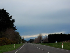
On the way to Darfield to locate the faultline where the tectonic plates slipped, causing the magnitude 7.1 earthquake on Saturday 4 September 2010.

A local resident walks to the nearest dairy for essentials after the 7.1 magnitude quake, that has caused major infrastructure damage to Christchurch City.

A photograph of the earthquake damage to a block of buildings on Worcester Street. One of the buildings has also suffered damage from a fire caused by the 4 September 2010 earthquake.

A photograph of an earthquake-damaged building on Riccarton Road. The top storey has collapsed causing rubble to spill onto the footpath, crushing a car. The area surrounding the building has been cordoned off.

A photograph of an earthquake-damaged building on Riccarton Road. The top storey has collapsed causing rubble to spill onto the footpath, crushing a car. The area surrounding the building has been cordoned off.
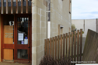
Corcoron French Lawyers on Williams Street in Kaiapoi. Liquefaction has caused the building to sink on the right side. This is shown by the fence which now sits at an angle.

Photograph captioned by Fairfax, "Aerial shot of the fault line that ruptured, causing Saturday's 7.1 earthquake. The fault line running through a woolshed near West Melton".

Photograph captioned by Fairfax, "Aerial shot of the fault line that ruptured, causing Saturday's 7.1 earthquake. The fault line ripped across a road which has been repaired".

Photograph captioned by Fairfax, "Aerial shot of the fault line that ruptured, causing Saturday's 7.1 earthquake. The fault runs between the house and garage of this property".

Sand volcanoes" in the Heathcote Estuary. The volcanoes were caused by liquefaction, where the soil lost its strength and water erupted out of the hole, taking silt with it.

Sand volcanoes" in the Heathcote Estuary. The volcanoes were caused by liquefaction, where the soil lost its strength and water erupted out of the hole, taking silt with it.

Sand volcanoes" in the Heathcote Estuary. The volcanoes were caused by liquefaction, where the soil lost its strength and water erupted out of the hole, taking silt with it.

A photograph of an excavator on the side of a road in Canterbury. This stretch of road is near the Greendale fault line which caused the 4 September 2010 earthquake.

Photograph captioned by Fairfax, "The early morning earthquake caused damage to the Royal Hotel. Pictured inspecting the damage is Derek Neill of The Timaru District Council".

Photograph captioned by Fairfax, "The early morning earthquake caused damage to the Royal Hotel at Temuka. Pictured is the new owner of the Royal Maz Opele".

Photograph captioned by Fairfax, "The early morning earthquake caused damage to the Royal Hotel at Temuka. Pictured is the new owner of the Royal Maz Opele".