
A photograph captioned by BeckerFraserPhotos, "Earthquake damage to Kingsford Street in the Horseshoe Lake district".

A photograph of a gold tinsel Christmas tree placed next to a Kingsford Street letterbox. A note on the letterbox reads, 'EQC visited'.

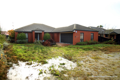
A photograph of an abandoned property at 78 Arncliff Street in Bexley. Wooden boards have been placed over the windows.

A photograph captioned by BeckerFraserPhotos, "Earthquake damage to Lois Place, photographed from River Road".

A photograph captioned by BeckerFraserPhotos, "The site of a demolished house on Queensbury Street in the Horseshoe Lake district".

A photograph captioned by BeckerFraserPhotos, "The site of a demolished house on Queensbury Street in the Horseshoe Lake district".

A photograph of a portaloo on the side of Kingsford Street in the Horseshoe Lake district. Behind the portaloo is a blue pipe which is carrying water temporarily to houses along the street.

A photograph captioned by BeckerFraserPhotos, "The corner of Alice Street and Kingsford Street in the Horseshoe Lake district".

A photograph captioned by BeckerFraserPhotos, "The intersection of Chings Gardens and Kingsford Street in the Horseshoe Lake district".

Photograph captioned by BeckerFraserPhotos, "A red-zoned property at 4 Seabreeze Close in Bexley".

A photograph of an abandoned property at 105 Bexley Road, Bexley. There is liquefaction on the lawn and driveway.

An abandoned residential property at 25 Waygreen Avenue in New Brighton. The section is covered with weeds and silt from liquefaction. Stones are scattered across the driveway.

An abandoned residential property at 16 Seabreeze Close in Bexley. Weeds are growing through the cracks in the ground and a window has been vandalised with graffiti.

A photograph of flooding and liquefaction in a residential street. The photograph is captioned by Paul Corliss, "Mitcham Place in the block of Bexley and Pages Roads".

A photograph of flooding and liquefaction in a residential street. The photograph is captioned by Paul Corliss, "Mitcham Place in the block of Bexley and Pages Roads".

Photograph captioned by BeckerFraserPhotos, "Ching Gardens and Irene Street, Horseshoe Lake".

Mesh fencing around a residential property. A recyling and an organics bin have been used to support the fencing, and inside a pile of building rubble can be seen.

The road and footpath in a residential area are lined with piles of silt from liquefaction. Recycling and rubbish bins waiting for collection can be seen down the footpath.

Photograph captioned by BeckerFraserPhotos, "Ching Gardens and Irene Street, Horseshoe Lake".

An aerial photograph of Horseshoe Lake. All of this land is red-zoned.

A photograph of a road cone decorated as Santa Claus along Kingford Street in Horseshoe Lake".

An abandoned residential property at 12A Waygreen Avenue in New Brighton. The section is overgrown with weeds and the garage door has been vandalised with blue graffiti.

Abandoned residential properties at 39 (left), 41 (centre), and 37 (right) Seabreeze Close in Bexley. The front yard and footpath are covered with weeds and silt from liquefaction.

An abandoned residential property at 14 Seabreeze Close in Bexley. The damaged garage door has been boarded up. The driveway is covered with weeds and silt from liquefaction.

A photograph of a felled tree, liquefaction, and flooding in a residential street in Christchurch. Road cones have been placed around hazards to warn road and footpath users.

A photograph of members of the New Zealand Army on the roof of a residential property. They have climbed the roof to cover a hole with a tarpaulin.

An abandoned residential property at 19 Waygreen Avenue in New Brighton. The section is overgrown with weeds. A single brick fence post remains standing. The gutter has flooded.

A photograph of members of the New Zealand Army on the roof of a residential property. They have climbed the roof to cover a hole with a tarpaulin.

An aerial photograph of a residential area in Avonside. The photograph has been captioned by BeckerFraserPhotos, "The dominant road in this picture is Avondale Road which crosses the River Avon. To the left of this photograph is all zoned red apart from a small piece on the other side of the river. On the right-hand side of Avondale Road, some streets are zoned green although the streets closest to the river are red-zoned".
An abandoned residential property at 10 Waygreen Avenue in New Brighton. The section is covered with weeds and silt from liquefaction. The front of the section is partly flooded.