
The Mandeville Tavern in Kaiapoi cordoned off with red danger tape. A large crack is visible in the wall of the tavern, and the road and footpath in front are cracked and buckled.

A photograph of the earthquake damage to St Paul's School in Dallington. Large cracks can be seen in the surface of the asphalt. Silt from liquefaction is visible in front of the school buildings. Tape has been placed on the building to keep people away.

A photograph of liquefaction along the footpath in front of St Paul's Church on Gayhurst Road. The church was severely damaged during the 4 September earthquake. Tape has been placed around the building to warn people off.
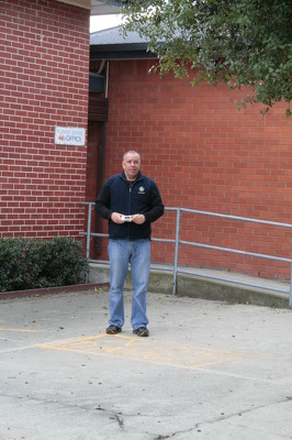
A photograph of Mark Osborne, a member of the Wellington Emergency Management Office, outside the office block of St Paul's School in Dallington.

A photograph of large cracks in the pavement in front of St Paul's School in Dallington. Liquefaction silt can also be seen. Police tape has been draped across the entrance of the building to the left.

A photograph of volunteers from the Wellington Emergency Management Office standing outside St Paul's School on Gayhurst Road. There are cracks in the asphalt in front, and liquefaction on the ground.

A photograph of a sign outside St Paul's Parish on Gayhurst Road. The sign reads, "St Paul's Parish Mass, Sunday 10am, Marian College Hall, North Parade". The church was damaged during the 4 September earthquake. Tape can be seen around the building in the background.

A photograph of a cardboard sign outside St Paul's Church in Dallington. The sign reads, "St Paul's Parish Mass, Sunday 10am, Marian College Hall, North Parade". In the background police tape is draped around the building.

A photograph of the Wellington Emergency Management Office, taking photos of St Paul's Church in Dallington. The church was severely damaged after the 4 September earthquake. Police emergency tape can be seen around the building, keeping people away.

A damaged brick building on Centaurus Road with "Danger Keep Out" tape around the property. The brick walls have cracked and broken above two of the windows and a red sticker has been placed on the front window indicating that the building is unsafe to enter.

Christchurch Earthquake Aftermath
PWS-2010-09-09-DSC02063

The fish and chip shop on Hills Road in Edgeware. The building is red stickered meaning it is unsafe to enter. Without the glass in the window, the inside of the store is easy to see. Panelling on the walls and roof have come down and much of the furniture has been removed.

A house in Christchurch with a red sticker on the window indicating that it is unsafe to enter. "No entry" and a large cross have also been spray painted on the front fence to warn people off. On the right side of the house, a tarpaulin can be seen covering a collapsed brick wall.

St Johns Church on Hereford Street with damage to the tip of the archway and a red sticker on the door indicating that the building is unsafe to enter. The side of the church has been braced to stabilise the west wall and limit further damage from aftershocks.

A brick house on Centaurus Road with damage to the top left window and "Danger Keep Out" tape around the edge. A yellow sign on the front window indicates that the building should only be entered for "Restricted Use". This means it has faired better than the brick house next door which is red-stickered.

A photograph of a map of Christchurch in a temporary Civil Defence headquarters set up at the Mainland Foundation Ballpark after the 4 September 2010 earthquake. Red, green and blue markings on the map indicate where flooding, sand and closures are located. Post-it notes and a key with a tag reading, "Manchester" are attached to the map.