
A photograph captioned by BeckerFraserPhotos, "A damaged residential property at 484 Avonside Drive".

A photograph captioned by BeckerFraserPhotos, "A damaged residential property at 456 Avonside Drive".

A garage in a residential property in Woolston which is leaning away from the house.
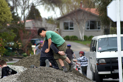
Children playing on a pile of gravel in a residential area following the September earthquake.

An aerial photograph of a residential area in Burwood with Donnell Park near the centre.

An infographic made up of graphs comparing residential property prices across Christchurch and New Zealand.

A photograph of a crack running through the pavement of a residential street in Christchurch.

A photograph of piles of liquefaction on the side of a residential street in Christchurch.

A motorcycle embedded in liquefaction and floods that cover the road in a residential area.

The road, driveway and footpath are covered in silt from liquefaction in a residential area.

The road, driveway and footpath are covered in silt from liquefaction in a residential area.

The road, driveway and footpath are covered in silt from liquefaction in a residential area.

The road, driveway and footpath are covered in silt from liquefaction in a residential area.

The road, driveway and footpath are covered in silt from liquefaction in a residential area.

Damage to a residential street. Road cones on the road mark out an uneven area.

Overgrown property in a residential area. The house has big cracks down the exterior wall.

Damage to a residential street. Road cones on the road mark out an uneven area.

Damage to a residential street. Road cones on the road mark out an uneven area.

A photograph of cracks running through the driveway of a residential property on Gayhurst Road.

A photograph captioned by BeckerFraserPhotos, "A damaged residential property at 490 Avonside Drive".

The road, driveway and footpath are covered in silt from liquefaction in a residential area.

A photograph captioned by BeckerFraserPhotos, "A damaged residential property at 486 Avonside Drive".

An abandoned residential property on Seabreeze Close in Bexley. The section is overgrown with weeds.

A photograph captioned by BeckerFraserPhotos, "A damaged residential property at 456 Avonside Drive".

The road, driveway and footpath are covered in silt from liquefaction in a residential area.

A photograph of the site of a demolished building on Tuam Street which is being used as a car park. The photograph was taken during the Residential Access Project which gave residents temporary access within the red-zone cordon in order to retrieve items from their homes after the 22 February 2011 earthquake.

A photograph of trailers full of furniture and belongings from people's homes on Poplar Lane parked on High Street near the intersection with Tuam Street. The items were removed from the homes during the Residential Access Project which gave residents temporary access within the red-zone cordon in order to retrieve their possessions.

A photograph of the inside of a fridge in a flat on Poplar Street taken during the Residential Access Project. The project gave residents temporary access within the red-zone cordon in order to retrieve items from their homes. The contents of the fridge have gone mouldy after being left in there for three weeks.

A residential property in Bexley with an overgrown garden. Dried liquefaction silt still covers the ground. The photographer comments, "Today I took a drive around the residential area between Bexley and New Brighton. It was a stark reminder to be thankful for the situation we're in and perhaps not complain too much that our garden wall hasn't yet been rebuilt".

A photograph of the inside of a fridge in a flat on Poplar Street taken during the Residential Access Project. The project gave residents temporary access within the red-zone cordon in order to retrieve items from their homes. The contents of the fridge have gone mouldy after being left in there for three weeks.