Search
found 1681 results

The South Island. 3 December 2010
Images, Alexander Turnbull Library
The South Island is depicted as a punch bag which is reeling with the punishment inflicted after having been practised on by 'blizzards', 'earthquakes', 'disasters' and now 'drought'. Context; the Christchurch earthquake of 4 October and the Pike River Mine disaster of 19 November as well as some fairly extreme weather. Quantity: 1 digital cartoon(s).

Planting natives at Harold Henry Park
Images, eqnz.chch.2010
20140927_2219_1D3-24 Planting natives at Harold Henry Park A planting of native bushes and trees in the old children's playground area in Bexley, Organised by the Facebook group Avon River Park and assisted by ex Bexley residents. This is right in the middle of the Bexley red zone with most houses removed or demolished now.
Rebekah Rogers WEMO Photograph 053
Images, UC QuakeStudies
A photograph of members of the New Zealand Army guarding a cordon near the intersection of Armagh Street and Rolleston Avenue.
Brockie, Robert Ellison, 1932-:[The New Zealand ship of state] 4 March 2011
Images, Alexander Turnbull Library
A ship named 'NZ Ship of State' lies high and dry on rocks; the great jagged holes in her represent 'the recession', 'Pike River', 'Chch 1' and 'Chch 2'. A man standing nearby asks 'How will we refloat her?' and a second man answers '...by cutting Working for Families & interest-free student loans' Someone outside the frame says 'Where's the No. 8 wire?' Context - The New Zealand economy was stagnating before the impact of the Christchurch earthquakes of 4 September 2010 and 22 February 2011 and the Pike River Mine disaster before that. The government was already considering cutting Working for Families & interest-free student loans before the earthquakes struck and it seems that now they are trying to push through these policy changes using the earthquakes as an excuse. Quantity: 1 digital cartoon(s).
Photograph of Gap Filler project 18 (35)
Images, UC QuakeStudies
Pallet Golf', a Gap Golf course on a the site of a demolished building. It has been built by Gap Filler to look like a journey through Christchurch. A plastic road cone as well as mini road cones, road signs, tunnels and rivers can be seen. The course has been built using green felt, wooden pallets, tyres, planks of wood and bricks.
Christchurch Mail Image: John Bisset 2010:09:10 14:25:04
Images, UC QuakeStudies
Photograph captioned by Fairfax, "Members of the Red Cross civil defence response team and South Canterbury Police have been in Christchurch helping with the earthquake clean up. Welfare checks required the team to walk along River Road checking on householders. Pictured from left are Aaron Sole, Andy Todd, Anna Munro, Ken Weavers, Tim Mitchell (Emergency Management Officer) and Tom Connolly".
22 February Earthquake - Photograph 25
Images, UC QuakeStudies
Damage to a house in Richmond. The brick wall is badly cracked and twisted, and some bricks have fallen, exposing the lining paper and framing below. The driveway is cracked and covered in liquefaction. The photographer comments, "These photos show our old house in River Rd and recovery work around Richmond and St Albans. Does that wall look straight to you?
Nisbet, Alistair, 1958- :'Quick! Fill it in before it climbs back out!' 1 …
Images, Alexander Turnbull Library
Prime Minister John Key tells the Minister for Earthquake recovery, Gerry Brownlee, to 'fill it in before it climbs back out!' Gerry Brownlee is sweeping rubble into a deep pit. The rubble represents many of the problems that New Zealand faces like Pike River, earthquakes, the Rena, child abuse, Winston Peters, gas pipeline damage and so on. Quantity: 1 digital cartoon(s).

20131014_4128_1D3-40 Polluted Water (Day 287/365)
Images, eqnz.chch.2010
There are occasional sewerage spills into the Avon River while all the sewer and road repairs are carried out. This rock wall was level and well above high tide level prior to the eathquakes. All the houses that can been seen here (except for those on the distant Port Hills) are in the suburban "red zone" and are still to be demolished.

20131214_6268_1D3-24 Where once stood houses (Day 348/365)
Images, eqnz.chch.2010
The area beside the lower Avon River in New Brighton of Evans Avenue and Admirals Way has been cleared of houses and boundary fences (there were between 15 and 20 houses on this block) , fully fenced with post and wire and "spray on" grass applied. These were all red zone properties acquired by the crown after the land was deemed too damaged t...
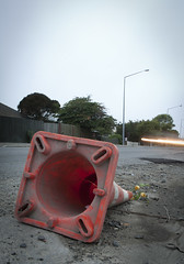
20120321_2416_1D3-24 Fallen Cone
Images, eqnz.chch.2010
A month after the 1st anniversary of the deadly Christchurch earthquake (22/02/11) a road cone lies on New Brighton Road, alongside the Avon River. Part of the earthquake 1st anniversary remembrance was for people to place flowers in road cones (and there are hundreds of thousands in the city). Many had flowers in them, as this one did. Photo ...
BeckerFraserPhotos December 2011 photograph 0372
Images, UC QuakeStudies
Photograph captioned by BeckerFraserPhotos, "An aerial photograph with Kerrs Reach in the middle of the picture".
[Aust NZ United in Tragedy] 13 January 2011
Images, Alexander Turnbull Library
The cartoon shows a flag which looks rather like that of both Australia and New Zealand but not exactly like either; the Union Jack is half out of the top left corner and there are just three of New Zealand's four red stars and three of Australia's white stars. The cartoonist's title is 'Aust NZ united in tragedy'. Context - The Queensland floods of December 2010 to January 2011. Colour and black and white versions available. Quantity: 2 digital cartoon(s).

Getting Smaller
Images, eqnz.chch.2010
Demolition underway on the old Government Life building on a walk around the city September 7, 2014 Christchurch New Zealand.
BeckerFraserPhotos October 2011 photograph 569
Images, UC QuakeStudies
Photograph captioned by BeckerFraserPhotos, "Looking north along Cambridge Terrace and Durham Street from St Michael and All Angels Church".

Earthquake Street
Images, eqnz.chch.2010
A Simple shot down the street where the shops are now marked for demolition. Twitter | Facebook | My Website |

Beyond the Fence
Images, eqnz.chch.2010
One Month after the Christchurch Earthquake. A view in Sydenham suburb - Columbo St Twitter | Facebook | My Website |

Sydenham Building
Images, eqnz.chch.2010
A corner shop in Sydenham - a Suburb of Christchurch. Front walls are all missing Twitter | Facebook | My Website |
22 February Earthquake - Photograph 23
Images, UC QuakeStudies
Two people examine damage to a house in Richmond. The brick wall is badly cracked and twisted, and some bricks have fallen, exposing the lining paper and framing below. The photographer comments, "These photos show our old house in River Rd and recovery work around Richmond and St Albans. The near wall is leaning at an alarming angle. I didn't like walking past it".
22 February Earthquake - Photograph 35
Images, UC QuakeStudies
A group of residents stand talking on the footpath beside River Road. The photographer comments, "Our neighbours were mostly already displaced by the Sep 4 2010 quakes. We all happened to arrive at the same time, so we had a good chat. From L-R; Deidre Crichton (389), Julie and Philip Cheyne (391), Marike Begg (363), Susannah and Kim Collins (383), Andy Corbin (389)".
Sagging in the Middle
Images, UC QuakeStudies
A wooden house in Wainoni has visibly bowed inwards towards its centre. The photographer comments, "During the numerous earthquakes in Christchurch the land which ran alongside the Avon river on Avonside Drive slumped towards the waterway. In a line parallel to the road the road, but around 20m away a ground movement occurred which caused some houses to rise up or sink down".

20111229_7210_1D3-195 Bexley Wetlands and Pacific Park
Images, eqnz.chch.2010
The flooded Bexley Wetlands, now about 1 - 1.5metre below pre earthquake level. The short length of fence (mid ground) was on the "river track" that the council closed about three years ago. The whole track in this view is now under about 500mm water at high tide. The main track in front of the houses was, prior to earthquakes, below the leve...

20130524_7214_1D3-40 Hidden park bench
Images, eqnz.chch.2010
Prior to the earthquakes (mainly the February 22 2011 event) this park bench was at track level. Shortly after the February quake someone in the council did the sums and realised that the area near the Avon River had dropped between a metre and 1.4m (about 4 foot), so a rush job by contractors shifted in many tonnes of rock and gravel to raise a...

20160415_0029_1D3-24 Red Zone Closures
Images, eqnz.chch.2010
The permanent closure (to motor vehicles) of the Bexley red zone streets has started. This was once the main south-north route just west of the Avon River in the New Brighton area, till an expressway (ring road) was built about 80m to the west (right) about 12-13 years ago. Then it became just another suburban street, but now all the houses ...

Cones
Images, eqnz.chch.2010
Selective colour full size view from one of my previous shots. Edgeware Road, Christchurch. Damaged from the Christchurch Earthquake Twitter | Facebook |
BeckerFraserPhotos December 2011 photograph 0329
Images, UC QuakeStudies
An aerial photograph of the Copthorne Hotel on Colombo Street. The photograph has been captioned by BeckerFraserPhotos, "When the PricewaterhouseCoopers building is demolished, the Copthorne Central Hotel will be alone on the block. Oxford on the Avon and Plunket House are also gone from Oxford Terrace, and on the other side of the river is the demolition site of the PGC building where 18 people died".
22 February Earthquake - Photograph 21
Images, UC QuakeStudies
Damage to a house in Richmond. The brick wall is badly cracked and twisted, and some bricks have fallen, exposing the lining paper and framing below. The driveway is cracked and covered in liquefaction. The photographer comments, "These photos show our old house in River Rd and recovery work around Richmond and St Albans. More shaking damage on the east wall of the living room at our house".
22 February Earthquake - Photograph 20
Images, UC QuakeStudies
Damage to a house in Richmond. The brick wall is badly cracked and twisted, and some bricks have fallen, exposing the lining paper and framing below. The driveway is cracked and covered in liquefaction. The photographer comments, "These photos show our old house in River Rd and recovery work around Richmond and St Albans. More shaking damage on the east wall of the living room at our house".
BeckerFraserPhotos October 2011 photograph 557
Images, UC QuakeStudies
Photograph captioned by BeckerFraserPhotos, "Looking south across Bealey Avenue and between Colombo and Durham Streets towards the CBD".