
An Environmental Health Officer collecting air readings on Gloucester Street, in the Christchurch central city.

Aerial image of Sumner taken by the Royal New Zealand Air Force for the Earthquake Commission.

Damage to the Lyttelton Port. A concrete slab has lifted and broken at the edge.

The Environmental Health Offices testing in the Christchurch central city, photographed outside the damaged Stonehurst Backpackers.

Air Force photographer LAC Grant Armishaw in front of the CTV Building on Madras Street.

Diggers clearing rubble on the site of the CTV Building.

Private Alex Crivellaro from the Auckland Territorial Unit clearing silt from a resident's garden in east Christchurch.

Aerial image of Lyttelton taken by the Royal New Zealand Air Force for the Earthquake Commission.

Aerial image of Cathedral Square taken by the Royal New Zealand Air Force for the Earthquake Commission.

Members of the New Zealand Fire Service spraying water into Lyttelton Harbour as the HMNZS Otago departs.

Aerial image of the Port Hills taken by the Royal New Zealand Air Force for the Earthquake Commission.

An aerial view of Lyttelton a week after the 22 February 2011 earthquake.

A camera operator filming Prime Minister John Key's briefing following the 22 February earthquake.

Members of the Auckland and Northland Territorial Units clearing bricks from a resident's garden in east Christchurch.

An aerial view of Sumner a week after the 22 February 2011 earthquake.
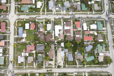
An aerial view of Christchurch a week after the 22 February 2011 earthquake.

An aerial view of Christchurch a week after the 22 February 2011 earthquake.

An aerial view of Christchurch a week after the 22 February 2011 earthquake.

An aerial view of Lyttelton a week after the 22 February 2011 earthquake.

An aerial view of Christchurch a week after the 22 February 2011 earthquake.

An aerial view of Rapaki a week after the 22 February 2011 earthquake.

An aerial view of Christchurch a week after the 22 February 2011 earthquake.

Environmental Health Officers collecting air readings outside Map World, on the corner of Manchester and Gloucester Streets.

An aerial view of Sumner a week after the 22 February 2011 earthquake.

Members of the Royal New Zealand Air Force disembarking from an Iroquois helicopter after a tour of Christchurch.

One of the Royal New Zealand Air Force's Iroquois helicopters landing after a tour of Christchurch.

Royal New Zealand Air Force Iroquois helicopters flying over the PGC Building after the 22 February 2011 earthquake.

Evacuees from Christchurch at the Royal New Zealand Air Force's Air Movements Terminal at Christchurch Airport.

People talk to security personnel from the Royal New Zealand Air Force at Christchurch Airport.

A woman talks to Air Force personnel at the Air Movements Terminal at Christchurch Airport.