Search

Digital Photograph: Earthquake damage to Church of the Most Holy Trinity, …
Images, Canterbury Museum
One landscape colour digital photograph taken on 15 June 2011 showing earthquake damage to the Anglican Church of The Most Holy Trinity in Winchester Street, Lyttelton. Photograph shows collapsed roof of the nave and north transept. Photograph taken from the north side of the church. Architect The collapse of the Church of the Most Holy Trinity ...

Digital Photograph: Earthquake Damage to Lyttelton Roman Catholic and Diss…
Images, Canterbury Museum
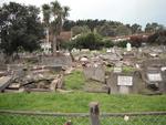
One landscape colour digital photograph taken on 30 June 2011 showing earthquake damage to graves in Lyttelton Roman Catholic and Dissenters (Public) Cemeteries in Reserve Terrace. Most of the headstones and grave surrounds in the photograph show damage. Looking east in the Dissenters (Public) section of the cemetery. The Lyttelton cemeteries a...

Digital Photograph: Earthquake Damage to Lyttelton Roman Catholic and Diss…
Images, Canterbury Museum
One landscape colour digital photograph taken on 30 June 2011 showing signs warning of the danger posed by unstable headstones in Lyttelton Roman Catholic and Dissenters (Public) Cemeteries in Reserve Terrace. Several toppled headstones and collapsed grave surrounds are visible in the photograph. Looking east from the main gate. The Lyttelton c...

Digital Photograph: Earthquake damage to a retaining wall, Lyttelton
Images, Canterbury Museum
One landscape colour digital photograph taken on 30 June 2011 showing earthquake damage to a section of retaining wall in Sumner Road. Plastic sheeting installed to stabilise previous damage and protect from water erosion is visible to the right of the photograph. Also visible in the photograph is a boarded up broken window and temporary safety ...

Digital Photograph: Earthquake damage to Church of the Most Holy Trinity, …
Images, Canterbury Museum
One landscape colour digital photograph taken on 15 June 2011 showing earthquake damage to the Anglican Church of The Most Holy Trinity in Winchester Street, Lyttelton. Photograph shows collapsed roof of the nave and north transept. Photograph taken from the northwest corner of the church. Architect The collapse of the Church of the Most Holy Tr...

Digital Photograph: Demolition of former Library and Fire Station, corner …
Images, Canterbury Museum
One landscape colour digital photograph taken on 6 September 2011 showing the demolition of 2 Sumner Road, the former library and fire station. This building was a private residence at the time of its demolition. Photograph taken looking north on Oxford Street. Also visible in the photograph are the Lyttelton Information Centre, an entrance to ...
Don't Put This Pipe Cleaner in Your Ear
Images, UC QuakeStudies
A worker uses a large water-blasting pipe to clear blocked drains. The photographer comments, "These guys worked really hard late at night to remove the liquefaction blocking our drains, but did not pre-warn people. Our elderly neighbour's toilet was drenched in water".

Digital Photograph: Former Convent of Our Lady of Mercy, Exeter Street, an…
Images, Canterbury Museum
One landscape colour digital photograph taken on 30 June 2011 showing earthquake damage to the former Convent of Our Lady of Mercy and to the Catholic Church of St Joseph the Worker. Photograph taken from St. Davids Street The sense of loss felt when confronted with the collapse or demolition of an historic building is compounded when that bui...

Digital Photograph: Temporary Premises of Lyttelton Bakery, corner of Norw…
Images, Canterbury Museum
One landscape colour digital photograph taken on 16 June 2011 showing the Lyttelton Bakery operating from a portable building on the Corner of Canterbury Street and Norwich Quay. This portable building has been placed on the site of the Royal Hotel. Also visible in the photograph are Shadbolt House and the rear of the buildings on the south side...
Regent Theatre dome damaged on June 13
Images, UC QuakeStudies
The broken Regent Theatre dome still attached to the building, but with most of its facade fallen away after the June earthquake.
Photograph by Jocelyn Kinghorn 635
Images, UC QuakeStudies
A powerful aftershock on 13 June has caused a building to partially collapse on the corner of Stanmore Road and Worcester Street. The area has been cordoned off from the public.
Photograph by Jocelyn Kinghorn 636
Images, UC QuakeStudies
A powerful aftershock on 13 June has caused a building to partially collapse on the corner of Stanmore Road and Worcester Street. The area has been cordoned off from the public.
The Orange Hand of Fate
Images, UC QuakeStudies
Damage to The Bone Dude's Bone Carving Studio and Cultured Gallery on Fitzgerald Avenue. The brick wall is cracked, and the guttering has fallen. The photographer comments, "This building was damaged in the September earthquake in Christchurch. It was the Bone dude's bone carving studio. The motto on the wall was 'Carve your own' and it looks like the earthquakes did just that".

Digital Photograph: Mitre Hotel
Images, Canterbury Museum
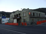
One landscape colour digital photograph taken on 26 May 2013 on the corner of Norwich Quay and Canterbury Street, Lyttelton. The photograph shows the Mitre Hotel surrounded by temporary fencing. Three years after the 2010-2011 earthquakes there are still many uncertainties about which buildings can or will be retained. These buildings, or parts...

Digital Photograph: Lyttelton Main School
Images, Canterbury Museum
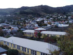
One landscape colour digital photograph taken on 26 May 2013 of Lyttelton Main School. The photograph is taken from St Davids Street looking northwest. One of the broader consequences of the 2010-2011 Canterbury earthquakes has been the Ministry of Education’s Shaping Education – Future Direction Review of Schools in the Greater Christchurch Ar...

High Viz Vest: SCIRT
Images, Canterbury Museum
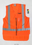
One orange High Viz vest with a SCIRT logo on the front.
Nisbet, Alastair, 1958- :"So Roger...two years in the job...how does it fe…
Images, Alexander Turnbull Library
Roger Sutton, former chief executive of the the power lines company, Orion and since June 2011 Chief Executive Officer of the Canterbury Earhquake Recovery Authority, is shown in a straitjacket, raving. An unseen interviewer asks him how it feels after 'two years in the job'. Roger Sutton's work in leading the Earthquake Authority after the February earthquake was extremely stressful, considering the magnitude of the task. Quantity: 1 digital cartoon(s).

Model: Wastewater Systems in an Earthquake
Images, Canterbury Museum
One interactive model which demonstrates how different types of pipes perform in an earthquake.

Award: Canstruction Christchurch
Images, Canterbury Museum
One glass trophy presented to SCIRT IST to mark winning the Jurors Favourite Category in the 2014 Canstruction Christchurch competition.
Brockie, Robert Ellison, 1932- :God at his computer. 17 June 2011
Images, Alexander Turnbull Library
The cartoon shows God sitting at his computer with an image of a devastated Christchurch on the screen. He is about to hit the 'smite' key. Text above reads 'God at his computer'. Context - Two more earthquakes rocked Christchurch on 13th June, following those of 4 September 2010 and 22 February 2011. The first magnitude 5.5 quake struck at 1pm, 10 kilometres east of Christchurch at Taylor's Mistake beach, at a depth of 11 kilometres, and sent people scrambling for cover. It was followed at 2.20pm by a more powerful magnitude 6 quake, centred 10 kilometres southeast of the city and 9km underground. Quantity: 1 digital cartoon(s).

Certificate: The Press Champion Canterbury Supreme Award
Images, Canterbury Museum
One framed certificate issued to SCIRT in 2013 to mark winning The Press Champion Canterbury Supreme Award in the Medium-Large Enterprise category.
Nisbet, Alistair, 1958- :"Er... can we just stay on the truck... permanent…
Images, Alexander Turnbull Library
A truck carries a house to a new position and the family in the house wonder if they 'can stay on the truck permanently'. Context - Continuing housing problems in Christchurch following the earthquakes of 4 September 2010 and February 22 and June 13 2011. Many aftershocks are still happening and the ground is unstable in many places. Quantity: 1 digital cartoon(s).

Medal: The Brunel Medal
Images, Canterbury Museum
One silver medal awarded to SCIRT in October 2013 from the Institution of Civil Engineers in the United Kingdom in recognition of the excellent in civil engineering. Includes storage case and explanation sheet.

Digital Photograph: Site of the Harbourlight Theatre, London Street, Lytte…
Images, Canterbury Museum
One landscape colour digital photograph taken on 14 September 2012 showing the site of the Harbourlight Theatre on London Street. The retaining wall at the rear of the site collapsed and part of the adjoining land eroded. Also visible in the photograph are the side walls of the Bank of New Zealand and the former Westpac Branch, now Himalaya Desi...

Digital Photograph: Partially Demolished Shops, corner of London and Oxfor…
Images, Canterbury Museum
One landscape colour digital photograph taken on 14 September 2012 showing a block of partially demolished shops on the corner of London and Oxford Streets. The businesses (from left to right) are Bells Pharmacy, Leslie's Bookshop and Lyttelton Sea Foods. The site of The Empire Hotel is visible to the right of the photograph. By the time this p...

Digital Photograph: Godley Head Lighthouse
Images, Canterbury Museum
One landscape colour digital photograph taken on 26 May 2013 showing the Godley Head Lighthouse and cliffs. Taken from the entrance to Lyttelton Harbour looking north. The Godley Head Lighthouse (K4286) was discontinued on 6 July 2012. Volcanic banding is visible in the face of the cliffs. There were several major rock falls along the coastal ...

Digital Photograph: Earthquake damage to searchlight emplacements, Godley …
Images, Canterbury Museum
One landscape colour digital photograph taken on 26 May 2013 showing the southern cliffs of Godley Head. Taken from the middle of the shipping channel. Some earthquake damage to the cliffs is visible. There were several major rock falls along the coastal cliffs near Christchurch and Lyttelton Harbour. At Godley Head these caused damage to the W...

Digital Photograph: Godley Head
Images, Canterbury Museum
One landscape colour digital photograph taken on 26 May 2013 showing the southern cliffs of Godley Head, taken from the middle of the shipping channel. Some earthquake damage to the cliffs is visible. There were several major rock falls along the coastal cliffs near Christchurch and Lyttelton Harbour. At Godley Head these caused damage to the ...

Digital Photograph: London and Oxford Streets
Images, Canterbury Museum
One landscape colour digital photograph taken on 27 May 2013 of London Street in Lyttelton. Taken from Sumner Road looking west across the intersection of London and Oxford Streets. The photograph shows several empty sections and the remaining buildings. The Lyttelton streetscape has changed dramatically from its pre-earthquake appearance and w...

