
A photograph captioned by Paul Corliss, "Lyttelton Engineering and dry dock area".

An aerial photograph captioned by BeckerFraserPhotos, "Reserve Terrace cemetery Lyttelton".

An infographic showing wartime tunnels found under the Lyttelton Time Ball Station.

A photograph captioned by Paul Corliss, "Lyttelton Engineering and dry dock area".

An infographic showing wartime tunnels found under the Lyttelton Time Ball Station.

A photograph captioned by Paul Corliss, "Lyttelton Engineering and dry dock area".

A photograph captioned by Paul Corliss, "Lyttelton Engineering and dry dock area".

The former Lyttelton Fire Station on the corner of Sumner Road and Oxford Street. Broken stonework from the top of the building lies on the footpath where it fell. Members of the New Zealand Fire Service are evaluating the building.

Damage to the Lyttelton Hotel on Norwich Quay. The top of the building has crumbled, bringing the roof down with it. Bricks have fallen on the awning and all along the footpath. Wire fencing and road cones have been used to create a cordon around the building.

The former Lyttelton Fire Station on the corner of Sumner Road and Oxford Street. Broken stonework from the top of the building lies on the footpath where it fell. Members of the New Zealand Fire Service are evaluating the building.

Samo Coffee Lounge signs decorate the front of The Loons Circus Theatre Company building on Canterbury Street in Lyttelton. The facade of the building is propped up by a timber frame and concrete blocks. Samo Coffee Lounge was run inside the Loons building by a group of former Lyttelton Coffee Company staff.

Damage to the former Lyttelton Public Library on the corner of Oxford Street and Sumner Road. The facade along the top of the building has crumbled into the street. Tape and road cones have been used to create a cordon around the building.

One landscape colour digital photograph taken on 25 February 2011 showing earthquake damage to the Presbyterian Church of St John in Winchester Street Lyttelton. Photograph shows the main doors, roof and collapsed tower at southern end of church. Architect St John's Lyttelton was one of the oldest Presbyterian Churches in Canterbury. The New Ze...

One portrait colour digital photograph taken on 1 March 2011 showing earthquake damage to the Dry Dock Pump House. Photograph taken from Dampiers Bay Pile Moorings showing the eastern end of the building and the Cassion. Engineer The brick pump house for the Lyttelton Graving or Dry Dock was damaged in the 22 February 2011 earthquake. Lyttelton...

One landscape colour digital photograph taken on 22 March 2011 showing the demolition of the Dry Dock Pump House. Photograph taken from Brittan Terrace looking east over the Inner Harbour. Engineer The brick pump house for the Lyttelton Graving or Dry Dock was damaged in the 22 February 2011 Earthquake. Lyttelton Port of Christchurch decided to...

One landscape colour digital photograph taken on 11 May 2011 showing the town of Lyttelton looking north from the footpath of the Oxford Street Over bridge. The Lyttelton streetscape has changed dramatically from its pre-earthquake appearance and will continue to change as new buildings are erected on empty sections. In this photograph the dome...

One landscape colour digital photograph taken on 15 June 2011 showing earthquake damage to the Presbyterian Church of St John in Winchester Street, Lyttelton. Photograph shows the collapsed roof and tower. The photograph is taken from the southeast corner of the church. Architect St John's Lyttelton was one of the oldest Presbyterian Churches in...

Aerial image of Lyttelton taken by the Royal New Zealand Air Force for the Earthquake Commission.

Aerial image of Lyttelton taken by the Royal New Zealand Air Force for the Earthquake Commission.

Aerial image of Lyttelton taken by the Royal New Zealand Air Force for the Earthquake Commission.

Members of the New Zealand Fire Service spraying water into Lyttelton Harbour as the HMNZS Otago departs.
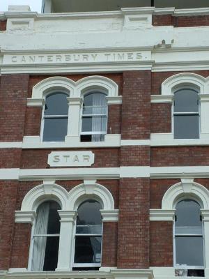
A colour photograph of details on the north side of the Lyttelton Times Building on Gloucester Street, taken after the 4 September 2010 earthquake.

An aerial view of Lyttelton a week after the 22 February 2011 earthquake.

Aerial image of Lyttelton taken by the Royal New Zealand Air Force for the Earthquake Commission.

Aerial image of Lyttelton taken by the Royal New Zealand Air Force for the Earthquake Commission.

Aerial image of Lyttelton taken by the Royal New Zealand Air Force for the Earthquake Commission.

A photograph of a tag on a fence in front of the Wunderbar in Lyttelton.

An aerial view of Lyttelton a week after the 22 February 2011 earthquake.

An aerial view of Lyttelton a week after the 22 February 2011 earthquake.

A view looking north-east down London Street in Lyttelton. On the left the Harbourlight Theatre can be seen with bracing around its towers.