
A view of Manchester Street, looking north.

A view of Manchester Street, looking west.

An aerial photograph of the AMI Stadium with liquefaction covering the field.

An aerial photograph looking east over Cathedral Square down Worcester Street.
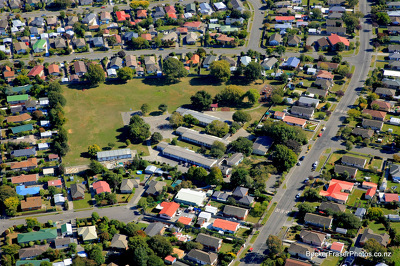
An aerial photograph of Rowley Avenue School in Hoon Hay.

A view of Cashel Street, looking east.

Vehicles drive through flooded roads in New Brighton.

None

Scaffolding around store fronts on High Street.

An aerial photograph looking south over Christchurch across the airport.

A view of Manchester Street, looking north.

An aerial photograph of Anzac Drive in Burwood.

Bracing supports the side of a damaged building on Canterbury Street in Lyttelton.

An aerial photograph looking north-west along High Street to Cathedral Square.

An aerial photograph looking west over the Christchurch CBD from Madras Street.

A view of Manchester Street, looking south.

An aerial photograph looking north-west over the Christchurch CBD.

The corner of Cashel Street and High Street.

A view of Hereford Street, looking west.

A view of Colombo Street, looking south.

An aerial photograph of a residential area in Lincoln.

An aerial photograph of the Christchurch CBD looking north along Colombo Street.

An aerial photograph of the Christchurch CBD looking north along Madras Street.

Scaffolding surrounds the Bridge of Remembrance on Cashel Street.

The corner of High Street and Cashel Street.

The partially-demolished BNZ building in Cathedral Square.

The corner of Cashel Street and High Street.

An aerial photograph of a industrial land development in Rolleston.

A view of Lichfield Street, looking west.

A stone clock tower on the cliffs near Ferrymead.